


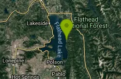
Map of 97 Things to do near Columbia Falls, MT 59912
first prev 1 2 3 4 5 next lastShowing results within 50 miles Distance miles of Columbia Falls, MT 59912, USA City, Zip, or Address
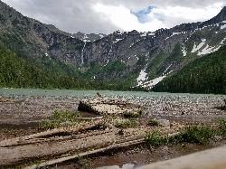
Avalanche Lake
Apgar Village, Glacier National Park
26.4 miles NEHike near Apgar Village, Glacier National Park
Hike 0.9 mi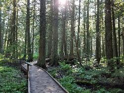
Trail of the Cedars
Apgar Village, Glacier National Park
26.5 miles NEThe Trail of the Cedars is one of the most popular hikes in the park because of it offers great views without too much exertion. It is a short loop hike around Avalanche Creek in Glacier...
Hike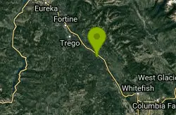
Finger Lake Trail #802
Olney, Montana
26.7 miles NWThe Finger Lake Trail is 1.5 miles long. The lake is a popular short day hike to a mountain lake the offers fishing and water play. The trailhead is located near the upper Stillwater...
Mountain Bike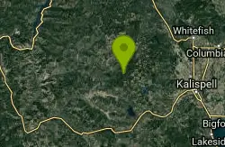
Lupine Lake Trail #210 (NRT)
Whitefish, Montana
27.9 miles WThe Lupine Lake Trail is 3.0 miles long. This trail provides access to one of the district mountain lakes and connects with Trail #310. The trail is open to non motorized and motorized...
Mountain Bike
Griffin Creek Trail #480
Whitefish, Montana
28.0 miles WThe Griffin Creek Trail is 3.5 miles long. The trail is open to non motorized and motorized uses. Hiking, mountain biking, horseback riding, motorcycle riding are all allowed. Trailhead...
Mountain Bike
Hay Creek Trail #3
29.2 miles NW
The Hay Creek trail is 5.4 miles long. It begins at the end of Rd #376 and ends at Jct. Whitefish Divide Trail #26. The trail is open for non-motorized uses. source: fs.usda.gov...
Mountain Bike
Crane Creek Trail #314
Bigfork, Montana
29.7 miles SThe Crane Creek trail is 2.1 miles long (total of 3.5 miles from trailhead) and climbs about 330 feet. It begins at the junction with the Beardance Trail #76 and ends at the junction...
Mountain Bike 5.0 mi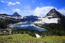
Hidden Lake
Glacier National Park
30.3 miles NEThe Hidden Lake Trail in Glacier National Park is a moderate to strenuous hike that offers breathtaking views of the surrounding landscape. Located in the northwest region of Montana, the park is...
Hike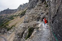
Highline Trail
Logan Pass, Glacier National Park
30.4 miles NEOne of the most popular hikes in Glacier National Park. The Highline Trail is on many people's hiking lists because it showcases all of the beauty of Glacier National Park in just one hike. This...
Backpack, Hike
Clements Mountain Trail
Logan Pass, Glacier National Park
30.4 miles NELocated in Glacier National Park, Clements Mountain is a four mile round trip hike. Clements Mountain is often mistaken for Reynolds Mountain, both of which can be seen from the Logan Pass...
Backpack, Camp, Hike, Rock Climb
Sanders Mountain Trail #172
Whitefish, Montana
30.5 miles WThe Sanders Mtn. Trail is 11.1 miles long. Has several access points, the northern access is on a closed FS Rd #2885, the mid access point is on Trail #171, and the southern access...
Mountain Bike
Bowman Lake Campground
Glacier National Park
31.0 miles NLocated in the heart of Montana's Glacier National Park, Bowman Lake Campground offers visitors the chance to experience the stunning beauty of the park's rugged landscape. With its crystal...
Camp
Elk Mtn. Trail #252 (NRT)
Whitefish, Montana
31.5 miles WThe Elk Mtn. Trail is 9.6 miles long. It begins at Road #113 At Brush Pass and ends at Elk Mtn. Lookout. The trail is open to both motorized and non motorized uses. Hiking, mountain...
Mountain Bike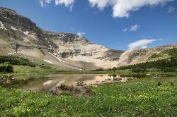
Siyeh Pass Trail
Logan Pass, Glacier National Park
32.3 miles NELIke many of the trails found throughout Glacier National Park, Siyeh Pass trail takes hikers through beautiful meadows and forests, complete with top-of-the-world views. The trail begins at Siyeh...
Backpack, Hike 1.4-4.6 mi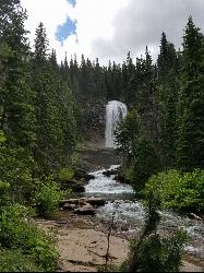
St Mary and Virginia Falls
Rising Sun, Glacier National Park
33.1 miles NEVirginia Falls is one of two major waterfalls that feed into St Mary Lake. The trail is about 3.7 miles roundtrip, where visitors will see other waterfalls such as St Mary waterfall. The trail begins...
Hike
Sixmile Lookout Trail #10
Bigfork, Montana
33.5 miles SEThe Sixmile Lookout trail is 4.6 miles long and climbs 3,400 feet. It begins off of Forest Service Road #9508 and ends at Sixmile Peak after the junction with the Alpine Trail #7. The...
Mountain Bike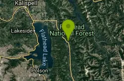
Sixmile Sidehill Trail #27
Bigfork, Montana
33.5 miles SEThe Sixmile Sidehill trail is 2.5 miles long after it's junction with Sixmile Lookout Trail #10. The trail is open for the following uses: hiking, horseback riding, mountain biking, and...
Mountain Bike 0.6 mi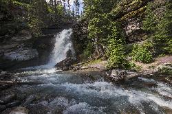
Baring Falls
Glacier National Park
33.7 miles NEThe Baring Falls are named after the Baring Creek, which flows into the Middle Fork of the Flathead River. The falls themselves are a stunning sight to behold, with a 30-foot drop into a pool of...
Hike
Beardance
Bigfork, Montana
34.1 miles SStart climbing right off the bat up beardance trail 314, and hang a right on trail 76 at the fork. climb until you hit forest road 498, and hang a left. ride along that road until you...
Mountain Bike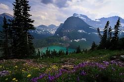
Grinnell Lake
Many Glacier, Glacier National Park
34.5 miles NEGrinnelll Lake was named after George Bird Grinnell who helped make Glacier into a national park. This lake allows visitors to see one of the remaining glaciers in the park and take in the immense...
Hike, Swim


