


Add Location
Refine Search
- hike 46
- swim 42
- camp 11
- mountain bike 8
- backpack 7
- canyoneer 4
- dive 4
- horseback 3
- rock climb 3
- cross-country ski 1
- hot springs 1
- kayak 1
50 locations
Add Location





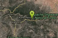


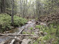

Haigler Canyon Campground
Payson, Arizona
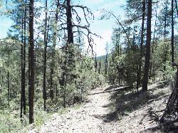
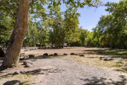
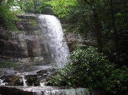
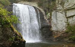
20.7 miles E of Payson, ArizonaA 2007-built campground along Haigler Creek with 14 overnight sites, trout fishing stocked April through late August, and chiseled canyon swimming holes nearby.
Camp, Hike, Swim Added on 30 Nov 2017
Hell's Gate
Payson, Arizona
12.9 miles E of Payson, ArizonaHellsgate Wilderness hides deep canyon pools possibly separated by impassable falls in a remote 37,000-acre preserve — a true adventure for spring and fall explorers.
Backpack, Camp, Hike, Swim Added on 30 Nov 2017 0.4 mi
Clear Creek Campground
Camp Verde, Arizona
6.0 miles SE of Camp Verde, ArizonaA grassy creekside campground shaded by tall cottonwoods on West Clear Creek — ideal for hiking, swimming, fishing for smallmouth bass and sunfish, and wildlife watching in a desert canyon oasis.
Camp, Hike, Swim Added on 29 Nov 2017 1.0 mi
Hidden Falls
Lake Toxaway, North Carolina
3.4 miles SW of Lake Toxaway, North CarolinaJust a few steps off the Horsepasture River trail, Hidden Falls drops less than ten feet into an idyllic boulder-rimmed pool — a serene and easy family swimming hole.
Hike, Swim Added on 28 Nov 2017 1.3 mi
Rainbow Falls
Lake Toxaway, North Carolina
3.4 miles SW of Lake Toxaway, North CarolinaA 150-foot spectacular cascade on the Horsepasture River can be admired from front, side, bottom, and top — one showstopper in a 2-mile series of incredible falls.
Hike, Swim Added on 28 Nov 2017
Big East Fork
Canton, North Carolina
11.7 miles S of Canton, North CarolinaHeavy forest, multiple waterfalls, and a river that shifts from white rapids to calm swimming holes along Big East Fork in Pisgah National Forest — great for kayaking, camping, and swimming year-round.
Backpack, Hike, Kayak, Swim Added on 28 Nov 2017 0.1 mi
Looking Glass Falls
Brevard, North Carolina
4.7 miles NW of Brevard, North CarolinaOne of North Carolina's most popular and accessible waterfalls — the 60-foot Looking Glass Falls drops roadside along the Forest Heritage Scenic Byway in Pisgah National Forest, with easy viewing from the parking area or a short walk.
Swim Added on 27 Nov 2017 0.8 mi
Daniel Ridge Falls
Brevard, North Carolina
4.8 miles NW of Brevard, North CarolinaAn easy half-mile hike in Pisgah National Forest near Brevard to a 150-foot waterfall known by three names — most impressive after rain, modest in dry spells, with an optional 4-mile loop to the top.
Hike, Mountain Bike, Swim Added on 27 Nov 2017
Cove Creek Tubs
Brevard, North Carolina
5.9 miles NW of Brevard, North CarolinaThree perfectly rounded pot holes — the Pisgah Forest's finest — stack up to 12 feet deep in sun-drenched pools that are best described as nature's own jacuzzi collection.
Swim Added on 27 Nov 2017
Whaleback Swimming Hole
Asheville, North Carolina
26.3 miles SW of Asheville, North CarolinaA horseshoe of massive bedrock around a deep, green swimming hole where Cove Creek meets the Davidson River — locals' quiet answer to crowded Sliding Rock.
Swim Added on 27 Nov 2017
Coontree Recreation Area
Brevard, North Carolina
4.2 miles NW of Brevard, North CarolinaA scenic picnic area on the Davidson River with direct access to calm, deep water for swimming and fishing — plus the 3.7-mile Coontree Loop Trail through Pisgah National Forest.
Hike, Mountain Bike, Swim Added on 27 Nov 2017
Davidson River Campground
Pisgah Forest, North Carolina
2.9 miles NW of Pisgah Forest, North CarolinaA year-round campground in Pisgah National Forest just four miles from Brevard and less than an hour from Asheville, with shaded loops, hiking trails, waterfalls, and fishing spots nearby.
Camp, Hike, Swim Added on 27 Nov 2017 1.4 mi
Turtleback Falls
Lake Toxaway, North Carolina
3.3 miles SW of Lake Toxaway, North CarolinaTurtleback Falls' dome-shaped slide drops riders 10 feet into the Chug Hole pool, but wait for calm currents — strong flows have swept swimmers downriver over 125-foot Rainbow Falls.
Backpack, Hike, Swim Added on 22 Nov 2017 4.0 mi
Woods Canyon Lake
Payson, Arizona
22.9 miles E of Payson, ArizonaA trout-fishing lake near Payson with a scenic loop hike and Mogollon Rim views — swimming is not recommended, but the scenery and fishing make it well worth the visit.
Camp, Hike, Swim Added on 14 Nov 2017 1.7 mi
Meadow Trail #505
Payson, Arizona
22.9 miles E of Payson, ArizonaMeadow Trail #505 is a short, paved, wheelchair-accessible path along the rim of Woods Canyon Lake, high on Arizona's Mogollon Rim.
Hike Added on 14 Nov 2017
Aspen Campground
Payson, Arizona
22.7 miles E of Payson, ArizonaA large, popular campground near Woods Canyon Lake in the Apache-Sitgreaves National Forest — note that Rim Road closes in winter, so the site is inaccessible during that time.
Camp Added on 14 Nov 2017
Sinkhole Campground
Payson, Arizona
25.6 miles E of Payson, ArizonaSinkhole Campground sits in cool ponderosa pines atop the Mogollon Rim, a short walk from the trout waters of Willow Springs Lake.
Camp, Hike, Mountain Bike Added on 13 Nov 2017
Upper Tonto Creek Campground
Payson, Arizona
15.0 miles NE of Payson, ArizonaA 9-site first-come-first-served campground at the junction of Tonto and Horton Creeks — with vault toilets, drinking water, and trailheads for Horton Spring and the Highline Trail nearby.
Camp, Hike Added on 13 Nov 2017 1.1-3.5 mi
Horton Springs
Payson, Arizona
15.1 miles NE of Payson, ArizonaA spring on the Mogollon Rim where water emerges dramatically from the mountainside — hike the easy Horton Creek Trail through wildflowers and maples, splash in the cold creek, and camp near the spring.
Backpack, Camp, Hike Added on 9 Nov 2017 3.3 mi
See Canyon Trail
Payson, Arizona
19.2 miles E of Payson, ArizonaA wooded Arizona trail climbing from Christopher Creek to the Mogollon Rim — easy and flat for the first mile (great for kids), then progressively steeper, with a side trail to See Spring for water.
Hike Added on 8 Nov 2017
×


