


Antelope Island Lakeside Trail
Syracuse, Utah

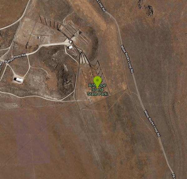
| Address: | Antelope Island State Park, 4528 W 1700 S, Syracuse, UT 84075, USA |
| GPS: |
41°1'56.6"N 112°13'40.5"W Maps | Directions |
| State: | Utah |
| Trail Length: | 5.80 miles |
| Trail Type: | Out & Back |
| Hike Difficulty: | Beginner |
| Trails/Routes: | 5.6 mi |
Restrooms Lakes Trails Rocks Wildflowers Pet Friendly State Park
Camp, Hike, and Horseback
The Lakeside Trail is a kid-friendly trail with great views and many bugs.
This is a gorgeous scenic hike winding around part of the Great Salt Lake. The trail on Antelope Island that runs about 300 yards from the lake. Trail has numerous rock formations and views of the Sierra-Nevada Mountain Range and the GSL. The hike begins at trailhead at the campground near Bridger Bay. There are restrooms at the campground. An easy hike that takes about 2 hours. Courtesy of alltrails.com
More Information
Be courteous, informed, and prepared. Read trailhead guidelines, stay on the trail, and don't feed the wildlife.
Read More- Plan Ahead and Prepare
- Travel & camp on durable surfaces
- Dispose of waste properly
- Leave what you find
- Minimize campfire impacts
- Respect wildlife
- Be considerate of other visitors
Directions
From Syracuse, Utah
- Head west on W 1700 S (3.3 mi)
- Continue onto Antelope Island Rd (7.2 mi)
- Turn left to stay on Antelope Island Rd (0.7 mi)
- Turn right to stay on Antelope Island Rd (0.3 mi)
- Turn left onto White Rocks Loop Rd (0.6 mi)
Trails
Distance ?
5.6 miles Round TripElevation Gain ?
8 feetReal Ascent ?
281 feetReal Descent ?
273 feetAvg Grade (0°)
0%Grade (-11° to 13°)
-19% to 22%Elevation differences are scaled for emphasis. While the numbers are accurate, the cut-away shown here is not to scale.
Other Hiking Trails and Horseback Trails Nearby

Antelope Island State Park
Syracuse, Utah
0.7 miles SWLocated just 41 miles north of Salt Lake City, Antelope Island State Park encompasses a vast selection of outdoor activities and spectacular scenery providing a peaceful nature experience. Experience...
Backpack, Camp, Hike, Horseback, Mountain Bike 7.2 mi
White Rock Loop
Syracuse, Utah
1.1 miles WLocated on Antelope Island near Syracuse, Utah, the White Rock Loop is an easy trail perfect for viewing the magnificent landscape views while hiking or biking around. Dogs which are kept on leashes...
Hike, Mountain Bike, Snowshoe 6.2-16.2 mi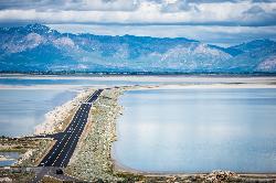
Antelope Island
Syracuse, Utah
1.7 miles NAntelope Island State Park, the largest island in the Great Salt Lake, is home to a roaming herd of 500 bison. Pronghorn and bighorn sheep also share the rangelands that overlook the desert...
Hike, Horseback, Mountain Bike 16.6 mi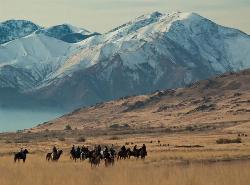
Antelope Island Figure 8
Layton, Utah
5.2 miles SThe vistas are awesome, the rock formations are beautiful, and the silence is something you don\\'t experience much these days. You WILL feel like you are on another planet when you are in the...
Hike, Mountain Bike, Snowshoe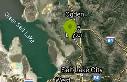
Great Salt Lake Shorelands Preserve
Layton, Utah
10.6 miles EBeautiful scenery with great trails that are close to the shoreline of the Great Salt Lake. Great for any skill level or just a leasurly walk on a beautiful day.
Hike, Mountain Bike 1.8 mi
Gailey Trail At Nicholls Park (Nicholls Hollow)
Kaysville, Utah
15.8 miles EThe shady Gailey Trail at Nicholls Park (also known as Bair Creek or Nicholls Hollow) is perfect for walking, running, and enjoying the fresh air of nature all four seasons of the...
Hike, Mountain Bike
Adams Canyon Waterfall
Layton, Utah
16.7 miles EA great hike that is moderate in difficulty, but also provides a sense of adventure to hikers who love climbing rocks and seeing majestic waterfalls.
Hike 0.7-2.0 mi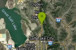
Farmington Creek trail
Farmington, Utah
17.8 miles EThe Farmington Creek trail is a unique pathway that allows access to many different points of interest such as; Farmington pond, Lagoon, and Farmington Station mall. the Farmington pond route is...
Hike, Mountain Bike, Skateboard 6.4 mi
Farmington Canyon
Farmington, Utah
17.9 miles EFarmington Canyon is a gorgeous location to explore during all four seasons of the year, but the prime months for visiting are April through October. The dusty Skyline Drive long is along a...
Hike, Mountain Bike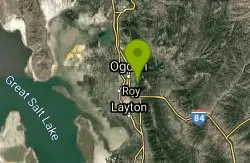
Bonneville Shoreline Trail, Ogden, UT, USA
Ogden, Utah
19.6 miles NEBackpack, Hike, and Mountain Bike near Ogden, Utah
Backpack, Hike, Mountain Bike
Parrish Canyon Trail
Centerville, Utah
20.3 miles EParrish Canyon Trail goes long the Wasatch Mountains; from the top of the mountain, this trail has beautiful views of Salt Lake City from a distance and interconnects with the Barnard Creek. It's...
Hike, Mountain Bike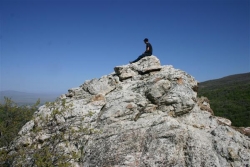
Mueller Park Trail
Bountiful, Utah
23.5 miles SEThe Mueller Park Trail is a great year-round trail that's almost right off the road. It's considered moderate difficulty. It's a gradual grade with beautiful views. It's a popular...
Cross-country Ski, Hike, Mountain Bike 4.7 mi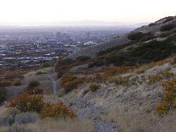
Bonneville Shoreline Trail
Salt Lake City, Utah
24.8 miles SEBonneville Shoreline Trail is a great place for hiking, biking, and trail running. It stretches from North Salt Lake to Parley's Canyon. The trail follows the shoreline of ancient Lake...
Hike, Mountain Bike 2.9 mi
Pineview Reservoir
Eden, Utah
27.7 miles NELocated on the backside of the Wasatch Front, Pineview Reservoir in the Ogden River Canyon is home to stunning views of the water, sandy beaches, the Southern Skyline trail, paved ramps, and...
Camp, Canoe, Hike, Kayak, Mountain Bike, Swim
Grandeur Peak
Salt Lake City, Utah
33.3 miles SEGrandeur Peak is the most easily accessible of the major peaks that form the Salt Lake City skyline. For many valley residents Grandeur Peak was there first major summit. The peak offers great...
Hike 2.6 mi
Salt Lake Valley Scenic Overlook
Salt Lake City, Utah
34.2 miles SEThe Salt Lake Valley Scenic overlook starts on the Desolation trail in Millcreek Canyon near Salt Lake City, Utah and offers hikers a wide variety of destinations to stop at along the trail,...
Hike
Pete's Rock
Salt Lake City, Utah
34.3 miles SEA large rock next to the Mount Olympus trailhead known locally as Pete's Rock and is a popular place for casual rock climbing. Mount Olympus is a prominent 9,026 feet peak on the east side of the...
Hike, Rock Climb
Ferguson Canyon
Cottonwood Heights, Utah
37.2 miles SEFerguson canyon is small canyon between Big and Little Cottonwood Canyons. This canyon has gained popularity over the last few year and is a popular destination for rock climbers. This is one hike...
Hike, Mountain Bike, Rock Climb
Storm Mountain
Salt Lake City, Utah
38.0 miles SEStorm Mountain is on of the smaller peaks included in the Wasatch Range. Storm Mountain is located in Cottonwood Canyon. Storm Mountain Day Use Area is just 3 miles up Big Cottonwood Canyon,...
Hike, Mountain Bike, Rock Climb
Hidden Falls
Salt Lake City, Utah
38.1 miles SEHidden Falls is a popular road side attraction for anyone cruising Big Cottonwood Canyon on a sunny afternoon. The falls are within strolling distance of the parking lot and only require about 15...
HikeNearby Campsites
Antelope Island State Park
Syracuse, Utah
0.7 miles SWLocated just 41 miles north of Salt Lake City, Antelope Island State Park encompasses a vast selection of outdoor activities and spectacular scenery providing a peaceful nature experience. Experience...
Backpack, Camp, Hike, Horseback, Mountain Bike
Holbrook Trailhead
Bountiful, Utah
22.6 miles SEairsoft feaild woth bunkers
Airsoft, Backpack, Camp, Paintball, Snowshoe 2.9 mi
Pineview Reservoir
Eden, Utah
27.7 miles NELocated on the backside of the Wasatch Front, Pineview Reservoir in the Ogden River Canyon is home to stunning views of the water, sandy beaches, the Southern Skyline trail, paved ramps, and...
Camp, Canoe, Hike, Kayak, Mountain Bike, Swim
Mill Creek Canyon
Salt Lake City, Utah
35.4 miles SEMill Creek is an out and back with over 1000 ft of elevation gain. The lower section of the ski trail gets a lot of foot traffic, but the upper section (above Elbow Fork) is generally very quiet....
Camp, Cross-country Ski, Snowshoe
Spruces Campground
Salt Lake City, Utah
41.0 miles SECamping isn't free. See USDA.gov for details. If you know the coordinates of the sledding hill here, please comment.
Camp, Sled


