


Punchbowls
Santa Paula, California

| Address: | Punch bowls, Creek, Santa Paula, CA 93060, USA |
| GPS: |
34°26'56.8"N 119°3'23.6"W Maps | Directions |
| State: | California |
Swim
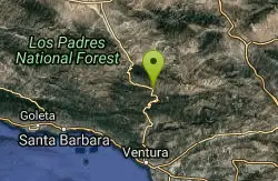
The Punchbowls (or Punch Bowls) are among the most beloved swimming holes in Southern California — a series of clear, deep, rock-rimmed pools fed by a waterfall deep in Santa Paula Canyon, in the Los Padres National Forest above the town of Santa Paula in Ventura County. A big 25-foot waterfall pours into the main pool, and the polished sandstone that cradles the water gives the “bowls” their name. It's a genuine backcountry reward, and on a hot day the cool water at the end of the hike feels like a small miracle.
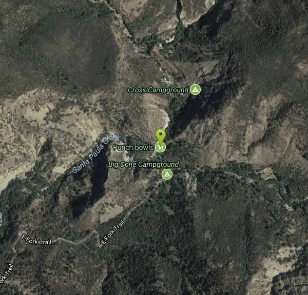
Reaching the Punchbowls is a strenuous hike of roughly 6 to 7 miles round trip. The trail starts near the entrance to Thomas Aquinas College off Highway 150 (Ojai Road) and heads up the canyon along Santa Paula Creek, passing Big Cone Camp before reaching the pools on the East Fork. The route climbs and crosses the creek several times, so expect wet feet and a real workout — but the scenery, with its cottonwoods, sandstone walls, and canyon views, is beautiful the whole way.
Above the main falls, the creek carves a set of natural rock water slides as it tumbles toward the bowls. They vary in difficulty, and the steepest is genuinely fast and slick, sending sliders close to a rock wall — fun for the bold, but a real hazard if you're not careful, so scout each slide and the pool below before committing.
An important access note: the first stretch of trail crosses private property by easement, including college and ranch land. You're welcome to use the trail to reach the national forest, but you must stay on it — no loitering, no wandering off across the property — so treat the access with real respect, since it's the reason the trail stays open. Check current trail status before you go, as the canyon has seen closures after fires and floods.
For those who want more, the canyon rewards an overnight. Big Cone Camp and Cross Camp, the two small Los Padres campgrounds that bracket the Punchbowls, let backpackers turn the trip into a relaxed weekend of swimming, exploring, and stargazing deep in the wilderness. Note that a National Forest Adventure Pass or equivalent may be required to park at the trailhead, and the canyon has been reshaped by wildfire in recent years — the 2017 Thomas Fire burned through here — so the landscape is still recovering and conditions can change.
Come prepared: carry plenty of water (and a way to filter more), wear sturdy shoes with grip that can get wet, and start early to beat the heat and the crowds, which can be heavy on summer weekends. Watch depth carefully before any jump or slide, keep an eye on kids, and pack out every scrap of trash to protect this well-loved canyon. Spring through early summer, when the creek runs full, is the sweet spot — that's when the Punchbowls are at their deep, clear, cliff-jumping best.
More Information
swimmingholes.org: CALIFORNIA SWIMMING HOLES
THE web site for beautiful, natural places for a cool dip or hot soak.
https://www.swimmingholes.org/ca.html
- Plan Ahead and Prepare
- Travel & camp on durable surfaces
- Dispose of waste properly
- Leave what you find
- Minimize campfire impacts
- Respect wildlife
- Be considerate of other visitors
Directions
From Santa Paula, California
- Head west on E Main St toward S 10th St (230 ft)
- Turn right onto N 10th St (0.3 mi)
- Continue onto CA-150 W/N Ojai Rd/Santa Paula Ojai Rd (5.9 mi)
- Turn right onto Mott Pl (489 ft)
- Continue onto Davis Rd (0.5 mi)
- Turn left toward E Fork Trail (499 ft)
- Slight right toward E Fork Trail (436 ft)
- Continue onto E Fork Trail (3.5 mi)


Other Swimming Holes Nearby
Sespe Gorge
Maricopa, California
14.7 miles NWMultiple swimming holes along the Sespe and Bear Creek junction, about 4.5 miles in, with good shade and a small camping area tucked into the canyon.
Swim
Carpinteria State Beach
Carpinteria, California
26.7 miles WTwelve miles south of Santa Barbara, a mile of clean swimming beach with year-round lifeguards, stellar tidepools, seal and whale sightings, and campsite access to hiking trails and town.
Camp, Hike, Swim 0.3-1.0 mi
Rock Pool
Agoura Hills, California
30.7 miles SEA river-fed swimming hole deep in Malibu Creek State Park, ringed by forest and rock formations — reach it via a short level path from the Visitor Center or a scenic 2-mile out-and-back from the campsite.
Camp, Hike, Swim
Fish Creek
Lake Hughes, California
33.2 miles NEA super-deep upper pool and a lower pool about 5 feet deep, with a slideable waterfall — plus some higher jump spots for those willing to do a bit of rock climbing.
Hike, Rock Climb, Swim
Point Dume State Beach
Malibu, California
33.9 miles SEHeadlands, rocky coves, a quiet beach, gray whale watching from December to April, an easy coastal hike to sweeping views, and a fun Iron Man movie cameo — all at Point Dume in Malibu.
Dive, Hike, Rock Climb, Swim 1.2 mi
Seven Falls and Three Pools
Santa Barbara, California
37.0 miles WA steep four-mile round trip leads to Seven Falls, then the cool, waterfall-fed Three Pools — with a natural waterslide when spring flows run high.
Hike, Swim
Red Rock
Santa Barbara County, California
37.5 miles WTall red and white rock walls, deep water, and cliffs to jump from along the Santa Ynez River — weekdays are quieter and rocky spots sit right at the water's edge.
Hike, Swim
White Rock
Santa Barbara, California
43.1 miles WA deep, cool swimming hole with low rocks for jumping on the Santa Ynez River, with an oak-shaded picnic area and restrooms just a short walk away.
SwimNearby Campsites
Carpinteria State Beach
Carpinteria, California
26.7 miles WTwelve miles south of Santa Barbara, a mile of clean swimming beach with year-round lifeguards, stellar tidepools, seal and whale sightings, and campsite access to hiking trails and town.
Camp, Hike, Swim
Malibu Creek State Park
Calabasas, California
30.6 miles SEJust 25 miles from downtown LA, 15 miles of streamside trail wind through oak and sycamore woodlands in a park with rich Chumash history and film location fame.
Camp, Hike, Horseback, Mountain Bike, Rock Climb 0.3-1.0 mi
Rock Pool
Agoura Hills, California
30.7 miles SEA river-fed swimming hole deep in Malibu Creek State Park, ringed by forest and rock formations — reach it via a short level path from the Visitor Center or a scenic 2-mile out-and-back from the campsite.
Camp, Hike, Swim


