


Three Forks Loop
Springville, Utah
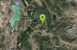
| Address: | ~Forest Rd 029, Springville, UT 84663, USA |
| GPS: |
40°5'5.4"N 111°21'16.9"W Maps | Directions |
| State: | Utah |
| Trail Length: | 16.00 miles |
| MTB Difficulty: | Advanced |
| Trail Type: | Loop |
| MTB Trail Type: | Singletrack |
Mountain Bike
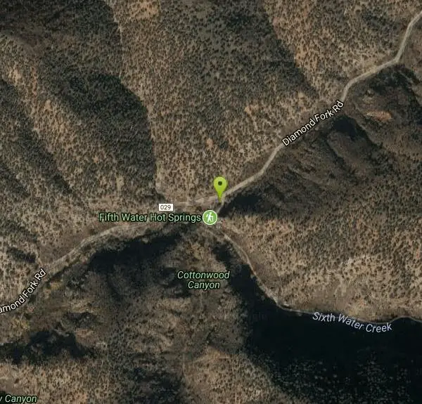
The Three Forks Loop is a strong-intermediate to advanced trail. Length is 16 miles, with 1900 vertical feet of elevation change. The trail begins at Three Forks, where Cottonwood Creek, Sixth Water, and Diamond Fork Creek come together. From the parking area, ride through the gate next to the rest rooms. Then immediately turn right onto a small footbridge that crosses Sixth Water. After crossing the river, bike straight ahead about 100 feet and plunge straight through Cottonwood Creek. Once you've crossed Cottonwood Creek, you're on the trail.At 4.7 miles, the trail comes to a dirt road. The actual trail turns to the left a climbs sharply uphill. You can either follow the trail or cross the small stream and ride the dirt road - both will eventually connect to Ray's Valley Road. If you're a strong rider, take the trail (my preference). At the waterfalls, you'll have to carry your bike up a short rock face. At a trail intersection .5 miles above the waterfalls, turn to the right.At Ray's Valley Road, turn left onto the road and ride 4.5 to 5 miles to the Fifth Water Trail. (Look for a prominent double-track crossing the road on the far side of a creek, note the sign that says "Fifth Water," and turn left downhill.) The first mile of Fifth Water is double-track. The next two miles of single-track have some tricky sections, then the trail widens and runs quickly down to Sixth Water (a larger creek), then to the Three Forks trailhead. You'll come out of the woods next to the bridge you crossed to reach Cottonwood Creek. Courtesy of Singletracks.com
More Information
Add ResourceNever modify trail features. Ride trails when they're dry enough that you won't leave ruts. Speak up when you see others on the trail and always yield to hikers, horses, and others coming uphill. Always ride on the established trail.
Read More- Plan Ahead and Prepare
- Travel & camp on durable surfaces
- Dispose of waste properly
- Leave what you find
- Minimize campfire impacts
- Respect wildlife
- Be considerate of other visitors
Directions
From Springville, Utah
- Head south on S Main St/S State St toward E 200 S (0.4 mi)
- Slight right onto US-89 S (signs for Mapleton/Price) (5.6 mi)
- Turn left onto US-6 E/US-89 S (signs for Price) (6.2 mi)
- Turn left onto Diamond Fork RdDestination will be on the right(9.8 mi)
Other Mountain Bike Trails Nearby

Fifth Water Hot Springs
Provo, Utah
0.0 miles SWAKA Diamond Fork Hot Springs A beautiful drive and a 2.5 mile hike along the river will end you at an amazing set of hot springs that's well worth the trip. There's a variety of...
Backpack, Camp, Hike, Hot Springs, Mountain Bike, Swim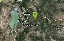
Wardsworth Creek
Springville, Utah
7.9 miles NThis trail is intermediate technical and moderate aerobic. The scenery is great as you follow the creek up the canyon. Enjoy some rooty and rocky climbs on your way up to a small pond...
Mountain Bike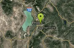
Squaw Peak Trail
Springville, Utah
14.0 miles NWStart at Rock Canyon trailhead, ride straight up the trail, passing a green gate and subsequently 5 wooden bridges. 1/4 mile after the last bridge, take a left on "Squaw Peak Trail."...
Mountain Bike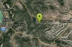
Strawberry Narrows
Heber City, Utah
17.0 miles ETrail is well maintained and only rises a few hundred feet in elevation in a roller coaster course. Starts in open fields then flows through thick forests in the narrows. Highest...
Mountain Bike
Blackhawk Loop
Salem, Utah
18.3 miles SWThe Blackhawk loop is one of the premier singletrack rides in Utah! Blackhawk loop is composed of couple of different trails, so the name changes from time to time. I would recommend...
Mountain Bike
4 Bay
Elk Ridge, Utah
18.3 miles WTrails are smooth with some rocky or root spots. Gradual climbs and descents. Crosses 4 wheeler trails. South of the small water reservoir, look for metal signs on wood posts with trail...
Mountain Bike
Big Springs
Provo, Utah
19.3 miles NWSingle track, winding through trees and an open meadow. Cross the service road about half way up to continue to the small water run off of Big Springs. There is approximately 1000 feet...
Mountain Bike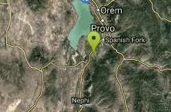
Sheepherder Loop
Payson, Utah
20.5 miles WSheepherder, along with the Blawkhawk trail are two of the best singletrack rides around! The Sheepherder trail is one of those "impossible, uphill loops"!! With all of the short climbs...
Mountain Bike
Provo River Parkway Trail
Provo, Utah
22.0 miles NWThis isn't quite as much mountain biking as it is an easy downhill bike ride. The whole trail is paved. One of the best ways to do it is to take two vehicles and park one at Will's Canyon...
Hike, Mountain Bike
South Fork of the Provo
Provo, Utah
22.5 miles NWSouth Fork of the Provo is a fun, short, scenic singletrack ride. It is an ideal trail to introduce a new mountain biker to the joys of singletrack! The trail has one or two rocky...
Mountain Bike
Deer Creek State Park
Wallsburg, Utah
24.1 miles NDeer Creek State Park is one of the finest year-round fishing spots in all of Utah. There are many different kinds of fish here and it is sure to not disappoint fisherman. Other...
Mountain Bike
Archie's Loop
Sundance, Utah
24.2 miles NWArchie's Loop Trail, a 2.2 mile stretch of mountain biking/hiking trail, recently opened up totally new country. The intermediate-level trail runs from Scott's Pond loop to connect with...
Mountain Bike
Grove Creek Trail
Pleasant Grove, Utah
27.4 miles NWThe Grove Creek Trail falls from the upper shoulder of Mount Timpanogos down Grove Creek Canyon to Pleasant Grove. It's usually ridden as a shuttled downhill -- because the climb up this...
Hike, Mountain Bike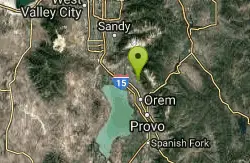
Bonneville Shoreline Trail - Cedar Hills to Grove Creek Canyon
Pleasant Grove, Utah
27.5 miles NWThe Cedar Hills to Grove Creek Canyon portion of the Bonneville Shoreline Trail is an intermediate level trail. There are some flat spots that are on old dirt roads, as well as single track...
Mountain Bike
Ridge Trail #157
Provo, Utah
27.5 miles NWThis trail is 15.7 miles in length and is commonly referred as the backbone of the American Fork Canyon trail system, because it connects several loop routes along the northern portion of the...
Mountain Bike
Timpanooke
Provo, Utah
28.2 miles NWThis is a great trail. Intermediate tech and moderate aerobic. It winds through pine forests and grass meadows. Start by heading down the Timpanooke section of the Great Western Trail...
Mountain Bike
Bear Canyon Loop
Provo, Utah
29.5 miles NWA route for the thrill seeker, the Bear Canyon Loop is an advanced mountain biking route. This a challenging route and should be done only by those who know how to handle their bike on steep rocky...
Mountain Bike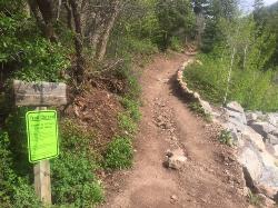
Tibble Fork
Provo, Utah
31.4 miles NWThis trail is advanced tech and strenuous aerobic. This trail involves a few miles of riding on the pavement. Start by heading back down to the intersection with the South Fork of American Canyon and...
Mountain Bike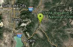
Chopped Coyote Loop
Heber City, Utah
32.1 miles NThe Coyote Canyon Loop lies northeast of Heber. It's a big ride that's best reserved for conditioned riders. Much of the trail is easier-intermediate technical, but there are many tight...
Mountain Bike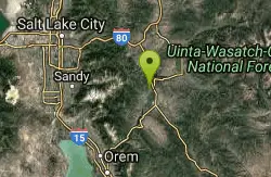
Wasatch Mountain State Park
Park City, Utah
33.1 miles NWasatch Mountain State Park, in beautiful Heber Valley, is Utahs most developed state park. Tucked away in the beautiful Wasatch Mountains, the park is both a summer and winter...
Mountain BikeNearby Campsites
Fifth Water Hot Springs
Provo, Utah
0.0 miles SWAKA Diamond Fork Hot Springs A beautiful drive and a 2.5 mile hike along the river will end you at an amazing set of hot springs that's well worth the trip. There's a variety of...
Backpack, Camp, Hike, Hot Springs, Mountain Bike, Swim
Y-Mountain Summit Trail
Provo, Utah
17.4 miles NWY Mountain is located directly east of Brigham Young University (BYU) in Provo, Utah, United States. The Slide Canyon/Y Mountain Trail leads to a large block Y located 1.2 miles (1.9 km) from a...
Camp, Hike 1.6-14.1 mi
Mount Timpanogas
Provo, Utah
28.2 miles NWMt. Timp, as the locals call it, is the 2nd highest mountain in the Wasatch range (only Mt. Nebo is higher). What sets "Timp" apart is its location. It towers over the Provo, Orem, Pleasant...
Camp, Hike, Horseback, Swim
Maple Canyon
Fountain Green, Utah
40.4 miles SWMaple Canyon is a fantastic place for hiking, rock climbing, and camping. This maple tree-filled canyon is one of the nation's most unique rock climbing areas and is well-known for sport...
Camp, Hike, Mountain Bike, Rock Climb
Spruces Campground
Salt Lake City, Utah
41.2 miles NCamping isn't free. See USDA.gov for details. If you know the coordinates of the sledding hill here, please comment.
Camp, Sled
Mill Creek Canyon
Salt Lake City, Utah
46.5 miles NWMill Creek is an out and back with over 1000 ft of elevation gain. The lower section of the ski trail gets a lot of foot traffic, but the upper section (above Elbow Fork) is generally very quiet....
Camp, Cross-country Ski, Snowshoe


