


Grizzly Peak Trail
Berkeley, California
| Address: | Grizzly Peak Trail, Berkeley, CA 94708, USA |
| GPS: |
37°53'1.6"N 122°14'18.1"W Maps | Directions |
| State: | California |
| Trail Length: | 2.50 miles |
| Trail Type: | Out & Back |
| Hike Difficulty: | Beginner |
| Elevation Gain: | 1759 feet |
| Trails/Routes: | 0.5-0.6 mi |
Trails Rocks Pet Friendly
Hike and Mountain Bike
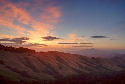
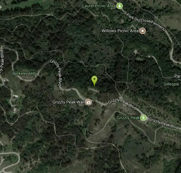
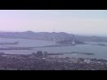
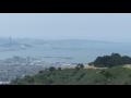
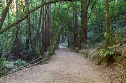
Grizzly Peak Trail is located near La Loma Park in the Berkeley Hills section of the city of Berkeley, California and leads to an incredible lookout of the San Francisco Bay area. Driving up Grizzly Peak Road there are many spectacular places to pull over to take photos. This is a great hike to take out-of-town guests or tourists to go on, and it can be done on the way to or from Oakland/Berkeley.
Many runners have said that this trail is great for running and that the peak is a great place to stop and enjoy the view. If you choose to run to the peak and back, it would be about a 1-mile run, roundtrip. If you want to run the whole trail, it would be a little over 2 miles. This trail is dog-friendly, however, you should keep your dog on a leash. This hike is the best and most beautiful when done on a clear day, so be sure to check the weather the day before your hike.
The peak can be climbed almost year round because its elevation is relatively low. During periods of recent snowfall, it may be best to avoid the peak because of the ice and snow. Snow doesn't last too long on the peak, usually melting off most of the routes within a few days of snow. In the height of summer, temperatures may be too warm for an enjoyable climb.
The peak was named because of the Grizzly bears inhabiting the area until the late 1880s. The last grizzly in all of California was killed in the Sierra foothills east of Fresno in August 1922.
More Information
Never modify trail features. Ride trails when they're dry enough that you won't leave ruts. Speak up when you see others on the trail and always yield to hikers, horses, and others coming uphill. Always ride on the established trail.
Read MoreBe courteous, informed, and prepared. Read trailhead guidelines, stay on the trail, and don't feed the wildlife.
Read More- Plan Ahead and Prepare
- Travel & camp on durable surfaces
- Dispose of waste properly
- Leave what you find
- Minimize campfire impacts
- Respect wildlife
- Be considerate of other visitors
Directions
From Berkeley, California
- Head west on University Ave toward Martin Luther King Jr Way (79 ft)
- Turn right at the 1st cross street onto Martin Luther King Jr Way (0.4 mi)
- Turn right onto Cedar St (0.9 mi)
- Turn left onto La Loma Ave (0.5 mi)
- Continue onto Glendale Ave (0.2 mi)
- Turn left onto Del Mar Ave (486 ft)
- Turn right onto Campus Dr (0.1 mi)
- Turn left onto Avenida Dr (0.2 mi)
- Turn right onto Fairlawn Dr (233 ft)
- Turn left onto Senior Ave (0.1 mi)
- Sharp right onto Grizzly Peak BlvdDestination will be on the left(0.9 mi)
Take Highway 24 west to Fish Ranch Road (last exit before the Caldecott tunnel). Go right on Fish Ranch Road. When you reach a four-way intersection take a right on Grizzly Peak Blvd. Drive about 8/10th of a mile. When you see logs along the left side of the road and a fire road gate on the right, park on the right side. This trailhead is called the Scotts Peak Trailhead and is less than 10 minutes from downtown Orinda!Courtesy of lamorindahikes.com
 courtesy of Grizzly Peak (Berkeley Hills)↗")

Trails
Distance ?
0.6 milesElevation Gain ?
130 feetReal Ascent ?
153 feetReal Descent ?
23 feetAvg Grade (2°)
4%Grade (-7° to 15°)
-12% to 27%Distance ?
0.5 milesElevation Gain ?
-245 feetReal Ascent ?
50 feetReal Descent ?
295 feetAvg Grade (-5°)
-9%Grade (-28° to 20°)
-54% to 36%Elevation differences are scaled for emphasis. While the numbers are accurate, the cut-away shown here is not to scale.
Other Mountain Bike Trails and Hiking Trails Nearby
East Ridge Trail
Oakland, California
7.6 miles SEThis trail is deeply tucked away up into the hills of Oakland. East Ridge is the perfect trail to deeply appreciate the beauty of the Redwoods and has many entry points. This trail weaves...
Hike
Auburn Area
San Francisco, California
11.4 miles SWAlongside of the North Fork of the American River in the Auburn State Recreation Area, there are several swimming holes. Located at Emigrant Gap in the Tahoe National Forest, the North...
Hike, Horseback, Kayak, Rock Climb, Swim, Whitewater
Battery Spencer
Mill Valley, California
13.9 miles WThis is easily one of the best places to view the Golden Gate Bridge. For over half a century, this was one of the most strategically important sites guarding the Golden Gate. Completed in 1897,...
Hike 0.4 mi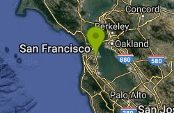
Portola Trail
San Francisco, California
14.7 miles SWMountain Bike near San Francisco, California
Mountain Bike 0.1-0.6 mi
Mt. Sutro Open Space Reserve
San Francisco, California
14.7 miles SWMount Sutro Open Space Reserve is a 61-acre ecological oasis in the heart of San Francisco, just south of UCSF's Parnassus Heights campus. UCSF is committed to maintaining the Reserve as a safe...
Hike, Mountain Bike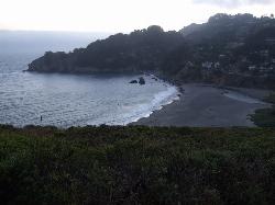
Muir Beach
Muir Beach, California
18.5 miles WMuir Beach is a little gem nestled away in the hills North of San Francisco, not far from the Muir Woods National Monument. There's a great beach and an entire network of trails. To get to the...
Hike, Swim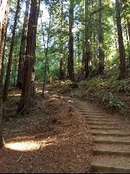
Muir Woods National Monument
Mill Valley, California
18.5 miles WThere are several suggested hikes on the main trail leaving from the visitors center. The longest, a loop, is about 2 miles. It is the only one that leaves the boardwalk. It has some elevation...
Hike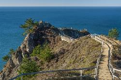
Muir Beach Overlook
Muir Beach, California
19.0 miles WHike near Muir Beach, California
Hike 4.0 mi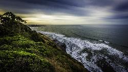
Palomarin Trail
Bolinas, California
28.0 miles WThis hike is about 5 miles north from Bolinas is the Palomarin Trailhead. As you hike the trail you overlook the ocean and beautiful beaches. The trail takes you up to different lakes and then...
Hike 0.1 mi
Bass Lake
Bolinas, California
29.1 miles WHike and Swim near Bolinas, California
Hike, Swim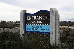
Half Moon Bay State Beach
Half Moon Bay, California
31.0 miles SHalf Moon Bay State Park's Coastside Trail runs parallel to the Pacific Coast along what used to be the Ocean Shore Railroad. The railroad itself was in operation for just 14 years before it was...
Camp, Hike, Horseback, Swim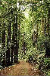
Pescadero Creek Trail Area
Loma Mar, California
42.2 miles SPerfect for all redwood lovers, the Pescadero Creek Park area is an incredible shady trail for a hike on a hot summer day. This is a great place to escape from city sounds and enjoy...
Hike, Horseback, Mountain Bike, Swim


