


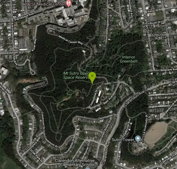
Mt. Sutro Open Space Reserve
San Francisco, California

| Address: | 247 Crestmont Dr, San Francisco, CA 94131, USA |
| GPS: |
37°45'31.3"N 122°27'21.9"W Maps | Directions |
| State: | California |
| Trails/Routes: | 0.1-0.6 mi |
Hike and Mountain Bike
Mount Sutro Open Space Reserve is a 61-acre ecological oasis in the heart of San Francisco, just south of UCSF's Parnassus Heights campus. UCSF is committed to maintaining the Reserve as a safe and accessible resource that residents and visitors can enjoy.Courtesy of ucsf.edu
On the slopes of Mount Sutro (see map here), a 900-foot hill in San Francisco California, is a glorious historic forest that is over a hundred years old. It was planted by Adolf Sutro, one of the city’s most colorful characters, and a former Mayor of the city. This 80-acre forest is a remnant of 1100 acres of eucalyptus that once covered most of the western side of the city.Courtesy of mntsutro.com
Visitors will enjoy an abundance of rare and native plants, as well as many species of trees including Monterey Pine, Monterey Cyprus and Blue Gum Eucalyptus. At the summit of Mount Sutro is Rotary Meadow, our native plant garden and demonstration area.Courtesy of ucsf.edu
It is accessible by paved road from Clarendon Avenue through UCSF's Aldea San Miguel housing complex. Most of the garden's plants reach peak bloom in the spring. It is encircled by the Eucalyptus forest, and therefore has no views of the city, as the nearby non-forested Twin Peaks and Tank Hill do. The hill and forest are accessible by hiking trails, many of which are suitable for mountain bikes. Sutro Stewards.org: Map of Mount Sutro [8][9] Another access to the summit is from 7th Avenue on the west side of the mountain, climbing the 355-step public stairway from Warren Drive to Crestmont Drive (named Oakhurst Way on many maps), then turning left/north and entering the forest where Crestmont makes a sharp right/east turn.Courtesy of en.wikipedia.org
Mapped Route/Trail Distances
| Fairy Gates Trail | 0.3 miles |
| Mystery Trail | 606 feet |
| Gardener's Trail | 894 feet |
| Lower Historic Trail | 0.5 miles |
| North Ridge Trail | 0.3 miles |
| South Ridge Trail | 485 feet |
| Edgewood Trail | 854 feet |
| East Ridge Trail | 0.3 miles |
| Historic Trail | 0.6 miles |
| Route #1 | 800 feet |
| West Ridge Trail | 799 feet |
| Quarry Road Trail | 845 feet |
| South Ridge Loop | 505 feet |
More Information
Add ResourceNever modify trail features. Ride trails when they're dry enough that you won't leave ruts. Speak up when you see others on the trail and always yield to hikers, horses, and others coming uphill. Always ride on the established trail.
Read MoreBe courteous, informed, and prepared. Read trailhead guidelines, stay on the trail, and don't feed the wildlife.
Read More- Plan Ahead and Prepare
- Travel & camp on durable surfaces
- Dispose of waste properly
- Leave what you find
- Minimize campfire impacts
- Respect wildlife
- Be considerate of other visitors
Directions
From San Francisco, California
- Head southwest on Market St (1.2 mi)
- Slight right to stay on Market St (259 ft)
- Continue onto 17th St (0.6 mi)
- Turn left onto Clayton St (292 ft)
- Slight right onto Twin Peaks Blvd (0.2 mi)
- Continue onto Clarendon Ave (0.3 mi)
- Turn right onto Johnstone Dr (0.2 mi)


Trails
Distance ?
0.3 milesElevation Gain ?
136 feetReal Ascent ?
259 feetReal Descent ?
123 feetAvg Grade (5°)
8%Grade (-34° to 41°)
-66% to 85%Distance ?
606 feetElevation Gain ?
43 feetReal Ascent ?
57 feetReal Descent ?
14 feetAvg Grade (4°)
7%Grade (-6° to 12°)
-10% to 21%Distance ?
894 feetElevation Gain ?
32 feetReal Ascent ?
77 feetReal Descent ?
45 feetAvg Grade (2°)
4%Grade (-8° to 29°)
-15% to 56%Distance ?
0.5 milesElevation Gain ?
-381 feetReal Ascent ?
39 feetReal Descent ?
420 feetAvg Grade (-9°)
-16%Grade (-33° to 12°)
-64% to 22%Distance ?
0.3 milesElevation Gain ?
-99 feetReal Ascent ?
125 feetReal Descent ?
224 feetAvg Grade (-3°)
-6%Grade (-29° to 22°)
-56% to 40%Distance ?
485 feetElevation Gain ?
28 feetReal Ascent ?
52 feetReal Descent ?
24 feetAvg Grade (3°)
6%Grade (-10° to 18°)
-19% to 32%Distance ?
854 feetElevation Gain ?
111 feetReal Ascent ?
170 feetReal Descent ?
59 feetAvg Grade (8°)
14%Grade (-45° to 30°)
-99% to 58%Distance ?
0.3 milesElevation Gain ?
105 feetReal Ascent ?
174 feetReal Descent ?
69 feetAvg Grade (4°)
7%Grade (-16° to 33°)
-28% to 65%Distance ?
0.6 milesElevation Gain ?
-203 feetReal Ascent ?
141 feetReal Descent ?
344 feetAvg Grade (-4°)
-6%Grade (-29° to 22°)
-55% to 40%Distance ?
800 feetElevation Gain ?
201 feetReal Ascent ?
249 feetReal Descent ?
48 feetAvg Grade (15°)
28%Grade (-19° to 45°)
-35% to 98%Distance ?
799 feetElevation Gain ?
200 feetReal Ascent ?
249 feetReal Descent ?
49 feetAvg Grade (15°)
27%Grade (-20° to 45°)
-37% to 98%Distance ?
845 feetElevation Gain ?
134 feetReal Ascent ?
139 feetReal Descent ?
5 feetAvg Grade (9°)
16%Grade (-4° to 22°)
-6% to 41%Distance ?
505 feetElevation Gain ?
3 feetReal Ascent ?
68 feetReal Descent ?
65 feetAvg Grade (0°)
1%Grade (-30° to 29°)
-58% to 55%Elevation differences are scaled for emphasis. While the numbers are accurate, the cut-away shown here is not to scale.
Other Mountain Bike Trails and Hiking Trails Nearby
Portola Trail
San Francisco, California
0.7 miles SEMountain Bike near San Francisco, California
Mountain Bike
Auburn Area
San Francisco, California
3.8 miles NEAlongside of the North Fork of the American River in the Auburn State Recreation Area, there are several swimming holes. Located at Emigrant Gap in the Tahoe National Forest, the North...
Hike, Horseback, Kayak, Rock Climb, Swim, Whitewater
Battery Spencer
Mill Valley, California
5.1 miles NThis is easily one of the best places to view the Golden Gate Bridge. For over half a century, this was one of the most strategically important sites guarding the Golden Gate. Completed in 1897,...
Hike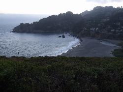
Muir Beach
Muir Beach, California
9.6 miles NWMuir Beach is a little gem nestled away in the hills North of San Francisco, not far from the Muir Woods National Monument. There's a great beach and an entire network of trails. To get to the...
Hike, Swim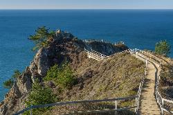
Muir Beach Overlook
Muir Beach, California
10.1 miles NWHike near Muir Beach, California
Hike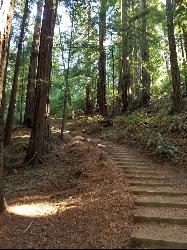
Muir Woods National Monument
Mill Valley, California
11.6 miles NWThere are several suggested hikes on the main trail leaving from the visitors center. The longest, a loop, is about 2 miles. It is the only one that leaves the boardwalk. It has some elevation...
Hike 0.5-0.6 mi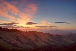
Grizzly Peak Trail
Berkeley, California
14.7 miles NEGrizzly Peak Trail is located near La Loma Park in the Berkeley Hills section of the city of Berkeley, California and leads to an incredible lookout of the San Francisco Bay area....
Hike, Mountain Bike 3.7 mi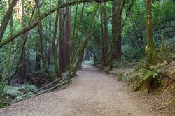
East Ridge Trail
Oakland, California
17.3 miles EThis trail is deeply tucked away up into the hills of Oakland. East Ridge is the perfect trail to deeply appreciate the beauty of the Redwoods and has many entry points. This trail weaves...
Hike 4.0 mi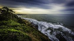
Palomarin Trail
Bolinas, California
20.0 miles NWThis hike is about 5 miles north from Bolinas is the Palomarin Trailhead. As you hike the trail you overlook the ocean and beautiful beaches. The trail takes you up to different lakes and then...
Hike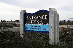
Half Moon Bay State Beach
Half Moon Bay, California
20.2 miles SHalf Moon Bay State Park's Coastside Trail runs parallel to the Pacific Coast along what used to be the Ocean Shore Railroad. The railroad itself was in operation for just 14 years before it was...
Camp, Hike, Horseback, Swim 0.1 mi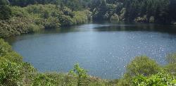
Bass Lake
Bolinas, California
21.5 miles NWHike and Swim near Bolinas, California
Hike, Swim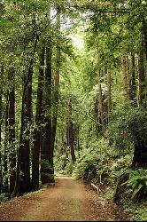
Pescadero Creek Trail Area
Loma Mar, California
34.7 miles SPerfect for all redwood lovers, the Pescadero Creek Park area is an incredible shady trail for a hike on a hot summer day. This is a great place to escape from city sounds and enjoy...
Hike, Horseback, Mountain Bike, Swim


