


Hardtimes Connector / 661
Asheville, North Carolina

| Address: | ~479E, Asheville, NC 28806, USA |
| GPS: |
35°29'28.5"N 82°37'47.8"W Maps | Directions |
| State: | North Carolina |
| Trail Length: | 1.00 miles |
| MTB Difficulty: | Intermediate |
| Trail Type: | Network |
| MTB Trail Type: | Singletrack |
Motorized Use
Hike, Horseback, and Mountain Bike
This trail connects to the main trail system and the big climbs to the top from the Hardtimes Trailhead. This section of singletrack lies in the flatter terrain but leads to the big climbs up the mountain. Courtesy of Singletracks.com
More Information
Hardtimes Connector / 661 Mountain Bike Trail in Asheville, North Carolina - Directions, Maps, Photo
Hardtimes Connector / 661 is a singletrack mountain bike trail in Asheville, North Carolina. View maps, videos, photos, and reviews of Hardtimes Connector / 661 bike trail in Asheville.
http://www.singletracks.com/bike-trails/hardtimes-connector-661/Never modify trail features. Ride trails when they're dry enough that you won't leave ruts. Speak up when you see others on the trail and always yield to hikers, horses, and others coming uphill. Always ride on the established trail.
Read MoreBe courteous, informed, and prepared. Read trailhead guidelines, stay on the trail, and don't feed the wildlife.
Read More
- Plan Ahead and Prepare
- Travel & camp on durable surfaces
- Dispose of waste properly
- Leave what you find
- Minimize campfire impacts
- Respect wildlife
- Be considerate of other visitors
Directions
From Asheville, North Carolina
- Head east on S Pack Square (154 ft)
- Turn left onto N Pack Square (289 ft)
- Turn right onto Broadway St (0.3 mi)
- Slight right onto the Interstate 240 W/U.S. 70 W ramp to U.S. 74 Alternante (0.2 mi)
- Merge onto I-240 W/US-70 WContinue to follow I-240 W(1.5 mi)
- Keep right at the fork to continue on I-26 E, follow signs for Interstate 240 W/Interstate 26 E/Interstate 40 (5.1 mi)
- Take exit 33 for NC-191 toward Blue Ridge Parkway (0.2 mi)
- Turn left onto NC-191 S/Brevard Rd (2.0 mi)
- Turn right onto Bent Creek Ranch Rd (0.3 mi)
- Slight left onto Wesley Branch Rd (2.1 mi)
- Keep right to continue on Bent Creek Gap Rd (0.2 mi)
- Turn right (33 ft)
- Slight left (105 ft)
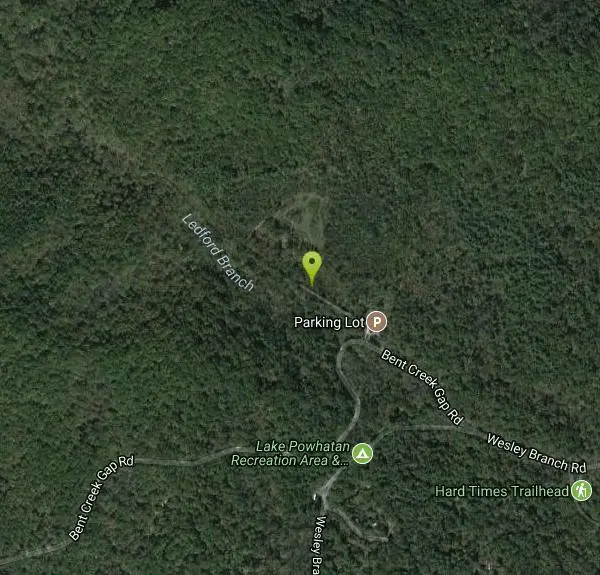
This connector trail is in what is popularly called the Bent Creek area, near Lake Powhatan Recreation Area. Leaving the Pisgah District Ranger Station/Visitor Center parking lot, turn left (south) onto US 276. At the first traffic light, turn left (east) on NC 280. Proceed approximately 12.5 miles, to NC 191 north. Turn left (north) onto NC 191, and then proceed 7.7 miles to Bent Creek Ranch Road (SR 806), which is ½ mile north of the Blue Ridge Parkway, signed for the Recreation Area and at a traffic light. Turn left on Bent Creek Ranch Road and proceed approximately 1½ miles to the Hardtimes parking area, on the left in front of a road gate. The trailhead is beyond the gate, about 200 feet from the paved road, on the left side of the gated (dirt) road. Courtesy of fs.usda.gov

Other Mountain Bike Trails, Hiking Trails, and Horseback Trails Nearby

Little Hickory Top
Asheville, North Carolina
0.0 miles SELittle Hickory Top is a flowy, moderate singletrack in Asheville's Bent Creek network, a favorite leg for building Pisgah mountain-bike loops.
Hike, Horseback, Mountain Bike
Bent Creek
Asheville, North Carolina
0.7 miles EAsheville's go-to trail system offers everything from flat beginner loops near Lake Powhatan to the legendary Green's Lick descent with massive berms, wallrides, and jump lines.
Hike, Mountain Bike
Trace Ridge #354
Horse Shoe, North Carolina
4.7 miles SAn exhilarating mountain bike trail near Horse Shoe that climbs forest road and singletrack to a technical rock garden before a fast and furious downhill finish.
Mountain Bike
Fletcher Creek
Horse Shoe, North Carolina
5.1 miles SSweet, fast singletrack on Fletcher Creek Trail weaves through dense forest and open meadows with multiple creek crossings near Horse Shoe, NC.
Mountain Bike
Middle Fork
Horse Shoe, North Carolina
5.1 miles SAbout 11 miles of fire road and 2.6 miles of singletrack with small drops, log jams, rock gardens, bogs, and creek crossings — plus an optional side trip to Hendersonville Reservoir.
Mountain Bike 3.7 mi
Bradley Creek Road
Horse Shoe, North Carolina
7.1 miles SA gated forest service road that mostly descends for 4 miles from FS 1206 through hardwood forest to a junction of singletrack trails — smooth and fast going down, a steady climb from the other direction.
Mountain Bike 2.2 mi
Pilot Cove / Slate Rocks / 102
Canton, North Carolina
8.9 miles SWA beautiful descent with stream crossings, a waterfall, and some downed trees along the way — not heavily trafficked, but the scenery makes it worth it.
Mountain Bike 2.2-2.3 mi
Richmond Hill
Asheville, North Carolina
9.1 miles NAn 18-hole wooded disc golf course at Richmond Hill Park in Asheville spanning 6,093 feet — hilly, challenging, and set in a 183-acre park with mountain biking, hiking, and birding.
Disc Golf, Hike, Mountain Bike
South Mills River Trail
Canton, North Carolina
9.9 miles SWAn easy out-and-back following the South Fork Mills River with several swinging bridge crossings leading to the historic Cantrell Lodge site — with a steep, technical river-access option.
Hike, Mountain Bike
Pink Beds
Pisgah Forest, North Carolina
11.0 miles SWMostly flat, creek-crossing beginner trails winding 3.3 miles one-way through the scenic seclusion of Pisgah's Pink Beds area — a great warm-up or cool-down ride.
Mountain Bike
Pilot Cove Loop Trail
Pisgah Forest, North Carolina
12.7 miles SWA short 1.8-mile singletrack loop in Pisgah Forest with steep, tight turns and one of the best ridge views in Pisgah National Forest.
Hike, Mountain Bike
Big East Fork
Canton, North Carolina
13.7 miles SWHeavy forest, multiple waterfalls, and a river that shifts from white rapids to calm swimming holes along Big East Fork in Pisgah National Forest — great for kayaking, camping, and swimming year-round.
Backpack, Hike, Kayak, Swim
FS 5058
Pisgah Forest, North Carolina
14.2 miles SWA gated gravel road climb in Pisgah Forest that many riders use as a steady ascent to access serious singletrack descents — park near the horse barns off FS 477.
Mountain Bike
Fs 477
Pisgah Forest, North Carolina
14.3 miles SWA partially gated forest road in Pisgah that serves as a great access route and loop connector for multiple trails — with dispersed camping all along the way.
Mountain Bike
North Slope
Pisgah Forest, North Carolina
15.3 miles SA seasonal mountain bike trail near Pisgah Forest open only October 15 to April 15, with impossible climbs, river sections, great mountain views, and tricky roots and bridges on the descent.
Hike, Mountain Bike
Brevard Bike Path
Brevard, North Carolina
15.3 miles SA paved bike path in Brevard connecting downtown to the Pisgah National Forest — a scenic, practical ride that also links to Oskar Blues Brewery and Davidson River Campground.
Mountain Bike
Davidson River Campground
Pisgah Forest, North Carolina
15.4 miles SA year-round campground in Pisgah National Forest just four miles from Brevard and less than an hour from Asheville, with shaded loops, hiking trails, waterfalls, and fishing spots nearby.
Camp, Hike, Swim
Thrift Cove
Brevard, North Carolina
15.5 miles SAbout 750 feet of elevation, red-blazed trail through Thrift Cove, and five back-to-back jump whoops that are among the best you'll find anywhere — worth lapping repeatedly.
Hike, Mountain Bike
Avery Creek / 327
Brevard, North Carolina
15.5 miles SClassic Pisgah-style singletrack: 3.2 miles of rutted, technical descent from a four-way junction with stream crossings, muck, and hidden flowy sections under a massive tree canopy.
Hike, Mountain Bike
Looking Glass Falls
Brevard, North Carolina
15.6 miles SWA cascading 60-foot waterfall over mossy stone with a wading pool below — just a short, beautiful walk from Pisgah Highway in Brevard, stunning in any season.
Hike, SwimNearby Campsites
Davidson River Campground
Pisgah Forest, North Carolina
15.4 miles SA year-round campground in Pisgah National Forest just four miles from Brevard and less than an hour from Asheville, with shaded loops, hiking trails, waterfalls, and fishing spots nearby.
Camp, Hike, Swim
Rocky Bluff
Hot Springs, North Carolina
28.4 miles NWRocky Bluff is a tranquil mountain getaway in the Pisgah National Forest near Hot Springs, North Carolina, where a wooded campground sits beside the lovely Spring Creek just a few miles south of...
Camp, Hike, Swim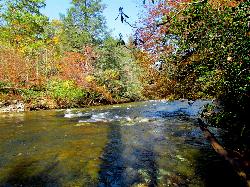
Carolina Hemlock
Burnsville, North Carolina
32.2 miles NEA family swimming area on the South Toe River near Mount Mitchell in the Pisgah National Forest campgrounds — note that the site is closed seasonally and fees apply.
Camp, Swim
Mt. LeConte Lodge
Sylva, North Carolina
36.2 miles WThe highest guest lodge in the eastern United States at 6,400 feet, with spectacular Smokies views from an open glade just below the Mt. LeConte summit in Great Smoky Mountains NP.
Camp, Hike, Horseback, Rock Climb
Cosby Campground
Cosby, Tennessee
37.3 miles NWCamp and Swim near Cosby, Tennessee
Camp, Swim
Old Forge Campground
Bethany, Tennessee
41.6 miles NPrimitive walk-in camping on scenic Jennings Creek in the Cherokee National Forest, with small waterfalls, swimming holes, and hiking trails right from camp — bring your own water.
Camp, Hike, Swim
Horse Creek Campground
Chuckey, Tennessee
42.7 miles NA Cherokee National Forest campground beside Horse Creek with fifteen sites, picnic tables, fishing for rainbow and brook trout, creek swimming, and 31 day-use picnic tables — $10/night camping fee.
Camp, Swim


