


70 Hiking Trails near Bunsen Peak Trail
first prev 1 2 3 4 next lastShowing Hiking Trails within 50 miles Distance miles of Bunsen Peak Trail near Mammoth Hot Springs, Yellowstone National Park City, Zip, or Address
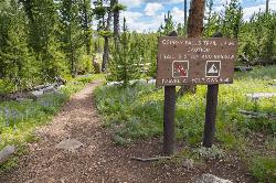
Osprey Falls Trail
Mammoth Hot Springs, Yellowstone National Park
0.0 miles WAn 8-mile out-and-back near Mammoth Hot Springs hiking green meadows and burned forest to the rim of Sheepeater Canyon and a breathtaking 150-foot waterfall on the Gardner River.
Hike 2.0 mi
Snow Pass Trail
Yellowstone National Park Wyoming
2.0 miles NA moderately difficult 2.4-mile out-and-back with 700 feet of gain near Mammoth Hot Springs, passing impressive boulder hoodoos and ending at a secluded mountain valley — hike in groups and carry bear spray.
Backpack, Hike 8.1 mi
Sepulcher Mountain Trail
Mammoth Hot Springs, Yellowstone National Park
3.1 miles NAn 11-mile loop from Mammoth Hot Springs to the 9,652-foot peak of Sepulcher Mountain, passing colorful meadows, aspen forests, and stunning views of Electric Peak — with frequent bighorn, moose, and grizzly sightings.
Hike 5.3 mi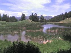
Beaver Ponds Trail
Mammoth, Yellowstone National Park
3.1 miles NA 5-mile loop above Mammoth Hot Springs with beaver ponds of varying sizes, elk, wildflowers, birds, and occasional bear sightings — a perfect morning or evening hike.
Hike 0.1-5.3 mi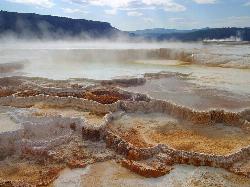
Mammoth Hot Springs
Mammoth, Yellowstone National Park
3.1 miles NEColorful limestone terraces covered in glistening hot-spring water, a 1-mile boardwalk with 300 feet of elevation, elk in the parking lot, and an easy family-friendly loop — Yellowstone's showiest geology.
Camp, Hike 
Mammoth/Gardiner Back Road
Mammoth Hot Springs, Yellowstone National Park
3.4 miles NEThe only road open into Yellowstone in winter runs from Gardiner, Montana through park headquarters at Mammoth Hot Springs and east to Silver Gate and Cooke City.
Hike, Mountain Bike 4.0 mi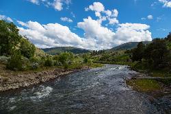
Lava Creek Trail
Mammoth Hot Springs, Yellowstone National Park
3.4 miles NEA 4.2-mile hike along scenic Lava Creek to the 60-foot tiered Undine Falls, with distant Mammoth Hot Springs views, meadows, Mount Everts, and frequent elk and bison sightings.
Hike 0.8 mi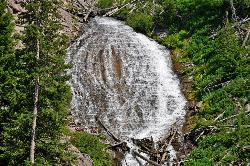
Wraith Falls Trail
Mammoth Hot Springs, Yellowstone National Park
5.2 miles EA less-than-a-mile family-friendly hike near Mammoth Hot Springs to the unique fan-shaped 79-foot Wraith Falls — open year-round and easy for all skill levels.
Hike 7.9 mi
Rescue Creek Trail
Mammoth Hot Springs, Yellowstone National Park
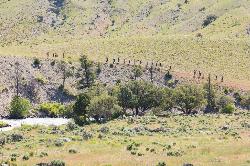
6.1 miles NA level, well-marked 8-mile point-to-point hike across the Montana-Wyoming border through colorful grasslands near Yellowstone, with frequent bighorn sheep, pronghorn, and elk sightings.
Hike 7.4 mi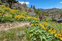
Blacktail Deer Creek to Yellowstone River Trail
Mammoth Hot Springs, Yellowstone National Park
6.7 miles EA 7-mile out-and-back trail dropping through green fields and boulder formations to waterfall views along the Yellowstone River, with a suspension bridge connecting onward trails.
Hike 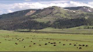
Forces of the Northern Range
Mammoth, Yellowstone National Park
8.1 miles EA half-mile boardwalk on Yellowstone's Blacktail Deer Plateau with mountain peak displays, a wildlife primer, and a view-packed introduction to the Northern Range's forces of nature.
Hike 
Hellroaring Creek Trail
Yellowstone National Park
14.4 miles EA suspension bridge over the Yellowstone River leads to sandy creek-side beaches and a mild backcountry trail past Yellowstone's largest granite slab — great for all ages.
Camp, Hike, Swim 2.4 mi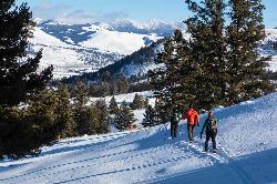
Lost Lake Trail
Tower Junction, Yellowstone National Park
15.1 miles EAn easy 2.8-mile loop behind Roosevelt Lodge, winding through forest, meadows, and along the shores of Lost Lake — open year-round and finishable in under two hours.
Hike 8.2 mi
Garnet Hill Trail
Tower Junction, Yellowstone National Park
15.4 miles EA 7.6-mile loop through Yellowstone meadows, sagebrush, and riverside forest with exceptional wildlife — wolves, bears, bison, moose, elk, and badgers all roam this area.
Hike 
Ice Lake Trail
Norris, Yellowstone National Park
15.6 miles SA short, peaceful trail through forest regrown after the 1988 Yellowstone fires, leading to a pretty, tree-lined lake with young lodgepole pines thriving all around.
Hike 0.8-3.8 mi
Little Gibbon Falls
Norris, Yellowstone National Park
16.0 miles SA family-friendly 4.5-mile Yellowstone loop reaches fishing and swimming spots along Gibbon Creek, with kid-safe trail, canoeing options, and bearspray-worthy backcountry feel.
Camp, Canoe, Hike 7.3 mi
Agate Creek Trail
Tower Junction, Wyoming
16.1 miles EA moderately difficult 7.3-mile hike along Yellowstone River with colorful cliff overlooks, the Narrows, and a primitive riverside campground at trail's end.
Hike 0.3 mi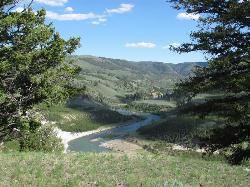
Yellowstone River Picnic Area Trail
Tower Junction, Yellowstone National Park
16.1 miles EA 3.9-mile loop trail from a Yellowstone picnic area along the canyon rim of the Yellowstone River — steam vents, wildlife sightings in meadows, and canyon erosion views throughout.
Hike 16.9 mi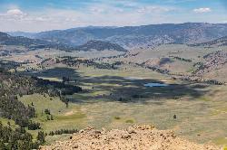
Specimen Ridge Trail (2K4)
Buffalo Ford, Wyoming
16.7 miles EA challenging 17-mile remote hike ascending 3,000 feet to Amethyst Mountain and descending into Lamar Valley — ending at a river ford that may require turning around if uncrossable.
Hike 3.4 mi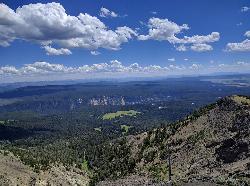
Dunraven Pass - Mount Washburn Trail
Canyon Village, Yellowstone National Park
16.8 miles SEA 6-mile Yellowstone hike via Dunraven Pass through quiet forests to the summit of Mount Washburn — a panoramic perch with bighorn sheep in summer and grizzlies near pine nuts in fall.
Hike


