


136 Hiking Trails near Corona Loop
first prev 1 2 3 4 5 6 7 next lastShowing Hiking Trails within 50 miles Distance miles of 13009 S Warpaint Dr, Phoenix, AZ 85044, USA City, Zip, or Address

Perl Charles Memorial Trail (#1A)
Phoenix, Arizona
14.9 miles NThis is a technical singletrack loop with some very steep up and down sections located in the Phoenix Mountain Preserves. This trail is for advanced riders who like to bleed and leave their skin on...
Hike, Horseback, Mountain Bike
Quartz Peak Trail
15.9 miles SW
Hike near
Hike
Riparian Preserve at Water Ranch Trail
Gilbert, Arizona
16.2 miles EThe Riparian Preserve is an urban park with a series of loop trails surrounding seven ponds stocked with fish and birds. It is located at 2757 E. Guadalupe Road, Gilbert AZ. Several...
Canoe, Hike 1.3 mi
Dreamy Draw Loop Trail
Phoenix, Arizona
16.3 miles NThe Dreamy Draw Nature Trail is a short multi-access loop trail that provides a true Sonoran Desert experience. The trail crosses a number of desert washes and, at times, becomes somewhat rocky....
Hike, Horseback, Mountain Bike 3.6 mi
Charles M. Christiansen Memorial Trail
Phoenix, Arizona
16.4 miles NPhoenix, Arizona is home to some of the best and largest city parks in the country and the Charles M. Christiansen Memorial Trail is a great introduction to this fantastic park system. Also known as...
Hike, Horseback, Mountain Bike 7.1 mi
Trail 100
Phoenix, Arizona
16.5 miles NMountain Bikers and Hikers in Phoenix, Arizona can rejoice in the challenge that is Trail 100. Trail 100, or Charles M. Christensen Memorial Trail, is a little over 14 miles out and back in the...
Hike, Mountain Bike 2.6 mi
L.V. Yates Trail (#8)
Phoenix, Arizona
16.6 miles NThe trail is strewn with large rocks and gulleys from recent torrential rains. Not impassable on foot, but definitely some hike-a-bike areas. Keep in mind there's no ridge hiking...
Hike, Horseback, Mountain Bike
L.V. Yates to "Two Bit" Peak Loop
Phoenix, Arizona
16.6 miles NWell this time of the year there really was not a lot of wild life to see, just to hot. Starting from the 40st trailhead gave me a different view of the preserve. I really enjoyed...
Hike, Horseback 8.3 mi
Estrella Mountains Competitive Track
Tolleson, Arizona
17.6 miles WThe third competitive track in the Maricopa County Regional Park system, located in Estrella Mountain Regional Park, was completed in February 2000. The track consists of two loops totaling 13 miles....
Hike, Horseback, Mountain Bike
Maxine Lakin Nature Trail
Phoenix, Arizona
17.8 miles NHike near Phoenix, Arizona
Hike
North Mountain National Trail
Phoenix, Arizona
18.3 miles NNorth Mountain National Trail is a 2.3 mile moderate, loop trail near Phoenix. It's easy to travel on if you go up the paved sections. The inclines are steep in parts, making it a real...
Hike
Shaw Butte and Charles M Christiansen Loop Trail
Phoenix, Arizona
18.9 miles NWhen you say "North Mountain," I think most Arizonans know where it is or can find it. When you say "Shaw Butte," it seems like you get a lot more questioning glances and "huh?". Shaw...
Hike, Mountain Bike
Indian Bend Bike Trail
Scottsdale, Arizona
19.3 miles NEIndian Bend Wash Greenbelt is a urban, concrete paved path, primarily used for biking and walking/jogging, in Scottsdale, Arizona. This point A to point B, 11 mile long trail takes you past parks,...
Hike, Mountain Bike
Shadow Mountain Trail
Phoenix, Arizona
20.1 miles NThis particular route trailhead starts at 23rd place and Sweetwater rd it's a great wildlife trail.
Hike
Desert Trails Bike Park
Mesa, Arizona
20.4 miles NEHike and Mountain Bike near Mesa, Arizona
Hike, Mountain Bike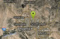
Lookout Mountain Circumference Trail
Phoenix, Arizona
20.7 miles NHike near Phoenix, Arizona
Hike
Lookout Mountain Summit Trail
Phoenix, Arizona
20.8 miles NLookout Mountain Summit Trail is a short, 1 mile trail in Phoenix, Arizona. The trail is steep, especially towards the summit, but it's manageable, and well worth the...
Hike 2.9 mi
Coldwater Trail
Goodyear, Arizona
20.8 miles WThe Cold Water Trail #27 is a seldom visited, remote backcountry destination along the backdrop of the rugged Verde Rim with healthy mixed vegetation and unique geology. The trail was originally used...
Hike, Horseback, Mountain Bike 13.8 mi
Butterfield to Gadsen Loop Trail
Goodyear, Arizona
20.8 miles WAs with other trails in Estrella, the trail is wide and the surface tends to be rather benign, varying from mostly smooth, to occasionally strewn with small rocks, sandy in the washes. Butterfield...
Hike, Horseback, Mountain Bike
Baseline Trail
Goodyear, Arizona
21.0 miles WThe Baseline trail is a 2.6 mile loop at Estrella Mountain Regional Park. This listing is based on access from a spur trail (33.378981, -112.371072) off of the Gila trail. Access is...
Hike


