


12 Hiking Trails near Harry Harm Park
first prev 1 next lastShowing Hiking Trails within 50 miles Distance miles of Harry Harm Park near Bigfork, Montana City, Zip, or Address

Jewel Basin
Kalispell, Montana
10.6 miles NEThe Jewel Basin Hiking Area packs 35 miles of hiker-only trail, two dozen alpine lakes, and the Mount Aeneas lookout into the Swan Range near Kalispell.
Backpack, Camp, Hike
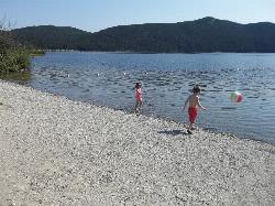
Tally Lake
Whitefish
34.0 miles NWBuoyed gravel swim beach and big lawn at Tally Lake Campground on Montana's deepest natural lake, west of Whitefish in the Flathead National Forest. Day use is $6 per vehicle.
Camp, Canoe, Hike, Kayak, Swim 4.5 mi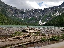
Avalanche Lake
Apgar Village, Glacier National Park
44.7 miles NHike near Apgar Village, Glacier National Park
Hike 0.9 mi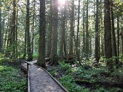
Trail of the Cedars
Apgar Village, Glacier National Park
44.8 miles NAn easy wheelchair-accessible loop through towering 500-year-old cedars up to 100 feet tall in Glacier National Park, with gorge views of glacial Avalanche Creek and a footbridge over the water.
Hike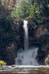
Running Eagle Falls
East Glacier Park
45.1 miles NERunning Eagle Falls, the waterfall older maps call Trick Falls, is a level 0.3 mile walk off the Two Medicine Road in Glacier National Park, wheelchair accessible to a viewing area. Two outlets run in spring, one over the cliff top and one straight out of
Hike, Swim
Logan State Park
Libby
45.8 miles WA small grassy swim beach on the north shore of Middle Thompson Lake in Montana's Logan State Park, along US 2 between Libby and Kalispell. Free for Montana residents with the parks registration fee, $8 per vehicle for others.
Camp, Canoe, Hike, Kayak, Swim 5.0 mi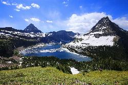
Hidden Lake
Glacier National Park
47.2 miles NA 6.6-mile round-trip hike from Logan Pass through alpine meadows, dense forest, and rocky terrain to the crystal-clear waters of Hidden Lake, with bighorn sheep and mountain goats along the way.
Hike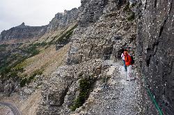
Highline Trail
Logan Pass, Glacier National Park
47.2 miles NOne of Glacier National Park's most celebrated hikes — the Highline Trail spans alpine meadows, the Continental Divide, and the Garden Wall with mountain goats, wildflowers, and views to rival anything in the park.
Backpack, Hike
Clements Mountain Trail
Logan Pass, Glacier National Park
47.3 miles NA four-mile round-trip climb of Clements Mountain in Glacier National Park, with several routes of varying difficulty and significant elevation gain — often confused with nearby Reynolds Mountain.
Backpack, Camp, Hike, Rock Climb 1.4-4.6 mi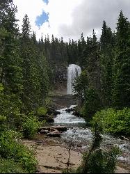
St Mary and Virginia Falls
Rising Sun, Glacier National Park
47.8 miles NEA scenic 3.7-mile roundtrip hike past St. Mary Falls' 50-foot two-tiered drop to the upper and lower tiers of Virginia Falls, best in early season when snowmelt is rushing.
Hike 0.6 mi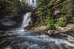
Baring Falls
Glacier National Park
48.3 miles NEA moderate trail hike in Glacier National Park to 30-foot Baring Falls dropping into crystal-clear water — with scenic mountain overlooks, wildlife, and an optional gorge viewpoint 1.5 miles beyond.
Hike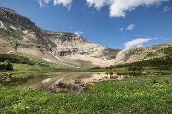
Siyeh Pass Trail
Logan Pass, Glacier National Park
48.4 miles NEA top-of-the-world point-to-point hike through Glacier's Preston Park meadows to a high pass with glacier views, mountain goats, and bighorn sheep.
Backpack, Hike


