


14 Hiking Trails near Sublett Creek Campground
first prev 1 next lastShowing Hiking Trails within 50 miles Distance miles of Forest Rd 564, Malta, ID 83342, USA City, Zip, or Address
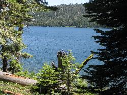
Independence Lakes
Elba, Idaho
34.3 miles WA 7.7-mile hike that climbs to the summit of Mt. Independence, revealing four jewel-tone glacial lakes — plus free kayaks, motorized boats, and floats available from Memorial Day through October 1.
Backpack, Camp, Canoe, Hike, Kayak, Swim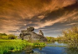
Castle Rocks State Park
Almo, Idaho
35.3 miles SWNeighboring City of Rocks, this state park opened in 2003 with additional climbing routes, bouldering areas, and less-crowded terrain — including a campground and an annual climbing festival with free admission.
Camp, Hike, Rock Climb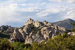
City of Rocks National Reserve
Malta, Idaho
38.3 miles SWOver 700 developed climbing routes on granite spires rising 30 to 600 feet in Idaho's City of Rocks — from 5.6 beginner routes to 5.13 expert lines, with trad, sport, and full-range technique all welcome.
Camp, Hike, Horseback, Mountain Bike, Rock Climb
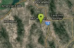
Garden Creek Gap
McCammon, Idaho
40.4 miles NEA sandstone rock climbing area in a scenic mountain gap west of I-15, with great Class 3-4 scrambling and some of the best technical routes in the Pocatello area.
Cross-country Ski, Hike, Horseback, Rock Climb
East Fork Mink Creek Trail
Pocatello, Idaho
40.7 miles NEAn early-season cross-country skiing destination near Pocatello on the East Fork Road leading to Justise Park — access depends on seasonal gate closures and snowpack conditions.
Cross-country Ski, Hike, Horseback, Mountain Bike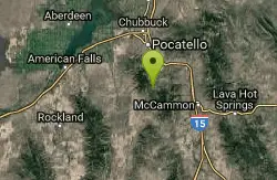
South Fork Of Mink Creek Trail
Pocatello, Idaho
40.7 miles NECross Country Ski, Hike, Mountain Bike, and Snowshoe near Pocatello, Idaho
Cross-country Ski, Hike, Mountain Bike, Snowshoe
West Fork Mink Creek Trail
Pocatello, Idaho
41.5 miles NEA 3.5-mile shaded singletrack trail near Pocatello popular with hikers, horseback riders, and mountain bikers, climbing gradually to Elk Meadows Road with connections to further trails beyond.
Hike, Horseback, Mountain Bike
Valve House Draw
Pocatello, Idaho
41.5 miles NEA motorized doubletrack trail in Pocatello that climbs through forest to the top before a 2-mile stretch of very sweet downhill singletrack — short but worth the 10-mile loop.
Cross-country Ski, Hike, Horseback, Mountain Bike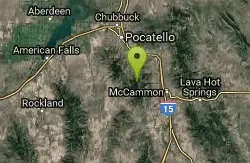
Scout Mountain Campground
Pocatello, Idaho
42.7 miles NEA scenic campground at 6,900 feet on beautiful Scout Mountain, 13 miles south of Pocatello, with birding, wildlife viewing, and a variety of multi-use trails nearby.
Camp, Hike
Cherry Springs
Pocatello, Idaho
43.7 miles NEThick green vegetation, abundant birds, and wildlife viewing along a picnic-table-lined trail just a short distance from Pocatello, Idaho — a peaceful nature escape close to town.
Hike 3.2 mi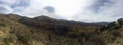
Kinney Creek Trail
Pocatello, Idaho
44.0 miles NEA 6.4-mile out-and-back to Indian Mountain Summit in Caribou-Targhee National Forest near Pocatello, with Idaho backcountry views and exceptional birdwatching — raptors, waterfowl, and songbirds.
Hike
Slate Mountain/Gibson Jack Trail
Pocatello, Idaho
44.3 miles NEA beautiful Gibson Jack loop in Pocatello with aspen, pines, sage, and meadow views — clockwise is the preferred direction, but watch for a steep creek-bottom fork at mile 5 that can sink a tire.
Hike, Horseback, Mountain Bike
Sportsman's Park American Falls Reservoir
Aberdeen, Idaho
44.5 miles NA 30-acre multi-use park on the American Falls Reservoir with two boat ramps, picnic shelters, RV hookups, playgrounds, volleyball courts, and a 1.1-mile paved trail along the reservoir rim.
Camp, Canoe, Hike 0.2-9.7 mi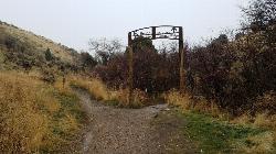
City Creek
Pocatello, Idaho
46.8 miles NEPocatello's city-maintained trail network packs over six miles of singletrack into City Creek Canyon, with everything from casual loops to a downhill-only expert run.
Hike, Horseback, Mountain Bike


