


75 Hiking Trails near Table Rock / Table Mountain
first prev 1 2 3 4 next lastShowing Hiking Trails within 50 miles Distance miles of Teton Canyon Rd, Alta, WY 83414, USA City, Zip, or Address

Bitch Creek Trestle
Tetonia, Idaho
17.9 miles NWAs part of the Rails to Trails project, this old railroad bridge has been transformed into a very safe little viewing experience for the whole family. You can drive right up to the bridge where...
Hike 0.6 mi
Packsaddle Lake
Tetonia, Idaho
21.1 miles WPacksaddle is one of the less well known lakes/trails in the area. If you've got a good offroad vehicle, you can probably make it all the way to the end of the road, otherwise, it's just an...
Dive, Hike, Mountain Bike, Snowshoe, Swim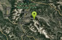
Blue Miner Lake
Jackson, Wyoming
24.2 miles SEBackpack and Hike near Jackson, Wyoming
Backpack, Hike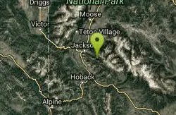
Cache Creek Trial
Jackson, Wyoming
25.2 miles SEHilly terrain with an elevation gain/loss of 850’. Groomed 4.6 miles to Noker Mine Draw on Monday, Wednesday and Friday, generally in the morning. Snowmobiles are allowed on the Cache Creek...
Hike 1.1 mi
Fish Lake
Ashton, Idaho
25.4 miles NHike near Ashton, Idaho
Hike 15.9-16.6 mi
Union Falls & Ouzel Pool
Grant Village, Yellowstone National Park
25.4 miles NBackpack, Hike, Hot Springs, and Swim near Grant Village, Yellowstone National Park
Backpack, Hike, Hot Springs, Swim 1.9 mi
Terraced Falls
Grant Village, Yellowstone National Park
25.9 miles N3.6 mile easy out and back trail. 430 ft Elevation gain. The trailhead is off Ashton-Flagg Ranch Road along Yellowstone's South border. Ashton-Flagg Ranch Road is closed during the winter.
Hike
Cave Falls of Yellowstone
Ashton, Idaho
27.0 miles NThis campgrond is situated on the banks of Fall River in Wyoming along the south border of Yellowstone National Park. Cave Falls Campground has 23 single site units and a terrific area for...
Camp, Hike 14.8-30.2 mi
Mr. Bubbles Hot Spring
Old Faithful, Yellowstone National Park
27.9 miles NMr. Bubbles is one of the few places you can actually soak in the thermal waters of Yellowstone National Park. The Bechler area of Yellowstone is one of the best kept secrets of the otherwise densely...
Hike, Hot Springs 5.6-8.3 mi

Palisades Creek Trail / Lakes and Waterfall Canyon
Irwin, Idaho
28.9 miles SWPalisades Creek Trail is located about 50 miles southeast of Idaho Falls and about 60 miles west of Jackson Hole WY in Swan Valley Idaho. The four mile hike up to lower Palisades Lake or the 6.2 mile...
Backpack, Camp, Hike, Horseback, Mountain Bike 0.8 mi
Conant Creek Pegram Truss Railroad Bridge
Ashton, Idaho
29.2 miles NWAs part of the Rails to Trails project, this old railroad bridge has been transformed into a very safe little viewing experience for the whole family. You can drive right up to the bridge where there...
Hike
Burns Canyon
Ririe, Idaho
29.6 miles WHike and Mountain Bike near Ririe, Idaho
Hike, Mountain Bike 3.3-10.0 mi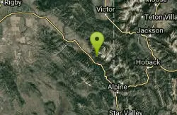
Sheep Creek Trail
Irwin, Idaho
30.2 miles SWHike and Mountain Bike near Irwin, Idaho
Hike, Mountain Bike 3.9 mi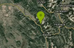
Little Elk Creek Trail
Irwin, Idaho
31.1 miles SBackpack, Hike, Horseback, and Mountain Bike near Irwin, Idaho
Backpack, Hike, Horseback, Mountain Bike 13.8 mi
Big Elk Creek
Irwin, Idaho
31.6 miles SBig Elk Creak Campground is a very versitile campground with plenty of activities to keep busy. Campgrounds are available, with three group sites that include picnic tables and campfire rings. There...
Backpack, Camp, Canoe, Hike, Horseback, Kayak
Fall Creek Falls
Swan Valley, Idaho
31.8 miles SWFalls Campground is located next to the Snake River near beautiful Swan Valley, only 45 miles east of Idaho Falls, Idaho. Mixed growth cottonwood trees provide partial shade, and grassy meadows with...
Camp, Cave, Hike, Kayak, Swim 3.2-47.0 mi
Yellowstone Branch Line Trail
Ashton, Idaho
31.9 miles NWYellowstone branch line trail runs from Warm River to the Montana border totaling 39 miles. There are a few places to jump on and off the trail as well as a few smaller trails that branch off of this...
Backpack, Cross-country Ski, Hike, Horseback, Mountain Bike 0.3-0.6 mi
Bear Gulch
Ashton, Idaho
32.8 miles NWBear Gulch is an abandoned ski hill out of operation since 1969. While the vegetation is beginning to take over, there's still some great sledding to be had. It's just far enough into the...
Camp, Cross-country Ski, Hike, Sled 0.6-2.2 mi
Fish Creek Area
Ririe, Idaho
33.0 miles WFish Creek is a network of mountain bike trails up in the Big Hole Mountains. The trails are easily accessed from either the Ririe or Rexburg side of the range. The trail system is set up much...
Hike, Mountain Bike
Calamity Campground
Irwin, Idaho
33.2 miles SWCalamity Campground is located just 55 miles east of Idaho Falls, Idaho. This is the perfect area to access the Palisades Reservoir and enjoy the water activities available there. The water here is...
Camp, Canoe, Hike, Kayak, Mountain Bike, Swim


