


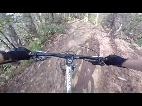
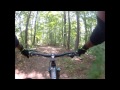
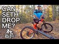
Kitsuma Mountain Bike Trail
Old Fort, North Carolina

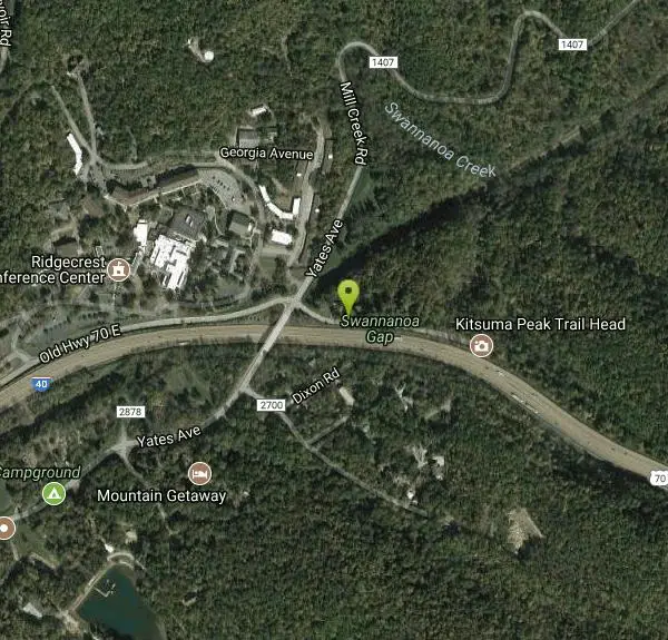
| GPS: |
35°37'18.0"N 82°16'15.7"W Maps | Directions |
| State: | North Carolina |
| Trails/Routes: | 4.5-5.0 mi |
Mountain Bike
Kitsuma Trail is an absolute classic in the Pisgah National Forest area, so classic in fact that Litespeed Bicycles named one of their old Hardtails after the trail.
After a short road ride to the trailhead from the parking area, the "intermediate" grade of Kitsuma is clear as soon as you start on the first switchback. Better find your climbing gears! After 1,000 feet of elevation gain in 12+ brutal switchbacks and close to 3 miles, your thighs will thank you as you near Kitsuma Peak-the summit of the trail. As you ride along a mellow ridge at the summit, the beautiful views of Mt. Mitchell and thick North Carolina forest offer some momentary relief from the climbing before starting down the lightning fast descent.
Though the climbing to the peak is difficult, the iconic 2.8 miles of descent towards the Old Fort picnic area allow ferocious speeds on unbelievably fast and flowy singletrack. The flow of the trail is accented with a healthy number of big berms, drops, and some rolling jumps that let you enjoy and play on your bike to the fullest. There are a handful of tighter corners on the downhill, so stay loose and prepare for these or you will shoot headfirst into the North Carolina brush. The trail and especially the descent are best ridden dry. The well-worn dirt on Kitsuma offers fantastic grip if you're riding sticky tires, but the trail and roots can also be on the loose side of things when wet or covered with leaves.
After resting and regaining the feeling in your face at the Old Fort picnic area, ride left onto Old US-70 and take the next left turn onto a paved road. Follow this road for 5 miles over some easy climbing back to the Kitsuma trailhead, rest for a bit more, then ride it again!
More Information
Never modify trail features. Ride trails when they're dry enough that you won't leave ruts. Speak up when you see others on the trail and always yield to hikers, horses, and others coming uphill. Always ride on the established trail.
Read More- Plan Ahead and Prepare
- Travel & camp on durable surfaces
- Dispose of waste properly
- Leave what you find
- Minimize campfire impacts
- Respect wildlife
- Be considerate of other visitors
Directions
From Old Fort, North Carolina
- Head west on N Railroad St toward Catawba Ave (194 ft)
- Turn right onto Catawba Ave (56 ft)
- Turn left onto US-70 W/W Main St (1.0 mi)
- Merge onto I-40 W/US-70 W (5.6 mi)
- Take exit 66 toward Ridgecrest (0.2 mi)
- Turn right onto Dunsmore Ave (174 ft)
- Turn right onto Old Hwy 70 E (0.9 mi)
- Continue straight onto Royal Gorge RdDestination will be on the left(331 ft)
Located near Old Fort, North Carolina.


Trails
Distance ?
4.5 milesElevation Gain ?
-1,097 feetReal Ascent ?
772 feetReal Descent ?
1,869 feetAvg Grade (-3°)
-5%Grade (-19° to 14°)
-35% to 25%Distance ?
5.0 milesElevation Gain ?
1,095 feetReal Ascent ?
1,187 feetReal Descent ?
92 feetAvg Grade (2°)
4%Grade (-7° to 21°)
-13% to 38%Elevation differences are scaled for emphasis. While the numbers are accurate, the cut-away shown here is not to scale.
Other Mountain Bike Trails Nearby

Richmond Hill
Asheville, North Carolina
17.9 miles WHilly, wooded course. Handmade signs and Astro Turf tees. Alt. pins on 14 holes. Long pants smart (poison ivy). Parking lot OB. Public (No Fee) Richmond Hill Park is Asheville's largest wooded...
Disc Golf, Hike, Mountain Bike 3.4 mi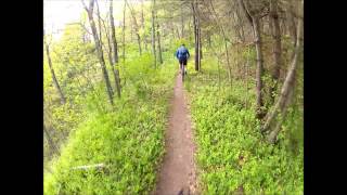
Alexander Mountain Bike Park
Alexander, North Carolina
21.4 miles WNice, challenging singletrack. Not overly technical, with some nice climbs and nice flowing sections, and a nice view of the French Broad river. However, this trail does get overgrown sometimes from...
Hike, Horseback, Mountain Bike
Bent Creek
Asheville, North Carolina
21.5 miles SWBent Creek is the go-to trail system for the greater Asheville area, and with the deeply-ingrained mountain bike culture in the Asheville/Brevard area, and Western North Carolina in general, Bent...
Hike, Mountain Bike
Little Hickory Top
Asheville, North Carolina
22.1 miles SWDogs: Leashed
Hike, Horseback, Mountain Bike
Hardtimes Connector / 661
Asheville, North Carolina
22.1 miles SWThis trail connects to the main trail system and the big climbs to the top from the Hardtimes Trailhead. This section of singletrack lies in the flatter terrain but leads to the big climbs up the...
Hike, Horseback, Mountain Bike
Trace Ridge #354
Horse Shoe, North Carolina
25.4 miles SWForest Road and singletrack. This trail is exhilarating. Climb up the forest road, the single track (rolling and steep), then bust up the technical rock garden and youre home free to fast and furious...
Mountain Bike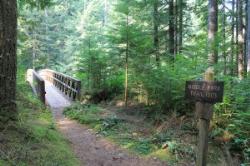
Middle Fork
Horse Shoe, North Carolina
25.8 miles SWThis trail is about 8.8 miles of fire road and 2.6 miles of singletrack. There are 2 gated roads from the trailhead take the one on the right, Fletcher Creek Road (AKA The Never Ending Road). It...
Mountain Bike
Fletcher Creek
Horse Shoe, North Carolina
25.8 miles SWFrom trailhead parking lot, ride back down gravel road. After concrete bridge, turn left on Wash Creek Road (FS5000). After proceeding up hill on FS5000 for about 2 miles, turn left onto Spencer...
Mountain Bike 3.7 mi
Bradley Creek Road
Horse Shoe, North Carolina
27.6 miles SWThis graded FS road gradually ascends from the Bradley Creek Trail (#351) on its way to Yellow Gap Road. Enjoy the surrounding hardwood forest as you climb - the road itself is not too exciting to...
Mountain Bike 2.2 mi
Pilot Cove / Slate Rocks / 102
Canton, North Carolina
29.9 miles SWFun descent with several stream crossings along the way. Nothing too steep but this trail doesn't get a lot of use so there are usually a few trees down along the way. Beautiful scenery and a...
Mountain Bike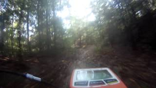
South Mills River Trail
Canton, North Carolina
31.4 miles SWThis is an easy out-and-back trail that follows the South Fork Mills River with several swinging bridge crossings that leads to the site of the old Cantrell Lodge. From the trail head, the left side...
Hike, Mountain Bike
Pink Beds
Pisgah Forest, North Carolina
32.3 miles SWGreat warm up/cool down trails or beginner trails for Pisgah, as they are mostly flat. The bikeable portion of this trail will dump you out on a gravel road near the South Mills River trail after...
Mountain Bike
Pilot Cove Loop Trail
Pisgah Forest, North Carolina
34.1 miles SWThis short 1.8-mile trail has some steep, very tight singletrack and some very tight turns... but it is well-worth riding because it houses one of the best views in Pisgah National Forest! Definitely...
Hike, Mountain Bike
Bennett Gap / 138
Pisgah Forest, North Carolina
34.3 miles SWThis trail is 3 miles in one direction. Again, another gnarly Pisgah-area trail! This trail has several awesome views off the top of the ridge of Looking Glass mountain. Absolutely incredible--be...
Hike, Mountain Bike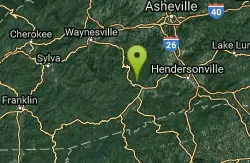
Fs 477
Pisgah Forest, North Carolina
34.3 miles SWParts of this road are gated, so you can't drive all the way through to the other end, which is further up 276. There is camping all along this road, which is great as it can be used...
Mountain Bike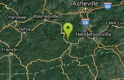
FS 5058
Pisgah Forest, North Carolina
34.4 miles SW5058 is a gated gravel road that many riders use as an easy climb to the tops of some wicked singletrack descents. Park near the horse barns off of FS 477 to access this climb....
Mountain Bike
North Slope
Pisgah Forest, North Carolina
34.5 miles SWThis trail is only open from October 15 - April 15. This trail is very worn and is more suitable to hiking, but it is an interesting bike trail nonetheless. Start from the parking lot and ride across...
Hike, Mountain Bike
Brevard Bike Path
Brevard, North Carolina
34.6 miles SWGovernment at it's best. Great way to get from town to the forest. If you are camping at the Davidson River Campground you can connect to the bike via Eastatoe Trail. The Bike path is great way...
Mountain Bike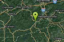
Thrift Cove
Brevard, North Carolina
34.8 miles SWStart riding the trail at the back of the parking lot. Go about 0.1 miles and turn right up Thrift Cove trail. Follow the red blazes and turn left at the intersection with Grass Road. On the way back...
Hike, Mountain Bike
Avery Creek / 327
Brevard, North Carolina
34.8 miles SWThe bottom end of Avery Creek can be accessed via FS 477, and the top can be accessed via the Buckwheat Knob trail, the Black Mountain trail, or the Club Gap trail. Avery Creek descends for 3.2 miles...
Hike, Mountain BikeNearby Campsites

Mount Mitchell Area
Trinity, North Carolina
13.2 miles NNice family swimming place right by N. F. campgrounds in the South Toe River (cold) in the Pisgah N. F... Fees: Yes This site is closed seasonally.
Camp, Swim
Davidson River Campground
Pisgah Forest, North Carolina
34.7 miles SWDavidson River Recreation Area offers camping and outdoor activities for the whole family. The campground boasts several loops of shaded campsites, as well as access to hiking trails, fishing spots,...
Camp, Hike, Swim
Rocky Bluff
Hot Springs, North Carolina
36.3 miles NWPlay in water in creek, shallow at times.
Camp, Hike, Swim
Old Forge Campground
Bethany, Tennessee
39.8 miles NWOld Forge Campground and Recreation Area is a small campsite perfect for campers looking for a primitive experience. Old Forge is located on the beautiful Jennings Creek in the Cherokee National...
Camp, Hike, Swim
Horse Creek Campground
Chuckey, Tennessee
39.9 miles NWHorse Creek Campground is a popular day use and camping location in the Horse Creek Recreation Area. This beautiful spot in the Cherokee National Forest is a great location to connect with nature...
Camp, Swim


