


P Mountain and Little Mountain
Payson, Utah
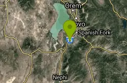
| Address: | Payson, UT, USA |
| GPS: |
40°2'39.8"N 111°43'55.7"W Maps | Directions |
| State: | Utah |
| Trail Length: | 1.00 miles |
| Trail Type: | Out & Back |
| Hike Difficulty: | Beginner |
Trails Rocks Wildflowers Pet Friendly Bicycles Restrooms Picnic Tables Lakes Rivers Waterfalls Streams Glaciers Ponds Paintball Permitted Skateboarding Fishing Motorized Use National Park State Park
Hike
P Mountain and Little Mountain is Payson's hometown hike, a short, rewarding ridge walk in the Uinta-Wasatch-Cache National Forest that leads to the point above the giant white "P" overlooking town, with sweeping views across the southern end of Utah Valley. Every Utah town seems to have a letter on its hillside, and this is the trail that gets you to Payson's, which makes it both a local ritual and one of the best view-per-effort outings in the area.
The route runs about 1.8 miles out and back with roughly 488 feet of elevation gain, taking most people an hour or so. It's rated moderately challenging, which is a fair description: the path along the ridge of Little Mountain, also known locally as P Hill, is relatively level but genuinely rocky, and there are some steep, loose sections that demand attention on the way down more than the way up. It's short enough for families and interesting enough not to feel like a chore.
The views are the payoff. From the ridge and the point above the P, southern Utah Valley spreads out below, with Payson at your feet and the Wasatch running north. It's a superb spot for sunset, and the short distance means you can catch one without committing to a headlamp epic on the way down, though bringing a light is still smart.
Dogs are welcome and must be kept on leash, which makes this a popular local dog walk. April through September is the prime window, with spring and fall the most comfortable and midsummer afternoons hot on the exposed slope. Winter access depends entirely on snow and ice, and the loose rock underfoot becomes considerably more interesting when frozen.
The two things reviewers flag are the steep, loose sections and some genuine trail confusion, since a web of use-paths and connecting routes crisscrosses the hillside and it's easy to end up on the wrong one, so a mapping app or a look at the route before setting out saves backtracking. The slope is exposed with essentially no shade.
Bring water, sun protection, and shoes with real grip for the rocky, loose tread; trail runners or boots beat sneakers here. For anyone in Payson, Spanish Fork or Santaquin looking for a quick after-work climb with a big view, or a visitor wanting to tag a local landmark, P Mountain delivers a genuinely satisfying hour on the hill.
More Information
Add ResourceBe courteous, informed, and prepared. Read trailhead guidelines, stay on the trail, and don't feed the wildlife.
Read More
- Plan Ahead and Prepare
- Travel & camp on durable surfaces
- Dispose of waste properly
- Leave what you find
- Minimize campfire impacts
- Respect wildlife
- Be considerate of other visitors
Directions
From Payson, Utah
- Head on Main St (1 ft)

Other Hiking Trails Nearby

Grotto Falls
Payson, Utah
7.1 miles SEA gentle wooded creek trail with bridges leads to a waterfall and limestone grotto you can crawl around — all ages welcome and especially stunning in fall color season.
Hike
Dripping Rock
Spanish Fork, Utah
7.7 miles EDripping Rock is along a paved path adjacent to Spanish Oaks Golf Course.
Hike
Bicentennial Park
Provo, Utah
12.9 miles NEA 16-hole disc golf course in Provo beside a duck pond, a playground, a boardwalk nature trail with natural springs, and mature trees that make even moderate holes a genuine challenge.
Disc Golf, Hike, Sled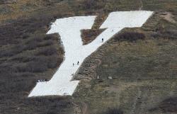
Y-Mountain Summit Trail
Provo, Utah
15.4 miles NEA 1.2-mile climb east of BYU leads to a massive block Y on the hillside and sweeping panoramas over Provo, Orem, Utah Valley, and Utah Lake below.
Camp, Hike 4.7 mi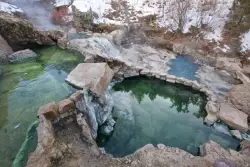
Fifth Water Hot Springs
Provo, Utah
20.1 miles EA scenic 2.5-mile riverside hike to the famous Diamond Fork rock pools and waterfall, with soaks up to 108°.
Backpack, Camp, Hike, Hot Springs, Mountain Bike, Swim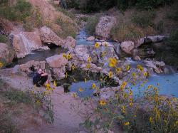
Fifth Water Hot Springs
Springville
22.0 miles ENatural hot pools below a waterfall on Fifth Water Creek in Diamond Fork Canyon, reached by a 4.5-mile round-trip hike from the Three Forks Trailhead ($10 Forest Service vehicle fee).
Hike, Swim
G Mountain Trail
Pleasant Grove, Utah
22.1 miles NA family-friendly 1.5-mile roundtrip hike from Kiwanis Park to a hillside 'G' landmark near Pleasant Grove — a little steep at the start and the end, but great for all ages.
Hike 1.2 mi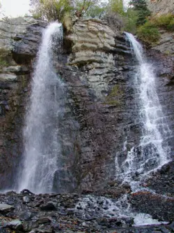
Battle Creek Falls
Pleasant Grove, Utah
22.1 miles NA short 1.2-mile family-friendly hike in Pleasant Grove to a scenic waterfall with views from below and above, plus a nearby rappelling and rock climbing area just beyond the falls.
Canyoneer, Hike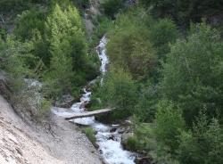
Grove Creek Trail
Pleasant Grove, Utah
22.9 miles NA steep, shuttled downhill singletrack dropping from the shoulder of Mount Timpanogos through Grove Creek Canyon — the climb is brutal, but the descent is worth it.
Hike, Mountain Bike
Provo River Parkway Trail
Provo, Utah
23.1 miles NA fully paved 6-mile canyon ride from Vivian Park to the mouth of Provo Canyon, passing waterfalls and a fish-feeding spot — best done with two cars for a car-shuttle downhill.
Hike, Mountain Bike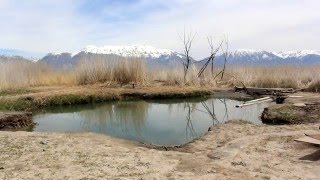
Saratoga Hot Springs
Saratoga Springs, Utah
23.1 miles NThree naturally heated pools around 100°F year-round, a muddy beautiful setting, and an easy walk to nearby Utah Lake for wildlife watching between soaks.
Hike, Hot Springs 0.3 mi
Kiowa Valley Path
Eagle Mountain, Utah
24.1 miles NWA 0.3-mile paved path affectionately dubbed 'Lizard Hill' by local kids — easy on any stroller, gentle enough for all ages, and filled with basking lizards and rabbits along the way.
Hike
Stewart Falls
Provo, Utah
25.7 miles NA glacier-fed, 200-foot multi-tiered waterfall on Mt. Timpanogos — about a 4-mile round trip hike through forest with a few steep edges near the falls.
Hike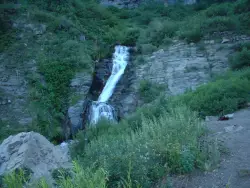
Timpanogos Falls
Provo, Utah
25.8 miles NA lesser-known multi-tiered waterfall on the Mt. Timpanogos trail, visible early on and surrounded by wildflowers in late spring — a great beginner hike shared with the Stewart Falls trailhead.
Hike 1.6-14.1 mi
Mount Timpanogas
Provo, Utah
27.2 miles NUtah's most-climbed mountain towers 7,000 feet above the Provo valley, stretching seven miles north to south with multiple peaks over 11,000 feet — a Wasatch landmark.
Camp, Hike, Horseback, Swim 1.5 mi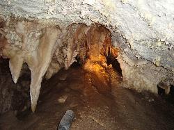
Timpanogas Cave
Provo, Utah
27.6 miles NColorful cave formations — cave bacons, columns, flowstone, and drapery — inside a Timpanogos mountain cave, reached by a 1.5-mile paved trail; tours run May through September.
Backpack, Cave, Hike 1.3 mi
Eagle Crest Trail
Draper, Utah
30.1 miles NA beginner-level 2.4-mile mountain bike trail along the north side of Traverse Mountain in Draper, with sweeping views of Salt Lake Valley, Mount Timpanogos, Lone Peak, and Box Elder Mountain.
Hike, Mountain Bike 1.7 mi
Schoolhouse Springs Trail
Alpine, Utah
30.3 miles NA short, scenic trail at 5,300 feet in Alpine, Utah, featuring a lake and activities from horseback riding to hiking — best enjoyed between May and October.
Hike, Mountain Bike
Mercer Hollow Trail
Draper, Utah
30.4 miles NA fast, flowy descent on the southern flank of Corner Canyon Ridge, packed with berms, rock features, rollers, and a quick uphill that rewards you on the way back down.
Hike, Mountain Bike
Little Valley Trail
Draper, Utah
31.2 miles NSuperbly constructed flow trails in a small Draper valley that are just as fun for adults as for kids — with connections to Corner Canyon for a longer ride.
Hike, Mountain BikeNearby Campsites
Y-Mountain Summit Trail
Provo, Utah
15.4 miles NEA 1.2-mile climb east of BYU leads to a massive block Y on the hillside and sweeping panoramas over Provo, Orem, Utah Valley, and Utah Lake below.
Camp, Hike 4.7 mi
Fifth Water Hot Springs
Provo, Utah
20.1 miles EA scenic 2.5-mile riverside hike to the famous Diamond Fork rock pools and waterfall, with soaks up to 108°.
Backpack, Camp, Hike, Hot Springs, Mountain Bike, Swim 1.6-14.1 mi
Mount Timpanogas
Provo, Utah
27.2 miles NUtah's most-climbed mountain towers 7,000 feet above the Provo valley, stretching seven miles north to south with multiple peaks over 11,000 feet — a Wasatch landmark.
Camp, Hike, Horseback, Swim
Maple Canyon
Fountain Green, Utah
33.9 miles SMaple Canyon's one-of-a-kind cobblestone conglomerate cliffs host 140+ bolted routes from 5.4 to 5.14, making it one of the most unique climbing destinations in the US.
Camp, Hike, Mountain Bike, Rock Climb
Spruces Campground
Salt Lake City, Utah
41.5 miles NA fee campground in Big Cottonwood Canyon near Salt Lake City — check USDA.gov for current rates and seasonal availability.
Camp, Sled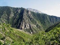
Mill Creek Canyon
Salt Lake City, Utah
45.3 miles NAn out-and-back canyon trail with over 1,000 feet of elevation gain — the lower ski trail sees heavy traffic while the upper section above Elbow Fork stays quiet, with a reservable Yurt at the top December through April.
Camp, Cross-country Ski, Snowshoe


