


Mint Springs Valley Park
Crozet, Virginia

| Address: | Mint Springs Valley Park, 6659 Mint Springs Park, Crozet, VA 22932, USA |
| GPS: |
38°4'53.7"N 78°43'51.8"W Maps | Directions |
| State: | Virginia |
Restrooms Picnic Tables
Hike, Mountain Bike, and Swim
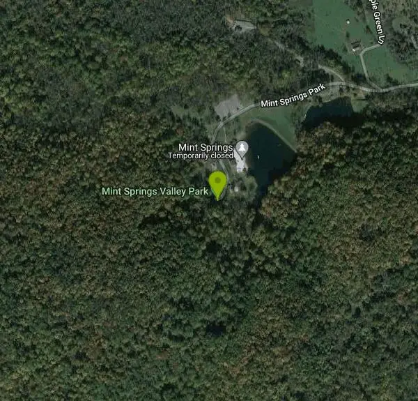
Mint Springs Valley Park is a beautiful eight acre park with a variety of activities to enjoy. The park has two small lakes with beaches and is surrounded by forests with miles of trails. The park also has reservable covered picnic table areas, a sand volleyball pit, and a playground.
The lakes are open for fishing year round, and are stocked with trout twice a year. The beaches are open year round for people wishing to relax on the shore, and are open for swimming during warmer months. Swim season information can be found on the park website. The forests surrounding the lakes create beautiful reflections on the lake and contain miles of trails open to hikers and mountain bikers.
More Information
Mint Springs Valley Park | County Parks Info | Albemarle County, VA
Mint Springs Valley Park (MSVP) Middle Dam Construction Has Begun
https://www.albemarle.org/Home/Components/FacilityDirectory/FacilityDirectory/70/360Mint Springs Valley Park | Kids in Parks
The Mint Springs Valley Park TRACK Trail adventures can be used on any of the park’s trails. There are over five miles of trails in the park, from easy trails along the lake to more strenuous trails up in the mountains. Please check a park map before venturing out on to any trail.
https://www.kidsinparks.com/mint-springs-valley-parkNever modify trail features. Ride trails when they're dry enough that you won't leave ruts. Speak up when you see others on the trail and always yield to hikers, horses, and others coming uphill. Always ride on the established trail.
Read MoreBe courteous, informed, and prepared. Read trailhead guidelines, stay on the trail, and don't feed the wildlife.
Read More
- Plan Ahead and Prepare
- Travel & camp on durable surfaces
- Dispose of waste properly
- Leave what you find
- Minimize campfire impacts
- Respect wildlife
- Be considerate of other visitors
Directions
From Crozet, Virginia
- Head northeast on Crozet Ave toward Three Notched Rd (148 ft)
- Turn left onto State Rte 788/
Railroad Ave (1.0 mi) - Continue onto Mint Springs Rd (0.7 mi)
- Turn left onto Mint Springs ParkDestination will be on the left(0.6 mi)


Other Mountain Bike Trails, Swimming Holes, and Hiking Trails Nearby

Sugar Hollow
Crozet, Virginia
4.2 miles NAn 11-mile loop starting and ending at Sugar Hollow Reservoir, passing Blue Hole and Rip Rap swimming holes — a hiker's way to combine challenge with a cool dip in Shenandoah.
Hike, Swim 6.1 mi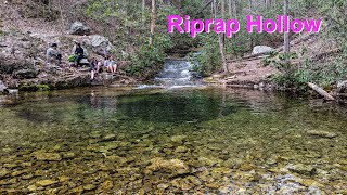
Rip Rap Hollow
Crozet, Virginia
6.9 miles NA 50-foot, mountain-fed swimming hole on a difficult 10-mile Shenandoah Valley loop that also passes Chimney Rock and a scenic waterfall — cold, clear, and worth the effort.
Hike, Swim
Charlottesville Area
Williamsville, Virginia
10.3 miles NETwo swimming spots north of Charlottesville, Virginia — a fee applies, so check details before heading out.
Swim
Pauls Creek
Nellysford, Virginia
13.3 miles SWA quick 1.2-mile hike along Paul's Creek leads to a cascading waterfall and a natural water slide — stones smoothed by the water let visitors slide right into the swimming hole below.
Hike, Swim
Campbell Creek
Tyro, Virginia
20.6 miles SWA 6-mile Appalachian Trail stretch with good elevation rewards remote explorers with a creek pool at the base of a waterfall — optional swimwear in this backcountry spot.
Swim
St. Mary's Falls
Raphine, Virginia
22.6 miles SWBlue-green water and unique low rock formations set the scene at this cascading waterfall swimming hole in St. Mary's Wilderness — a 4.4-mile out-and-back hike through George Washington National Forest.
Hike, Swim
Natural Chimneys
Mount Solon, Virginia
27.1 miles NWTowering vertical limestone formations draped in trees and vines, with shallow river swimming holes, 2.5 miles of hiking and biking trails, and a well-equipped 135-site campground.
Camp, Hike, Mountain Bike, Swim
Fridley Gap
Keezletown, Virginia
28.7 miles NA small, chest-deep swimming hole at the halfway point of a beautiful George Washington National Forest loop — cold all year and only 0.5 miles from the trailhead.
Hike, Swim
Stokesville Campground
Madison, Virginia
29.5 miles NWSwim near Madison, Virginia
Swim
Big Marys Creek Slide
Vesuvius, Virginia
29.7 miles SWA natural waterslide that launches you into a swimming hole below, with waterfalls and cool water in the Virginia hills — wear swimwear and foot protection, and check depth first.
Swim
North River Gap
Mount Solon, Virginia
30.2 miles NWA free recreation area with an easy 2.4-mile river gorge hike through lush forest, a wading and swimming spot in the North River, and primitive campsites for $5 a night.
Camp, Hike, Swim
Rapidan Rivers
Madison, Virginia
31.8 miles NESwimming holes beneath small waterfalls along the Rapidan River in Shenandoah, accessible on short hikes — protected waters known for trout and catfish fishing.
Swim 0.3 mi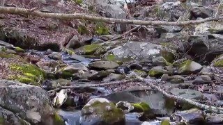
Big Rock Falls
Syria, Virginia
33.1 miles NEA moderately challenging 1.5-mile trail follows Mill Prong River to a beautiful cascading waterfall with a swimming hole that fills up nicely at higher water levels.
Hike, Swim
Rose River
Syria, Virginia
35.8 miles NEA moderately difficult 4-mile forested loop in Shenandoah National Park descending to the Rose River and a stunning 67-foot waterfall — wading is possible in some spots.
Hike, Swim
Old Rag Area
Crewe, Virginia
37.4 miles NESix swimming holes at the base of waterfalls and along rivers in Shenandoah National Park's Old Rag area, all reached by hikes of varying length from Skyline Drive or nearby routes.
Swim 2.8 mi
Cedar Run Falls
Oldrag, Virginia
37.4 miles NESix waterfalls, a natural waterslide, and a deep swimming hole reward experienced hikers who tackle this strenuous 8-mile, 2,794-ft-elevation Shenandoah trail.
Hike, Swim
Whiteoak Canyon
Syria, Virginia
38.8 miles NEA Shenandoah hike featuring both a two-tiered lower waterfall and a classic single-drop upper falls — with cool wading spots along the trail for a well-earned break before the 1,040-foot climb back.
Hike, Swim
Panther Falls
Amherst, Virginia
40.0 miles SWPanther Falls is one of the most popular swimming holes in the central Virginia mountains, a broad, boulder-framed cascade on the Pedlar River just east of the Blue Ridge Parkway near Buena Vista and...
Swim
Nicholson Hollow Trail
Morning Star, Virginia
41.9 miles NEAn 8-mile moderately strenuous Shenandoah hike past stream crossings, small cascading waterfalls, shaded forest, and the historic Corbin Cabin — wading is possible in low-flow conditions.
Hike, Swim
Ben Salem Wayside
Lexington, Virginia
42.7 miles SWSwim near Lexington, Virginia
SwimNearby Campsites
Natural Chimneys
Mount Solon, Virginia
27.1 miles NWTowering vertical limestone formations draped in trees and vines, with shallow river swimming holes, 2.5 miles of hiking and biking trails, and a well-equipped 135-site campground.
Camp, Hike, Mountain Bike, Swim
North River Gap
Mount Solon, Virginia
30.2 miles NWA free recreation area with an easy 2.4-mile river gorge hike through lush forest, a wading and swimming spot in the North River, and primitive campsites for $5 a night.
Camp, Hike, Swim
Bear Creek Lake State Park Beach
Cumberland, Virginia
45.8 miles SESand beach on the 40-acre lake at Bear Creek Lake State Park, tucked inside Cumberland State Forest between Richmond and Lynchburg, with camping, cabins and 30 miles of trail.
Camp, Hike, Kayak, Mountain Bike, Swim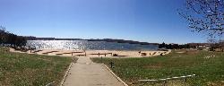
Swim Beach at Lake Anna State Park
Mineral
48.9 miles EA groomed sand beach on the public side of Lake Anna, with a buoyed swimming area, a bathhouse and a seasonal snack bar at the end of the state park road. Swimming is unguarded and free; only parking is charged.
Camp, Canoe, Hike, Kayak, Swim


