


Pike Lake State Park Beach
Bainbridge
Camp, Canoe, Hike, Kayak, and Swim
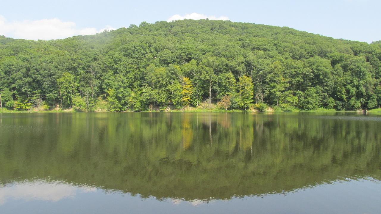
The swimming beach at Pike Lake State Park is a small sand beach on Pike Lake, a 13-acre reservoir in western Pike County, Ohio, about 5 miles south-southeast of Bainbridge. The Ohio Department of Natural Resources, Division of Parks and Watercraft, runs the park. The lake itself is a piece of history: Civilian Conservation Corps crews dug it largely by hand in the 1930s, damming Richardson Hollow at its south end, and the state turned the area into a park in 1949. Steep, wooded ridges of the surrounding Pike State Forest drop right down to the water on most sides, so the beach is one of the few open, flat spots along the shore.
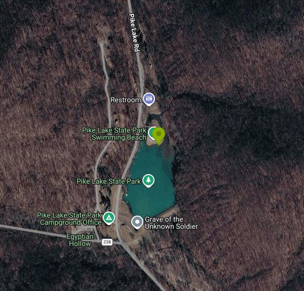
Pike Lake Road (County Road 4) runs through the park and passes the north half of the lake, where the beach sits on the east side of the road. Paved parking lots are close to the sand, with more parking near the boat launch and the dam to the south. From Bainbridge, follow the signs for the state park south off US 50 into the hills. The last few miles are narrow, curving forest roads, so take them slowly, especially with a trailer or camper.
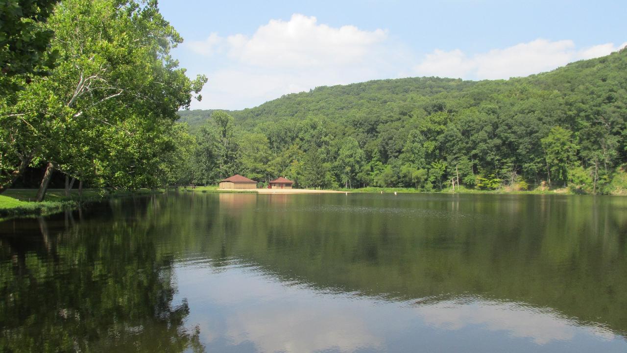
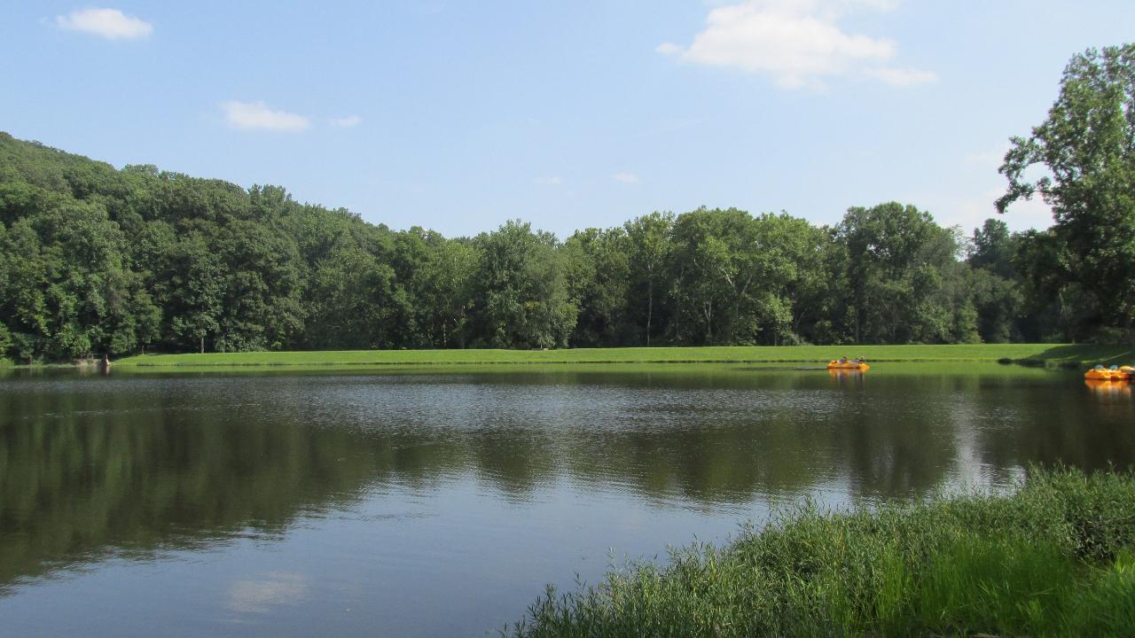
The beach is a modest strip of sand facing the open water of the lake. A beach house beside it has restrooms, changing rooms and outdoor showers. ODNR says swimming is allowed only in the designated area and asks swimmers to use caution, and its park page does not list lifeguards, so plan on watching your own group. Pike Lake is a quiet, small lake with no current, and only paddle craft and boats with small electric motors (4.5 horsepower or less) are allowed on it, so there is no wake from powerboats. Pets are not permitted on the beach. The lake is small and sits in a shaded valley, so the water is warmest in July and August and cools off fast once fall arrives.
There is no charge to swim. Ohio state parks charge no entrance fee, and the beach is open to anyone, not just campers or cabin guests. Park hours are 6am to 11pm daily, and the park office is staffed 8am to 4:30pm on weekdays at (740) 493-2212. Fees apply only to extras like campsites, cabins and boat rentals.
Water quality at the beach is sampled from Memorial Day to Labor Day, and the results are posted on the Ohio Department of Health's BeachGuard site. If a bacteria or algae advisory sign is posted at the beach, take it seriously and stay out of the water until it is lifted. Outside that season nobody is testing, so swimming after heavy rain is a judgment call.
There is plenty to do once you dry off. The camp store rents canoes, kayaks and pedal boats, including to visitors who are not camping. Five short trails start in the park, among them the 0.4-mile Lake Rim Trail around the water and the 1.2-mile Mitchell Ridge Trail, which links to the Buckeye Trail. The park also has an 18-hole disc golf course with no fee, a nature center, picnic shelters, playgrounds, a family campground and rental cabins. The creek that runs through the campground has a shallow swimming hole of its own, though it can dry up by late summer.
More Information
Between Columbus And Cincinnati Is An Underrated Ohio Lakeside State Park With Camping, Swimming, An
Pike Lake is a quiet spot with great camping options, from quiet wooded sites to spiffy preferred cabins, all giving great access to the park
https://www.islands.com/2167768/pike-lake-state-park-between-columbus-cincinnati-ohio-underrated-lakeside-camping-swimming-hiking/DeWine recognizes outdoors during Ohio State Parks Week
The recognition is to highlight the state's outdoors, recreational opportunities and conservation efforts across the 76 parks.
https://spectrumnews1.com/oh/columbus/news/2025/04/21/gov--dewine-recognizes-outdoors-during-ohio-state-parks-week--Gov. DeWine proclaims June 1 to 7 as Ohio State Parks Week
COLUMBUS — The Ohio Department of Natural Resources (ODNR) has announced that Governor Mike DeWine has officially proclaimed June 1 to 7, as Ohio State Parks Week, celebrating the natural beauty, outdoor recreational opportunities, and award winning excellence of Ohio’s 76 state parks. ODNR’s Division of Parks and Watercraft manages Ohio’s state parks to ensure they remain accessible to […]
https://www.knoxpages.com/2026/06/02/gov-dewine-proclaims-june-1-ro-7-as-ohio-state-parks-week/Pike Lake State Park
587-acre Pike Lake State Park is located in the midst of the scenic wooded hills of southern Ohio. The small 13-acre lake is surrounding by state forest lands contributing to the park's rustic charm.
https://ohiodnr.gov/go-and-do/plan-a-visit/find-a-property/pike-lake-state-parkSplash Into Summer — Visit Pike County, Ohio
Buy Local and Win! Learn how you can win up to $500 in prizes!
https://visitpike.com/splashBe courteous, informed, and prepared. Read trailhead guidelines, stay on the trail, and don't feed the wildlife.
Read More
- Plan Ahead and Prepare
- Travel & camp on durable surfaces
- Dispose of waste properly
- Leave what you find
- Minimize campfire impacts
- Respect wildlife
- Be considerate of other visitors
Directions
From Bainbridge
- Head north toward Madison Ave N (253 ft)
- Turn left onto Henshaw Way NE (331 ft)
- Turn right onto Madison Ave N (0.7 mi)
- At the traffic circle, take the 1st exit onto High School Rd NE (0.3 mi)
- Turn right onto WA-305 SParts of this road may be closed at certain times or days(0.8 mi)
- Continue onto Olympic Dr SE (482 ft)
- Keep left to continue on Ferry Dock/
Olympic Dr SE (0.2 mi) - Turn left onto Ferry DockToll road(217 ft)
- Take the Seattle - Bainbridge Ferry to SeattleToll road(8.6 mi)
- Continue straight onto Seattle Ferry TerminalToll road(486 ft)
- Continue straight onto Marion St (0.4 mi)
- Slight right onto 6th Ave (0.3 mi)
- Take the I-5 S ramp on the left to Portland (0.5 mi)
- Slight left to merge onto I-90 E toward Bellevue/
Spokane (1.3 mi) - Keep left to stay on I-90 EPassing through IdahoEntering Montana(822 mi)
- Keep left to continue on I-94 EPassing through North DakotaEntering Minnesota(758 mi)
- Keep right to stay on I-94 E (59.0 mi)
- Keep left to stay on I-94 E (6.8 mi)
- Slight left onto I-694 E (12.9 mi)
- Keep right to stay on I-694 E (10.8 mi)
- Continue onto I-494 S (443 ft)
- Take exit 58B for I-94 E toward Madison (0.3 mi)
- Take the ramp onto I-94 EEntering Wisconsin(248 mi)
- Keep right to continue on I-90 EToll roadEntering Illinois(103 mi)
- Keep left to stay on I-90 EToll road(13.6 mi)
- Take the I-290 E/
IL-53 S exit toward Chicago/ W Suburbs Toll road(1.3 mi) - Continue onto Exit 1B (signs for IL-72/
Higgins Rd) (0.4 mi) - Merge onto I-290 E/
IL-53 S Continue to follow I-290 E(5.1 mi) - Slight right to stay on I-290 E (signs for Chicago) (9.1 mi)
- Take the exit toward I-294 S (0.4 mi)
- Continue onto I-294 SToll road(0.3 mi)
- Take the exit on the left toward I-294 N (0.4 mi)
- Continue onto I-294 NToll road(31.8 mi)
- Continue onto I-80 EEntering Indiana(12.9 mi)
- Take exit 11 to merge onto I-65 S toward Indianapolis (130 mi)
- Continue onto I-865 E (0.3 mi)
- Continue onto I-65 S (16.7 mi)
- Take exit 112 to merge onto I-70 E toward Dayton (5.5 mi)
- Keep left to stay on I-70 E (59.5 mi)
- Slight left (4.3 mi)
- Merge onto I-70 EEntering Ohio(37.2 mi)
- Take exit 33A to merge onto I-75 S toward Dayton (8.8 mi)
- Take exit 52 to merge onto US-35 E toward Xenia (13.2 mi)
- Take the US-35 E exit toward Washington C H (0.4 mi)
- Continue onto US-35 E (34.7 mi)
- Take the OH-41 exit toward Greenfield (0.3 mi)
- Turn right onto OH-41 S/
State Rte 41 S (10.2 mi) - Turn left onto OH-753 N (0.5 mi)
- Turn right onto Wolfe Rd (1.3 mi)
- Continue straight onto State Rte 138 S (0.1 mi)
- Turn right to stay on State Rte 138 S (0.6 mi)
- Turn left onto OH-28 E/
State Rte 41 S (0.3 mi) - Turn right onto State Rte 41 S (11.2 mi)
- Turn left onto E Main St/
State Rte 50 Scn (0.8 mi) - Turn right onto Potts Hill Rd (0.6 mi)
- Turn right to stay on Potts Hill Rd (2.6 mi)
- Turn right onto Pike Lake RdDestination will be on the left(3.0 mi)




Other Swimming Holes, Hiking Trails, Canoeing Areas, and Kayaking Areas Nearby
Shoemaker Beach
Bainbridge
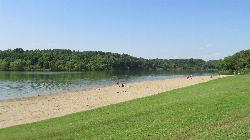
9.7 miles NWA 1,000-foot sand beach on Paint Creek Lake, the Army Corps reservoir at the center of Paint Creek State Park near Bainbridge. Swimming is inside the buoys only and there are no lifeguards, and Ohio's BeachGuard system tracks the water quality all season.
Camp, Canoe, Hike, Kayak, Swim
Rocky Fork Lake South Beach
Hillsboro
13.8 miles WSouth Beach is one of two free public swimming beaches on Rocky Fork Lake, run by the Ohio Department of Natural Resources about seven miles east of Hillsboro. Check the state's BeachGuard listing before you go, because this beach went under a bacteria ad
Camp, Canoe, Hike, Kayak, Swim
Deer Creek State Park
Mount Sterling, Ohio
32.4 miles NA 2,337-acre resort park centered on a 1,700-foot swimming lake with two boat ramps, 232 campsites, 7 miles of trails, an 18-hole golf course, and a full marina with boat rentals.
Camp, Disc Golf, Hike, Mountain Bike, Sled, Swim
Cowan Lake State Park
Wilmington
39.4 miles NWCowan Lake's 1,000-foot public beach is free, unguarded and daylight only, on a 700-acre reservoir with a 10-horsepower limit that keeps it quiet. ODNR begins drawing the lake down 13.5 feet on November 1 for dam rehabilitation, and water is not expected
Camp, Canoe, Hike, Kayak, Swim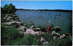
Cowan Lake Public Beach
Wilmington
39.4 miles NWA free, unguarded 1,000-foot public beach on the south shore of Cowan Lake, seven miles from Wilmington. Ohio DNR is drawing the lake down 13.5 feet for dam rehabilitation beginning November 1, and normal water levels are not expected back until summer 20
Camp, Canoe, Hike, Kayak, Swim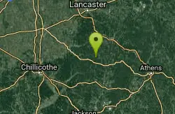
Hocking Hills State Park
Logan, Ohio
40.9 miles NESandstone rock outcrops, deep cool gorges, and waterfalls define six scenic park areas in Hocking Hills, where white-tailed deer, wild turkey, and box turtles are regular sightings.
Camp, Hike, Mountain Bike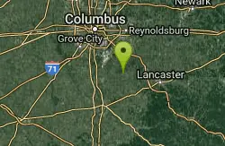
Slate Run Metro Park
Ashville, Ohio
46.1 miles NESlate Run Metro Park spans grasslands, wetlands, meadows, and beech-oak-hickory forest — home to a rich mix of habitats rooted in 350-million-year-old shale geology.
Hike, Horseback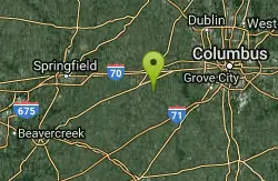
Sugar Maple Hiking Trail Madison Lake State Park
London, Ohio
49.7 miles NA peaceful half-mile Sugar Maple Hiking Trail winds through woodlands and along the shoreline of small, serene Madison Lake — a quiet Darby Plains escape for anglers, canoeists, and rowers.
Hike
Caesar Creek State Park Visitor Center Trail
Waynesville, Ohio
50.0 miles NWA multi-use recreational area at Caesar Creek Lake offering camping, hiking, horseback riding, boating, fossil collecting, and more across 2,830 acres of water and 7,720 acres of land.
Hike
Battelle Darby Creek
Grove City, Ohio
50.0 miles NThe largest Columbus Metro Park at over 7,000 acres — 20-plus miles of riparian forest along the nationally noted Big and Little Darby Creeks, rich in aquatic and terrestrial diversity.
Cross-country Ski, HikeNearby Campsites
Shoemaker Beach
Bainbridge
9.7 miles NWA 1,000-foot sand beach on Paint Creek Lake, the Army Corps reservoir at the center of Paint Creek State Park near Bainbridge. Swimming is inside the buoys only and there are no lifeguards, and Ohio's BeachGuard system tracks the water quality all season.
Camp, Canoe, Hike, Kayak, Swim
Rocky Fork Lake South Beach
Hillsboro
13.8 miles WSouth Beach is one of two free public swimming beaches on Rocky Fork Lake, run by the Ohio Department of Natural Resources about seven miles east of Hillsboro. Check the state's BeachGuard listing before you go, because this beach went under a bacteria ad
Camp, Canoe, Hike, Kayak, Swim
Deer Creek State Park
Mount Sterling, Ohio
32.4 miles NA 2,337-acre resort park centered on a 1,700-foot swimming lake with two boat ramps, 232 campsites, 7 miles of trails, an 18-hole golf course, and a full marina with boat rentals.
Camp, Disc Golf, Hike, Mountain Bike, Sled, Swim
Cowan Lake State Park
Wilmington
39.4 miles NWCowan Lake's 1,000-foot public beach is free, unguarded and daylight only, on a 700-acre reservoir with a 10-horsepower limit that keeps it quiet. ODNR begins drawing the lake down 13.5 feet on November 1 for dam rehabilitation, and water is not expected
Camp, Canoe, Hike, Kayak, Swim
Cowan Lake Public Beach
Wilmington
39.4 miles NWA free, unguarded 1,000-foot public beach on the south shore of Cowan Lake, seven miles from Wilmington. Ohio DNR is drawing the lake down 13.5 feet for dam rehabilitation beginning November 1, and normal water levels are not expected back until summer 20
Camp, Canoe, Hike, Kayak, Swim
Hocking Hills State Park
Logan, Ohio
40.9 miles NESandstone rock outcrops, deep cool gorges, and waterfalls define six scenic park areas in Hocking Hills, where white-tailed deer, wild turkey, and box turtles are regular sightings.
Camp, Hike, Mountain Bike


