


Pink Lime
Provo-Orem, UT, Utah
Cave
The Pink Lime Pit is a popular location to practice vertical rope work. The place is ideal because it has several bolts and natural anchors that can be used simultaneously, and up to 10 ropes can be rigged at the same time. Ropes can be rigged for traditional rappelling (feet against the wall) or static rappelling (not touching any walls). There's even an anchor high on one wall where you can practice passing a bolt while descending or ascending.
More Information
Pink Lime Pit | The Dye Clan
The Pink Lime Pit is a popular location to practice vertical rope work. The place is ideal because it has several bolts and natural anchors that can be used simultaneously, and up to 10 ropes can be rigged at the same time. Ropes can be rigged for traditional rappelling (feet against the wall) or static rappelling (not touching any walls). There
https://dyeclan.com/outdooractivities/caving/?id=122
- Plan Ahead and Prepare
- Travel & camp on durable surfaces
- Dispose of waste properly
- Leave what you find
- Minimize campfire impacts
- Respect wildlife
- Be considerate of other visitors
Directions
From Provo-Orem, UT, Utah
- Head northeast on E Provo Canyon Rd (0.4 mi)
- Make a U-turn (1.0 mi)
- Turn right onto 800 N (3.7 mi)
- Turn right onto the ramp to Salt Lake (0.2 mi)
- Merge onto I-15 N (6.3 mi)
- Take exit 278 for Main Street toward American Fork (0.3 mi)
- Keep left at the fork, follow signs for Pioneer Crossing/Lehi/Saratoga Springs/Eagle Mountain (0.1 mi)
- Turn left onto W Main St (0.1 mi)
- Continue onto Pioneer Crossing (5.3 mi)
- Continue straight to stay on Pioneer Crossing (1.1 mi)
- Continue straight to stay on Pioneer Crossing (0.6 mi)
- Continue onto UT-73 W/W Cedar Fort RdContinue to follow UT-73 W(14.6 mi)
- Turn left onto N 18150 W (12.9 mi)
- Slight right onto S 18150 W (226 ft)
- Turn right onto 12 Mile Pass Rd (1.2 mi)
- Turn left (1.1 mi)
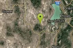
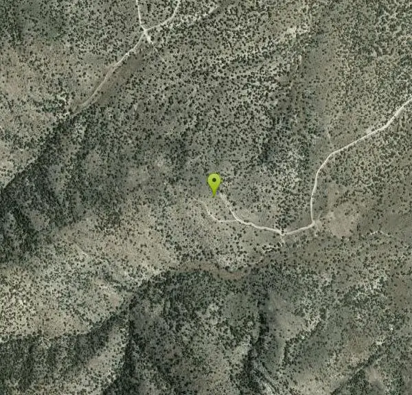
Utah County – 40° 4’22.94”N, 112° 7’47.60”W
Other Caves Nearby
Nutty Putty Cave
Provo-Orem, UT, Utah
5.2 miles ECLOSED. The body of caver John Jones could not be recovered without risking injury to rescue personnel and the decision was made to make the cave the permanent resting place with assurances to the family that the cave would be closed and that his body would never be disturbed. A naturally formed thermal cave on Utah Lake's west side with many rooms connected by narrow tunnels — great for beginners seeking a manageable underground adventure.
Cave 
Silly Putty Cave
Provo-Orem, UT, Utah
6.3 miles ECLOSED. Permanently closed. This is Nutty Putty Cave, which was sealed shut with concrete in 2009 after a caver died trapped inside; the cave is now his memorial and is completely inaccessible to the public. The cave first entered in 1960 by Salt Lake caver Dale Green, after local ranchers directed him to a snake-inhabited pit on a nearby hill — the origin story of Nutty Putty Cave.
Cave 1.5 mi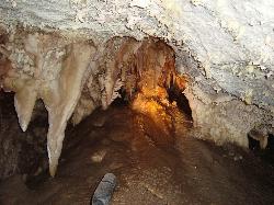
Timpanogas Cave
Provo, Utah
34.0 miles NEColorful cave formations — cave bacons, columns, flowstone, and drapery — inside a Timpanogos mountain cave, reached by a 1.5-mile paved trail; tours run May through September.
Backpack, Cave, HikeNearby Campsites
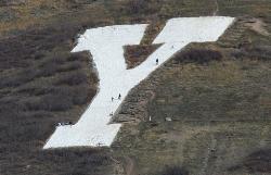
Y-Mountain Summit Trail
Provo, Utah
30.0 miles NEA 1.2-mile climb east of BYU leads to a massive block Y on the hillside and sweeping panoramas over Provo, Orem, Utah Valley, and Utah Lake below.
Camp, Hike 1.6-14.1 mi
Mount Timpanogas
Provo, Utah
35.8 miles NEUtah's most-climbed mountain towers 7,000 feet above the Provo valley, stretching seven miles north to south with multiple peaks over 11,000 feet — a Wasatch landmark.
Camp, Hike, Horseback, Swim 4.7 mi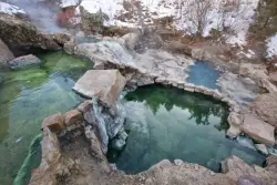
Fifth Water Hot Springs
Provo, Utah
41.0 miles EA scenic 2.5-mile riverside hike to the famous Diamond Fork rock pools and waterfall, with soaks up to 108°.
Backpack, Camp, Hike, Hot Springs, Mountain Bike, Swim 
Maple Canyon
Fountain Green, Utah
43.1 miles SEMaple Canyon's one-of-a-kind cobblestone conglomerate cliffs host 140+ bolted routes from 5.4 to 5.14, making it one of the most unique climbing destinations in the US.
Camp, Hike, Mountain Bike, Rock Climb 
Spruces Campground
Salt Lake City, Utah
47.0 miles NEA fee campground in Big Cottonwood Canyon near Salt Lake City — check USDA.gov for current rates and seasonal availability.
Camp, Sled 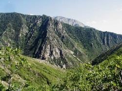
Mill Creek Canyon
Salt Lake City, Utah
48.5 miles NEAn out-and-back canyon trail with over 1,000 feet of elevation gain — the lower ski trail sees heavy traffic while the upper section above Elbow Fork stays quiet, with a reservable Yurt at the top December through April.
Camp, Cross-country Ski, Snowshoe


