


Prescott City Beach
Prescott
Swim
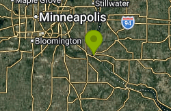
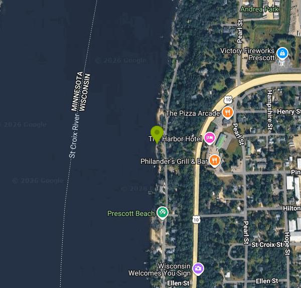
Prescott City Beach is the municipal swimming beach of the City of Prescott, Wisconsin, a strip of sand on the east bank of the St. Croix River a short distance north of downtown. The city lists it among its parks as City Beach and describes it as sitting along the St. Croix off Lake Street, north of the U.S. Highway 10 bridge. This is the bottom of Lake St. Croix, the wide, slow lower reach of the river, and roughly a mile upstream of the point where the clear St. Croix meets the browner Mississippi. The river here is also the state line, so the far shore you look at is Minnesota.
To get there, head north from downtown Prescott on Lake Street North, which runs north between the river and Highway 10/35 as it leaves town. The beach is a narrow city-owned parcel at the water's edge, and the city's listing does not describe a dedicated lot, so follow posted signs for where parking is allowed on the residential streets nearby. From downtown it is a short walk or bike ride, which is often easier than finding a spot on a hot weekend.
The swim area is a city-designated swimming area with a sand beach, a bathhouse with changing space, restrooms, picnic tables and a bike rack, according to the city's facility listing. The bottom is river sand close to shore, but Lake St. Croix deepens quickly away from the beach and the main channel is not far out. The water is generally warm enough for comfortable swimming from late June through August. Neither the city's facility page nor its beach ordinance mentions lifeguards, so plan on swimming without one and keep children within reach.
There is no admission fee listed anywhere by the city, and the beach ordinance says the designated swimming area is open each year for public use during posted hours, so it is a free public beach. City parks close from 10 p.m. to 6 a.m. unless posted otherwise, and swimming and use of the bathhouse are not allowed between sunset and sunrise. The ordinance also bans alcohol, glass and other litter, fireworks at or near the swim area, and animals other than service animals. Changing clothes is only permitted in the bathhouse or another enclosed space. Violators can be cited and barred from the beach for 30 days per violation, and the police chief or council can close the beach for weather, conditions or safety.
The main hazards are the river itself. Lake St. Croix carries heavy recreational boat traffic in summer, much of it running between Hudson, Stillwater and the Mississippi, so expect wakes and stay inside the swim area rather than heading out toward the channel. Depth changes quickly once you leave the shallows, and river levels rise after heavy rain and spring melt, which can shrink the beach or cover it. The city does not post water testing results for this beach on its site, so it is sensible to skip swimming for a day or two after a big storm.
Downtown Prescott is a few minutes south, with the riverfront walkway, restaurants and the Highway 10 drawbridge over the St. Croix. Freedom Park on the bluff above town has a view over the confluence of the two rivers, and Kinnickinnic State Park, a few miles north on the Wisconsin shore, has a larger sand beach on the St. Croix if this small one is crowded.
More Information

- Plan Ahead and Prepare
- Travel & camp on durable surfaces
- Dispose of waste properly
- Leave what you find
- Minimize campfire impacts
- Respect wildlife
- Be considerate of other visitors
Directions
From Prescott
- Head south toward E Goodwin St (23 ft)
- Turn left onto E Goodwin St (0.2 mi)
- Turn left onto S Pleasant St (0.1 mi)
- Turn right onto E Gurley St (0.7 mi)
- Continue straight to stay on E Gurley St (0.2 mi)
- Keep right to continue on AZ-69 SPass by Carl's Jr (on the right in 6.2 mi)(15.0 mi)
- Turn left onto AZ-169 N (15.1 mi)
- Turn left to merge onto I-17 N toward Flagstaff (61.5 mi)
- Take exit 340A to merge onto I-40 E toward AlbuquerqueEntering New Mexico(289 mi)
- Continue onto U.S. Route 66 (1.2 mi)
- Continue onto I-40 E (211 mi)
- Take exit 339 toward NM-278 (0.2 mi)
- Turn left onto State Rte 88/
Quay County Rd Ai Continue to follow Quay County Rd Ai(4.0 mi) - Turn right onto US-54 EPass by Subway (on the right in 15.8 mi)Entering Texas(85.6 mi)
- Turn left onto Denver Ave (0.3 mi)
- Denver Ave turns slightly right and becomes US-54 E/
Liberal St Pass by Toot'n Totum (on the right)Entering Oklahoma(101 mi) - Continue onto US-54 EEntering Kansas(11.6 mi)
- Continue onto E Pancake Blvd (1.5 mi)
- Continue onto US-54 E (12.0 mi)
- US-54 E turns slightly right and becomes US-54 EPass by Casey's (on the left in 154 mi)(204 mi)
- Take the exit toward I-35 N (0.1 mi)
- Take the ramp onto I-35 NToll road(75.6 mi)
- Continue onto I-335 NToll road(50.2 mi)
- Continue onto I-470 EToll road(6.8 mi)
- Merge onto I-70 EToll road(50.7 mi)
- Take exit 418B on the left to merge onto I-635 NEntering Missouri(7.8 mi)
- Take exit 12B to merge onto I-29 S/
US-71 S toward I-35 (3.3 mi) - Take exit 1B to merge onto I-35 N toward Des MoinesParts of this road may be closed at certain times or daysEntering Iowa(193 mi)
- Take exit 137A for I-235 W toward Des Moines (0.2 mi)
- Slight left to merge onto I-35 NEntering Minnesota(201 mi)
- Take exit 69 for MN-19 toward New Prague/
Northfield (0.2 mi) - At the traffic circle, take the 3rd exit onto 46/
Hazelwood Ave (1.1 mi) - Turn right onto 70th St W (0.5 mi)
- Continue onto 320th St W (5.0 mi)
- Continue straight to stay on 320th St W (1.7 mi)
- Turn right onto MN-3 S (0.2 mi)
- Turn left onto Northfield Blvd (20.6 mi)
- Continue onto Jorgen Ave (0.4 mi)
- Turn right onto 160th St E (0.7 mi)
- Continue onto Vermillion Rd (1.2 mi)
- Turn left onto US-61 N/
Great River Rd/ Vermillion St Continue to follow US-61 N/Great River Rd Pass by NAPA Auto Parts (on the right in 0.4 mi)(2.8 mi) - Turn right onto 127th St S (0.2 mi)
- Turn right onto US-10 E/
I-94 ALT Entering Wisconsin(2.8 mi) - Turn left onto Lake St N (0.2 mi)
- Turn left to stay on Lake St NDestination will be on the left(0.5 mi)
Other Swimming Holes Nearby
Cedar Lake Ice Hole
Minneapolis
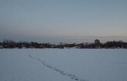
28.9 miles NWA permitted winter plunge hole cut in the ice on the west side of Cedar Lake, maintained by Endurance United volunteers. Free, waiver required, no lifeguard, and cold shock is the real danger.
Canoe, Hike, Kayak, Swim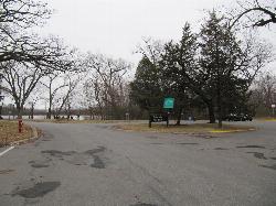
Cedar Lake Point Beach
Minneapolis
28.9 miles NWA free, lifeguarded summer sand beach on a wooded point on Cedar Lake's west shore in Minneapolis, run by the park board and popular with kayakers and open-water swimmers.
Canoe, Hike, Kayak, Swim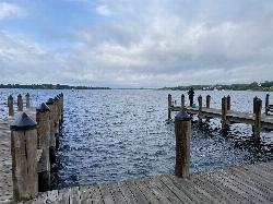
Wayzata Beach
Wayzata
37.9 miles NWWayzata Beach is the City of Wayzata's free public sand beach on Wayzata Bay of Lake Minnetonka, with a swimming dock, playground and picnic areas, open mid-June to mid-August with no lifeguard on duty.
Kayak, Swim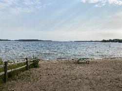
Excelsior Public Beach
Excelsior
38.9 miles WFree, unguarded city swimming beach in The Commons on Excelsior Bay of Lake Minnetonka, open daily 7 am to 8 pm from Memorial Day to Labor Day, with a buoyed swim area and paid street parking nearby.
Swim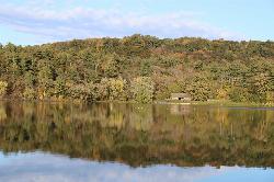
Lake O' the Dalles Beach
St. Croix Falls
44.5 miles NThe swimming beach at Wisconsin's Interstate Park, on a calm lake below the St. Croix River bluffs in St. Croix Falls. Sand beach, no lifeguards, state park vehicle pass required.
Camp, Canoe, Hike, Kayak, Swim


