


Rick's Revenge
Bear Valley, California

| Address: | 45 Bear Valley Rd, Bear Valley, CA |
| GPS: |
38°27'42.9"N 120°2'31.0"W Maps | Directions |
| State: | California |
Disc Golf
At 7100' in an alpine meadow. Fairly flat with guardian trees - some tough routes to get a birdie. Front 9 is shorter with some cross over between, 4, 5, 7 and 8. Back 9 has more difficulty and length. Tees are rubber with log borders. Alt. pin positions. Public (No Fee)Courtesy of DiscGolfUnited.com
More Information
Add Resource
- Plan Ahead and Prepare
- Travel & camp on durable surfaces
- Dispose of waste properly
- Leave what you find
- Minimize campfire impacts
- Respect wildlife
- Be considerate of other visitors
Directions
From Bear Valley, California
- Head northeast (233 ft)
- Turn right (0.9 mi)
- Turn left onto Mt Reba Rd (0.6 mi)
- Continue onto CA-207 S (0.8 mi)
- Turn right onto CA-4 W (2.1 mi)
- Turn right onto Bear Valley Rd (299 ft)
From Angels Camp; go 45 miles east on Hwy 4 to Bear Valley. From Markleeville; go 38 miles west on Hwy 4.Courtesy of DiscGolfUnited.com

Other Folf Courses Nearby
Kirkwood Mountain Resort
Kirkwood, California
15.3 miles NOpen late June through October along the Sierra Crest at 7,800-foot base elevation — hike through old growth, over creeks, and across open meadows while throwing disc.
Disc Golf
White Pines Lake
Arnold, California
20.8 miles SWA free 9-hole disc golf course laid out along a lake and around a softball field in Arnold, with some elevation and a mix of open to tight pin positions.
Disc Golf
White Pines Park Disc Golf Course
Arnold, California
21.4 miles SWA student-designed disc golf course through the beautiful and challenging terrain of White Pines Park — bring the map to navigate.
Disc Golf
Turtle Rock Park Disc Golf
Markleeville, California
22.1 miles NEAn eastern Sierra disc golf course at elevations from 5,890 to 8,636 feet with mountain views, seasonal creek island pins, and Grover Hot Springs just 10 miles away.
Disc Golf
Mollie Joyce Park Disc Golf Course
Pioneer, California
29.3 miles WChallenging disc golf through hills, trees, and scrub near Pioneer — a tough, natural course that demands all your shots.
Disc Golf
Feeney
Murphys, California
30.0 miles SWA fun park course mixing short technical holes and longer distance throws around a parking lot, soccer fields, and a skatepark in Murphys.
Disc Golf
Bijou Community Park
South Lake Tahoe, California
32.6 miles NVaried disc golf fairways through 100-foot pines, open mountain meadows, and three seasonal pond hazards near Lake Tahoe.
Disc Golf
Gold Ridge Forest
Pollock Pines, California
34.4 miles NWA very technical private disc golf course through oaks and pines with uphill and downhill holes — dual tees make 18, and you'll need to contact Bryan for access.
Disc Golf
Pioneer Park
Somerset, California
37.1 miles WA free recreational disc golf course in a flat wooded area near wineries and mountain scenery in Somerset, California — with a playground, horse arena, and community center nearby.
Disc Golf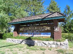
Zephyr Cove Park
Glenbrook, Nevada
38.3 miles NSix tennis courts, disc golf, a sledding hill, a beach, and a fishing pond all at one free park make Zephyr Cove one of Lake Tahoe's most versatile family hangouts.
Camp, Canoe, Disc Golf, Hike, Horseback, Kayak, Swim
Lions Park
Placerville, California
43.5 miles NWA free disc golf course in a Placerville park with tennis courts, playground, ball fields, and alternate pins — first-time players will need a guide to navigate the layout.
Disc Golf
Finnion Lake
Placerville, California
44.8 miles NWA reservoir-circling course with water on three holes, a shorter technical front 8, a longer open back, and a 750-foot hole 9 — camping right next to the course.
Disc Golf
Indian Hills Disc Golf Course
Carson City, Nevada
45.2 miles NHigh-desert disc golf near Carson City with 27 holes sprawling across Sierra foothills, canyon walls, and ridge tops — a top-of-the-world tee shot on hole 22 and great views of the Carson Valley.
Disc Golf
Howard Park
Ione, California
48.9 miles WA tight, technical putt-and-approach disc golf course with tonal targets and lots of precision shots in a public park — free to play.
Disc GolfNearby Campsites
Nevada Beach Campground
Zephyr Cove
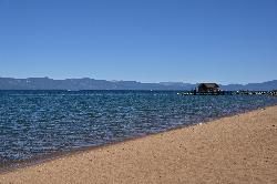
36.1 miles NA mile of wide, coarse granite sand on the Nevada shore of Lake Tahoe, with a long shallow shelf that makes it one of the easiest big beaches on the lake to swim from. The Forest Service concessionaire charges a per vehicle day use fee at the Elks Point R
Camp, Hike, Kayak, Swim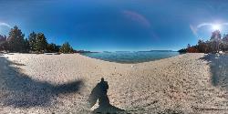
Lester Beach
South Lake Tahoe
37.4 miles NLester Beach is the sandy main swim beach at D. L. Bliss State Park on Lake Tahoe's west shore, with clear, cold, shallow water and a $10 per vehicle day-use fee in season.
Camp, Canoe, Hike, Kayak, Swim
Zephyr Cove Park
Glenbrook, Nevada
38.3 miles NSix tennis courts, disc golf, a sledding hill, a beach, and a fishing pond all at one free park make Zephyr Cove one of Lake Tahoe's most versatile family hangouts.
Camp, Canoe, Disc Golf, Hike, Horseback, Kayak, Swim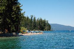
Sugar Pine Point Beach
Tahoma
41.1 miles NA quarter-mile walk from the parking lot puts you on a sand beach at the foot of Ed Z'berg Sugar Pine Point State Park, where General Creek meets Lake Tahoe and the water runs clear enough to read the bottom. It is also genuinely cold, even in August.
Camp, Hike, Kayak, Swim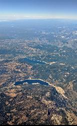
Hell Hole Reservoir
Georgetown
46.0 miles NWA 4,630 foot Rubicon River reservoir in the Eldorado National Forest, 51 miles and two hours east of Georgetown, where the boat ramp cove is the only drivable shoreline and the lake drops over 100 feet by September.
Camp, Canoe, Hike, Kayak, Swim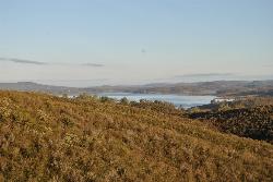
New Hogan Lake
Valley Springs, California
46.3 miles SWNew Hogan Lake is a 4,400-acre reservoir tucked into the golden Sierra Nevada foothills of Calaveras County, California, about 30 miles northeast of Stockton near the little town of Valley Springs....
Backpack, Camp, Hike, Swim 5.7 mi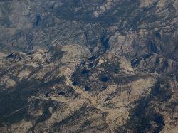
Ten Lakes
Tuolumne Meadows, Yosemite National Park
48.0 miles SEA 6.4-mile hike from Yosemite Creek to three of the Ten Lakes Basin's seven lakes, through wildflower meadows, forests, and past the Grand Canyon of the Tuolumne, gaining 2,200 feet.
Backpack, Camp, Hike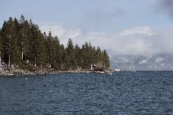
Lake Forest Beach
Tahoe City
49.8 miles NA free public beach at the end of Bristlecone Street, owned by Placer County and run by the Tahoe City Public Utility District. Sandy, pine shaded and genuinely quiet, with the one real constraint being how few cars fit at the end of the road.
Camp, Canoe, Kayak, Swim


