


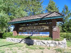
Zephyr Cove Park
Glenbrook, Nevada
| Address: | 233 Warrior Way, Zephyr Cove, NV |
| GPS: |
39°0'38.4"N 119°56'36.6"W Maps | Directions |
| State: | Nevada |
| Disc Golf Target Type: | DISCatcher |
| Disc Golf Tee Type: | Rubber Mats |
Restrooms Picnic Tables Lakes Pet Friendly Bicycles Fishing Motorized Use State Park
Camp, Canoe, Disc Golf, Hike, Horseback, Kayak, and Swim
Zephyr Cove Park is located 4.6 miles off highway 50 in Nevada. This park is a great place to have your summer activities; it includes Picnic tables for groups and couples, Barbecue facilities, 6 tennis courts, Softball/soccer fields, a library, Playground for the kids, Sledding hills for the winter months, 18 hole disc golf courses and a volleyball court. you can also go to Zephyr Cove beach and fishing (Any person over 16 years of age must have a valid fishing Nevada or California license.) It has many activities to choose from in one place during the summer time and the price of using these facilities are free thanks to the locals near the park except parking and camping. There are additional amenities for camping: Outdoor patio at the campground office, Free WIFI in resort main lobby and restaurant, Vending Machines and Cable (RVs) for T.V.
More Information
Zephyr Cove RV Park | Zephyr Cove Resort
Stay at Zephyr Cove Resort’s RV Park & Campground near Lake Tahoe’s southeast shore. Enjoy modern comforts, beach access, top marina activities, and family fun.
https://www.zephyrcove.com/lodging/zephyr-cove-rv-campgroundBe courteous, informed, and prepared. Read trailhead guidelines, stay on the trail, and don't feed the wildlife.
Read More- Plan Ahead and Prepare
- Travel & camp on durable surfaces
- Dispose of waste properly
- Leave what you find
- Minimize campfire impacts
- Respect wildlife
- Be considerate of other visitors
Directions
From Glenbrook, Nevada
- Head southeast on Pray Meadow Rd toward Glenbrook Inn RdRestricted usage road(0.3 mi)
- Slight right onto Prey Meadow RdRestricted usage road(361 ft)
- Slight right onto Old Hwy 50Restricted usage road(381 ft)
- Old Hwy 50 turns right and becomes Short RdRestricted usage road(0.1 mi)
- Short Rd turns slightly right and becomes Old Hwy 50Restricted usage road(0.1 mi)
- Turn right to stay on Old Hwy 50Restricted usage road(0.4 mi)
- Continue straight onto Glenbrook RdRestricted usage road(135 ft)
- Turn right onto US-50 W (5.1 mi)
- Turn left onto Warrior Way (276 ft)
- Turn right (0.2 mi)
- Turn rightDestination will be on the right(499 ft)
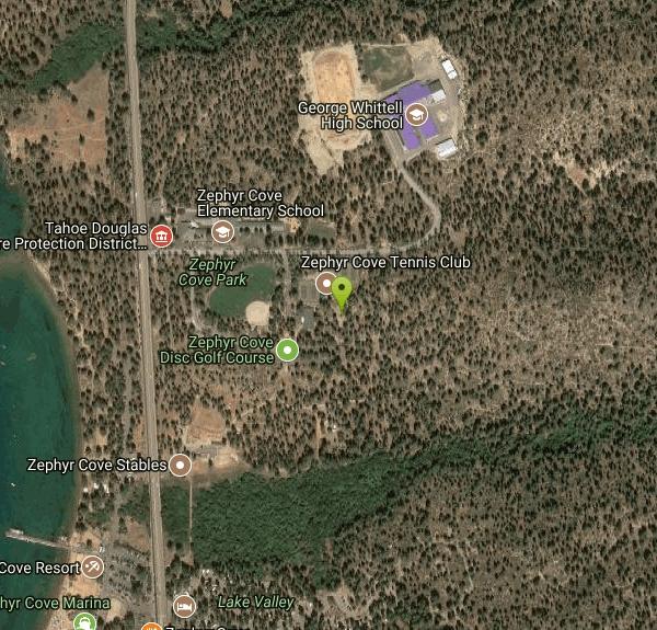
Travel north from South Lake Tahoe on highway 50 for 4.6 miles. You will see Zephyr Cove Resort and Beach on your left. Take the next right (at the fire house) onto Warrior Way. You will see an elementary school on your left and the park facilities on your right. If you turn right immediately on Warrior Way you can park in the rear by the Playground, picnic areas, and disc golf course. If you take the second right, you can park by the library, tennis courts and softball/soccer field. Courtesy of visit-lake-tahoe.net


Other Swimming Holes, Hiking Trails, Canoeing Areas, Horseback Trails, Kayaking Areas, and Folf Courses Nearby
Bijou Community Park
South Lake Tahoe, California
5.8 miles SVaried disc golf fairways through 100-foot pines, open mountain meadows, and three seasonal pond hazards near Lake Tahoe.
Disc Golf 1.5 mi
Skunk Harbor
Carson City, Nevada
8.2 miles NA forest service road hike from the 28 freeway to a secluded beach area near Carson City with mountain views, a historic building, and a marker — dogs welcome.
Hike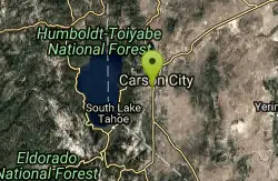
Indian Hills Disc Golf Course
Carson City, Nevada
9.9 miles NEHigh-desert disc golf near Carson City with 27 holes sprawling across Sierra foothills, canyon walls, and ridge tops — a top-of-the-world tee shot on hole 22 and great views of the Carson Valley.
Disc Golf 0.4 mi
Glen Alpine Falls
South Lake Tahoe, California
11.4 miles SWA roadside waterfall near Lake Tahoe — wider than it is tall — with roadside parking, a scenic overlook, and the option to scramble down the rocks for a closer look.
Hike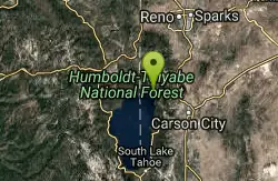
North Tahoe Lions Club Disc Golf Course
Incline Village, Nevada
16.1 miles NA short, tight course set along beautiful Third Creek that rewards accuracy over power — funded by local businesses and built by volunteers near Lake Tahoe.
Disc Golf 4.1 mi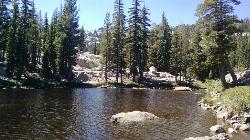
Shirley Lake Canyon Trail
Olympic Valley, California
20.6 miles NWA 2.5-mile hike from Squaw Valley Village past streams and waterfalls to a pure Sierra lake — rocky near the top, with a free gondola ride back down from High Camp as a reward.
Hike, Swim
Shirley Canyon
Olympic Valley, California
21.2 miles NWHike near Olympic Valley, California
Hike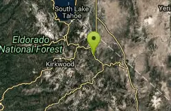
Turtle Rock Park Disc Golf
Markleeville, California
21.3 miles SAn eastern Sierra disc golf course at elevations from 5,890 to 8,636 feet with mountain views, seasonal creek island pins, and Grover Hot Springs just 10 miles away.
Disc Golf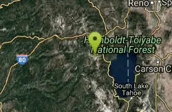
Tahoe Area
Olympic Valley, California
21.9 miles NWSwim near Olympic Valley, California
Swim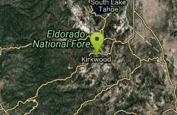
Kirkwood Mountain Resort
Kirkwood, California
23.6 miles SOpen late June through October along the Sierra Crest at 7,800-foot base elevation — hike through old growth, over creeks, and across open meadows while throwing disc.
Disc Golf
Truckee River Regional Park
Truckee, California
25.3 miles NWDisc golf on the southern bank of the Truckee River in Truckee, with multiple pin placements, great Sierra views, and a park that also offers fishing, hiking, and mountain biking.
Disc Golf
Sierra College Truckee
Truckee, California
25.6 miles NWA wooded course traversing rolling hills with elevation on every hole — accessible during school hours when the college gate is open.
Disc Golf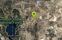
Dayton Disc Golf Course
Dayton, Nevada
29.3 miles NEA river-adjacent disc golf course in Dayton, Nevada — open and tight technical holes wind through living and dead trees, with seasonal water adding minor tributaries to the mix.
Disc Golf
Reno Adventure Park - Blue
Reno, Nevada
30.5 miles NEChallenging fairways through pinyon pines and rock columns on this unique 9-hole cliff-top disc golf course in Reno — a labor of love from the course designer, with donations appreciated.
Disc Golf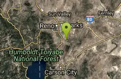
Reno Adventure Park - Green
Reno, Nevada
30.5 miles NETwo 18-hole and one 9-hole cliff-top disc golf courses rolling through pinion pines and rock columns in the hills of southeast Reno — a labor of love, donations appreciated.
Disc Golf
Reno Adventure Park - Red
Reno, Nevada
30.5 miles NEThe expert Red course at Reno Adventure Park — challenging cliff-top fairways through pinion pines and rock columns in the rolling hills of southeast Reno.
Disc Golf
Palisades Creek Trail
Truckee, California
33.1 miles NWA difficult Sierra Nevada trail past Palisade Falls — one of the tallest on the American River — with views of Devils Peak, alpine lakes, and 2,000 feet of elevation gain.
Hike, Swim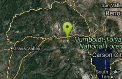
Heath Falls Overlook Trail
Truckee, California
33.1 miles NWHike and Swim near Truckee, California
Hike, Swim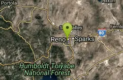
Reno Area
McGill, Nevada
36.1 miles NSwim near McGill, Nevada
Swim
Wingfield Park
Reno, Nevada
36.1 miles NAn oasis in downtown Reno where manmade dams and natural rock formations turn the Truckee River into a playground for swimming, kayaking, tubing, and rafting.
Kayak, Swim


