


Salinas Area
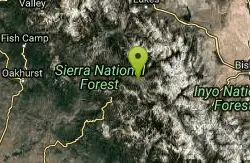
Lakeshore, California
| GPS: |
37°19'33.6"N 119°1'4.8"W Maps | Directions |
| State: | California |
Swim
More Information
Add Resource- Plan Ahead and Prepare
- Travel & camp on durable surfaces
- Dispose of waste properly
- Leave what you find
- Minimize campfire impacts
- Respect wildlife
- Be considerate of other visitors
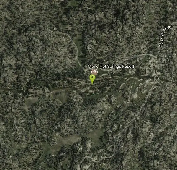
Directions
From Lakeshore, California
- Head southeast on Big Creek Rd/Huntington Lake Rd toward Lower Deer Creek Ln (0.8 mi)
- Turn left onto Kaiser Pass Rd (3.1 mi)
- Continue onto Kaiser Pass Rd (13.6 mi)
- Turn left onto Edison Lake Rd (1.7 mi)
- Slight left at Edison Lake Rd (0.2 mi)
- Turn rightDestination will be on the left(0.1 mi)
Other Swimming Holes Nearby

Crowley Lake
Mammoth Lakes, California
25.3 miles NENestled in the picturesque landscape near Benton, California, Crowley Lake stands as a hidden gem, known not only for its breathtaking natural beauty but also for the intriguing geological formations...
Hike, Swim
Hot Creek
Mammoth Lakes, California
27.0 miles NCLOSED. Entering the water is now prohibited at this location. This note came in 2008:"I noticed your report of swimming in Hot Creek near Bishop, Calif. I was there in 2006 and it was closed to...
Swim 5.5 mi
Ostrander Lake
Wawona, California
35.7 miles NWOstrander Lake is a long, 11.4 mile hike just behind Sentinel Dome. Unlike most of Yosemite's summer hikes, the trail to Ostrander Lake is open during the winter for people to ski through....
Hike, Swim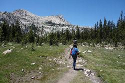
Elizabeth Lake
Wawona, California
40.7 miles NWElizabeth Lake is a gorgeous lake tucked underneath the High Sierras in Yosemite. It's about a 4.8 mile hike to reach it, with an elevation gain of 1000 feet. Even though it's not super long,...
Hike, Swim
Mirror Lake
Yosemite Valley, Yosemite National Park
41.1 miles NWMirror Lake is a seasonal lake situated in a secluded corner of the beautiful Yosemite Valley. The lake sits at the base of Half Dome and allows a different perspective of the famous monolith....
Backpack, Hike, Swim 4.0 mi
Mono Pass
Yosemite Valley, CA
41.3 miles NAt an elevation of 10,600 feet, the hike through Mono Pass is an 8 mile journey that takes you across the High Sierras, through several meadows, and stops at a few different lakes along the...
Hike, Swim
Devil's Bathtub
Yosemite Valley, California
42.0 miles NWDevil's Bathtub is one of those destinations that's a little more off the beaten path of Yosemite tourists. It's just above the Majestic Yosemite (AKA Ahwanhee Hotel). Earlier in the...
Swim 0.9-3.2 mi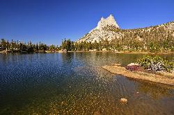
Cathedral Lakes
Wawona, California
42.2 miles NWOne of the busiest trails in the Tuloumne Meadows area, the hike to Cathedral Lakes is a gorgeous 7 mile walk to the perfect place to rest and recuperate. While there are several High Sierra...
Hike, Swim
Merced River
Yosemite Valley, Yosemite National Park
42.2 miles NWThe main fork of Merced River at Yosemite National Park is a perfect place to fish, swim, raft, and even pan for gold. The river circles around the center of Yosemite Valley, and almost every...
Camp, Swim, Whitewater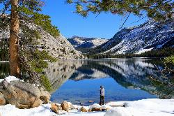
Tenaya Lake
Yosemite Valley, Yosemite National Park
42.7 miles NWTenaya Lake is one of the most visited destinations in Yosemite National Park. The lake is easily accessed by Highway 120/Tioga Pass road which runs along the north shore of the lake. On the east...
Canoe, Hike, Kayak, Swim 1.8 mi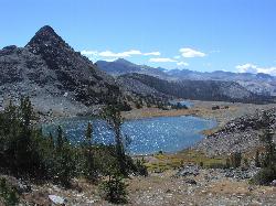
Gaylor Lakes
Yosemite Valley, CA
42.8 miles NGaylor Lakes is one of Yosemite's most underrated hikes. It's a 2 mile trail with views the entire way. At various points along the trail, you can see Dana Meadows and the mountains...
Hike, Swim 0.8-4.1 mi
Dog Lake and Lembert Dome
Yosemite Valley, CA
42.8 miles NWThe hike to Dog Lake is often paired with the hike to Lembert Dome, because the two are so close in proximity. Each hike by itself is 2.8 miles round trip, but Lembert Dome has an elevation gain of...
Hike, Swim 1.2-1.6 mi
May Lake
Yosemite Valley, Yosemite National Park
44.4 miles NWMay lake is a relatively small lake that rests at the base of Mt. Hoffman in Yosemite National Park. One of the park's most scenic lakes, May lake not only gets up close and personal with...
Hike, Swim
Glen Aulin
Glen Aulin, California
45.9 miles NWThis trail is a popular route to take in the Yosemite High Country because it is a good introductory hike into the backcountry. At the end of the hike there are several waterfalls as well as a...
Backpack, Camp, Hike, Swim 0.7 mi
Lukens Lake
Tuolumne Meadows, Yosemite National Park
48.7 miles NWLukens Lake is a small lake in the White Wolf area of Yosemite National Park. The hike is a short, 1.6 mile walk through a forest to the secluded lake surrounded by trees and a small...
Hike, SwimNearby Campsites

Crystal Lake
Mammoth Lakes, California
19.2 miles NUnlike many hikes in the Sierra's, Crystal lake can be done as a day hike and as the perfect way to get away for a bit. As hikers make their way to the lake, they will see the monolith Crystal...
Camp, Hike
Crowley Lake Campground
Crowley Lake, California
21.9 miles NENestled amidst the stunning Eastern Sierra region, Crowley Lake BLM Campground near Benton, California, is a hidden gem waiting to be discovered by nature enthusiasts and camping aficionados. With...
Camp
Wild Willy's Hot Spring
Mammoth Lakes, California
26.7 miles NEWild Willy's Hot Springs, also known as Crowley Hot Springs, is a spring located in Long Valley. Long Valley is home to one of the highest concentrations of geothermal surface water in...
Camp, Hot Springs
Tuolumne Meadows
Tuolumne County, California
42.1 miles NWA beautiful alpine meadow found in the upper Sierra Nevada Mountains. Open during the summer, this meadow offers excellent views of nearby granite domes and mountains. There is a roadway through...
Camp, Hike
Merced River
Yosemite Valley, Yosemite National Park
42.2 miles NWThe main fork of Merced River at Yosemite National Park is a perfect place to fish, swim, raft, and even pan for gold. The river circles around the center of Yosemite Valley, and almost every...
Camp, Swim, Whitewater 6.0 mi
Glen Aulin
Wawona, California
45.9 miles NWThis is an 11 mile hike along the Tuolumne River to Glen Aulin. There is a view to take in at every turn on this hike, whether it's the Tuolumne River, Tuolumne Fall, Soda Springs,...
Backpack, Camp, Hike
Glen Aulin
Glen Aulin, California
45.9 miles NWThis trail is a popular route to take in the Yosemite High Country because it is a good introductory hike into the backcountry. At the end of the hike there are several waterfalls as well as a...
Backpack, Camp, Hike, Swim 4.0 mi
Saddlebag Lake
Lee Vining, California
46.3 miles NA man-made lake found in the Inyo forest, resting at about 10,008 feet above sea level, Saddlebag Lake is located just outside the Tioga Pass entrance to Yosemite National Park. This lake has some of...
Camp, Canoe, Hike 5.7 mi
Ten Lakes
Tuolumne Meadows, Yosemite National Park
48.3 miles NWA 6.4 mile hike will lead you to three of the Ten Lakes at Ten Lakes Basin. There are three possible trails to take to see this phenomenon. The shortest begins at Yosemite Creek. The other two...
Backpack, Camp, Hike


