


Swan Lake Ditch Ride
Bigfork, Montana
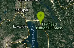
| Address: | ~82359 MT-83, Bigfork, MT 59911, USA |
| GPS: |
48°3'4.9"N 113°58'28.8"W Maps | Directions |
| State: | Montana |
| Trail Length: | 8.00 miles |
| MTB Difficulty: | Beginner |
| Trail Type: | Out & Back |
| MTB Trail Type: | Singletrack |
Mountain Bike
In Montana, it is completely legal to run ATV's, dirtbikes, horses, and the like in the ditches along the highways. This has actually created a rather vast network of singletrack trails in the highway ditches. While rather flat in most places, they stay snow free and so are ideal for getting in shape in the spring time. The also do have several interesting spots, and offer some opportunites to air over and off of driveways and the like. Ride from the bar south down the swan highway until roughly the tip of the swan lake. about there the singletrack dries up. Turn around and head back. Combine this with the Bigfork ditch loop for about a 25 mile ride. Courtesy of Singletracks.com
More Information
Swan Lake Ditch Ride
Swan Lake Ditch Ride is a singletrack mountain bike trail in Bigfork, Montana. View maps, videos, photos, and reviews of Swan Lake Ditch Ride bike trail in Bigfork.
http://www.singletracks.com/bike-trails/swan-lake-ditch-ride/Never modify trail features. Ride trails when they're dry enough that you won't leave ruts. Speak up when you see others on the trail and always yield to hikers, horses, and others coming uphill. Always ride on the established trail.
Read More
- Plan Ahead and Prepare
- Travel & camp on durable surfaces
- Dispose of waste properly
- Leave what you find
- Minimize campfire impacts
- Respect wildlife
- Be considerate of other visitors
Directions
From Bigfork, Montana
- Head north toward Monroe St (144 ft)
- Turn left at the 1st cross street onto Monroe St (338 ft)
- Monroe St turns right and becomes Chickadee Ln (348 ft)
- Turn left onto Commerce St (0.3 mi)
- Turn left onto Grand Ave (128 ft)
- Turn right onto Holt Dr (269 ft)
- Turn left onto MT-35 E (0.7 mi)
- Turn left onto MT-209 (4.8 mi)
- Turn right onto MT-83 SDestination will be on the right(98 ft)

Other Mountain Bike Trails Nearby
Peterson Creek Trail #293
Bigfork, Montana
2.4 miles EA 5.9-mile trail climbing 1,700 feet through forest and an old burn, with great views of Swan Lake and the Flathead Valley along the way.
Mountain Bike
Old Bigfork Canyon Road
Bigfork, Montana
4.5 miles WA two-mile gravel road run along the river with excellent views and easy riding — especially useful for linking up a longer loop on the Bigfork ditch trails.
Mountain Bike
Bigfork Ditch Loop
Bigfork, Montana
6.0 miles NWHighway ditch singletrack loops around Bigfork on Swan and Hwy 209, staying snow-free in spring and offering jumps over driveways and a connection to Old Bigfork Canyon Road.
Mountain Bike
Echo Lake Logging Roads
Kalispell, Montana
6.0 miles NOld logging roads and ATV trails wind past Flathead Lake near Bigfork, with lake and mountain views tucked in — a pleasant local option for those already in the area.
Mountain Bike
Jewel Basin Road
Kalispell, Montana
6.0 miles NA brutal gravel road climb near Kalispell that rewards the effort with gorgeous views along the way up to Jewel Basin.
Mountain Bike
Broken Leg Divide Trail #353
Bigfork, Montana
6.1 miles NA 2.8-mile mountain bike trail climbing 520 feet through the Flathead National Forest, connecting the Peterson Creek Trail to the Echo-Brokenleg trail.
Mountain Bike
Wolf Creek Trail/Echo Broken Leg #544
Bigfork, Montana
6.1 miles NA mountain bike trail near Bigfork with bench-cut singletrack, loamy deep-woods riding, stream crossings, and exposed corners with stunning valley views — about 6 miles each way.
Mountain Bike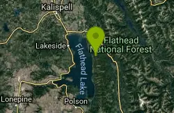
Crane Creek Trail #314
Bigfork, Montana
6.2 miles SA 2.1-mile trail climbing 330 feet through larch and pine forest with thick undergrowth on Crane Mountain near Bigfork — open to hikers, equestrians, and mountain bikers.
Mountain Bike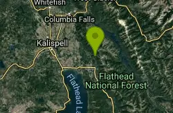
Switchback/trail# 725
Kalispell, Montana
7.3 miles NA legendary descent on Switchback Trail #725 near Kalispell — 42 switchbacks over 3 miles dropping off the frontside of the mountains after riding Trail #717 toward the Jewel Basin boundary.
Mountain Bike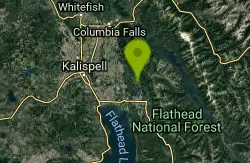
Strawberry Lake Road
Kalispell, Montana
8.4 miles NA punishing gravel road climb near Kalispell — and if that's not enough, the Strawberry Lake trail at the top adds an even steeper, longer grind.
Mountain Bike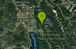
Horse Trails And Logging Roads Near Strawberry Lake
Kalispell, Montana
8.5 miles NA steeply climbing trail near Strawberry Lake that opens into a vast network of horse, ATV, snowmobile, and logging roads where you can literally ride for hours near Kalispell, Montana.
Mountain Bike
Sixmile Lookout Trail #10
Bigfork, Montana
9.1 miles SEA demanding 4.6-mile mountain trail climbing 3,400 feet to Sixmile Peak near Bigfork — open for hiking, mountain biking, horseback riding, and motorcycle use.
Mountain Bike
Sixmile Sidehill Trail #27
Bigfork, Montana
9.1 miles SEA 2.5-mile multi-use trail for hikers, mountain bikers, horseback riders, and motorcyclists branching from the Sixmile Lookout Trail — bring a map and respect private property at the north end.
Mountain Bike
Strawberry Lake
Kalispell, Montana
9.4 miles NA brutal 5-mile singletrack climb to Strawberry Lake near Kalispell — then 5 miles of pure descent back to the car.
Mountain Bike
Road 5388
Kalispell, Montana
9.9 miles NPark at the bottom and grind your way to the top of this tough Kalispell hill climb, then bomb back down — side trails offer extra adventure for the willing.
Mountain Bike
Hall Lake Trail #61
Bigfork, Montana
10.4 miles SEA 5.8-mile mountain trail climbing about 2,000 feet to Hall Lake — open to hikers, horseback riders, and mountain bikers, ending at the Alpine Trail junction.
Mountain Bike
Peters Ridge Trail #37
Kalispell, Montana
10.8 miles NA 2.6-mile trail climbing 1,400 feet along a ridge with great Flathead Valley views — open to hikers, bikers, equestrians, and motorcycles, with seasonal road access restrictions.
Mountain Bike
Beardance
Bigfork, Montana
11.0 miles SA stinking-killer climb up Beardance Trail 314 rewards mountain bikers with a sweet singletrack descent on steep switchbacks, rocks, roots, drops, and stunning Flathead Lake views.
Mountain Bike
Bond Creek Trail #21
Bigfork, Montana
11.8 miles SEA 7.5-mile trail climbing alongside a creek through an avalanche slide path to two alpine lakes, with a popular waterfall picnic spot at the 3.5-mile mark.
Mountain Bike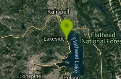
Blacktail Mountain Road
Lakeside, Montana
11.8 miles WAn epic 18-mile, 4,000-vertical-foot climb up Blacktail Mountain on dirt and gravel road near Lakeside — and an equally epic descent, but save this one for summer when the summit isn't freezing.
Mountain BikeNearby Campsites

Jewel Basin
Kalispell, Montana
8.5 miles NThe Jewel Basin Hiking Area packs 35 miles of hiker-only trail, two dozen alpine lakes, and the Mount Aeneas lookout into the Swan Range near Kalispell.
Backpack, Camp, Hike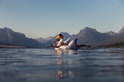
Apgar Campground
Apgar Village, Glacier National Park
32.7 miles NCampsites on the shores of Lake McDonald within Glacier National Park, with easy access to the Apgar Visitor Center, nature center, nearby hiking, and the western entrance to Going-to-the-Sun Road.
Camp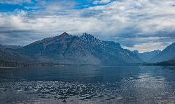
Fish Creek Campground
Glacier National Park
34.3 miles NA 193-site Glacier National Park campground along Fish Creek, surrounded by pine and cedar forest, with mountain views, fire rings, and access to the Trail of the Cedars nearby.
Camp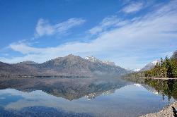
Sprague Campground
Glacier National Park
38.6 miles NAn 85-site campground on the west side of Glacier National Park near Lake McDonald, with swimming, boating, fishing, wildlife viewing, and the Trail of the Cedars nearby.
Camp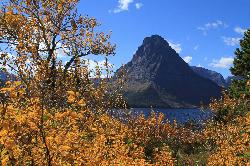
Two Medicine Campground
Glacier National Park
41.3 miles NETwo Medicine Campground lies in the quiet, dramatic southeast corner of Glacier National Park, on the shore of Two Medicine Lake beneath the sharp pyramid of Sinopah Mountain. About 13 miles up the...
Camp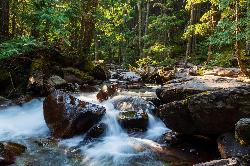
Avalanche Campground
Glacier National Park
43.9 miles NNestled on Glacier National Park's west side, Avalanche Campground puts 128 sites, flush toilets, and bear-proof storage right next to the Trail of the Cedars and the stunning Avalanche Lake hike.
Camp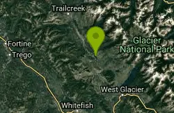
Logging Creek Campground
Glacier National Park
45.8 miles NA first-come, first-served campground nestled in the Many Glacier area of Glacier National Park, with 49 sites and close access to the Grinnell Glacier and Swiftcurrent trails.
Camp
Clements Mountain Trail
Logan Pass, Glacier National Park
46.1 miles NA four-mile round-trip climb of Clements Mountain in Glacier National Park, with several routes of varying difficulty and significant elevation gain — often confused with nearby Reynolds Mountain.
Backpack, Camp, Hike, Rock Climb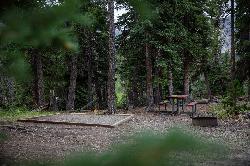
Cut Bank Campground
Glacier National Park
46.7 miles NEA peaceful forested campground along Cut Bank Creek in Glacier National Park with 48 first-come sites, nearby hiking trails, and access to fishing at St. Mary Lake.
Camp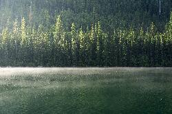
Quartz Creek Campground
Glacier National Park
47.8 miles NA peaceful 22-site campground in the heart of Glacier National Park, close to Going-to-the-Sun Road and a short hike from iconic Grinnell Glacier.
Camp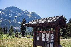
Rising Sun Campground
Glacier National Park
49.1 miles NEMore than 150 sites in eastern Glacier National Park close to Going-to-the-Sun Road, St. Mary's Falls and Red Rock Falls trails, and frequent bear, elk, and bighorn sightings.
Camp


