


Spring Lake Beach
Glendale

Canoe, Kayak, and Swim
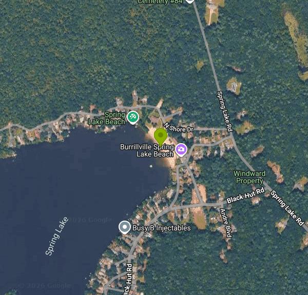
Spring Lake Beach is the Town of Burrillville's public swimming beach, run by the town's Parks and Recreation Department on the east shore of Spring Lake in the village of Glendale, in the northwest corner of Rhode Island. The lake covers about 95 acres and stretches roughly half a mile north to south, with houses along much of the shore and some wooded shoreline, including the southern boat ramp, inside the state's Black Hut Management Area.
The beach sits off Old Hillside Drive near the junction of Spring Lake Road and Black Hut Road. From Route 146, the town routes drivers up Route 146A and Route 102, then by East Avenue, Victory Highway and Joslin Road to Spring Lake Road. Turn onto Black Hut Road and the beach parking areas are a few yards in, on both sides of the road. The town lists no separate parking charge for day visitors (resident season passes come with a parking permit), and it warns that even a pass does not guarantee entry once the beach reaches capacity, so arrive early on hot weekends.
You swim in the lake straight off the sand, and a few small plastic slides at the water's edge let kids splash into the shallows. Local coverage reports a lifeguard on duty daily during the season. The town does not publish depth, bottom or water temperature figures, so expect a typical New England pond beach: still water with no current, cool in early June and warmest from mid July through August. Canoes, kayaks, paddleboards and small kids' boats have been rented at the beach in past seasons. A separate state boat ramp sits at the end of the lake's southern arm, and only non-motorized boats and electric-motor boats are allowed on the lake.
This is not a free beach. For 2026 the town charges daily admission of $5 per person for Burrillville residents and $8 per person for non-residents. Nonprofit groups of 15 or more with a reservation pay $4 (resident) or $7 (non-resident) per person. Season passes ($40 family, $30 individual) are sold only to Burrillville residents with proof of residency, so out-of-town visitors pay the daily rate every visit. The 2026 season ran May 23 to 25 and May 30 to 31 on weekends, then daily from June 6 to August 23 from 10 a.m. to 7 p.m., and daily from August 24 to September 7 from 10 a.m. to 6 p.m. Hours are weather permitting and can change with staffing; outside the season the beach is closed to swimming.
The main hazard here is water quality. The Rhode Island Department of Health samples Spring Lake during the summer and has recommended closing the beach for high bacteria several times in recent seasons, reopening it once counts drop. Status can change within days, so check the RIDOH beach status page or call the state beach line at 401-222-2751 before driving out. Swim during staffed hours when a lifeguard is on the stand and keep a close eye on small children near the slides.
The beach is as much a family park as a swimming spot. The privately run Spring Lake Arcade, opened by the water in 1930, is believed to be the oldest penny arcade business in the country and still runs games that take pennies, nickels and dimes. There are also a snack bar, picnic tables, two small playgrounds, ping pong tables and a volleyball court, a small museum of beach history photos, restrooms with outdoor showers, and Champlin Hall, which the town rents for events.
More Information
Daily Admission | Burrillville, RI
Explore Burrillville Daily Admission rates for residents and non-residents, as well as group rates for over 15 people and nonprofits.
https://www.burrillvilleri.gov/322/Daily-AdmissionDirections | Burrillville, RI
Find directions to Spring Lake Beach.
https://www.burrillvilleri.gov/323/DirectionsHit the beach, without the traffic: Northern RI’s freshwater shores offer great alternative for summ
Editor’s note: The below content is offered as part of our special Summer/Back In Business section. View the complete printable pdf here. Far closer – and more affordable – than the ocean waters, Northern Rhode Island’s lakes and ponds have a beauty and charm you won’t find elsewhere. There’s Peck Pond and Bowdish Reservoir, surrounded by
https://www.nrinow.news/2021/07/07/hit-the-beach-without-the-traffic-northern-ris-freshwater-shores-offer-great-alternative-for-summer-fun/Hours of Operation | Burrillville, RI
See the city schedule calendar for 2026 with seasonal hours and dates.
https://www.burrillvilleri.gov/324/Hours-of-OperationRI.gov: Rhode Island Government
The Official Web Site of the State of Rhode Island
https://www.ri.gov/press/view/43812RI.gov: Rhode Island Government
The Official Web Site of the State of Rhode Island
https://www.ri.gov/press/view/44170Season Passes | Burrillville, RI
Obtain season passes for Burrillville residents at Spring Lake Beach.
https://www.burrillvilleri.gov/326/Season-PassesSpring Lake Beach | Burrillville, RI
Spring Lake Beach is OPEN:Saturday, June 6, through Labor Day, September 7, 2026.(Weather permitting.)**Swimming Lessons available at Spring Lake Beach Facility** PDF: Swim Lessons at Spring Lake Policies and ProceduresRegistration is OPEN!
https://www.burrillvilleri.gov/321/Spring-Lake-BeachSpring Lake: Rhode Island Blueways
41° 58.731' N 71° 39.906' W See this location in: Google Maps Map Server Acme Maps
https://exploreri.org/siteReport.php?siteID=244
- Plan Ahead and Prepare
- Travel & camp on durable surfaces
- Dispose of waste properly
- Leave what you find
- Minimize campfire impacts
- Respect wildlife
- Be considerate of other visitors
Directions
From Glendale
- Head east on W Colorado St toward S Brand Blvd (0.4 mi)
- Turn left onto S Glendale AvePass by IHOP (on the left in 0.9 mi)(1.0 mi)
- Turn right to merge onto CA-134 E (6.1 mi)
- Continue onto I-210 E (18.5 mi)
- Continue onto CA-210 (19.0 mi)
- Take exit 64A to merge onto I-15 N toward Barstow (8.6 mi)
- Continue straight to stay on I-15 N (signs for Barstow/
Kenwood Ave) (0.2 mi) - Keep left to stay on I-15 N, follow signs for Barstow (58.7 mi)
- Keep left to stay on I-15 N, follow signs for Las VegasPassing through Nevada, ArizonaEntering Utah(397 mi)
- Take exit 132 for I-70 E toward Richfield/
Denver (0.5 mi) - Continue onto I-70 EEntering Colorado(473 mi)
- Take exit 241 toward Idaho Spgs (0.3 mi)
- Turn right onto I-70BL E (0.1 mi)
- Turn right toward East Idaho Springs Road (118 ft)
- Turn left onto East Idaho Springs Road (1.9 mi)
- Turn left onto Central City Pkwy (62 ft)
- Turn right to merge onto I-70 E (25.8 mi)
- Take exit 269B on the left for I-76 E toward Fort Morgan (0.6 mi)
- Continue onto I-76 EEntering Nebraska(186 mi)
- Take the exit onto I-80 E (342 mi)
- Keep left to stay on I-80 EEntering Iowa(132 mi)
- Continue onto I-235 E (signs for Des Moines) (13.8 mi)
- Take the exit onto I-80 E toward Davenport (152 mi)
- Take exit 290 for I-280 E/
US-6 E/ US-61 S toward Rock Island/ Moline (0.6 mi) - Continue onto I-280 E/
US-6 E/ US-61 N Continue to follow I-280 EEntering Illinois(26.7 mi) - Continue onto I-80 E (115 mi)
- Keep left (0.8 mi)
- Keep left (0.1 mi)
- Continue straight (4.3 mi)
- Take the exit toward I-80 E (187 ft)
- Keep left to continue on I-80 EToll road(24.5 mi)
- Keep left to stay on I-80 EToll roadEntering Indiana(23.7 mi)
- Take exit 16 to merge onto I-80 E/
I-90 E Toll roadEntering Ohio(278 mi) - Continue straight onto I-80 EToll road(9.2 mi)
- Take exit 151 to merge onto I-480 E toward Cleveland (20.4 mi)
- Keep right to stay on I-480 E (5.9 mi)
- Keep left to stay on I-480 E, follow signs for I-271 N/
US-422/ Erie Pa/ Warren (1.2 mi) - Take the I-271 N exit on the left toward I-90/
Erie Pa (0.6 mi) - Continue onto I-271 Express N/
Outerbelt E Fwy (13.9 mi) - Merge onto I-90 EToll roadPassing through PennsylvaniaEntering New York(446 mi)
- Slight right onto Governor Thomas E. Dewey Thruway/
NY State Thruway (signs for I-87 S/ New York/ Boston) (1.0 mi) - Continue onto I-87 S/
Governor Thomas E. Dewey Thruway/ NY State Thruway Toll road(13.6 mi) - Take exit 21A toward I-90 E/
Mass Tpke Toll road(1.0 mi) - Continue onto NY-912M EToll road(6.4 mi)
- Continue onto I-90 EToll roadEntering Massachusetts(111 mi)
- Take exit 94 toward US-20/
MA-146/ Worcester/ Providence Toll road(0.6 mi) - Turn right onto Rte 20 Connector (0.1 mi)
- Turn right to merge onto MA-146 S/
Worcester-Providence Turnpike toward Millbury/ Providence Rl (17.0 mi) - Take exit 1 for MA-146A S (0.2 mi)
- Turn left onto MA-146A S/
RI-146A S Continue to follow RI-146A SEntering Rhode Island(1.3 mi) - Turn right onto RI-102 S (3.5 mi)
- Turn left onto Glendale Bypass (328 ft)
- Turn right onto Victory Hwy (436 ft)
- Turn right onto Joslin Rd/
Main St (0.2 mi) - Turn left onto Spring Lake Rd (1.4 mi)
- Turn left onto N Shore DrDestination will be on the left(0.1 mi)


Other Swimming Holes, Canoeing Areas, and Kayaking Areas Nearby

Georgiaville Pond Beach
Smithfield
10.2 miles SESmithfield's town-run public beach on 92-acre Georgiaville Pond, open to non-residents with a $4 day pass and a $20 parking sticker. Check RIDOH and DEM water advisories before swimming.
Canoe, Hike, Kayak, Swim
Lincoln Woods State Park Beach
Lincoln
13.2 miles SEFree freshwater beach on Olney Pond in Lincoln Woods State Park, Rhode Island's first state park, with seasonal lifeguards, a beach pavilion and showers just north of Providence.
Canoe, Hike, Kayak, Swim
Falls Pond
North Attleborough
17.1 miles EA residents only town beach on the north basin of Falls Pond in North Attleborough, with a paved lot, a state boat ramp, no lifeguards, and a long record of summer E. coli closures.
Canoe, Kayak, Swim
Hopkinton State Park Upper Beach
Ashland
20.1 miles NThe unguarded reservoir beach above the dam at Hopkinton State Park, separate from the guarded Main Beach below it, with 8 dollar resident parking and boat rentals on the water.
Canoe, Hike, Kayak, Swim
Coes Pond Beach
Worcester
20.5 miles NWWorcester's lifeguarded city beach on Coes Reservoir, officially the John J. Binienda Memorial Beach, with a bathhouse, free summer kayak and paddleboard loans, and trails around the pond. No admission fee.
Canoe, Hike, Kayak, Swim
Regatta Point Beach
Worcester
20.7 miles NA small guarded swimming beach on Lake Quinsigamond in Worcester, part of DCR's Quinsigamond State Park, with lifeguards in summer and a daily DCR parking fee of $8 for Massachusetts plates and $30 for out-of-state plates.
Swim
Lake Mashapaug
Union, Connecticut
24.3 miles WSwim near Union, Connecticut
Swim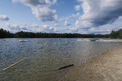
Memorial Beach at Dug Pond
Natick
24.9 miles NENatick's town swimming beach on Dug Pond, with lifeguards, a diving crib and a floating dock. Open to everyone in summer for a day pass sold at the gate, with higher rates for non-residents.
Canoe, Kayak, Swim
Wayland Town Beach
Wayland
27.1 miles NELifeguarded town beach on the North Pond of Lake Cochituate in Wayland, with a roped swim area, boat rentals and a picnic grove. Day passes are $5 for residents and $10 for non-residents.
Canoe, Kayak, Swim
WWII Memorial Beach
Marlborough
27.5 miles NMarlborough's lifeguarded city beach on Fort Meadow Reservoir, open daily in summer from 11 am to 6:45 pm. Free for Marlborough residents; non-residents pay a $20 daily parking fee.
Swim
Chaplin Area
Chaplin, Connecticut
28.2 miles SWSwim near Chaplin, Connecticut
Swim
Mount Hope Brook
Mansfield, Connecticut
30.1 miles SWSwim near Mansfield, Connecticut
Swim
Dean Pond
Monson, Massachusetts
32.4 miles WSwim near Monson, Massachusetts
Swim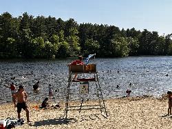
Houghton's Pond Beach
Milton
32.6 miles NEFree, lifeguarded beach on a spring-fed kettle pond in DCR's Blue Hills Reservation in Milton, with free parking, a bathhouse and trails into the Blue Hills.
Hike, Swim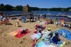
Crystal Lake Beach
Newton
33.0 miles NENewton's lifeguarded city beach on Crystal Lake, a 33-acre spring-fed great pond a short walk from the Newton Highlands Green Line stop. Day passes are sold at the bathhouse ($8 residents, $15 non-residents).
Canoe, Kayak, Swim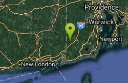
Ashville Pond
Hopkinton, Rhode Island
34.0 miles SSwim near Hopkinton, Rhode Island
Swim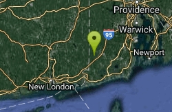
Colt State Park
Hopkinton, Rhode Island
34.0 miles SA rocky bay beach at Colt State Park near Bristol where attire becomes more optional the further you walk — a laid-back Rhode Island shoreline spot with an unofficial clothing-optional tradition.
Swim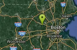
Walden Pond State Resreve
Concord, Massachusetts
35.2 miles NESwim near Concord, Massachusetts
Swim
Alton
Richmond, Rhode Island
38.1 miles SSwim near Richmond, Rhode Island
Swim
Fort Wetherill State Park
Jamestown, Rhode Island
38.3 miles SESwim near Jamestown, Rhode Island
Swim


