


248 Things to do near Ashton to Tetonia Trail
first prev 2 3 4 5 6 7 8 9 10 11 next lastShowing results within 50 miles Distance miles of N 3600 E, Ashton, ID 83420, USA City, Zip, or Address

Buffalo Soldier
Moose, Wyoming
31.0 miles SETrail is a nice loop, all singletrack, with about 300' of elevation gain. Trail is about 1.8 miles one way. You can also use it as a connector to Mill Creek or lightning loop. Buffalo...
Mountain Bike 3.0 mi
Cowboy Trail
Ririe, Idaho
31.0 miles SMountain Bike near Ririe, Idaho
Mountain Bike 4.0 mi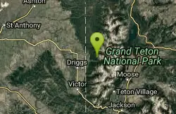
Quakie Ridge
Moose, Wyoming
31.0 miles SETrail starts at the base ski area on a service road then heads out on nice single track. Trail winds through meadows of wildflowers. Some minor altitude gain along the trail. The...
Mountain Bike 7.1 mi
Mill Creek Trail
Moose, Wyoming
31.2 miles SEThere are two ways to do this ride, one as a loop with the Targhee road providing the bulk of the climb, or as an out and back (up the trail and back down). Keep in mind that this trail is...
Cross-country Ski, Mountain Bike, Snowshoe 4.5 mi
Sheep Bridge Trail
Driggs, Idaho
31.2 miles SEThis is a great easy trail for beginner hikers or mountain bikers. In the early summer, you'll find many beautiful wildflowers and large kaleidoscopes of butterflies to go with them. You...
Hike, Mountain Bike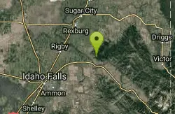
Kelly Canyon
Ririe, Idaho
31.3 miles SThe trail switchbacks up Kelly Mountain, hitting two brief red-line climbs before you get up on the top. The famed "Shale Chute" is back there somewhere (so this is part of the route for...
Mountain Bike
Howard Creek Trail
Island Park, Idaho
31.4 miles NThe Howard Creek trail follows Howard Creek upstream to the old Taylor Creek Road. The old Taylor Creek Road connects the Howard Creek trail to the Continental Divide Trail. Howard...
Mountain Bike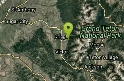
Spring Creek Trail
Alta, Wyoming
31.4 miles SEThis trail starts at the remains of the historic Rapid Creek Ranger Station. The trail heads east following an old road. After crossing Rapid Creek, the trail climbs up to a ridge...
Mountain Bike 3.8 mi
Kelly Mountain Trail
Ririe, Idaho
31.5 miles SKelly Canyon Trail is a moderate, uphill trail that can be used by hikers, mountain bikers, and ATV riders. The trail features views of hills, mountains, trees, wildflowers, and some wildlife. Dogs...
Cross-country Ski, Hike, Mountain Bike, Snowshoe

Poison Flats
Ririe, Idaho
31.5 miles SHike near Ririe, Idaho
Hike
Lower Hawley Gulch Trail
Ririe, Idaho
31.6 miles SThis is a singletrack biking trail in Ririe, Idaho. The trail is mainly flat with a few gradual slopes. You may have to carry your bike over obstacles such as fallen trees, logs, and small ponds....
Mountain Bike 4.5 mi
Aspen Trail
Alta, Wyoming
31.6 miles SEAspen Trail (tr 034) is single track trail for 4.35 miles along 6,800 ft contour to Darby Canyon (tr 012). Spring Creek Trail (tr 032) is double track trail for 3.68 miles to end. The trail starts...
Hike, Mountain Bike
Table Rock Campground
Ririe, Idaho
31.7 miles STable Rock / Poison Flat Campground is located at the Caribou-Targhee National Forest which occupies over 3 million acres and stretches across southeastern Idaho, from the Montana, Utah, and Wyoming...
Camp
Kelly Canyon/Table Rock
Ririe, Idaho
31.8 miles SThe initial climb is soft, so you might wash out a little. There are enough roots and rocks to add some challenge to the climb and some air to the descent. The trail forks at one point,...
Mountain Bike 1.0-1.3 mi
Lorenzo Bridge
Rexburg, Idaho
32.0 miles SWThis is the old site of the Lorenzo Boat Launch, which has moved to the other side of the river a little further downstream. This spot sees very little traffic. There are beautiful, yet...
Airsoft, Hike, Paintball 0.3-0.6 mi
Cress Creek Nature Trail
Rexburg, Idaho
32.0 miles SWMeandering along the scenic South Fork of the Snake River, the beautiful 1¼ mile Cress Creek Nature Trail will lead you on a journey through sagebrush-grass communities, over juniper covered...
Hike
Paramount Wall / Blanche Rock
Ririe, Idaho
32.1 miles SSitting high above the road, the routes at Paramount offer great exposure and relief from the afternoon summer sun. Chuck Oddette, Steve Reiser and Jed Miller established the routes from 1989...
Camp, Horseback, Rock Climb
Henderson Canyon
Victor, Idaho
32.1 miles STrail begins as dirt road/double track with numerous "cow" trails breaking off of road. Some of these trails see more tire tracks than others.
Mountain Bike 1.8 mi
Crystal Cruise
Ririe, Idaho
32.2 miles SThis trail uses the Crystal Cruise Nordic Trail along the Kelly Canyon ski resort boundary, taking you up to Kelly Canyon proper. It's a good climb, and a quick downhill back to the parking...
Mountain Bike
Wolverine Creek Trail
Ririe, Idaho
32.2 miles SThe Wolverine Creek Trail is a doubletrack trail in Ririe, Idaho. It begins at South Fork Road and ends at Wolverine trailhead. It is commonly used by dirt bikes and four wheelers. This trail is...
Mountain Bike


