


234 Things to do near Indian Bend Bike Trail
first prev 3 4 5 6 7 8 9 10 11 12 next lastShowing results within 50 miles Distance miles of 10901 N 92nd St, Scottsdale, AZ 85260, USA City, Zip, or Address
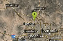
West Wing Mountain Advanced Trail
Peoria, Arizona
23.4 miles NWHike near Peoria, Arizona
Hike
Paseo Vista Recreation Area
Chandler, Arizona
23.6 miles SMulti-use park on a former land fill site. 11 holes have dual tees and 1 hole has 2 baskets. Mostly wide open with some OB. Features 2 concrete culvert mandos through pipe. Multiple berms and a...
Disc Golf
Chandler Skatepark
Chandler, Arizona
23.9 miles SChandler, an outdoor 33,000-square-foot park, has been reported to be the best skatepark in Arizona. Designed by SITE Systems Design Group, it features ledges, two bowls, banks, quarterpipes,...
Skateboard
Lost Dutchman State Park
Apache Junction, Arizona
24.7 miles EThis park has dirt biking trails. Bikes can use the lower trails (#58) shared with hikers. Bikes are not allowed above Jacobs Crosscut Trail.The park has added a new "Mountain Bike...
Mountain Bike
Siphon Draw Trailhead to Flatiron
Apache Junction, Arizona
24.8 miles EThe Siphon Draw Trail up to Flatiron is a beautiful trail within the Lost Dutchman State Park. It is a 5.5 mile, there and back trail near Apache Junction, Arizona. It is a more advanced hike with...
Hike
Queen Creek Disc Golf
Queen Creek, Arizona
25.4 miles SEOpen park area with 7 numbered baskets (#4 and #8 are missing). Entirely flat with green grass a few trees and weird small box tees. OB defined by concrete planters. Very hot in the summer, bring...
Disc Golf
Marbella Vineyards
Gilbert, Arizona
25.5 miles SShort straight shots over grass with few trees to baskets surrounding a subdivision neighborhood park. Undefined tees. Reverse to make 18. Private (No Fee)
Disc Golf 1.4 mi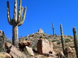
Ballantine Trail
Rio Verde, Arizona
25.5 miles NEthis trail looks a lot better once it moves away from the highway. A somewhat strenuous climb reveals a landscape of knuckle-and-joint, mica-imbedded boulders, deep gorges and a battalion of regal...
Hike
Emery Henderson
Phoenix, Arizona
26.6 miles NWBct(Black Canyon Trail) trail head features paved parking and restrooms. From here you can head south on relatively flat ground, or North, working into the desert hills, on multiuse...
Mountain Bike 3.9 mi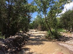
Cave Creek Swimming Hole
Cave Creek, Arizona
26.8 miles NHidden along Cave Creek Trail #4 is a swimming hole deep enough to refresh from the summer heat. It takes almost four miles of hiking in Arizona desert to reach the swimming hole, but the water is...
Hike, Swim
Discovery Trail
Peoria, Arizona
27.4 miles NWDiscovery Trail is a path within Peoria, Arizona for residents of Vistancia. This concrete paved, 3.5 mile path meant for walking, running, and biking. Yoga, stargazing, and picnicking are...
Hike
Goodyear Skatepark
Goodyear, Arizona
28.4 miles WSkate Park Rules USE AT YOUR OWN RISK! This skate park is not supervised. This facility is used by both experienced and inexperienced skaters and riders. Serious injury or death may result from...
Skateboard 8.3 mi
Estrella Mountains Competitive Track
Tolleson, Arizona
29.2 miles SWThe third competitive track in the Maricopa County Regional Park system, located in Estrella Mountain Regional Park, was completed in February 2000. The track consists of two loops totaling 13 miles....
Hike, Horseback, Mountain Bike
K-trail & Vortex
Gold Canyon, Arizona
29.7 miles SEThis is definitely a challenging way to ride both the entire K and Vortex trails. They are best ridden from the North to the South but to do this you need to get to the North end of the...
Mountain Bike
Lost Goldmine & Cougar Loop
Gold Canyon, Arizona
29.7 miles SEThis is a short, fun but pretty technical ride. The technical part is the fact that it starts out with a ride on the Lost Goldmine trail which is a very rocky trail built for hiking....
Mountain Bike
Cloudview
Gold Canyon, Arizona
29.7 miles SEThis parking area is used primarily for the very popular Hieroglyphs hiking trail and the Lost Goldmine hiking trail which connects with Peralta Road seven miles to the East. It is also...
Mountain Bike
San Tan
Queen Creek, Arizona
30.1 miles SETke the Goldmine trail (approximately 1.1 miles uphill on wide trail) Take left onto SanTan for approximately 1.5 miles. At this point you will reach a T. Go to right for the San Tan...
Mountain Bike
Holy Hill And Gila Monster
Gold Canyon, Arizona
30.1 miles SEThe Holy Hill By-Pass Trail was the newest trail in the Gold Canyon system as of April 2012. The Gila monster trail was listed as still under construction earlier in the year but seemed...
Mountain Bike
Baseline Trail
Goodyear, Arizona
31.4 miles SWThe Baseline trail is a 2.6 mile loop at Estrella Mountain Regional Park. This listing is based on access from a spur trail (33.378981, -112.371072) off of the Gila trail. Access is...
Hike
Secret, Tech & K
Gold Canyon, Arizona
31.6 miles SEFrom the parking lot start riding the main trail by the sign. Ride about 30 feet and then take the single track trail to the right. This is called the Horse Trail and leads to all of...
Mountain Bike


