


260 Things to do near Lake Blanche
first prev 1 2 3 4 5 6 7 8 9 10 next lastShowing results within 50 miles Distance miles of Lake Blanche Trail, Salt Lake City, UT 84121, USA City, Zip, or Address
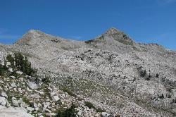
Pfeiferhorn Peak
Provo, Utah
2.2 miles SAn easily accessible Wasatch peak east of Salt Lake City with alpine lakes below and mountain goats spotted regularly above — breathtaking views of the Salt Lake valley from one of the range's highest points.
Backpack, Hike
Hidden Falls
Salt Lake City, Utah
2.6 miles NWA popular roadside waterfall in Big Cottonwood Canyon that's just a short stroll from the parking lot — a quick 15-minute detour with a big payoff.
Hike
Lisa Falls
Sandy, Utah
2.9 miles SWA shaded granite climbing area in Little Cottonwood Canyon with polished friction faces, clean cracks, juggy overhangs, and a roaring waterfall that keeps the atmosphere cool and energizing.
Hike, Rock Climb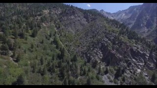
Storm Mountain
Salt Lake City, Utah
2.9 miles NWA compact Wasatch peak just 3 miles up Big Cottonwood Canyon, with rock climbing routes, hiking, biking, and Big Cottonwood Creek running right alongside the day-use area.
Hike, Mountain Bike, Rock Climb 0.7 mi
Great White Icicle
Sandy, Utah
3.5 miles SWAn ice climb in winter and a waterfall rappel in summer just outside Salt Lake City — the Great White Icicle in Little Cottonwood Canyon offers four shelves of ice and a bucket-list 4-to-5-hour ascent for all seasons.
Hike, Rock Climb
Spruces Campground
Salt Lake City, Utah
3.8 miles NEA fee campground in Big Cottonwood Canyon near Salt Lake City — check USDA.gov for current rates and seasonal availability.
Camp, Sled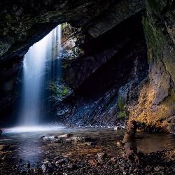
Donut Falls
Salt Lake City, Utah
3.8 miles NEA waterfall that pours through a hole in a cave ceiling — earning the 'donut' name — on a family-friendly 3-mile round-trip hike through Big Cottonwood Canyon.
Hike, Swim
American Fork Twin Peaks
Provo, Utah
4.2 miles SEA high-elevation, intermediate-friendly peak scramble that doubles as a gateway to multi-summit ridge traverses — offering sweeping views over Snowbird ski resort from the alpine ridge.
Hike
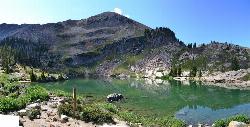
Cecret (Secret) Lake
Alta, Utah
4.4 miles SEA short, easy alpine hike through Albion Basin meadows in Little Cottonwood Canyon leads to a beautiful mountain lake everyone can enjoy.
Hike
White Pine Lake
Sandy, Utah
4.5 miles SA canyon that ski resort lobbyists fought to keep out of wilderness, now open to hikers and rare mountain bikers — hike in and discover why everyone has been arguing over White Pine Canyon.
Hike, Mountain Bike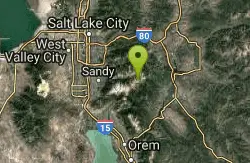
Sugarloaf Peak
Alta, Utah
4.5 miles SEAn easily reached 11,000-foot Wasatch summit overlooking Albion Basin, Secret Lake, and Alta ski resort — one of the easiest of the Wasatch 11ers with a high trailhead and gentle terrain.
Hike 3.2 mi
Little Cottonwood Pipeline Trail
Sandy, Utah
4.8 miles SWA single-track trail starting at the mouth of Little Cottonwood Canyon that stays smooth for the first mile, then gets rocky and steep — ending across a creek from historic ruins after 3.5 miles.
Mountain Bike
Scruffy Band Little Cottonwood Canyon
Sandy, Utah
4.9 miles SWRock Climb near Sandy, Utah
Rock Climb
Ferguson Canyon
Cottonwood Heights, Utah
5.0 miles WA popular climbing destination tucked between Big and Little Cottonwood Canyons, where you can hike into a shaded canyon with a stream or push on to a rocky summit for sweeping views.
Hike, Mountain Bike, Rock Climb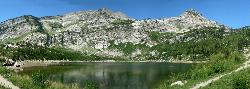
Silver Lake (Big Cottonwood)
Brighton, Utah
5.7 miles EA Wasatch Mountains trail passing three alpine lakes, abundant wildlife from chipmunks to moose, shady forest, and sweeping views — with the option to hike counter-clockwise for a gentler climb.
Hike, Mountain Bike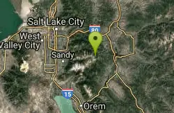
Brighton Lakes Loop
Salt Lake City, Utah
5.8 miles EA challenging mountain bike loop past four alpine lakes — Dog, Mary, Martha, and Catherine — in Big Cottonwood Canyon, with a wild descent down the Lake Mary trail.
Mountain Bike 1.1-4.7 mi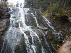
Bells Canyon
Sandy, Utah
6.5 miles SWA 4.5-mile moderate hike up to a canyon waterfall through gorgeous fall foliage, meadows, wildflowers, and a creekside trail — the last 1.2 miles involve serious climbing over large rocks.
Backpack, Hike, Mountain Bike, Snowshoe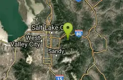
Mill Creek Pipeline
Salt Lake City, Utah
6.6 miles NA connector trail system feeding into Mill Creek Pipeline near Salt Lake City — about 6.5 miles in, a sign marks the Rattlesnake downhill, which drops you near the toll booth.
Mountain Bike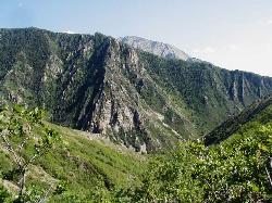
Mill Creek Canyon
Salt Lake City, Utah
6.6 miles NAn out-and-back canyon trail with over 1,000 feet of elevation gain — the lower ski trail sees heavy traffic while the upper section above Elbow Fork stays quiet, with a reservable Yurt at the top December through April.
Camp, Cross-country Ski, Snowshoe 2.6 mi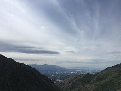
Salt Lake Valley Scenic Overlook
Salt Lake City, Utah
6.7 miles NWA 2-mile uphill hike through Millcreek Canyon switchbacks rewards you with a breathtaking overlook of the Salt Lake Valley from high above downtown's skyline.
Hike


