


140 Things to do near Mirror Lake
first prev 1 2 3 4 5 6 7 next lastShowing results within 50 miles Distance miles of Mirror Lake Trail, Hanna, UT 84031, USA City, Zip, or Address
Wardsworth Creek
Springville, Utah
44.1 miles SWThis trail is intermediate technical and moderate aerobic. The scenery is great as you follow the creek up the canyon. Enjoy some rooty and rocky climbs on your way up to a small pond...
Mountain Bike
Lisa Falls
Sandy, Utah
44.9 miles WLisa Falls is a great place to climb Spring through Fall, any time of day. The base is well shaded by trees and offers many flat places to belay, or just hang out and relax. The roaring waterfall...
Hike, Rock Climb
Storm Mountain
Salt Lake City, Utah
45.2 miles WStorm Mountain is on of the smaller peaks included in the Wasatch Range. Storm Mountain is located in Cottonwood Canyon. Storm Mountain Day Use Area is just 3 miles up Big Cottonwood Canyon,...
Hike, Mountain Bike, Rock Climb 2.6 mi
Salt Lake Valley Scenic Overlook
Salt Lake City, Utah
45.3 miles WThe Salt Lake Valley Scenic overlook starts on the Desolation trail in Millcreek Canyon near Salt Lake City, Utah and offers hikers a wide variety of destinations to stop at along the trail,...
Hike
Grandeur Peak
Salt Lake City, Utah
45.6 miles WGrandeur Peak is the most easily accessible of the major peaks that form the Salt Lake City skyline. For many valley residents Grandeur Peak was there first major summit. The peak offers great...
Hike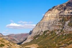
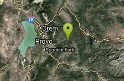
Provo Canyon
Provo, Utah
45.7 miles SWProvo Canyon is a canyon located in unincorporated Utah County, Utah, USA and Wasatch County, Utah. Provo Canyon splits between Mount Timpanogos on the north and Mount Cascade on the south. The...
Rock Climb 0.7 mi
Great White Icicle
Sandy, Utah
45.7 miles WThe Great White Icicle is located in Little Cottonwood Canyon just outside of Salt Lake City, Utah. It is a climbing area that is a frozen waterfall in the winter and a cascading waterfall...
Hike, Rock Climb 1.5 mi
Timpanogas Cave
Provo, Utah
46.6 miles SWKnown for it's colorful cave decorations, the Timpanogas cave attracts numerous visitors per year, is steep but it's paved so that visitors can access the cave. To access the cave, visitors...
Backpack, Cave, Hike 3.2 mi

Little Cottonwood Pipeline Trail
Sandy, Utah
47.4 miles WLocated in Sandy, UT, Little Cottonwood Pipeline trail starts at the mouth of Little Cottonwood Canyon and is a single-track trail with some rocky situations on the trail. The first portion of the...
Mountain Bike
Scruffy Band Little Cottonwood Canyon
Sandy, Utah
47.4 miles WRock Climb near Sandy, Utah
Rock Climb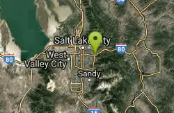
Parley's Canyon
Salt Lake City, Utah
47.4 miles WIt's located at the mouth of Parley's Canyon adjacent to a subdivision. This climb is quick and easy to access if you live in Salt Lake City. Even if you don't, since it's not...
Rock Climb
Ferguson Canyon
Cottonwood Heights, Utah
47.6 miles WFerguson canyon is small canyon between Big and Little Cottonwood Canyons. This canyon has gained popularity over the last few year and is a popular destination for rock climbers. This is one hike...
Hike, Mountain Bike, Rock Climb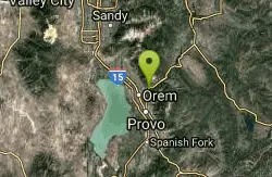
South Fork of the Provo
Provo, Utah
47.8 miles SWSouth Fork of the Provo is a fun, short, scenic singletrack ride. It is an ideal trail to introduce a new mountain biker to the joys of singletrack! The trail has one or two rocky...
Mountain Bike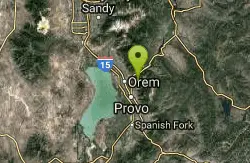
Squaw peak
Provo, Utah
47.8 miles SWAirsoft and Paintball near Provo, Utah
Airsoft, Paintball
Pete's Rock
Salt Lake City, Utah
48.2 miles WA large rock next to the Mount Olympus trailhead known locally as Pete's Rock and is a popular place for casual rock climbing. Mount Olympus is a prominent 9,026 feet peak on the east side of the...
Hike, Rock Climb 1.7 mi
Schoolhouse Springs Trail
Alpine, Utah
48.3 miles WSchoolhouse Springs trail has an elevation trail at 5,300 ft. It's located at the end of the town of Alpine. It features a lake and there's a number of activities including horse-back...
Hike, Mountain Bike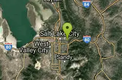
Mt. Wire
Salt Lake City, Utah
48.4 miles WThe Mt. Wire Pipeline Trail is a great singletrack away from the crowds. The lower portion is steep with loose rock. The Pipeline itself is loose gravel and has more hills then a...
Mountain Bike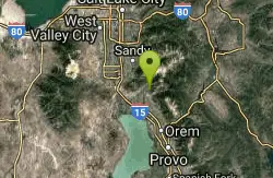
Rodeo Down
Alpine, Utah
48.6 miles WBlack Dog. Trail winds from the middle of Corkscrew down to Flank and River, just south of the water tank. Some technical aspects, length 0.5 miles with 300 vertical feet elevation...
Mountain Bike 1.2 mi
Battle Creek Falls
Pleasant Grove, Utah
48.8 miles SWBattle Creek Falls, located near Pleasant Grove, Utah, is a scenic waterfall that also has a rappelling and rock climbing area nearby. Hikers are allowed to see the falls from two view points, below...
Canyoneer, Hike
G Mountain Trail
Pleasant Grove, Utah
48.8 miles SWThe trail starts at Kiwanis Park which is south of the 'G' at the end of Battle Creek Road. The trail starts out a little steep for about .25 mile and the very last bit is a...
Hike


