


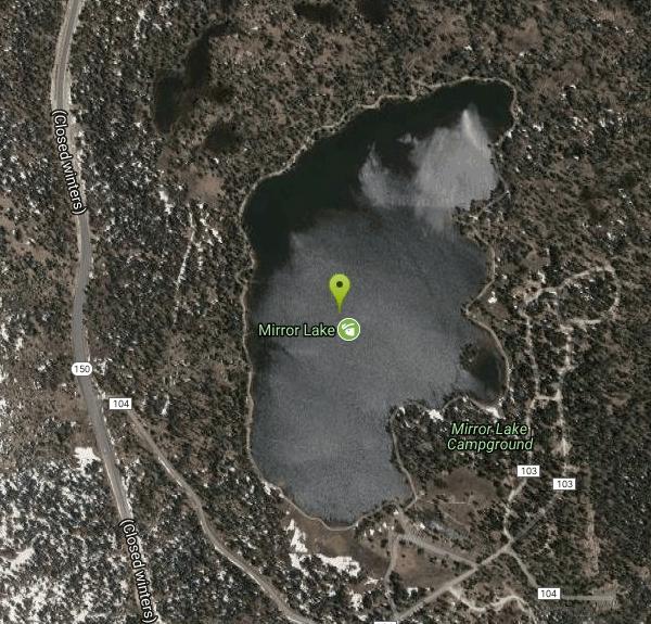
Mirror Lake
Salt Lake City, Utah

| Address: | Mirror Lake Trail, Hanna, UT 84031, USA |
| GPS: |
40°42'15.8"N 110°53'19.8"W Maps | Directions |
| State: | Utah |
| Trail Length: | 2.90 miles |
| MTB Difficulty: | Beginner |
| Trail Type: | Loop |
| Hike Difficulty: | Beginner |
Lakes Rivers Trails Rocks Wildflowers Pet Friendly Bicycles Fishing State Park Restrooms Picnic Tables Waterfalls Streams Glaciers Ponds Paintball Permitted Skateboarding National Park
Backpack, Hike, Mountain Bike, and Swim
Mirror Lake is a beautiful recreation area packed with opportunities to experience nature. Because of the stillness and clarity of the water, Mirror Lake is a beautiful reflection of the surrounding forests and mountains. This beautiful view makes Mirror Lake worthy of its namesake.
There is parking near Mirror Lake, making this area easily accessible for people of all ability levels. Mirror Lake itself is open to swimming, boating, kayaking fishing and canoeing. The water here is cold year round making it the perfect place to cool off on hot summer days. The recreation area is open all year, but water activities are recommended only from late spring to early fall.
Around Mirror Lake there are several miles of trails available for hikers and mountain bikers. The most popular of these trails rings the lake and is easy for hikers of all abilities. For more challenging hikes hikers can enjoy trails that move up into the mountains.
Accessing Mirror Lake costs $3 per car for a three day pass. America the Beautiful Passes are also honored here.
More Information
Mirror Lake - Western Uintas - Road Trip Ryan
Mirror Lake, the namesake of the Mirror Lake Highway, is arguably one of the most popular and visited lakes in the Uinta Mountains. Here is information for visiting Mirror Lake.
https://www.roadtripryan.com/go/t/utah/northern-utah/mirror-lakeNever modify trail features. Ride trails when they're dry enough that you won't leave ruts. Speak up when you see others on the trail and always yield to hikers, horses, and others coming uphill. Always ride on the established trail.
Read MoreBe courteous, informed, and prepared. Read trailhead guidelines, stay on the trail, and don't feed the wildlife.
Read More
- Plan Ahead and Prepare
- Travel & camp on durable surfaces
- Dispose of waste properly
- Leave what you find
- Minimize campfire impacts
- Respect wildlife
- Be considerate of other visitors
Directions
From Salt Lake City, Utah
- Head west on 400 S/
University Blvd toward S Main St (0.2 mi) - Turn left at the 1st cross street onto SW Temple (0.2 mi)
- Turn right onto 500 S/
5th S/ Cesar E. Chavez Blvd (0.6 mi) - Take the I-15 S/
I-80 E/ I-80 W ramp to S.L. Int'l Airport (0.2 mi) - Keep left at the fork, follow signs for I-15 S/
I-80 E/ Cheyenne/ Las Vegas and merge onto I-15 S/ I-80 E (2.5 mi) - Take exit 304 for I-80 E toward Cheyenne (0.6 mi)
- Continue onto I-80 E (4.3 mi)
- Keep left to stay on I-80 E (19.4 mi)
- Take exit 146 toward Heber/
Vernal (0.7 mi) - Continue onto US-189/
US-40 E (3.2 mi) - Take exit 4 toward UT-248 E (0.4 mi)
- Turn left onto UT-248 E (11.4 mi)
- Turn left after 7-Eleven (on the right) (0.2 mi)
- Turn right at the 2nd cross street onto UT-150 E/
E Center St Continue to follow UT-150 EParts of this road may be closed at certain times or days(31.2 mi) - Turn right onto Forest Rd 104/
FR104 (0.6 mi) - Turn left onto Forest Rd 103 (0.2 mi)
- Turn left to stay on Forest Rd 103 (0.1 mi)


Other Mountain Bike Trails, Swimming Holes, Hiking Trails, and Backpacking Trails Nearby
Provo River Falls
Kamas, Utah
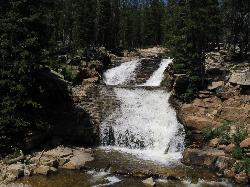
4.4 miles SWThree cascading waterfalls visible from the Mirror Lake Highway pullout near Kamas — wade in the swift, icy snowmelt water or just watch from the established viewing areas and nearby fishing banks.
Hike 
Hell Hole Lake
Evanston, Utah
5.9 miles NEA challenging wash hike in Evanston's Dry Wash, navigating sand and boulders for 1.8 miles to Hellhole Canyon at the edge of the Red Mountain Wilderness.
Camp, Hike, Horseback 
Beaver Creek Trail
Kamas, Utah
16.4 miles WMostly easy hard-packed dirt makes Beaver Creek Trail near Kamas a great first alpine mountain bike ride — gentle grades with options to branch off onto more technical terrain.
Mountain Bike 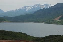
Jordanelle Perimeter Trail
Heber City, Utah
24.9 miles WA 29-mile expert mountain bike trail circling Jordanelle Reservoir with beautiful lake views, rough singletrack, loose rock climbs, and a fee to enter the park.
Mountain Bike 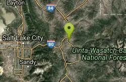
Rockport State Park
Peoa, Utah
26.9 miles WA state park next to Rockport Reservoir with beginner-to-expert trails including a 27-mile paved Rail Trail to Park City and the technical expert-rated Princess Di singletrack.
Mountain Bike 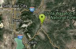
Chopped Coyote Loop
Heber City, Utah
29.5 miles WA big ride northeast of Heber with intermediate-technical singletrack, aspen groves, views of the Wasatch mountains, and a steep switchback descent — best for conditioned riders.
Mountain Bike 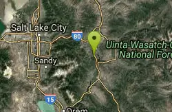
Spin Cycle
Park City, Utah
30.0 miles WA famous Park City singletrack featuring a natural half-pipe known as Spin Cycle — mostly a one-way downhill blast, with a washing machine at the end of the half-pipe as your reward.
Mountain Bike 
Round Valley
Park City, Utah
30.6 miles WA smooth, accessible intermediate singletrack loop with curvy fast sections, nice vistas, rock gardens, and a moderate climb-and-descend pattern right from town.
Mountain Bike 
Wasatch Mountain State Park
Park City, Utah
31.2 miles WUtah's most developed state park in beautiful Heber Valley, offering hiking, biking, golfing, camping, horseback riding, snowmobiling, and cross-country skiing in the Wasatch Mountains.
Mountain Bike 
Historic Union Pacific Rail Trail
Park City, Utah
31.2 miles WA 28-mile non-motorized trail connecting Park City to Echo Reservoir, open to biking, hiking, horseback riding, jogging, Nordic skiing, and wildlife watching along the historic Union Pacific rail corridor.
Mountain Bike 
SOS
Park City, Utah
31.2 miles WA steep 0.3-mile advanced descent off the Prospector Trail in Park City — hang on tight for this fast, demanding drop to Prospector Park.
Mountain Bike 
Snow Park Loop
Park City, Utah
31.2 miles WOne of the best mountain bike loops in the country at Deer Valley — well-marked blue ribbon singletrack mixing smooth buffed sections with hair-raising, endo-inducing descents.
Mountain Bike 
Solamere
Park City, Utah
31.3 miles WA fast, smooth downhill with sweeping switchbacks and a fun rock garden, dropping to Solamere Drive where connections to Lost Prospector and Deer Crest await.
Mountain Bike 
Prospector Area
Park City, Utah
31.7 miles WA 0.75-mile uphill connector to the top of Masonic Hill, where multiple downhill options including Solamere and Masonic await, all within the Prospector trail network.
Mountain Bike 
Corvair
Park City, Utah
31.9 miles WA narrow, steep, and rocky high-alpine trail near Park City that crosses and intersects with TG Trail multiple times.
Mountain Bike 
Deer Valley Resort Bike Park
Park City, Utah
32.0 miles WAn extensive mountain bike zone at Deer Valley Resort spanning from PCMR to Jordanelle, with lift-accessed downhill trails and multi-use two-way routes for all levels.
Mountain Bike 
Poison Creek
Park City, Utah
32.1 miles WA paved greenway running through the heart of Park City, Utah, connecting to multiple other trails so you can get around town by bike without touching busy roads.
Mountain Bike 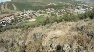
Lost Prospector
Park City, Utah
32.1 miles WA machine-built singletrack trail in the Gambel Oaks system with rocky and loamy sections, fantastic views, and a layout perfect for an after-work ride.
Mountain Bike 
Masonic
Park City, Utah
32.1 miles WA twisty, old-school descent off the knob down to Lost Prospector — narrow tread, sharp turns, and technical rocks reminiscent of legacy trails.
Mountain Bike 
John's Trail
Park City, Utah
32.2 miles WA twisting aspen trail at Park City Mountain Resort accessible by lift on PayDay — full of roots and tight squeezes for a fun, lively mountain bike challenge.
Mountain BikeNearby Campsites
Hell Hole Lake
Evanston, Utah
5.9 miles NEA challenging wash hike in Evanston's Dry Wash, navigating sand and boulders for 1.8 miles to Hellhole Canyon at the edge of the Red Mountain Wilderness.
Camp, Hike, Horseback 
Spruces Campground
Salt Lake City, Utah
39.6 miles WA fee campground in Big Cottonwood Canyon near Salt Lake City — check USDA.gov for current rates and seasonal availability.
Camp, Sled 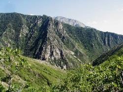
Mill Creek Canyon
Salt Lake City, Utah
43.2 miles WAn out-and-back canyon trail with over 1,000 feet of elevation gain — the lower ski trail sees heavy traffic while the upper section above Elbow Fork stays quiet, with a reservable Yurt at the top December through April.
Camp, Cross-country Ski, Snowshoe 1.6-14.1 mi
Mount Timpanogas
Provo, Utah
43.7 miles SWUtah's most-climbed mountain towers 7,000 feet above the Provo valley, stretching seven miles north to south with multiple peaks over 11,000 feet — a Wasatch landmark.
Camp, Hike, Horseback, Swim 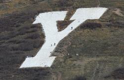
Y-Mountain Summit Trail
Provo, Utah
49.4 miles SWA 1.2-mile climb east of BYU leads to a massive block Y on the hillside and sweeping panoramas over Provo, Orem, Utah Valley, and Utah Lake below.
Camp, Hike 4.7 mi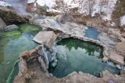
Fifth Water Hot Springs
Provo, Utah
49.4 miles SWA scenic 2.5-mile riverside hike to the famous Diamond Fork rock pools and waterfall, with soaks up to 108°.
Backpack, Camp, Hike, Hot Springs, Mountain Bike, Swim


