


99 Things to do near Mount Washburn Spur Trail
first prev 1 2 3 4 5 next lastShowing results within 50 miles Distance miles of Mount Washburn Spur Trail near Canyon Village, Yellowstone National Park City, Zip, or Address

Chittenden Road - Mount Washburn Trail
Canyon Village, Yellowstone National Park
0.1 miles EA steady, well-packed 5.8-mile out-and-back on the former Chittenden service road to Mount Washburn's summit, with bighorn sheep, wildflowers, and sweeping Yellowstone views at the top.
Hike 3.4 mi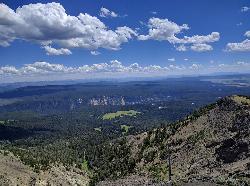
Dunraven Pass - Mount Washburn Trail
Canyon Village, Yellowstone National Park
1.3 miles SWA 6-mile Yellowstone hike via Dunraven Pass through quiet forests to the summit of Mount Washburn — a panoramic perch with bighorn sheep in summer and grizzlies near pine nuts in fall.
Hike 2.8 mi
Mount Washburn Bike Trail
Devils Den, Wyoming
1.9 miles NA steep 2.5-mile gravel service road climb to the top of Mount Washburn with 1,500 feet of elevation gain and sweeping Yellowstone views — watch for service vehicles and carry bear spray.
Mountain Bike 7.6 mi
Observation Peak Trail
Canyon Village, Yellowstone National Park
4.1 miles SWA nearly 10-mile Yellowstone hike that eases through meadows and past beautiful Cascade Lake before a strenuous 1,400-foot climb to a spectacular panoramic peak.
Hike 2.4 mi
Cascade Lake Trail
Canyon Village, Yellowstone National Park
4.1 miles SWAn easy, well-marked 4.5-mile out-and-back hike through meadows and forest to Cascade Lake near Canyon Village, with wildflowers in summer and frequent wildlife sightings year-round.
Hike 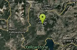
Canyon Campground
Canyon Junction, Yellowstone National Park
5.1 miles SWA popular Yellowstone campground of 300-plus sites just minutes from the Grand Canyon of the Yellowstone and the Upper and Lower Falls, with hiking trails and North Rim Drive access right from camp.
Camp 9.0 mi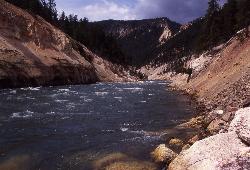
Seven Mile Hole Trail
Canyon Village, Yellowstone National Park
5.1 miles SA challenging 10-mile hike along the Grand Canyon of Yellowstone rim, then a 1,000-foot descent into the canyon for up-close Yellowstone River views and active hot spring sightings.
Hike 18.2 mi
Howard Eaton Trail
Canyon Village, Yellowstone National Park
5.5 miles SWA 10-mile Yellowstone trail passing Cascade Lake, Grebe Lake, and Wolf Lake through forests and meadows — fish any of the lakes with a valid permit, or hike the full 20-mile out-and-back.
Hike 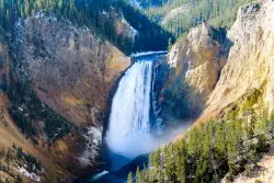
Lower Falls of the Yellowstone
Canyon Village, Yellowstone National Park
6.2 miles SWAt 308 feet, the tallest waterfall in Yellowstone National Park towers over the iconic yellow canyon walls — taller than Niagara Falls, with multiple viewpoints and trails accessible even in winter.
Hike 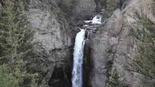
Tower Falls
Tower Junction, Yellowstone National Park
6.9 miles NTower Fall plunges 132 feet off Tower Creek in Yellowstone, framed by dramatic rock pinnacles — located about 3 miles south of Roosevelt Junction.
Camp, Hike 1.4-2.6 mi
Ribbon Lake Trail
Canyon Village, Yellowstone National Park
7.0 miles SWA gentle 6-mile trail through Yellowstone meadows past Clear Lake's thermal blue-green waters, lily-padded Ribbon Lake, and Grand Canyon overlooks — with bison and bears en route.
Hike 2.9 mi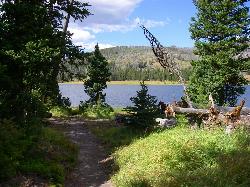
Grebe Lake Trail
Canyon Village, Yellowstone National Park
8.0 miles SWAn easy 6-mile Yellowstone round trip on a converted fire road to Grebe Lake — with elk, wildflowers, burned forest regeneration, and fishing allowed on the lake at trail's end.
Hike 2.4 mi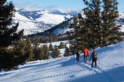
Lost Lake Trail
Tower Junction, Yellowstone National Park
8.1 miles NAn easy 2.8-mile loop behind Roosevelt Lodge, winding through forest, meadows, and along the shores of Lost Lake — open year-round and finishable in under two hours.
Hike 8.2 mi
Garnet Hill Trail
Tower Junction, Yellowstone National Park
8.2 miles NA 7.6-mile loop through Yellowstone meadows, sagebrush, and riverside forest with exceptional wildlife — wolves, bears, bison, moose, elk, and badgers all roam this area.
Hike 16.9 mi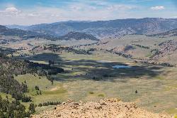
Specimen Ridge Trail (2K4)
Buffalo Ford, Wyoming
8.2 miles NA challenging 17-mile remote hike ascending 3,000 feet to Amethyst Mountain and descending into Lamar Valley — ending at a river ford that may require turning around if uncrossable.
Hike 0.3 mi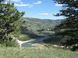
Yellowstone River Picnic Area Trail
Tower Junction, Yellowstone National Park
8.4 miles NA 3.9-mile loop trail from a Yellowstone picnic area along the canyon rim of the Yellowstone River — steam vents, wildlife sightings in meadows, and canyon erosion views throughout.
Hike 7.3 mi
Agate Creek Trail
Tower Junction, Wyoming
8.4 miles NA moderately difficult 7.3-mile hike along Yellowstone River with colorful cliff overlooks, the Narrows, and a primitive riverside campground at trail's end.
Hike 4.0 mi
Specimen Ridge Day Hike and Fossil Forrest Trail
Buffalo Ford, Wyoming
9.4 miles NEA strenuous 4-mile hike to Specimen Ridge with rewarding views, plus a side route to an outcropping of fossilized trees visible from the ridge — rugged and unmarked, but worth it.
Hike 
Hellroaring Creek Trail
Yellowstone National Park
10.5 miles NA suspension bridge over the Yellowstone River leads to sandy creek-side beaches and a mild backcountry trail past Yellowstone's largest granite slab — great for all ages.
Camp, Hike, Swim 0.8-3.8 mi

Little Gibbon Falls
Norris, Yellowstone National Park
11.1 miles SWA family-friendly 4.5-mile Yellowstone loop reaches fishing and swimming spots along Gibbon Creek, with kid-safe trail, canoeing options, and bearspray-worthy backcountry feel.
Camp, Canoe, Hike


