


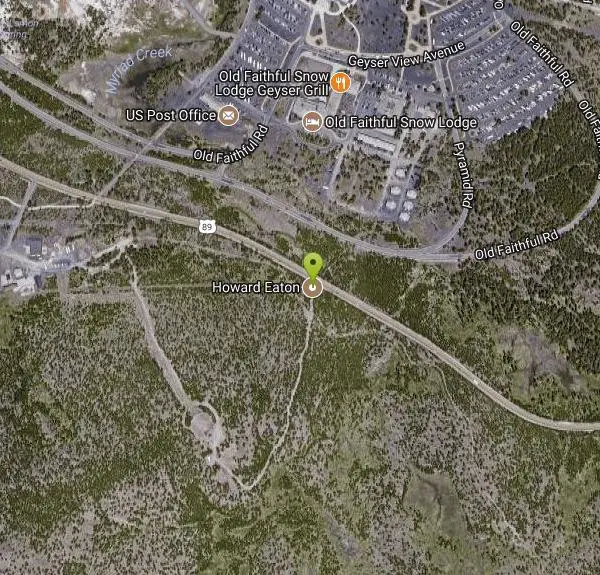
Howard Eaton Trail
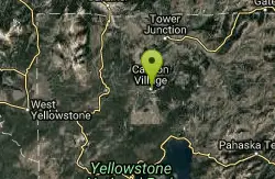
Canyon Village, Yellowstone National Park

| Address: | Norris Canyon Road, Yellowstone National Park, WY, USA |
| GPS: |
44°44'7.3"N 110°30'12.3"W Maps | Directions |
| State: | Wyoming |
| Trail Type: | Point A to B |
| Hike Difficulty: | Intermediate |
| Elevation Gain: | 1069 feet |
| Trails/Routes: | 18.2 mi |
Lakes Streams Trails Wildflowers Ponds Fishing National Park Restrooms Pet Friendly
Hike
The Howard Eaton Trail is a hike with a variety of destinations along a 10 mile trail. The trail can be entered and exited at several points but is most commonly started near Canyon Village. The trailhead can be found about a half mile west of Canyon Village on Norris Canyon Road. There is a turn out by the trailhead where parking is available.
Along the trail, hikers pass Cascade Lake, Grebe Lake and Wolf Lake. These are beautiful lakes where hikers can stop and fish. Anyone wishing to fish must comply with Yellowstone’s fishing rules and guidelines.
The Howard Eaton Trail is open during the summer and fall months. Hikers can enjoy this warmer weather as they hike through miles of forests and meadows along the trail.
Hikers wishing to hike the entire trail should prepare for a long hike. Howard Eaton Trail is 10 miles in one direction. Hikers can prepare by leaving a vehicle at the other end of the trail or packing enough supplies to hike the full 20 miles.
The Howard Eaton Trail is a beautiful, challenging trail with a variety of views. The forests, lakes and meadows of this trail make this unique hike a wonderful Yellowstone adventure.
More Information
Be courteous, informed, and prepared. Read trailhead guidelines, stay on the trail, and don't feed the wildlife.
Read More- Plan Ahead and Prepare
- Travel & camp on durable surfaces
- Dispose of waste properly
- Leave what you find
- Minimize campfire impacts
- Respect wildlife
- Be considerate of other visitors
Directions
From Canyon Village, Yellowstone National Park
- Head northeast (0.1 mi)
- Turn left at the 2nd cross street at N Rim Dr (0.2 mi)
- Turn right onto Grand Loop RdToll roadMay be closed at certain times or days(0.5 mi)
- Turn left onto Canyon Government Area Rd (0.2 mi)
- Turn left to stay on Canyon Government Area Rd (0.4 mi)
- Turn right to stay on Canyon Government Area Rd (394 ft)
- Turn right onto Norris Canyon RdToll roadMay be closed at certain times or days(0.3 mi)
- Turn rightDestination will be on the right(23 ft)


Trails
Distance ?
18.2 miles Round TripElevation Gain ?
34 feetReal Ascent ?
845 feetReal Descent ?
811 feetAvg Grade (0°)
0%Grade (-5° to 14°)
-8% to 26%Elevation differences are scaled for emphasis. While the numbers are accurate, the cut-away shown here is not to scale.
Other Hiking Trails Nearby
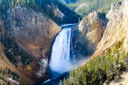
Lower Falls of the Yellowstone
Canyon Village, Yellowstone National Park
1.1 miles SLower Yellowstone Falls is one of the most popular places to visit in Yellowstone, coming in just behind the geyser, Old Faithful. The tallest waterfall in the park, Lower Yellowstone Falls is...
Hike 2.4 mi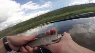
Cascade Lake Trail
Canyon Village, Yellowstone National Park
1.4 miles NECascade Lake Trail is an easy, short hike through picturesque meadows to the beautiful cascade lake. The trailhead is located North of Canyon Village on Grand Loop Road. There is a pullout here where...
Hike 7.6 mi
Observation Peak Trail
Canyon Village, Yellowstone National Park
1.4 miles NEObservation Peak Trail is one of the most famous hikes in Yellowstone National Park. The hike is an almost 10 miles there and back hike that starts and ends at the same trailhead. Observation...
Hike 9.0 mi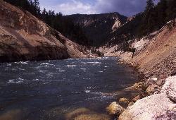
Seven Mile Hole Trail
Canyon Village, Yellowstone National Park
1.6 miles ESeven Mile Hole is a challenging out and back trail that winds along and into the Grand Canyon of Yellowstone. This 10-mile hike begins and ends at Canyon Village where parking is available. From...
Hike 1.4-2.5 mi
Ribbon Lake Trail
Canyon Village, Yellowstone National Park
1.9 miles SRibbon Lake Trail is a 6-mile trail that leads hikers through beautiful meadows, past colorful lakes and beside Yellowstone River. This trail gives hikers a beautiful view of the Grand Canyon of...
Hike 2.9 mi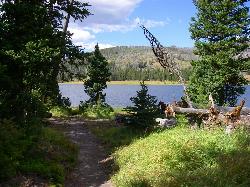
Grebe Lake Trail
Canyon Village, Yellowstone National Park
2.6 miles SWGrebe Lake Trail is an alternative route to Howard Eaton Trail for visiting Grebe Lake. This trail is a converted old fire road that forms a more direct route to the lake. The hike on Grebe Lake...
Hike 3.4 mi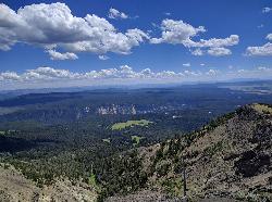
Dunraven Pass - Mount Washburn Trail
Canyon Village, Yellowstone National Park
4.2 miles NEHikers looking for a scenic hike to the peak Mount Washburn will be pleased hiking the Mount Washburn Trail via Dunraven Pass. This trail winds through quiet forests to the peak. The trailhead for...
Hike 16.3 mi
Mount Washburn Spur Trail
Canyon Village, Yellowstone National Park
5.5 miles NEWashburn Spur Trail is an exciting 8-mile trail connecting the peak of Mount Washburn to Seven Mile Hole Trail near Canyon Village. Hikers typically hike the trail starting at Mount Washburn and...
Hike 4.4 mi
Chittenden Road - Mount Washburn Trail
Canyon Village, Yellowstone National Park
5.5 miles NEHiking Mount Washburn via Chittenden Road is the shortest and easiest route to the top. The trail was once a service road and is now a clear well packed trail with a steady, gradual incline. The...
Hike 1.5-3.8 mi
Little Gibbon Falls
Norris, Yellowstone National Park
6.3 miles WIce Lake and Little Gibbon Falls Loop is a 4.5 mile loop trail located near Yellowstone National Park, Wyoming. The trail is good for all skill levels and primarily used for hiking, but there are...
Camp, Canoe, Hike
Ice Lake Trail
Norris, Yellowstone National Park
6.5 miles WThis is a short trail leading to a pretty, tree-lined lake, across ground covered by a lattice of fallen pine trunks from the 1988 fires. The entire trail went through areas burned by the fires of...
Hike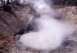
Mud Volcano
Lake Village, Yellowstone National Park
8.4 miles SEIn 1870 Mud Volcano had a cone-shaped mud deposit that covered the feature. By 1872 a thermal explosion had blown that mud away to reveal what we see today.
Hike
Tower Falls
Tower Junction, Yellowstone National Park
12.2 miles NETower Fall is a waterfall on Tower Creek in the northeastern region of Yellowstone National Park, in the U.S. state of Wyoming. Approximately 1,000 yards (910 m) upstream from the creek's...
Camp, Hike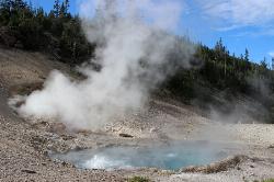
Beryl Spring / Emerald Spring
Norris, Yellowstone National Park
12.6 miles WThis spring is located right off the Grand Loop Road in Yellowstone National Park. The spring is a very quick walk, with a parking lot located right off the road.The trail seems to be a boardwalk,...
Hike 2.4 mi
Lost Lake Trail
Tower Junction, Yellowstone National Park
13.0 miles NLost Lake Trail is a 2.8 mile hike that can be completed in less than two hours. This is an easy hike with very little elevation change. Hikers can enjoy forests, meadows and a view of Lost Lake...
Hike 8.2 mi
Garnet Hill Trail
Tower Junction, Yellowstone National Park
13.2 miles NGarnet Hill Trail is a 7.6 mile loop that follows an old, dirt stagecoach road. This trail passes through large meadows, dusty areas with sagebrush, forests and beside the Yellowstone River. This...
Hike 2.8 mi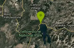
Elephant Back Mountain Trail
Lake Village, Yellowstone National Park
13.3 miles SElephant Back Mountain Trail is a 3 mile loop trail. The trailhead can be found 1 mile south of Fishing Bridge Junction near Lake Village. This trail climbs 800 feet and gives hikers a stunning view...
Hike 16.9 mi
Specimen Ridge Trail (2K4)
Buffalo Ford, Wyoming
13.5 miles NESpecimen Ridge Trail is a challenging hike that requires navigational and technical skills to complete. This 17 mile hike is remote, and though it is marked by carins and blazes, it is often...
Hike 0.3 mi
Yellowstone River Picnic Area Trail
Tower Junction, Yellowstone National Park
13.5 miles NThe Yellowstone River Picnic Area trail is 3.9 miles loop trail. It is called the Yellowstone Picnic Area trail because the beginning of the trail is in a picnic area.This hike features a...
Hike 7.3 mi
Agate Creek Trail
Tower Junction, Wyoming
13.5 miles NAgate Creek Trail is a moderately difficult trail through some of Yellowstone's most beautiful and isolated landscapes. This 7.3 mile hike starts at the Yellowstone River Picnic Area. Parking is...
HikeNearby Campsites
Canyon Campground
Canyon Junction, Yellowstone National Park
0.7 miles ECanyon Campground is a popular choice for visitors to Yellowstone National Park, and it's easy to see why. Located in the heart of the park, the campground offers easy access to some of the...
Camp 1.5-3.8 mi
Little Gibbon Falls
Norris, Yellowstone National Park
6.3 miles WIce Lake and Little Gibbon Falls Loop is a 4.5 mile loop trail located near Yellowstone National Park, Wyoming. The trail is good for all skill levels and primarily used for hiking, but there are...
Camp, Canoe, Hike
Norris Campground
Norris, Yellowstone National Park
9.5 miles WNorris campground is centrally located in Yellowstone National Park and offers a good spot for those planning to visit many of the most famous features in Yellowstone. Norris is a relatively short...
Camp
Tower Falls
Tower Junction, Yellowstone National Park
12.2 miles NETower Fall is a waterfall on Tower Creek in the northeastern region of Yellowstone National Park, in the U.S. state of Wyoming. Approximately 1,000 yards (910 m) upstream from the creek's...
Camp, Hike
Fishing Bridge RV Campground
Lake Village, Yellowstone National Park
13.6 miles SEThe Fishing Bridge Recreational Vehicle Park is located near the mouth of the Yellowstone River as it leaves Yellowstone Lake. The RV park is named after the Fishing Bridge, a wooden vehicle bridge...
Camp
Bridge Bay
Lake Village, Yellowstone National Park
14.3 miles SBridge Bay Campground was named for its proximity to Bridge Bay Marina on Yellowstone Lake. The area is quite scenic, with wooded areas, open meadows and some limited views of the lake. Because of...
Camp
Indian Creek Campground Yellowstone
Mammoth Hot Springs, Yellowstone National Park
15.1 miles NWIndian Creek Campground is a quiet and secluded wooded campground within Yellowstone National Park, ideal for tent campers. It’s close to lots of hiking and fishing, and only a few miles to...
Camp
Hellroaring Creek Trail
Yellowstone National Park
15.2 miles NIf the name didn't scare you enough, the Hellroaring creek trail begins with an arduous descent down to the the Yellowstone River Suspension Bridge.The suspension bridge is a beautiful...
Camp, Hike, Swim
Slough Creek Campground
Tower Junction, Yellowstone National Park
17.6 miles NESlough Creek campground is a small but very popular campground on the Northeast Entrance Road. Most of the campsites are situated right on the banks of Slough Creek where fishing is a favorite...
Camp
Madison Campground
Madison, Yellowstone National Park
18.9 miles WMadison Campground is named for its proximity to the Madison River, which runs through the area in a lush mountain setting rich in wildlife. Madison Campground is at an elevation of 6,800’ and...
Camp
Mammoth Hot Springs Campground
Mammoth Hot Springs, Yellowstone National Park
19.1 miles NWMammoth Hot Springs Campground is the only campground in Yellowstone that is open to campers year-round. Campsites cannot be reserved and are available on a first come first served basis. It is...
Camp 0.1-5.2 mi
Mammoth Hot Springs
Mammoth, Yellowstone National Park
19.2 miles NWMammoth Hot Springs is a unique sight in Yellowstone National Park. The soft limestone in this area allowed the water to form colorful terraces. The extremely hot running water is clear and smooth,...
Camp, Hike
Pebble Creek Campground
Northeast Entrance, Yellowstone National Park
22.9 miles NEPebble Creek is a popular campground for fishermen and those seeking a more quiet and smaller campground in Yellowstone National Park. The campsites can fill very early, so get there before 11 AM...
Camp
Grant Village
Grant Village, Yellowstone National Park
23.8 miles SGrant Village was built in 1984 and named after Ulysses S. Grant, president when Yellowstone became the world’s first national park in 1872. Located near the West Thumb of Yellowstone Lake,...
Camp, Canoe, Kayak 14.8 mi
Biscuit Basin to Fairy Falls and Firehole Meadows
Old Faithful, Yellowstone National Park
27.2 miles SWFreight Road trail is a almost 15 mile hike that leaves from Biscuit Basin or Fountain Flats Drive. This hike is a beautiful remote hike that passes several unique landmarks, breaking up this hike...
Backpack, Camp, Hike 6.9 mi
Heart Lake Trail
Grant Village, Yellowstone National Park
29.3 miles SThe trail is very clear and leads to a moderate eight mile hike to Heart Lake. This hike has many possibilities. Day hikers need to push their time to make sure they are on the trail early to allow...
Backpack, Camp, Hike, Hot Springs 0.1 mi
Lewis Lake Campground
Grant Village, Yellowstone National Park
31.9 miles SLewis Lake is located in the southern part of Yellowstone National Park. It is 4 miles southeast of Shoshone Lake. Lewis Lake offers a plethora great water activities. This lake offers...
Camp, Canoe, Kayak
Big Springs
Island Park, Idaho
40.6 miles SWThere's also a great little walking trail along the river with placards that tell about the ecosystem and history of the area. There's about a 1/2 mile that's paved and then a 1/2 mile...
Camp, Hike
Upper Coffee Pot Campground
Island Park, Idaho
45.7 miles WUpper Coffeepot Campground stretches along a floatable section of Henry's Fork of the Snake River. A mixed growth lodgepole pine forest provides partial shade and summer wildflowers are...
Camp, Canoe 17.5 mi
Tear Drop Lake
Ashton, Idaho
47.0 miles SWNestled in the Targhee National Forest just off of Ashton's Fish Creek Road, this tear drop shaped lake is a family adventure waiting to happen. The lake isn't very big but it is teeming with...
Camp, Canoe, Hike, Kayak, Mountain Bike, Swim


