


53 Things to do near Ousel Falls
first prev 1 2 3 next lastShowing results within 50 miles Distance miles of 0usel Falls View Rd, Gallatin Gateway, MT 59730, USA City, Zip, or Address
Ousel Falls
Big Sky, Montana
0.9 miles NEI rode this everyday before work! There is a bathroom at the top of the trail and people, horses and bikes are allowed on this double-wide packed trail. This is a great trail for any...
Mountain Bike
Bighorn Ridge
Big Sky, Montana
3.1 miles NEShort but challenging with lots of fun shots. Fairly open on the front 9, fairly wooded on the back 9. Support Big Sky Community Park. Public (No Fee)
Disc Golf
Buck Ridge
Gallatin Gateway, Montana
5.3 miles SEThis is a ride you do for the scenery rather than the singletrack. It is an out-and-back on about 8 miles of doubletrack/atv trail. Most of the ride give you fantastic views of the...
Mountain Bike
Little Wapiti
Gallatin Gateway, Montana
14.1 miles SThe climb is partially double track. The descent is narrow, at times rocky, singletrack. Gorgeous views. At 9,000 plus feet...wolf tracks, too.
Mountain Bike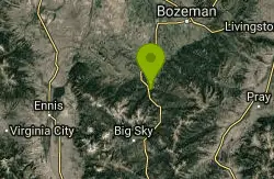
Garnett Mountain
Gallatin Gateway, Montana
15.2 miles NEThis is a great singletrack but it is merciless. Just don't make it your first ride of the year. No problems following this trail, just follow the most obvious route. Though not overly...
Mountain Bike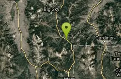
Daly Creek
Gallatin Gateway, Montana
16.6 miles SEDaly Creek Trail is a 5.2 mile out and back trail located near Gallatin Gateway, Montana and is good for all skill levels. The trail is primarily used for hiking and is accessible from May until...
Hike 10.1 mi
Sky Rim Trail to Sheep Mountain
Big Sky, Montana
18.1 miles SESky Rim Trail to Sheep Mountain is a challenging hike with stunning and famous views. This 10 mile out-and-back trail starts at Dailey Creek Trailhead (WK1). The trail follows Dailey Creek over...
Backpack, Hike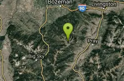
Hyalite Creek Trail
Gallatin Gateway, Montana
22.5 miles NESummer activities are on a timeshare basis, with specific days and activities listed at the trailhead. The entire trail is 11 miles, with eleven waterfalls along the trail! Bear...
Hike, Horseback, Mountain Bike
Cabin Creek
West Yellowstone, Montana
25.3 miles SStarts out as a nice, buff trail. After a mile or two, there are a lot of tough creek crossings and when I rode it in 2010 there were a lot of trees down. This was from a recent...
Mountain Bike
Practice Rock
Bozeman, Montana
25.9 miles NEThis rock is about 2.8 miles into the canyon. There is a pullout on the right, and you can see a small trail on the left side leading up a steep approach. Several fun routes here, but usually pretty...
Rock Climb
Revenue Flats
Norris, Montana
29.4 miles NWLocated between the communities of Norris and McAllister, Revenue Flats is in Madison County, approximately 36 miles southwest of Bozeman and 18 miles north of Ennis. This recreation area provides...
Rock Climb
Sheep Creek Trail
29.8 miles S
The trail has a few interesting spots (rocks, roots, etc.), but mostly it's pretty simple and straightforward. A pretty good climb, especially the last few hundred yards to the lake....
Mountain Bike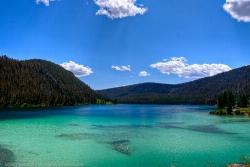
Wade Lake
Cameron, Montana
31.6 miles SCamp, Canoe, Kayak, and Swim near Cameron, Montana
Camp, Canoe, Kayak, Swim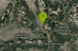
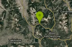
Mile Creek Trail
33.2 miles S
It is important to note that Mile Creek Trail is part of the Continental Divide Trail system, so it connects to other trails of various difficulties. Mile Creek Trail itself is a great...
Mountain Bike
Bozeman Skatepark
Bozeman, Montana
33.5 miles NEConcrete 6,000-square-foot park is free and no pads are required. Admission is free. Locals report that its a good use of space. Park includes three-quarter bowl and street course with...
Skateboard 3.8 mi
Abandoned Railroad Bed Bike Trail
Gardiner, Montana
34.0 miles SEThe Abandoned Railroad Bed Bike Trail, otherwise known as Shortline Trail, is a easily accessible bike trail found just inside the North Entrance of Yellowstone National Park. This bike trail follows...
Mountain Bike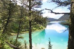
Cliff Lake
Cameron, Montana
34.1 miles SCanoe and Kayak near Cameron, Montana
Canoe, Kayak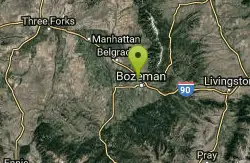
Rose Park
Bozeman, Montana
34.5 miles NEPublic (No Fee)
Disc Golf 7.9 mi
Rescue Creek Trail
Mammoth Hot Springs, Yellowstone National Park
35.4 miles SERescue Creek Trail is an 8 mile hike that crosses the Montana/Wyoming boarder. This double trail makes for a leisurely hike through beautiful hills and colorful yellow green grasslands. This trail,...
Hike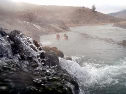
Boiling River
North Entrance, Yellowstone National Park
36.3 miles SEThe Boiling River is created where a large hot spring enters the Gardner River, allowing the hot and cool waters to mix into a temperature comfortable enough to bathe in. The natural hot tub makes a...
Hot Springs, Swim


