


23 Hiking Trails near Ousel Falls
first prev 1 2 next lastShowing Hiking Trails within 50 miles Distance miles of 0usel Falls View Rd, Gallatin Gateway, MT 59730, USA City, Zip, or Address
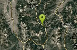
Daly Creek
Gallatin Gateway, Montana
16.6 miles SEA 5.2-mile out-and-back trail good for all skill levels near Gallatin Gateway, Montana, primarily used for hiking and accessible from May through October.
Hike 10.1 mi
Sky Rim Trail to Sheep Mountain
Big Sky, Montana
18.1 miles SEA challenging 10-mile out-and-back hike climbing to some of Yellowstone's highest peaks — Sky Rim Trail rewards with sweeping views and bighorn sheep sightings near Big Horn and Sheep Mountain.
Backpack, Hike
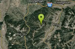
Hyalite Creek Trail
Gallatin Gateway, Montana
22.5 miles NEAn 11-mile hike with 11 waterfalls and frequent black bear sightings — dogs on leashes are common on the trail, and timeshare activity rules apply on certain days.
Hike, Horseback, Mountain Bike 7.9 mi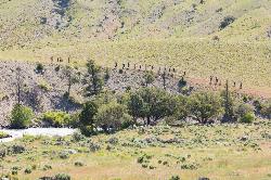
Rescue Creek Trail
Mammoth Hot Springs, Yellowstone National Park
35.4 miles SEA level, well-marked 8-mile point-to-point hike across the Montana-Wyoming border through colorful grasslands near Yellowstone, with frequent bighorn sheep, pronghorn, and elk sightings.
Hike
Mammoth/Gardiner Back Road
Mammoth Hot Springs, Yellowstone National Park
36.4 miles SEThe only road open into Yellowstone in winter runs from Gardiner, Montana through park headquarters at Mammoth Hot Springs and east to Silver Gate and Cooke City.
Hike, Mountain Bike 8.1 mi
Sepulcher Mountain Trail
Mammoth Hot Springs, Yellowstone National Park
36.4 miles SEAn 11-mile loop from Mammoth Hot Springs to the 9,652-foot peak of Sepulcher Mountain, passing colorful meadows, aspen forests, and stunning views of Electric Peak — with frequent bighorn, moose, and grizzly sightings.
Hike 5.3 mi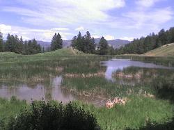
Beaver Ponds Trail
Mammoth, Yellowstone National Park
36.4 miles SEA 5-mile loop above Mammoth Hot Springs with beaver ponds of varying sizes, elk, wildflowers, birds, and occasional bear sightings — a perfect morning or evening hike.
Hike 0.1-5.3 mi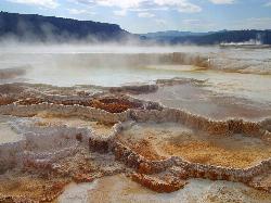
Mammoth Hot Springs
Mammoth, Yellowstone National Park
36.4 miles SEColorful limestone terraces covered in glistening hot-spring water, a 1-mile boardwalk with 300 feet of elevation, elk in the parking lot, and an easy family-friendly loop — Yellowstone's showiest geology.
Camp, Hike 2.0 mi
Snow Pass Trail
Yellowstone National Park Wyoming
36.6 miles SEA moderately difficult 2.4-mile out-and-back with 700 feet of gain near Mammoth Hot Springs, passing impressive boulder hoodoos and ending at a secluded mountain valley — hike in groups and carry bear spray.
Backpack, Hike 4.0 mi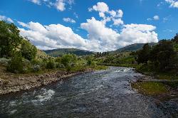
Lava Creek Trail
Mammoth Hot Springs, Yellowstone National Park
36.8 miles SEA 4.2-mile hike along scenic Lava Creek to the 60-foot tiered Undine Falls, with distant Mammoth Hot Springs views, meadows, Mount Everts, and frequent elk and bison sightings.
Hike 7.8 mi
Osprey Falls Trail
Mammoth Hot Springs, Yellowstone National Park
36.9 miles SEAn 8-mile out-and-back near Mammoth Hot Springs hiking green meadows and burned forest to the rim of Sheepeater Canyon and a breathtaking 150-foot waterfall on the Gardner River.
Hike 4.0 mi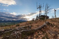
Bunsen Peak Trail
Mammoth Hot Springs, Yellowstone National Park
37.0 miles SEA moderately difficult 4.6-mile hike to Bunsen Peak with a 1,300-foot climb and sweeping views of Mammoth Hot Spring Terraces, Swan Lake Flats, and the Gallatin Mountains.
Hike 0.8 mi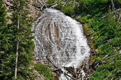
Wraith Falls Trail
Mammoth Hot Springs, Yellowstone National Park
40.9 miles SEA less-than-a-mile family-friendly hike near Mammoth Hot Springs to the unique fan-shaped 79-foot Wraith Falls — open year-round and easy for all skill levels.
Hike 7.4 mi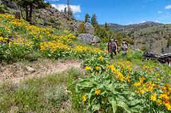
Blacktail Deer Creek to Yellowstone River Trail
Mammoth Hot Springs, Yellowstone National Park
41.7 miles SEA 7-mile out-and-back trail dropping through green fields and boulder formations to waterfall views along the Yellowstone River, with a suspension bridge connecting onward trails.
Hike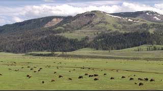
Forces of the Northern Range
Mammoth, Yellowstone National Park
42.8 miles SEA half-mile boardwalk on Yellowstone's Blacktail Deer Plateau with mountain peak displays, a wildlife primer, and a view-packed introduction to the Northern Range's forces of nature.
Hike 0.8 mi
Harlequin Lake Trail
Madison, Yellowstone National Park
47.1 miles SEA half-mile stroll through peaceful pine forest leads to a lily-pad-covered lake frequented by Harlequin ducks and other waterfowl — quiet and uncrowded even in busy Yellowstone.
Hike 1.3-3.9 mi
Lewis & Clark Caverns Trails
Whitehall, Montana
47.3 miles NWA 3,000-acre Montana state park with over 10 miles of trails from a quarter-mile nature loop to a rugged 4-mile descent with 831 feet of elevation change — perfect for a full-day shuttle adventure.
Hike, Mountain Bike 6.1 mi
Purple Mountain Trail
Madison, Yellowstone National Park
47.5 miles SEA quiet 6-mile out-and-back through dense Yellowstone forest, climbing 1,500 feet to the peak of Purple Mountain for panoramic views of the Madison and Gibbon rivers.
Hike 4.2 mi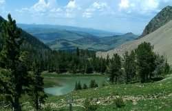
Lake Marie
Island Park, Idaho
47.5 miles SA high Continental Divide hike across the Idaho-Montana border to a cold, snowmelt-fed lake in a wildflower meadow — water level shifts dramatically from spring to fall.
Backpack, Hike 7.6 mi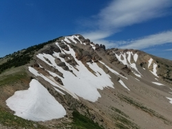
Mount Jefferson
Island Park, Idaho
47.5 miles SIdaho's highest point in the Centennial Mountains crowns a remote 10,203-ft Continental Divide summit on the Idaho-Montana border west of Yellowstone.
Hike


