


227 Things to do near Rocky Peak Via Spooky Trail
first prev 1 2 3 4 5 6 7 8 9 10 next lastShowing results within 50 miles Distance miles of W 7750 S, Victor, ID 83455, USA City, Zip, or Address

Channel Lock
Driggs, Idaho
9.1 miles NWTrail is a little over 1 mile uphill. Recommended route up to access the larger Horseshoe canyon trail system. Makes a nice downhill with twists. Gets its name from the deep ruts made from cows....
Mountain Bike
Bovine
Driggs, Idaho
9.1 miles NWBovine trail is part of a larger system. You can use it to access more trails or make it your end destination from other trailheads. It is a steep climb but returns the favor with a fast downhill....
Mountain Bike
Horseshoe Trails
Driggs, Idaho
9.1 miles NWMountain Bike near Driggs, Idaho
Mountain Bike
Sharks Belly
Driggs, Idaho
9.1 miles NWTrail system can start from Channel lock or Bovine. Channel Lock is an easier climb than Bovine. This description and mileage starts at the Channel Lock trail, forest service boundary marker. Take...
Mountain Bike

Horseshoe Canyon
Tetonia, Idaho
9.2 miles NWHorseshoe Canyon is one of the closest trail systems to the town of Driggs, Idaho. This network doesn't have a ton of climbing or descending, but the smooth, swooping singletrack with a...
Mountain Bike
North Mahogany Trail #220
Tetonia, Idaho
9.4 miles NWhe N. Mahogany Trail is open to Motorbikes, Mountain bikes, Horses, and Hikers. Motorbikes and Horseback riders are the most common visitors, but the trail is becoming increasingly...
Mountain Bike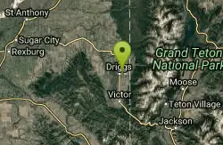
Driggs Nordic Trail
Driggs, Idaho
9.5 miles NEDistance: 3.1 miles (5km) Trail Map: Driggs_Nordic_Track_2015.pdf Grooming Report: http://tvtap.org/nordic-grooming
Cross-country Ski, Snowshoe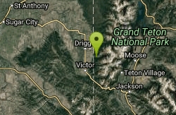
Darby Canyon Cliffs
Alta, Wyoming
9.6 miles NEAn interesting cave by Darby Canyon is the major draw to this popular west slope hike, closely followed by intermittent waterfalls splashing down the canyon rim along with impressive displays of...
Rock Climb
Darby Canyon Camping
Alta, Wyoming
9.6 miles NEThere's no official campgrounds up the canyon but there are several dispersed campsites with existing fire lays. Please adhere to principles of Leave No Trace. Use existing fire lays and leave...
Camp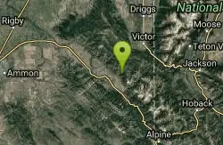
North/South Rainey Creek Trails
Irwin, Idaho
9.9 miles SMotorcycle trail. source: fs.usda.gov
Mountain Bike
Probation And Burg Bumper
Tetonia, Idaho
10.9 miles NWThe Probation part of the trail is the steepest downhill in the area. Has multiple bridges and log jumps in the short mile down. The Burg portion of the trail is uphill with some...
Mountain Bike 4.5 mi
Aspen Trail
Alta, Wyoming
10.9 miles NEAspen Trail (tr 034) is single track trail for 4.35 miles along 6,800 ft contour to Darby Canyon (tr 012). Spring Creek Trail (tr 032) is double track trail for 3.68 miles to end. The trail starts...
Hike, Mountain Bike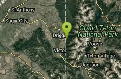
Spring Creek Trail
Alta, Wyoming
11.1 miles NEThis trail starts at the remains of the historic Rapid Creek Ranger Station. The trail heads east following an old road. After crossing Rapid Creek, the trail climbs up to a ridge...
Mountain Bike
Thousand Springs Trail
Driggs, Idaho
12.3 miles WThe Thousand Springs trail begins at Moody Swamp trailhead and ends at Jct Prospect Peak Trail. source: fs.usda.gov Courtesy of Singletracks.com
Mountain Bike 0.1-6.2 mi
Darby Wind Cave
Driggs, Idaho
12.3 miles NEDarby Wind Cave is a beautiful hike full of waterfalls, wildflowers, streams, and mountainous views. The sites you see will depend on the time of year you visit but it will always be beautiful and...
Backpack, Cave, Hike, Rock Climb 4.6 mi
Coal Creek Trail
Alta, Wyoming
12.4 miles SEEnjoy outstanding views from upper Coal Creek Meadows, this hike description travels just beyond the meadows to the top of Coal-Mesquite Divide where you'll enjoy some rather dramatic views of...
Hike, Mountain Bike
South Fork Snake River Trail
Ririe, Idaho
12.5 miles SWGo left at the trail head. It heads down about a mile and a half on double track. Then you'll come to a creek crossing. After the crossing the trail heads across a gate. Head left...
Mountain Bike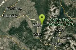
Alta Nordic Trail
Alta, Wyoming
12.6 miles NEDistance: 6.2 miles (10km) Trail Map: Alta_Nordic_Trail_2015.pdf Grooming Report: http://tvtap.org/nordic-grooming
Cross-country Ski, Snowshoe
South Fork Rim Trail
Ririe, Idaho
13.3 miles WMotorcycle trail. source: fs.usda.gov Courtesy of Singletracks.com
Mountain Bike
Blacks Canyon Trail
Ririe, Idaho
13.3 miles WThe Blacks Canyon trail begins at Black Can Road and ends at Junction Fleming Canyon Trail. The trail is open for the following uses: Motorcycle Trail Riding, Off Highway Vehicles (OHV)...
Mountain Bike


