


Darby Canyon Camping
Alta, Wyoming
| Address: | Driggs, ID, USA |
| GPS: |
43°40'27.3"N 111°1'14.7"W Maps | Directions |
| State: | Wyoming |
Camp
Darby Canyon is one of the great hikes on the quiet "backside" of the Tetons, a stunning glacial canyon in the Jedediah Smith Wilderness above Alta, Wyoming, that leads to a genuine natural wonder: the Darby Wind Cave. The trail climbs through classic Teton high country of wildflower meadows and towering limestone walls to a gaping cave mouth that exhales a steady cold wind, and for those equipped for it, connects to a hidden ice cave deeper in the mountain. It's a family-friendly hike with a spectacular payoff and, beyond the cave entrance, a serious technical challenge.
The hike runs about 6.2 miles out and back, rated moderately challenging, and takes most people around three and a half hours, best done from June through October once the snow clears. The trailhead sits at the end of Darby Canyon Road, roughly 20 minutes from Driggs across the Idaho line. The route gains steadily through forest and meadow to the mouth of the Wind Cave, a huge portal in the limestone that anyone can walk into for about 100 yards without needing to crawl, duck low, or wear a helmet, which makes the cave entrance a reasonable goal even for families.
Beyond that first stretch, the cave changes character completely. The Wind Cave is labyrinthine and connects through steep drop-offs to a nearby ice cave, and going deep is genuinely technical: it requires ropes, rappelling and real caving experience, the passages feature several large drops, and the exit is known to freeze over, which can trap unprepared explorers. The cold wind that gives the cave its name pours out of that ice-bound interior. In spring, water flows intensely from the cave; by fall it's a trickle. Treat anything past the easy entrance as expert terrain.
The setting is pure Teton wilderness, and the canyon is beautiful in its own right even if you never step inside the cave. Wildflowers peak in July, and the limestone scenery and creek make the hike a worthy destination regardless.
Bring layers for the cold air at the cave mouth (it's chilly even in summer), sturdy footwear for the rocky approach, a headlamp if you plan to poke into the entrance, plenty of water and sun protection for the exposed meadows, and good judgment about where to stop. This is bear country, so standard precautions apply. For a moderate hike to a wind-breathing cave in the Jedediah Smith Wilderness, with the option to turn back at the easy entrance or, for experts, press into the ice beyond, Darby Canyon is one of the Teton region's most memorable outings.
More Information
Hiking to the Darby Canyon Wind Caves, Wyoming - Girl on a Hike
The Darby Canyon Wind Caves are located near Alta, WY, within the Jedediah Smith Wilderness ("the backside" of the Tetons).
https://girlonahike.com/hiking-to-the-darby-canyon-wind-caves-wyoming.htmlHome | Caribou-Targhee National Forest | Forest Service
Caribou-Targhee National Forest occupies over 3 million acres and stretches across southeastern Idaho, from the Montana, Utah, and Wyoming borders.
https://www.fs.usda.gov/ctnf
- Plan Ahead and Prepare
- Travel & camp on durable surfaces
- Dispose of waste properly
- Leave what you find
- Minimize campfire impacts
- Respect wildlife
- Be considerate of other visitors
Directions
From Alta, Wyoming
- Head south on Alta School Rd toward W Alta Ski Hill Rd (82 ft)
- Slight right onto W Alta Ski Hill Rd (0.5 mi)
- Turn left onto S Stateline RdPassing through IdahoEntering Wyoming(5.1 mi)
- Continue onto Darby Canyon RdDestination will be on the left(1.3 mi)


Other Arenas Nearby

Darby Canyon Cliffs
Alta, Wyoming
0.3 miles NWA popular west-slope hike near Alta, Wyoming to an ancient Wind Cave snaking through 350-million-year-old dolomite, with waterfalls and wildflowers cascading down the canyon rim along the way.
Rock Climb 6.2 mi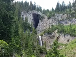
Darby Wind Cave
Driggs, Idaho
2.7 miles EWaterfalls, wildflowers, creek crossings, and a wind cave high on the canyon wall — Darby's switchback trail rewards hikers with views found nowhere else in the Tetons.
Backpack, Cave, Hike, Rock Climb 4.5 mi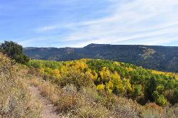
Aspen Trail
Alta, Wyoming
3.3 miles NFlowing singletrack along a 6,800-ft ridgeline contour connects to Darby Canyon on a mix of smooth and rocky terrain — a satisfying intermediate out-and-back or loop.
Hike, Mountain Bike
Spring Creek Trail
Alta, Wyoming
3.6 miles NOld doubletrack follows Rapid Creek past historic ranger station ruins before climbing a ridge with spectacular central Teton and Darby Canyon panoramas.
Mountain Bike 0.1-0.2 mi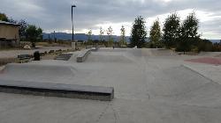
Driggs Bike and Skate Park
Driggs, Idaho
5.1 miles NWA great concrete skatepark with a deep multi-bowl setup alongside a small mountain bike park with about half a mile of singletrack, dirt jumps, and a large wooden berm.
Mountain Bike, Skateboard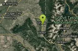
Teton Valley Disc Golf Course
Driggs, Idaho
5.2 miles NWA city park disc golf course in Driggs with 360-degree mountain views and a skateboard area on the way to the Grand Targhee course — free to play.
Disc Golf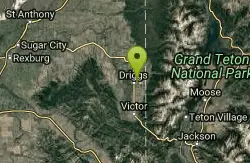
Driggs Nordic Trail
Driggs, Idaho
5.4 miles NWA 3.1-mile groomed Nordic track in Driggs, perfect for cross-country skiing — check the online grooming report before heading out.
Cross-country Ski, Snowshoe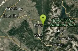
Alta Nordic Trail
Alta, Wyoming
5.6 miles NA 6.2-mile free public cross-country ski and snowshoe loop around Teton Springs Golf Course, with minimal elevation change and frequent elk, moose, and waterfowl sightings.
Cross-country Ski, Snowshoe 3.9 mi
Three Wookie Trail
Driggs, Idaho
5.7 miles NWMountain Bike near Driggs, Idaho
Mountain Bike 4.5 mi
Sheep Bridge Trail
Driggs, Idaho
6.2 miles NAn easy 2.25-mile trail through summer wildflowers and kaleidoscopes of butterflies along Teton Creek — cross a bridge, meander east, and dip down to the creek at a midway rest spot.
Hike, Mountain Bike 7.1 mi
Mill Creek Trail
Moose, Wyoming
6.2 miles NA cross-country downhill mountain bike ride at 7,000–10,000 ft elevation, linking Targhee resort via Lightning Ridge and Colter's Escape down Mill Creek into Teton Canyon — best shuttled for the descent.
Cross-country Ski, Mountain Bike, Snowshoe
Cold Springs
Moose, Wyoming
6.3 miles NA winding loop through Teton-area forest via jeep road and singletrack — starts up Ski Hill Road, drops through trees on the Cold Springs trail, and finishes back on Mill Creek.
Mountain Bike
Grand Targhee Resort
Moose, Wyoming
6.3 miles NA spectacular Teton mountain disc golf course at 8,000 feet elevation at Grand Targhee Resort — discs available at the Activity Center, open June through October when snow clears.
Disc Golf
Victor Bike Park
Victor, Idaho
6.7 miles SWA compact but progressive bike park in Victor, Idaho with a jump line, pumptrack, and additional stunt features — a great skills-builder spot in the Teton Valley.
Mountain Bike
Reunion Flat Campground
Alta, Wyoming
6.7 miles NECamp near Alta, Wyoming
Camp
Pioneer Park Nordic Trail
Victor, Idaho
6.9 miles SWA 3-mile groomed Nordic trail winding through the scenery near Victor, Idaho — check the grooming report before you go and enjoy fresh-tracked snow on a classic winter loop.
Cross-country Ski, Snowshoe
Teton Canyon Campground
Alta, Wyoming
7.6 miles NETeton Canyon Campground is the gateway to Alaska Basin, Table Rock, and the Teton Crest Trail — each site stocked with a picnic table, fire ring, and bear box.
Camp 3.8-6.4 mi
Table Rock / Table Mountain
Driggs, Idaho
7.7 miles NEA big climb to 11,300 feet for arguably the finest view of the Grand Tetons — pick the steep Face or the gradual Huckleberry trail.
Camp, Hike 15.0-18.4 mi
Alaska Basin
Driggs, Idaho
7.7 miles NEA stunning trail through the Jedediah Wilderness into Wyoming near Grand Teton National Park, with wildflowers, rushing rivers, the Teton Range, and the serene Alaska Basin — intermediate to advanced.
Backpack, Hike, Horseback 7.9 mi
Devil's Stairs
Driggs, Idaho
7.7 miles NEAn 8-mile round-trip trail that starts from the Teton Canyon Trailhead, climbs 1,000 feet in switchbacks, and arrives at a stunning high meadow filled with wildflowers and framed by a towering cliff.
Backpack, Hike
Nearby Campsites
Reunion Flat Campground
Alta, Wyoming
6.7 miles NECamp near Alta, Wyoming
Camp
Teton Canyon Campground
Alta, Wyoming
7.6 miles NETeton Canyon Campground is the gateway to Alaska Basin, Table Rock, and the Teton Crest Trail — each site stocked with a picnic table, fire ring, and bear box.
Camp 3.8-6.4 mi
Table Rock / Table Mountain
Driggs, Idaho
7.7 miles NEA big climb to 11,300 feet for arguably the finest view of the Grand Tetons — pick the steep Face or the gradual Huckleberry trail.
Camp, Hike
Mike Harris Campground
Victor, Idaho
8.5 miles SA scenic mountain campground at 6,200 feet along Teton Pass just 5 miles from Victor, Idaho — a peaceful base for fishing, trail exploring, and sightseeing in the Teton region.
Camp
Pine Creek Campground
Victor, Idaho
11.6 miles SWThe Pine Creek Campground has 10 single units and has restrooms.
Camp 1.3-4.3 mi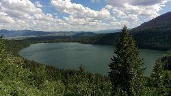
Phelps Lake
Jackson, Wyoming
12.8 miles EA 5.5-mile loop around beautiful Phelps Lake with mountain scenery, majestic blue water, several Teton waterfalls, and lakeside campsites — plus a popular cliff jumping rock along the trail.
Backpack, Camp, Dive, Hike, Swim
Jenny Lake Campground
Jackson Hole, WY
15.8 miles ETucked right at the base of the Tetons, this tent-only campground fills before 8 AM in summer for good reason — alpine beauty, quiet sites, and unbeatable Teton proximity.
Camp 2.8-4.1 mi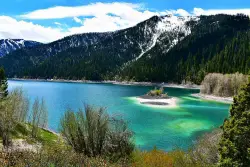
Palisades Creek Trail / Lakes and Waterfall Canyon
Irwin, Idaho
21.4 miles SWSpectacular mountain views, two landslide-formed alpine lakes, and mountain goat sightings — all within a 4-to-6-mile hike in the Swan Valley wilderness.
Backpack, Camp, Hike, Horseback, Mountain Bike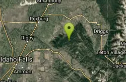
Moody Meadows
Driggs, Idaho
22.2 miles WGood place for kids, they can ride bikes in the meadow, play in the stream, and camping is off of the road. Hiking, motorbiking, and horseback riding trails are abundant in the area.
Camp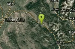
Falls Campground
Victor, Idaho
23.9 miles SWA Snake River campground near Swan Valley with cottonwood shade, abundant wildlife — eagles, osprey, moose, and deer — and Fall Creek Falls just a quarter mile away; Palisades Reservoir is 20 miles out.
Camp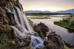
Fall Creek Falls
Swan Valley, Idaho
24.1 miles SWA shaded Snake River campground near Swan Valley with abundant wildlife, great trout fishing, and Fall Creek Falls a quarter-mile away.
Camp, Cave, Hike, Kayak, Swim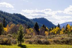
Big Elk Campground
Irwin, Idaho
24.8 miles SA versatile campground near Palisade Reservoir with fishing, hiking, horseback riding, and kayaking — plus a small secluded lake on the drive in that's perfect for a quiet afternoon.
Camp 6.9 mi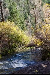
Big Elk Creek
Irwin, Idaho
24.8 miles SA versatile campground on a small dammed lake with fishing, kayaking, hiking and backpacking into the Caribou-Targhee National Forest, and stunning fall Aspen and Douglas-Fir colors on the Big Elk Creek Trail.
Backpack, Camp, Canoe, Hike, Horseback, Kayak
Calamity Campground
Irwin, Idaho
25.8 miles SA wooded Palisades Reservoir campground 55 miles east of Idaho Falls with clean blue water for swimming, boating, water skiing, and fishing — plus miles of ATV routes.
Camp, Canoe, Hike, Kayak, Mountain Bike, Swim
Sheep Falls on Fall River
Ashton, Idaho
28.3 miles NA local gem off Cave Falls Road where the river splits into multiple falls tumbling over each other — primitive campsites and beautiful views make it a great picnic stop.
Camp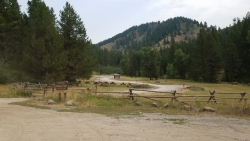
Table Rock Campground
Ririe, Idaho
28.6 miles WA campground in Caribou-Targhee National Forest — part of a 3-million-acre stretch from Montana to the Utah and Wyoming borders — with access to the Curlew National Grassland.
Camp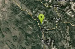
Indian Creek Campground (Palisades)
Irwin, Idaho
28.7 miles SA picturesque reservoir nestled between the Snake River and Caribou ranges, just 25 miles from Jackson Hole — a beautiful drive and a wildlife-rich fishing base.
Camp, Hike, Horseback, Swim 0.5-3.5 mi
Webster's Dam
Ririe, Idaho
28.9 miles WAn abandoned dam in Moody Creek canyon where sediment split the stream into two beautiful 15-foot waterfalls — stunning in spring runoff and blazing with fall colors.
Camp, Hike, Mountain Bike
Big Hole Dispersed Campsites
Ririe, Idaho
29.3 miles WA network of dispersed campsites with fire rings in the Big Hole mountains above Kelly Canyon — first come, first served, no reservations, and Leave No Trace principles are essential.
Camp 6.6-6.8 mi
Bear Creek Hot Springs
Irwin, Idaho
29.5 miles STrek ~13 miles up a creek canyon near Palisades Reservoir to a secluded natural hot spring — gentle most of the way, with one rewarding final climb.
Backpack, Camp, Hike, Horseback, Hot Springs, Mountain Bike


