


233 Things to do near Trail 1A
first prev 3 4 5 6 7 8 9 10 11 12 next lastShowing results within 50 miles Distance miles of E Dreamy Draw Bikeway, Phoenix, AZ 85028, USA City, Zip, or Address

Rainbow Valley to Toothaker Loop Trail
Goodyear, Arizona
23.9 miles SWEstrella Mountain Regional Park has many trails within it, a great beginner to intermediate friendly trail is the Rainbow Valley to Toothaker Loop Trail. This 6.6 mile hike is mostly flat with a few...
Hike, Horseback, Mountain Bike

Pass Mountain
Mesa, Arizona
24.2 miles EMultiple loop options and trails with various degrees of difficulty. Beginners/novices will enjoy Moonrock and Blevins trails while experts will enjoy Pass Mt and the Cat Peaks loops. I...
Mountain Bike
Chandler Skatepark
Chandler, Arizona
24.3 miles SEChandler, an outdoor 33,000-square-foot park, has been reported to be the best skatepark in Arizona. Designed by SITE Systems Design Group, it features ledges, two bowls, banks, quarterpipes,...
Skateboard
Buckhorn Campground Nature Trail
Apache Junction, Arizona
24.3 miles ECamp and Hike near Apache Junction, Arizona
Camp, Hike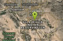
Paseo Vista Recreation Area
Chandler, Arizona
24.8 miles SEMulti-use park on a former land fill site. 11 holes have dual tees and 1 hole has 2 baskets. Mostly wide open with some OB. Features 2 concrete culvert mandos through pipe. Multiple berms and a...
Disc Golf 1.5 mi
Moon Rock Loop
Apache Junction, Arizona
24.8 miles ELocated within the larger Usery Mountain Regional Park, the Moon Rock loop is a fast and smooth trail that adds 1.3 miles to the more famous Blevins Trail. Although the Moon Rock loop is not known as...
Hike, Horseback, Mountain Bike 1.7 mi
Levee Trail
Mesa, Arizona
24.8 miles ELocated within the Usery Mountain Regional Park, the Levee trail is named so because it mostly follows the top of levee, running parallel to a large section of the channel trail and a Phoenix...
Hike, Horseback, Mountain Bike
Usery Mountain Regional Park
Mesa, Arizona
24.9 miles EThere are many miles of two-way single-track trails in the park at several levels of difficulty. The Pass Mountain Trail should challenge intermediate to advanced riders. The Cat Peaks...
Mountain Bike
Crismon Wash Trail
Mesa, Arizona
25.0 miles EThe Crismon Wash Trail is 1.8 mile trail that is accessible from the south at the Crismon road trailhead. It is also accessible from the Blevins train to the north. There are several...
Hike, Horseback, Mountain Bike
Cat Peaks - Blevin - Moonrock
Apache Junction, Arizona
25.2 miles EFollow Blevins trail 0.6 miles, the entrance to the Moonrock loop will be on your right, marked by a brown sign and arrow. Take this loop (around 1.4 miles) until it returns to Blevin's...
Mountain Bike
Pebble Beach
Mesa, Arizona
26.2 miles EPebble Beach is a popular place to go tubing and swimming with designated picnic areas. It's located along the Salt River in Cibola National Forest. The reason the Salt River is so salty is...
Swim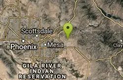
Blevins Via Meridian
Apache Junction, Arizona
26.8 miles EThe ride East down Meridian trail is a one mile intermediate to beginner ride. However if you can stay on the pedals through the several dry wash crossings you are definitely not a...
Mountain Bike
Cat Peaks Via Ruidoso
Apache Junction, Arizona
27.0 miles EThe Ruidoso trail is a beginner ride with a few tricky dry wash crossings that will challenge you to try and stay on the pedals. This trail ends at the Spillway trail after 1.2 miles....
Mountain Bike
Wildlife Trail
Waddell, Arizona
27.2 miles WA short trail which terminates at a small pond.
Hike, Horseback
Mule Deer Trail (Maricopa Trail)
Waddell, Arizona
27.2 miles WMule Deer trail is a 3.5 mile out-and-back trail that it part of the Maricopa Trail within White Tank Mountain Regional Park. This is a beginner to moderate friendly trail for both hikers and...
Hike, Horseback, Mountain Bike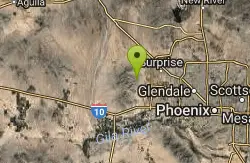
Black Rock Loop Trail
Waddell, Arizona
27.3 miles WBlack Rock Trail is a 1.3 mile loop trail located near Waddell, Arizona and is good for all skill levels. The trail is primarily used for hiking and is accessible year round. Black...
Hike
South, Bajada, Mule Deer Loop Trail
Waddell, Arizona
27.3 miles WSouth - Bajada - Mule Deer Loop is a 4.1 mile loop trail located near Waddell, Arizona that offers the chance to see wildlife. The trail is rated as moderate and is accessible from...
Hike, Horseback, Mountain Bike
White Tanks Competitive Track
Waddell, Arizona
27.4 miles WNice climbs and nice technical downhills.
Mountain Bike
White Tanks Regional Park Trails
Waddell, Arizona
27.4 miles WI have not ridden these trails yet, but I was surprised that they were not listed yet on the ST's database. There are 28 miles of multi-use trails in the park, not including the park's...
Mountain Bike
Goat Camp Trail
Buckeye, Arizona
27.5 miles WGoat Camp Trail is a well-liked mountain biking and hiking trail in White Tank Mountain Regional Park. This is a 16 mile out-and-back trail that is rated as advanced due to the length, as well as the...
Hike, Mountain Bike


