


234 Things to do near Gilbert, Arizona
first prev 3 4 5 6 7 8 9 10 11 12 next lastShowing results within 50 miles Distance miles of Gilbert, AZ, USA City, Zip, or Address
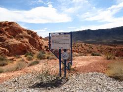
Arrowhead Point Trail
Glendale, Arizona
32.7 miles NWArrowhead Trail is a 2.4 mile hiking and mountain biking trail within Thunderbird Conservation Park. This trail is manageable enough for beginners, but offers enough challenge for more experienced...
Hike, Mountain Bike
H-1 to H-4 Trails Loop
Glendale, Arizona
32.7 miles NWThunderbird Park in Glendale, AZ consists of 5 H-Trails, named so because of the Hedgpeth Hills through which they wind. H-1: One-Way - 5.0 miles H-1a: Loop trail - 2.5 miles - 400...
Hike, Mountain Bike 1.4 mi
Ballantine Trail
Rio Verde, Arizona
33.1 miles NEthis trail looks a lot better once it moves away from the highway. A somewhat strenuous climb reveals a landscape of knuckle-and-joint, mica-imbedded boulders, deep gorges and a battalion of regal...
Hike
Deem Hill
Phoenix, Arizona
33.3 miles NWThe trail starts out going north around the mountain then heads uphill and gives you some good inclines with switch backs. Total incline is approximately 650'. The trail is rocky and...
Mountain Bike
Deem Hills East Trail
Phoenix, Arizona
33.3 miles NWDeem Hills is one of the newer parks in Phoenix to open (2010) and as such a lot of people still don't know it's there. This means that it has much more of a secluded feel then some of...
Hike
Palisade to Basalt to Circumference Trail Loop
Phoenix, Arizona
33.3 miles NWHike near Phoenix, Arizona
Hike
Deem Hills Inner Loop
Phoenix, Arizona
33.3 miles NWHike and Mountain Bike near Phoenix, Arizona
Hike, Mountain Bike
Dixie mountain
Glendale, Arizona
33.4 miles NWGreat network of trails including some beginner to intermediate. Connect as many loops as you want to get the desired distance or connect to the north Sonoran preserve via connector...
Mountain Bike 2.9 mi
Coldwater Trail
Goodyear, Arizona
33.5 miles WThe Cold Water Trail #27 is a seldom visited, remote backcountry destination along the backdrop of the rugged Verde Rim with healthy mixed vegetation and unique geology. The trail was originally used...
Hike, Horseback, Mountain Bike 13.8 mi
Butterfield to Gadsen Loop Trail
Goodyear, Arizona
33.5 miles WAs with other trails in Estrella, the trail is wide and the surface tends to be rather benign, varying from mostly smooth, to occasionally strewn with small rocks, sandy in the washes. Butterfield...
Hike, Horseback, Mountain Bike
Baseline Trail
Goodyear, Arizona
33.6 miles WThe Baseline trail is a 2.6 mile loop at Estrella Mountain Regional Park. This listing is based on access from a spur trail (33.378981, -112.371072) off of the Gila trail. Access is...
Hike 3.6 mi
Toothaker Trail
Goodyear, Arizona
33.7 miles WToothaker is an easy roller coaster of a trail. It crosses numerous washes ranging from small to large and can be a tad loose and/or rocky in some sections. The end reward is a nice view of Rainbow...
Hike, Horseback, Mountain Bike
Estrella Mountain Park
Goodyear, Arizona
33.7 miles WNice mix of singletrack and doubletrack. One way loops, long loop and tech loop. A few mild climbs and some mild rock gardens, just let it ride. There is a lot of loose rocks on the...
Mountain Bike
Dysart Trail
Goodyear, Arizona
33.7 miles W$6 entry fee per car.
Hike, Horseback, Mountain Bike
Rainbow Valley to Toothaker Loop Trail
Goodyear, Arizona
33.7 miles WEstrella Mountain Regional Park has many trails within it, a great beginner to intermediate friendly trail is the Rainbow Valley to Toothaker Loop Trail. This 6.6 mile hike is mostly flat with a few...
Hike, Horseback, Mountain Bike
Deem Hills Circumference Trail with Summit
Phoenix, Arizona
33.7 miles NWDeem Hills is one of the newer parks in Phoenix to open (2010) and as such a lot of people still don't know it's there. This means that it has much more of a secluded feel then some of...
Hike
Deem Hills Circumference Trail
Phoenix, Arizona
33.8 miles NWDeem Hills s a 10.5 mile loop trail located near Phoenix, Arizona. The trail is rated as moderate and primarily used for mountain biking.
Hike, Horseback, Mountain Bike
Bobcat Trail - Sonoran Preserve
Phoenix, Arizona
33.9 miles NWBobcat Trail is a short, easy trail, often used for connecting to other bigger trails in the Sonoran Desert Preserve. This is a 2 mile out-and back trail. There isn't much of a parking...
Hike
Goodyear Skatepark
Goodyear, Arizona
34.0 miles WSkate Park Rules USE AT YOUR OWN RISK! This skate park is not supervised. This facility is used by both experienced and inexperienced skaters and riders. Serious injury or death may result from...
Skateboard 1.0 mi
Quail Trail
Goodyear, Arizona
34.2 miles WQuail Trail is the access trail from the Nature Center to the main trail system. It is a pretty steep climb, but smooth and steady. Quail Trail is a spur trail in the Estrella Mountain...
Hike, Horseback, Mountain Bike


