


Add Location
Refine Search
- skateboard 124
- mountain bike 31
- hike 19
- swim 10
- camp 9
- rock climb 7
- horseback 4
- cave 3
- disc golf 3
- kayak 2
- sled 2
- hot springs 2
- dive 1
- canyoneer 1
- canoe 1
- whitewater 1
174 locations
Add Location
 Full Listing
Show more
Skateboard
Full Listing
Show more
Skateboard
 Full Listing
Show more
Skateboard
Full Listing
Show more
Skateboard
 Full Listing
Show more
Mountain Bike
Full Listing
Show more
Mountain Bike
 Full Listing
Show more
Skateboard
Full Listing
Show more
Skateboard
 Full Listing
Show more
Mountain Bike
Full Listing
Show more
Mountain Bike
 Full Listing
Show more
Kayak, Swim
Full Listing
Show more
Kayak, Swim
 Full Listing
Show more
Hike, Mountain Bike, Rock Climb
Full Listing
Show more
Hike, Mountain Bike, Rock Climb
 Full Listing
Show more
Camp, Hike, Horseback, Swim
Full Listing
Show more
Camp, Hike, Horseback, Swim
 Full Listing
Show more
Camp, Hike, Horseback, Mountain Bike
Full Listing
Show more
Camp, Hike, Horseback, Mountain Bike
 Full Listing
Show more
Skateboard
Full Listing
Show more
Skateboard
 Full Listing
Show more
Canoe, Kayak, Swim
Full Listing
Show more
Canoe, Kayak, Swim
 Full Listing
Show more
Cave, Hike
Full Listing
Show more
Cave, Hike
 Full Listing
Show more
Hike, Mountain Bike, Rock Climb
Full Listing
Show more
Hike, Mountain Bike, Rock Climb
 Full Listing
Show more
Dive, Hike, Rock Climb, Swim
Full Listing
Show more
Dive, Hike, Rock Climb, Swim
 Full Listing
Show more
Camp, Hot Springs
Full Listing
Show more
Camp, Hot Springs
 Full Listing
Show more
Skateboard
Full Listing
Show more
Skateboard
 Full Listing
Show more
Skateboard
Full Listing
Show more
Skateboard
Pala Skatepark
Pala, California
0.3 miles E of Pala, CaliforniaThe Pala Skatepark is a fun, well-designed public skatepark on the Pala Indian Reservation in northern San Diego County, California, tucked into the Jim Banks Sports Complex off Pala Mission Road. Built by the Pala Band of Mission Indians and opened in 2008, it's a quality park that gives skaters across the region a safe, enjoyable place to ride.
Designed by the award-winning skatepark builder Wally Hollyday, the park offers a great variety of terrain, including rails, drops, and ramps, plus a carved bowl modeled after a classic abandoned backyard pool — a nod to the empty-pool skating that shaped the sport in the 1980s and '90s — and a fun, flowing snake run. Lights throughout the park mean you can skate into the evening, and the park has hosted skateboarding events over the years, including an annual Bowl Jam competition.
It's a welcoming community facility in a scenic inland-valley setting. As always, gear up with a helmet and pads (especially younger skaters), be courteous and take turns, bring water, and check for any posted hours or rules. Well-built, lit for night sessions, and rich with pool-skating flavor, the Pala Skatepark is a standout stop in North County San Diego.
The Cove Skate Park
Santa Monica, California
0.6 miles E of Santa Monica, CaliforniaThe Cove Skatepark in Santa Monica, California, is a legendary spot steeped in skateboarding history, tucked into Memorial Park just inland from the famous Southern California coast. Named for The Cove at the old Pacific Ocean Park pier — the surf break where the legendary Z-Boys of Dogtown honed the moves they would translate into modern skateboarding — it's a genuine piece of the sport's heritage and a fantastic place to skate.
Spanning about 20,000 square feet of smooth concrete, The Cove is built for both transition and street skating, with an old-school flavor and endless fun lines. Features include ramps, bowls, stairs, rails, a pool with tile coping, and an over-vert bowl, drawing skaters and bikers of all levels and ages. Its blend of history and quality terrain has made it a frequent backdrop in skate videos since the 1990s.
Note that The Cove charges a modest fee — expect a first-time registration and a small daily rate (roughly $3 to $5), with a discount for Santa Monica residents — and requires safety gear. So bring your helmet and pads and check current hours and pricing before you go. As always, be courteous and take turns with a crowd that can include serious talent, bring water, and follow the posted rules. Historic, well-built, and steps from the beach, The Cove is a must-skate on any Los Angeles skate pilgrimage.
Yuba State Park
Levan, Utah
15.6 miles S of Levan, UtahYuba State Park is a sunny water-recreation playground built around Yuba Reservoir in central Utah, near Levan about 110 miles south of Salt Lake City. Beloved for having some of the warmest water of any Utah reservoir, it's a favorite summer getaway for swimming, boating, and camping on sandy beaches — and a great base camp for mountain biking, hiking, and off-road adventures in the surrounding country.
The reservoir is the star. Because its water warms up more than most Utah lakes, swimming, paddleboarding, wakeboarding, tubing, and personal watercraft are especially enjoyable here, and the sandy shoreline beaches make for relaxed days by the water. Anglers fish for walleye, perch, and catfish, while paddlers explore the quieter coves.
On land, the areas around the reservoir offer hiking, mountain biking, rock hounding, and OHV riding, with several routes that connect to wider trail systems. The park is also a handy launch point for the trails of the nearby Wasatch Plateau and Fishlake and Manti-La Sal national forests, as well as the famous climbing at Maple Canyon just to the east. Multiple campgrounds — including Oasis, Painted Rocks, and Eagle View — offer everything from sandy beach sites to spots with electric hookups, boat launches, drinking water, and restrooms.
As a Utah State Park, a per-vehicle day-use fee applies (one fee covers a carful of up to eight people), plus camping fees for overnight stays, and reservations are wise for summer weekends. Come prepared for hot, exposed high-desert conditions with plenty of water, sun protection, and shade, watch the wind on the open water, and pack out your trash. For warm-water fun and a great recreation hub, Yuba State Park is hard to beat.
Sierra Vista Skate & Bike Court
Sierra Vista, Arizona
1.0 miles NE of Sierra Vista, ArizonaThe Sierra Vista Skate and Bike Court is a large, uniquely designed public skatepark in Sierra Vista, Arizona, set within the city's Veterans Memorial Park in the high desert of the state's southeast corner. At around 17,000 square feet of poured concrete laid out in a distinctive ring shape, it's one of the more original park designs you'll find and a great spot in the Cochise County skate scene.
The park (built with the local Kiwanis) packs in a rich variety of features, including concrete berms and banks, an assortment of ramps and rails, step-ups, hubba ledges, banked walls, a pier block, and an advanced kidney-shaped bowl for those who like to ride vert and transition. There's a seven-stair set with a grind rail and a smaller four-stair with a rail for street skaters chasing gaps and lines. The unusual ring layout keeps the flow interesting as you move around the park.
This roughly three-acre facility is admission-free and lit for night sessions, though note it's limited to skateboards (up to about 35 inches) and BMX bikes. As always, gear up with a helmet and pads (especially younger riders), be courteous and take turns, bring water for the desert climate, and check for any posted rules. Varied, well-lit, and one of a kind, the Sierra Vista Skate and Bike Court is a standout in southern Arizona.
Mary's Peak Trail
Philomath, Oregon
9.4 miles W of Philomath, OregonMarys Peak is the highest point in Oregon's Coast Range, a 4,097-foot summit crowned with open wildflower meadows and rare noble fir forest, rising west of Corvallis and Philomath in the Siuslaw National Forest. Famous for its 360-degree views — west to the Pacific Ocean and east across the Willamette Valley to the snow-capped Cascades — it's one of the great scenic destinations of the mid-Willamette Valley, popular with hikers, cyclists, and mountain bikers alike.
There's a route for every ability. For the biggest payoff with the least effort, drive up Marys Peak Road to the summit parking lot and take the easy, family-friendly Summit Trail (about 1.4 miles round trip) to the very top. For a bigger challenge, the East Ridge Trail climbs roughly 1,400 feet over 3.5 miles through old-growth Douglas fir into noble firs, while the North Ridge Trail is the toughest, gaining about 2,200 feet over 5.5 miles. The 1.6-mile Meadowedge Loop offers a sheltered forest walk near the summit. The paved road and trail network also make the peak a favorite with road cyclists and mountain bikers.
The summit meadows put on a changing show of wildflowers through late spring and summer, and clear days deliver that unforgettable ocean-to-Cascades panorama. A Northwest Forest Pass or day-use fee is required to park at developed sites.
Come prepared for mountain weather: the summit is often windy, cool, and cloud-wrapped even when the valley is sunny, so bring layers, and be aware the upper road closes seasonally with snow. Wear sturdy shoes, carry water, stay on trails to protect the fragile meadow, and pack out all trash. Whether you drive up or hike from below, Marys Peak is a Coast Range treasure.
Kahala Beach
Honolulu, Hawaii
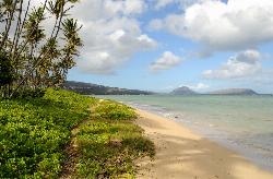
5.9 miles SE of Honolulu, HawaiiKahala Beach is a tranquil, scenic stretch of sand fronting the upscale Kahala neighborhood on the southeast shore of Oahu, just east of Diamond Head and a world away from the crowds of Waikiki. Lined with palm trees and fronted by a cute little offshore islet, it's a peaceful, postcard-pretty spot — a favorite for strolls, sunbathing, and beach weddings — though it's better suited to relaxing than to serious swimming.
A few honest notes about the water. A reef sits almost immediately offshore, so the water close in is shallow and rocky, which makes for difficult wading and only passable snorkeling. If you do get in, water shoes are essential to protect your feet from the rocks and reef, and a rash guard helps avoid scrapes on the coral. The beach's real charms are above the waterline: soft sand, swaying palms, and a quiet, local atmosphere.
Take the ocean seriously here. Despite its calm appearance, this stretch of coast is known for unpredictable rip currents and occasionally dangerous waves, and drownings have occurred in the area. There are no lifeguards on this stretch, so never swim alone, keep a very close eye on children, stay out when the surf is up, and don't venture over the reef in rough conditions.
To find it, look for the discreet public beach-access path off Kahala Avenue (near Kala Place), and park thoughtfully in the residential area. Bring water shoes, reef-safe sunscreen, and a towel, mind the ocean conditions, and pack out everything. For a quiet, scenic escape from the tourist hubbub — with the swimming caveats in mind — Kahala Beach is one of Oahu's loveliest hidden corners.
Ferguson Canyon
Cottonwood Heights, Utah
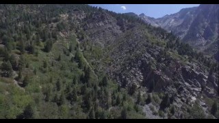
1.6 miles E of Cottonwood Heights, UtahFerguson Canyon is a hidden gem of the Wasatch Front — a small, forested canyon tucked between Big and Little Cottonwood Canyons in Cottonwood Heights, just southeast of Salt Lake City. Known for its impressive granite cliffs, shady creekside trail, and big mountain views, it's a local favorite for both hikers and rock climbers, all within minutes of the city.
The canyon itself is the destination. A trail climbs up through pine and scrub-oak forest alongside a creek, with the towering granite walls that have made Ferguson a popular climbing spot rising on either side. You can do a shorter hike of about 1.6 miles to a scenic overlook with views out over the Salt Lake Valley, or push on toward the upper meadow for a more challenging outing of around 5 miles round trip. Climbers come for the quality granite crags right along the route.
A nice bonus: because Ferguson Canyon sits just outside the Salt Lake City watershed (unlike the neighboring Cottonwood canyons), dogs are allowed here — making it a favorite for local hikers with four-legged friends.
A practical heads-up: the trail starts from a residential neighborhood, so parking is limited and fills fast, especially on weekends when both hikers and climbers pack the canyon. Go early in the morning or on a weekday for a quieter experience, and park considerately. Spring through fall is ideal; bring water and sturdy shoes for the rocky, sometimes steep trail, watch your footing near the cliffs, and pack out everything. Close to the city yet genuinely wild, Ferguson Canyon is a perfect quick Wasatch escape.
Silver Falls State Park
Sublimity, Oregon
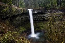
7.6 miles NE of Sublimity, OregonSilver Falls State Park is a forested canyon that features 10 amazing waterfalls throughout the park. It is the largest state park in Oregon and one of the most popular, both nationally and internationally. People come from all over to witness the beauty of these splendid waterfalls at this unique and amazing park. It's less than an hour east of the Salem state capital in the green foothills of the Cascade Mountains.
At the South Falls, you can walk in awe behind a 177-foot waterfall. It's a part of the Trail of Ten Falls which is a breathtaking and nationally recognized hiking trail. This trail winds through lush, dense forested landscape and along a canyon where you will see many gorgeous waterfalls from different vantage points. You descend the trail following a serpentine creek to the forest floor. Photographers of all skill levels love to come to Silver Falls to capture the picturesque, scenic views it has to offer.
The full loop to hike all 10 waterfalls is about 7.2 miles and is considered a moderate hike with an elevation change of 800 feet. There are connecting trails that can make the hike shorter if one so desires. The park provides over 25 miles of backcountry trails for the outdoor enthusiast to enjoy.
Besides hiking, many visitors enjoy mountain biking, horseback riding, as well as camping at Silver Falls. The campground has tent and RV sites as well as cabins. If you bring a horse, there is a horse campground for you to stay at. There are also group tent and RV sites for larger groups and ranches that can sleep 75 people in dormitory-style bunkhouses.
The South Falls Day Use Area has open lawns, picnic tables, and shelters, barbecue stands, a playground, horseshoe pits, and an off-leash area for dogs. This area is frequently used for potlucks, family reunions, and even weddings.
(No pets are allowed on the Canyon Trail for everyone's safety. Pets on a leash can be on all other trails)
A day-use parking fee (recently $5 per car, payable by card at the lots) is charged to park anywhere in the state park.
NOTE: It's important to remember that bears and cougars live in the more remote areas of the park.
Trail tips: the Trail of Ten Falls is best hiked as a loop starting from the South Falls parking area and heading clockwise. Four of the ten falls let you walk behind the curtain of water, so bring a rain layer on high-flow days. Flow peaks with spring snowmelt (March is excellent), and a couple of the falls sit just off the main loop, so download the trail map before you go to be sure you catch all ten.
Mohican State Park
Perrysville, Ohio
4.0 miles SE of Perrysville, OhioMohican State Park is the crown jewel of north-central Ohio's “Mohican Country” — a gorgeous 1,110-acre park wrapped around the scenic Clear Fork of the Mohican River and bordered by the vast Mohican-Memorial State Forest. With a famous canoeing river, dramatic gorge and waterfall hikes, and miles of trails, it's one of the most beloved outdoor destinations in the state.
The Clear Fork is the heart of it all. Known as the “Canoe Capital of Ohio,” the river draws paddlers from across the region to float its gentle current through wild, wooded country — several local liveries rent canoes, kayaks, tubes, and rafts and run shuttles, making for an easy day on the water. The river is also a popular spot to cool off and wade on a hot summer day.
On land, the hiking is superb. Trails wind through the 300-foot-deep Clear Fork Gorge (a National Natural Landmark) and lead to the park's two waterfalls — the Lyons Falls Trail follows the gorge to both Big and Little Lyons Falls, prettiest in spring. Overlooks, a historic covered bridge, and shoreline trails around nearby Pleasant Hill Lake round out the options (overnight guests can also enjoy the park's swimming pool).
Summer is prime for paddling and river play, while spring brings roaring falls and fall sets the hardwood forest ablaze with color. Bring water shoes for the river, watch levels after rain, and pack out everything you bring. Whether you come to paddle, chase waterfalls, or hike the gorge, Mohican State Park delivers a classic Ohio outdoor escape.
Peoria Skatepark
Peoria, Arizona
2.4 miles N of Peoria, ArizonaPeoria Skatepark is a spacious public skate spot in Peoria, Arizona, in the northwest Phoenix metro — a wide-open, well-designed park that's a favorite of the West Valley skate scene. With tons of room to roll and a layout geared toward street and transition skating, it's a great place to session for skateboarders, BMX riders, and scooter kids of all levels.
The park is known for its generous, open footprint — lots of smooth concrete to spread out on — with a strong street section of ledges, rails, and stairs, plus a pair of fun clover bowls for those who like to carve and pump. (Note for vert fans: there's no big vert ramp here, so if that's your thing, the skatepark over in Goodyear is the spot.) It's an excellent place to practice flatground tricks, work lines through the street features, or flow the bowls.
As a public city facility, it's free and open to the community. As always at skateparks, gear up with a helmet and pads (especially younger riders), be courteous and take turns, and — this being Arizona — bring plenty of water and try to skate in the cooler parts of the day during the brutal summer heat. Check for any posted hours before you go.
Roomy, fun, and welcoming, Peoria Skatepark is one of the better public parks in the Phoenix area and a solid stop for any traveling skater.
Sipsey River
Double Springs, Alabama
9.4 miles N of Double Springs, AlabamaThe Sipsey River is one of the South's most beautiful wild waterways — Alabama's only National Wild and Scenic River, winding through the rugged Sipsey Wilderness in the William B. Bankhead National Forest. Known as the “Land of a Thousand Waterfalls,” this enchanting stretch of north Alabama is a paradise of clear pools, sandstone bluffs, hanging gardens of fern and moss, and some of the best swimming holes in the state.
The river is made for warm-weather adventure. Numerous swimming holes dot its course, including the popular spot below Kinlock Falls, a lovely cascade with an even lovelier pool at its base. Large boulders along the river tempt jumpers — but always climb down and check the depth and what lies below the surface before you leap, since water levels shift with the season. Beyond swimming, the Sipsey is a classic float: a roughly 9.5-mile wilderness paddle runs from the Thompson Creek access down to the Sipsey River Recreation Area, where bluffs over 100 feet tall rise straight from the water. The Sipsey River Picnic Area offers a canoe launch, a riverside trail, and tables.
This is a designated wilderness, so come prepared for a true backcountry experience: there are no services along the river, cell coverage is spotty, and the whole point is to find solitude. Bring plenty of water, sturdy footwear for slick rock, and a willingness to pack out everything you bring in to keep the wilderness pristine.
Late spring through early fall (roughly May to September) brings the most comfortable temperatures and the best water for swimming and floating. Whether you come to paddle the wild river, hunt for waterfalls, or simply soak in a clear pool beneath the bluffs, the Sipsey rewards you with one of Alabama's great natural treasures.
Montezuma Mines
Kanab, Utah
15.2 miles NE of Kanab, UtahMontezuma Mines is one of southern Utah's most intriguing underground adventures — a network of hand-dug tunnels and sandstone caves carved into a hillside in Johnson Canyon, east of Kanab, born from one of the West's great treasure legends. For experienced explorers, it's a fascinating, slightly eerie place to poke around: a maze of passages, weathered wooden ladders, and deep shafts with a story to match.
That story dates to 1922, when a prospector named Freddy Crystal arrived in Kanab convinced he'd found the lost gold of the Aztec emperor Montezuma, hidden in the white sandstone cliffs of southern Utah. He sold the whole town on the idea, and for several years Kanab's residents dug and tunneled into the rock in search of the fabled treasure. No gold was ever found — but the elaborate warren of tunnels they left behind remains, a monument to one of the region's most colorful get-rich dreams.
Today the site is a hand-carved labyrinth: a main passage big enough to walk through, side tunnels that narrow into belly-crawls, and at least three deep pits or shafts. Some still have old ladders in place, and at least one pit is descended with a rope by those equipped for it. It's a real caver's playground — equal parts history lesson and underground scramble.
A serious safety note: this is an old, unmaintained mine, and it should be treated with real caution. The hand-dug passages, century-old ladders, and open pits can be genuinely dangerous. Only explore if you're experienced and properly equipped — bring a helmet, multiple light sources, and proper rope and rigging if you intend to drop any of the pits, and never trust the old ladders with your full weight. Don't go alone, tell someone your plans, and turn back if anything feels unstable.
Part of the appeal is the atmosphere. Poking through the hand-hewn tunnels, ducking under low ceilings, and peering down the dark shafts, it's easy to imagine the fever of the 1920s treasure hunt that carved them — the whole town of Kanab convinced that Montezuma's gold lay just a few more feet into the rock. The mines have since become a quietly legendary spot among Southern Utah explorers, turning up on caving forums and backroad-adventure lists, though they remain refreshingly undeveloped and unsigned.
Getting there takes some effort: from Kanab, head east on Highway 89 about 9 miles, turn onto Johnson Canyon Road for roughly 11 miles, then take the sandy dirt road off to the right — a four-wheel-drive, high-clearance vehicle is a must for the wash crossing. Come prepared for remote desert country, pack plenty of water, and you'll find a one-of-a-kind blend of Old West legend and backcountry caving that few places can match.
4.7 mi
 Full Listing
Show more
Hike, Mountain Bike
Full Listing
Show more
Hike, Mountain Bike
Bonneville Shoreline Trail
Salt Lake City, Utah
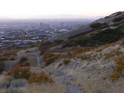
2.1 miles N of Salt Lake City, UtahBonneville Shoreline Trail is a great place for hiking, biking, and trail running. It stretches from North Salt Lake to Parley's Canyon. The trail follows the shoreline of ancient Lake Bonneville.
There are multiple trailheads to choose from. The City Creek trailhead (which is at the bottom of City Creek Canyon) can take you to North Salt Lake. Distance is about 5 miles.
You can also take the City Creek trailhead and follow the trail for about 7 miles into the foothills. It crosses paths with the Bobsled trail which is a very steep slope that will take you right into the city.
Storm Mountain
Salt Lake City, Utah
12.2 miles SE of Salt Lake City, UtahStorm Mountain is on of the smaller peaks included in the Wasatch Range. Storm Mountain is located in Cottonwood Canyon. Storm Mountain Day Use Area is just 3 miles up Big Cottonwood Canyon, conveniently close to Salt Lake City. Big Cottonwood Creek runs alongside the site.
Storm Mountain is more suited for rock climbing than peak bagging. There are also many various trails for hiking and biking.
Hiking to the peak is considered strenuous and there a majority of the hike will be rocky and covered with woody shrubs.
Visitors enjoy fishing, hiking, and biking in the Cottonwood Canyon area.
1.2 mi
 Full Listing
Show more
Canyoneer, Hike
Full Listing
Show more
Canyoneer, Hike
Battle Creek Falls
Pleasant Grove, Utah
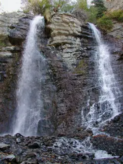
2.0 miles E of Pleasant Grove, UtahBattle Creek Falls, located near Pleasant Grove, Utah, is a scenic waterfall that also has a rappelling and rock climbing area nearby. Hikers are allowed to see the falls from two view points, below and above the falls, if hikers are willing to hike beyond the falls. The Battle Creek Falls trail head start at Kiwanis Park in Pleasant Grove where hikers take a short hike to the falls. The canyon area is beautiful and the trail is very wide allowing for many hikers to hike up to and come back from the falls at a time.
The trail is accessible year round but the best times to hike the trail are from April to October because the trail gets icy in winter months (although Battle Creek Falls is beautiful when frozen over). The trail is about 1.2 miles and is an out and back style trail. Hikers have the option to keep going up Battle Creek Canyon if they wish to get some steep climbs in for the day. The hike is very easy and is very family friendly with lots of great spots to take pictures.
Locals and visitors alike enjoy Battle Creek Falls for its majestic beauty and fun, easy hiking. If you and your family are looking for an activity to do together Battle Creek Falls could be exactly what you are looking for.
Point Dume State Beach
Malibu, California
2.3 miles SW of Malibu, CaliforniaPoint Dume State Beach features headlands, cliffs, rocky coves and vast beach access. The beach is presently operated by Los Angeles County, which also operates Zuma County Beach. These facilities are noted for swimming, surfing, scuba diving, and fishing. Point Dume is a perfect place to watch for California gray whales during the December to mid-April migration period.
Point Dume Beach is a great place to get away from the crazy summer crowds that flood California beaches. It still gets its fair share of visitors but is not overly crowded like many of the other beaches. It's one of the more quiet and tranquil beaches around. There is an easy hiking trail where you can hike up the to the highest point of the coastal hills and see a great view of the beach all around you. At the A fun fact: you can see Tony Stark's home from the Iron Man movie up there.
This location is a popular destination for filmmakers shooting movies, so it's not uncommon to see camera crew here.
There is very limited parking near beach access, so finding a parking spot may prove to be a hassle. Some places are free to park, others have a small parking fee. You should also expect to walk a bit after parking since there are only a few parking spots right next to the beach access point.
Wild Willy's Hot Spring
Mammoth Lakes, California
11.0 miles E of Mammoth Lakes, CaliforniaWild Willy's Hot Springs, also known as Crowley Hot Springs, is a spring located in Long Valley. Long Valley is home to one of the highest concentrations of geothermal surface water in California. Wild Willy's is surrounded by mountains in sagebrush plains, so you get to see a pretty view while you soak and relax in the natural hot springs.
There is a long wooden walkway that's about .2 miles long from where you park that leads you straight to the springs. The surrounding area is wide open with views of the Sierra Nevadas, making it quiet and peaceful if the springs aren't crowded, which they usually are.
There are a few pools here, the larger one attracting more people since it is deeper and has the capacity to accommodate larger groups. The smaller ones are a bit more shallow and are best for a couple people. The smaller pools are also usually hotter, making it feel more like a hot tub. The downside to these hot springs is that it attracts so many visitors because it is free and public.
The water temperature ranges from 95 - 105 degrees, depending on the day.
There are designated camping areas for those who prefer the overnight experience.
Alameda Skatepark
Alameda, California
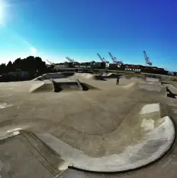
3.9 miles NW of Alameda, CaliforniaAlameda Skate Park is a popular location for skateboards, scooters and bikes. It has a unique layout perfect for all levels of skaters; featuring steel ramps, a large concrete bowl, as well as a variety of transitions. The skate park has been built on a former naval base, is well maintained, includes awesome views of boats on the ocean and is open from dawn until dusk.
Avalon Skatepark
Avalon, California
0.3 miles S of Avalon, CaliforniaSkateboard near Avalon, California
Full Listing
Show more
Skateboard
Reed Skatepark
Mesa, Arizona
2.2 miles E of Mesa, Arizona
This nineteen acre outdoor concrete skatepark is fairly big. It features an intermediate level street course, a combi pool, hips, and a large beginners area. For more information call Mesa Reed Skatepark or check out their Web site: ci.mesa.az.us.Courtesy of skatepark.com
×


