


Huckaby Trail
Sedona, Arizona
| Address: | Huckaby Trail, Sedona, AZ 86336, USA |
| GPS: |
34°51'59.9"N 111°44'55.8"W Maps | Directions |
| State: | Arizona |
| Trail Length: | 3.00 miles |
| MTB Difficulty: | Advanced |
| Trail Type: | Out & Back |
| MTB Trail Type: | Singletrack |
| Hike Difficulty: | Intermediate |
| Trails/Routes: | 3.0 mi |
Restrooms Streams Trails Rocks Fall Colors Bicycles
Canoe, Hike, and Mountain Bike
On the hunt for adventure? Established in 1998, Huckaby Trail is just the adventuresome route for both avid hikers and mountain bikers. It offers up forestry of Arizona Sycamores and picturesque views of the enticing Red Rocks of Sedona; along with some gnarly mountain biking challenges. You may catch an occasional breeze during the summer months, but this 3-mile trail is temperately more enjoyable during the Spring and Fall months. Although if you’re up for enduring some modest snowfall and the crisp air that comes with it a winter hike can prove to be a contrasting experience. You won’t believe you’re in the desert!
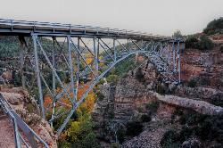
Huckaby is just a quick 5-minute drive from the city with two entrances via the north and south trailhead. At the north end, Midgley Bridge Trailhead supplies minimal parking; making this end of the trail a suitable start for early birds. The trail begins with a steep elevation drop down Oak Creek Canyon to its running waters. Feeling a swim? Bring your suit and take a dip in the creek pools. There is one large boulder passage across Oak Creek to cross before resuming on the trail. However, exercise caution, as a rise in water level can be hazardous. If waters are dangerously high, just continue down the creek and traverse through a narrower part. Be prepared for some boulder hopping either way!
For you mountain bikers, after crossing you’ll enjoy a nice half-mile cruise before pumping yourself up for an intense hike-a-bike climb. Bear in mind there are at least two of these carries throughout the trail. After conquering this feat you’re rewarded with astonishing views of Wilson Mountain and Steamboat Rock at Mitten Ridge. For you hikers, be sure to don hiking boots with a reliable grip. If you want to successfully take on this diverse terrain, then running shoes just won’t cut it!
A bench memorial sits atop the climb overlooking the surrounding landmarks - a good stopping point in your journey (if you so choose). Once you reach this point shade is less abundant the rest of the trail so be sure to have your sun protection handy. Continuing on south for about another half-mile, you will moderately descend toward Bear Wallow Wash. On the way down look out for Snoopy Rock - named after the delightful Peanuts character! A sideways glance will reveal the shape of the beagle lying on its back. Just as quickly as you began your descent another trek up-hill through switchbacks begins nearing the end of the trail. Once you reach the top the trail will level out for about 1/8 of a mile until finally reaching the finish at Schnebly Hill Trailhead. This side of the trail is known for its more ample parking space than the northern trailhead. Keep that in mind if you plan on arriving in the later part of the morning/afternoon.
Generally, this dog and kid friendly hike is a fun experience for all!
More Information
Huckaby Mountain Bike Trail in Sedona, Arizona - Directions, Maps, Photos, and Reviews
Huckaby is a singletrack mountain bike trail in Sedona, Arizona. View maps, videos, photos, and reviews of Huckaby bike trail in Sedona.
http://www.singletracks.com/bike-trails/huckaby/HUCKABY TRAIL | 101 Hiking Trails | The Hike House
The hike to Jacks Canyon Trail will lead you to spectacular views! The breathtaking scenery of this trail will leave you in awe.
https://thehikehouse.com/trails/huckaby-trail/Midgley Bridge and Huckaby Trail, Hiking Sedona AZ
Description and review of Huckaby Trail and Midgley Bridge Vista in Sedona, Arizona.
https://www.sedonahikingtrails.com/huckaby-trail.htmtripadvisor.com
Please enable JS and disable any ad blocker
https://www.tripadvisor.com/Attraction_Review-g31352-d254062-Reviews-Huckaby_Trail-Sedona_Arizona.htmlNever modify trail features. Ride trails when they're dry enough that you won't leave ruts. Speak up when you see others on the trail and always yield to hikers, horses, and others coming uphill. Always ride on the established trail.
Read MoreBe courteous, informed, and prepared. Read trailhead guidelines, stay on the trail, and don't feed the wildlife.
Read More- Plan Ahead and Prepare
- Travel & camp on durable surfaces
- Dispose of waste properly
- Leave what you find
- Minimize campfire impacts
- Respect wildlife
- Be considerate of other visitors
Directions
From Sedona, Arizona
- Head south on N State Rte 89A toward Forest Rd (0.3 mi)
- At the traffic circle, take the 3rd exit onto AZ-179 S (0.4 mi)
- At the traffic circle, take the 2nd exit onto Schnebly Hill Rd (0.9 mi)
- Turn left (79 ft)
- Turn right (207 ft)
- Turn rightDestination will be on the left(72 ft)


Other Mountain Bike Trails, Hiking Trails, and Canoeing Areas Nearby
Hangover
Sedona, Arizona
0.0 miles SEHangover Trail in Sedona is one of the most technical mountain bike trails in the area — serious exposure, steep rock rolls, and tight singletrack for experienced riders only.
Mountain Bike
Courthouse Butte Loop
Sedona, Arizona
0.7 miles WA 4-mile clockwise loop circling Courthouse Butte and Bell Rock in Sedona — wide cairn-marked trails, a Wilderness section, and spectacular red rock scenery.
Mountain Bike
Midgley Bridge Trail
Sedona, Arizona
1.4 miles NHike near Sedona, Arizona
Hike
Wilson Mountain Trail
Sedona, Arizona
1.4 miles NHike near Sedona, Arizona
Hike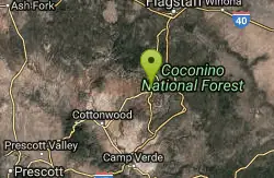
Jim Thompson
Sedona, Arizona
1.6 miles NWBest ridden west to east, Jim Thompson Trail in Sedona delivers great scenery, loose-rock wide sections, tight singletrack, and a screaming descent into Wilson Canyon.
Mountain Bike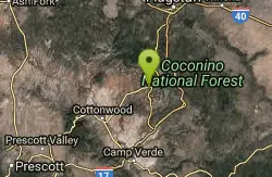
Soldier Wash Trails
Sedona, Arizona
1.6 miles WEleven miles of flowing, renegade-origin singletrack in Sedona that locals once kept secret — now part of the USFS Soldier Wash Trails system with great signage on the ground.
Mountain Bike 3.4 mi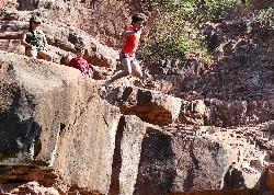
Grasshopper Point
Sedona, Arizona
1.7 miles NECrimson red rock walls frame a teal swimming hole in Oak Creek Canyon — with multiple cliff jumping spots, picnic tables, restrooms, and access via Allen's Bend and the Huckaby Trail.
Dive, Hike, Swim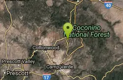
Broken Arrow Trail / Chicken Point
Sedona, Arizona
1.9 miles SWTechnical climbs, drop-offs, stairs, narrow cliff singletrack, and awesome slickrock views at the top — Broken Arrow is not for beginners.
Mountain Bike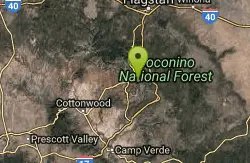
Cow Pies
Sedona, Arizona
2.1 miles ESweet slickrock with awesome views, Cow Pies functions as a climb from Munds Wagon Trail up to the Hangover trail — a short but scenic connector.
Mountain Bike
Chavez Crossing
Sedona, Arizona
2.3 miles SWA campground on Oak Creek in Sedona's red-rock canyon, perfectly placed for cool water play, sunsets over Munds Mountain, and access to nearby swimming holes.
Camp, Hike, Swim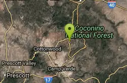
Broken Arrow Trail System
Sedona, Arizona
2.3 miles SWA system of classic Sedona rides — Broken Arrow, Hog Heaven, Hog Wash, Pig Tail and more — ranging from relatively easy to technical double-black-diamond exposure.
Mountain Bike 4.2 mi
Munds Wagon Trail
Sedona, Arizona
2.4 miles EA gnarly, loose-rock mountain bike climb near Sedona with 1,700 feet of elevation gain over six miles, delivering increasingly jaw-dropping views the higher you ride.
Hike, Mountain Bike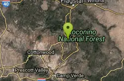
Schnebly Hill Trail
Sedona, Arizona
2.4 miles NEAn upper-mountain mountain bike trail in Sedona that dead-ends at the wilderness boundary and flows naturally into the Munds Wagon trail heading down.
Mountain Bike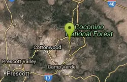
Pig Tail
Sedona, Arizona
2.6 miles SWA short, one-way downhill blast packed with jumps, drops, berms, and rocks — Pig Tail in Sedona is pure descent fun from start to finish.
Mountain Bike
North Urban Trail System - East
Sedona, Arizona
2.7 miles WAn interconnected North Sedona trail system with scenic red rock loops, Jordan Trail bikeable as an easy 2-mile loop with 200 feet of elevation gain.
Mountain Bike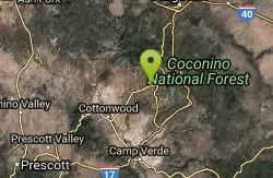
Ridge Trail
Sedona, Arizona
3.0 miles WA lower-profile Sedona ride through Red Rock country connecting Ridge Trail to Secret Slick Rock, Oak Creek, and Cathedral Rock — includes a $2 park crossing fee or a ford of the creek.
Mountain Bike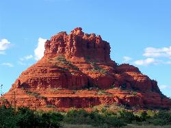
Schnebly Hill Vista Overlook
Sedona, Arizona
3.0 miles NEA sweeping red rock formation divided into four geological members — from reptile-fossil-bearing sandstone to limestone and dolomite — telling 500-foot stories of Sedona's ancient past.
Hike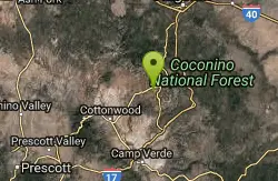
Airport Mesa Trail Network
Sedona, Arizona
3.1 miles WA network of trails south of Hwy 89A and north of Oak Creek in Sedona, with several possible routes through the Airport Mesa area for mountain bikers to explore.
Mountain Bike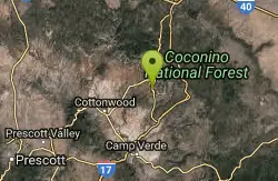
Templeton
Sedona, Arizona
3.3 miles SWA twisting Sedona singletrack through two tunnels under Highway 179 and along Cathedral Rock's slickrock contours, with river stretches and technical switchbacks to cap it off.
Mountain Bike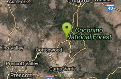
Chimney Rock Trail
Sedona, Arizona
3.6 miles WA 3.16-mile figure-eight hike near Sedona linking Upper and Lower Chimney Rock Trails, with two optional summit spurs to scenic overlooks — bikes must skip the upper wilderness loop.
Mountain BikeNearby Campsites
Chavez Crossing
Sedona, Arizona
2.3 miles SWA campground on Oak Creek in Sedona's red-rock canyon, perfectly placed for cool water play, sunsets over Munds Mountain, and access to nearby swimming holes.
Camp, Hike, Swim 0.1-0.7 mi
Cave Springs
Sedona, Arizona
9.0 miles NAn 84-site campground on Oak Creek in Sedona's canyon, with picnic tables and natural tree shade, close to Slide Rock, swimming holes, and the Coconino National Forest.
Camp, Hike, Swim
Beaver Creek Dispersed Camping
13.4 miles S
Free dispersed camping on the cliffs above Beaver Creek.
Camp
Beaver Creek Campground
Camp Verde, Arizona
13.7 miles SBeaver Creek is a refreshing creekside oasis in the high desert of central Arizona, where the cool, clear waters of Wet Beaver Creek wind beneath big cottonwoods and sycamores in the Coconino...
Camp, Canoe, Kayak, Swim 0.4 mi
Clear Creek Campground
Camp Verde, Arizona
24.3 miles SA grassy creekside campground shaded by tall cottonwoods on West Clear Creek — ideal for hiking, swimming, fishing for smallmouth bass and sunfish, and wildlife watching in a desert canyon oasis.
Camp, Hike, Swim
Verde Hot Springs
Camp Verde, Arizona
36.0 miles SNatural hot spring pools beside the Verde River — the remnants of an old resort — reached by wading upstream from a dispersed camping area with no amenities near Sedona.
Camp, Hike, Hot Springs 0.1-7.8 mi
Wolf Creek Falls
Prescott, Arizona
49.8 miles SWSix miles of trails, two campgrounds, and a 90-foot waterfall that roars in spring storms and glitters as a frozen cascade in winter — Wolf Creek Falls is dramatic in every season.
Camp, Hike, Swim


