


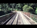
Edwards Crossing
Nevada City, California

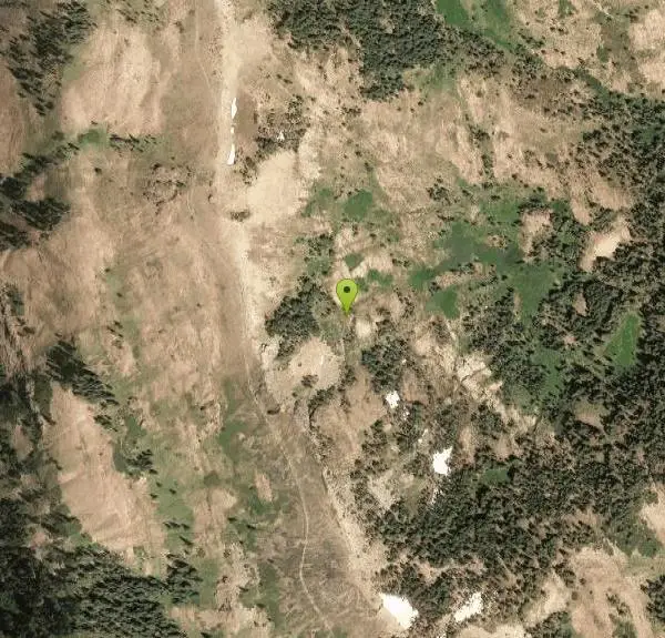
| Address: | 17285 N Bloomfield-Graniteville Rd, Nevada City, CA 95959, USA |
| GPS: |
39°19'48.7"N 120°59'2.9"W Maps | Directions |
| State: | California |
| Trails/Routes: | 0.1 mi |
Hike and Swim
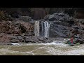
Edwards Crossing is a popular and easily accessible swimming hole on the Yuba River. The swimming hole is named for Edwards Crossing Bridge which can be viewed from there. The river here is up to 20 feet deep in parts and has rock cliffs and forests on either side. The beautiful rock formations and blue water create stunning views for visitors to Edwards crossing.
The depth of the river water and the low rock formations make for great low points for jumping in. Jumpers should be careful to watch water depth and they jump at their own risk.
Edwards crossing also has a sandy beach for visitors to play at and makes for easy access to the water. The beach and swimming hole are a short easy half mile hike from the gravel parking lot near the bridge.
Edwards Crossing is popular with locals due to its accessibility. Summers and weekends can be crowded.
More Information
Be courteous, informed, and prepared. Read trailhead guidelines, stay on the trail, and don't feed the wildlife.
Read More- Plan Ahead and Prepare
- Travel & camp on durable surfaces
- Dispose of waste properly
- Leave what you find
- Minimize campfire impacts
- Respect wildlife
- Be considerate of other visitors
Directions
From Nevada City, California
- Head north on Sacramento St toward Broad St (157 ft)
- Turn left onto Broad St (0.8 mi)
- Turn left onto CA-49 N (9.8 mi)
- Turn right onto Tyler Foote Rd/
Tyler Foote Crossing Rd (8.1 mi) - Turn right onto Grizzly Hill Rd (0.2 mi)
- Turn left to stay on Grizzly Hill Rd (0.6 mi)
- Turn right to stay on Grizzly Hill Rd (2.3 mi)
- Turn right onto N Bloomfield Rd/
N Bloomfield-Graniteville Rd Destination will be on the left(1.4 mi)

Trails
Distance ?
488 feetElevation Gain ?
-92 feetReal Ascent ?
1 feetReal Descent ?
93 feetAvg Grade (-11°)
-19%Grade (-23° to 1°)
-43% to 1%Elevation differences are scaled for emphasis. While the numbers are accurate, the cut-away shown here is not to scale.
Other Swimming Holes and Hiking Trails Nearby

North Fork Falls
Colfax, California
16.9 miles EA very popular hike in the summer time, North Fork Falls offers a pleasant break from the city while enjoying the beautiful Sierra Nevada mountains. Hike into the forest and visitors will find a...
Camp, Hike, Swim 5.6 mi
Quarry Trail
Cool, California
28.7 miles SThis is a hike along the river and an old, historic railway. The trail leads you to a a beautiful amphitheater carved from limestone.You are surrounded by beautiful nature and peaceful...
Hike 1.2-2.7 mi
Lake Clementine Trail Loop
Auburn, California
28.7 miles SLocated in Auburn, California, Lake Clementine Trail Loop is a hike along the North Fork American River is an easy to moderate trail with an elevation gain of 785 ft. It's wheelchair...
Camp, Canoe, Hike, Kayak, Mountain Bike, Swim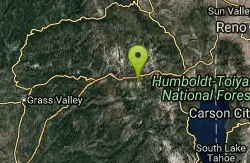
Heath Falls Overlook Trail
Truckee, California
29.4 miles EHike and Swim near Truckee, California
Hike, Swim
Palisades Creek Trail
Truckee, California
29.4 miles EThe Palisades Creek Trail is a difficult hike that can be done in a day, but is better enjoyed as an overnight trip. This trail has showcases some beautiful waterfalls along the way as well as...
Hike, Swim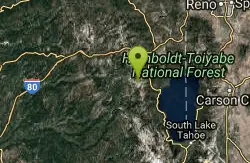
Tahoe Area
Olympic Valley, California
39.2 miles ESwim near Olympic Valley, California
Swim
Shirley Canyon
Olympic Valley, California
40.2 miles EHike near Olympic Valley, California
Hike 4.1 mi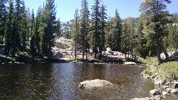
Shirley Lake Canyon Trail
Olympic Valley, California
40.8 miles EShirley Lake is a pretty and pure lake located in Squaw Valley. The Shirley Lake Canyon Trail goes up into the rugged and lovely Sierra Mountains. You begin the trail in Squaw Valley Village and...
Hike, Swim
Sutter National Wildlife Refuge
Meridian, California
44.8 miles WSutter National Wildlife Refuge, the southern-most refuge in the Sacramento Refuge Complex, is located in the Sacramento Valley of California, about 50 miles north of the metropolitan area of...
HikeNearby Campsites
North Fork Falls
Colfax, California
16.9 miles EA very popular hike in the summer time, North Fork Falls offers a pleasant break from the city while enjoying the beautiful Sierra Nevada mountains. Hike into the forest and visitors will find a...
Camp, Hike, Swim 1.2-2.7 mi
Lake Clementine Trail Loop
Auburn, California
28.7 miles SLocated in Auburn, California, Lake Clementine Trail Loop is a hike along the North Fork American River is an easy to moderate trail with an elevation gain of 785 ft. It's wheelchair...
Camp, Canoe, Hike, Kayak, Mountain Bike, Swim


