


Tahoe Area
Olympic Valley, California
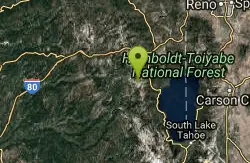
| GPS: |
39°12'7.8"N 120°16'13.9"W Maps | Directions |
| State: | California |
Swim
More Information
swimmingholes.org: CALIFORNIA SWIMMING HOLES
THE web site for beautiful, natural places for a cool dip or hot soak.
http://www.swimmingholes.org/ca.html
- Plan Ahead and Prepare
- Travel & camp on durable surfaces
- Dispose of waste properly
- Leave what you find
- Minimize campfire impacts
- Respect wildlife
- Be considerate of other visitors
Directions
From Olympic Valley, California
- Head north on Olympic Vly Rd (2.3 mi)
- Turn right onto CA-89 S (1.4 mi)
- Turn right onto Alpine Meadows Rd (1.6 mi)
- Turn right onto Juniper Mountain Rd (1.9 mi)
- Turn left (4.6 mi)
- Turn right (0.2 mi)
- Turn right (0.3 mi)

Other Swimming Holes Nearby
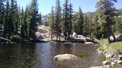
Shirley Lake Canyon Trail
Olympic Valley, California
1.6 miles EA 2.5-mile hike from Squaw Valley Village past streams and waterfalls to a pure Sierra lake — rocky near the top, with a free gondola ride back down from High Camp as a reward.
Hike, Swim
Palisades Creek Trail
Truckee, California
11.2 miles NWA difficult Sierra Nevada trail past Palisade Falls — one of the tallest on the American River — with views of Devils Peak, alpine lakes, and 2,000 feet of elevation gain.
Hike, Swim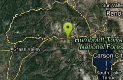
Heath Falls Overlook Trail
Truckee, California
11.2 miles NWHike and Swim near Truckee, California
Hike, Swim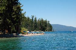
Sugar Pine Point Beach
Tahoma
13.2 miles SEA quarter-mile walk from the parking lot puts you on a sand beach at the foot of Ed Z'berg Sugar Pine Point State Park, where General Creek meets Lake Tahoe and the water runs clear enough to read the bottom. It is also genuinely cold, even in August.
Camp, Hike, Kayak, Swim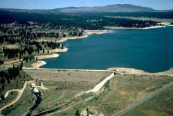
Boca Reservoir Hidden Beach
Truckee, California
18.0 miles NESandy informal beaches on the northeast shore of Boca Reservoir above Truckee, free to use, windy in the afternoons, and drawn down hard by the end of summer.
Camp, Canoe, Kayak, Kiteboard, Swim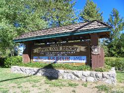
Zephyr Cove Park
Glenbrook, Nevada
22.0 miles SESix tennis courts, disc golf, a sledding hill, a beach, and a fishing pond all at one free park make Zephyr Cove one of Lake Tahoe's most versatile family hangouts.
Camp, Canoe, Disc Golf, Hike, Horseback, Kayak, Swim
North Fork Falls
Colfax, California
22.3 miles WClear water, cliff-jumping pools, and waterfalls at Sierra Nevada's North Fork Falls — a summer hike to two deep pools with 10-to-25-foot cliffs ready for leaping.
Camp, Hike, Swim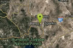
Reno Area
McGill, Nevada
32.8 miles NESwim near McGill, Nevada
Swim
Wingfield Park
Reno, Nevada
32.9 miles NEAn oasis in downtown Reno where manmade dams and natural rock formations turn the Truckee River into a playground for swimming, kayaking, tubing, and rafting.
Kayak, Swim 0.1 mi
Edwards Crossing
Nevada City, California
39.2 miles WDeep blue water, rock cliffs, and a sandy beach on the Yuba River — with a half-mile walk from the parking lot and cliff jumping spots up to 20 feet deep.
Hike, Swim 1.2-2.7 mi
Lake Clementine Trail Loop
Auburn, California
45.6 miles SWFour connected trails loop around Lake Clementine on the North Fork American River — wheelchair accessible, pet friendly, and great for fishing, camping, and family summer outings.
Camp, Canoe, Hike, Kayak, Mountain Bike, Swim
American River Confluence
Auburn, California
45.7 miles SWThe Confluence — where the North and Middle Forks of the American River meet below Foresthill Bridge — is Auburn's favorite swimming and rafting hub.
Hike, Horseback, Kayak, Rock Climb, Swim, WhitewaterNearby Campsites
Sugar Pine Point Beach
Tahoma
13.2 miles SEA quarter-mile walk from the parking lot puts you on a sand beach at the foot of Ed Z'berg Sugar Pine Point State Park, where General Creek meets Lake Tahoe and the water runs clear enough to read the bottom. It is also genuinely cold, even in August.
Camp, Hike, Kayak, Swim
Boca Reservoir Hidden Beach
Truckee, California
18.0 miles NESandy informal beaches on the northeast shore of Boca Reservoir above Truckee, free to use, windy in the afternoons, and drawn down hard by the end of summer.
Camp, Canoe, Kayak, Kiteboard, Swim
Zephyr Cove Park
Glenbrook, Nevada
22.0 miles SESix tennis courts, disc golf, a sledding hill, a beach, and a fishing pond all at one free park make Zephyr Cove one of Lake Tahoe's most versatile family hangouts.
Camp, Canoe, Disc Golf, Hike, Horseback, Kayak, Swim
North Fork Falls
Colfax, California
22.3 miles WClear water, cliff-jumping pools, and waterfalls at Sierra Nevada's North Fork Falls — a summer hike to two deep pools with 10-to-25-foot cliffs ready for leaping.
Camp, Hike, Swim 1.2-2.7 mi
Lake Clementine Trail Loop
Auburn, California
45.6 miles SWFour connected trails loop around Lake Clementine on the North Fork American River — wheelchair accessible, pet friendly, and great for fishing, camping, and family summer outings.
Camp, Canoe, Hike, Kayak, Mountain Bike, Swim


