


Skunk Harbor
Carson City, Nevada
| Address: | NV-28, Carson City, NV 89703, USA |
| GPS: |
39°7'42.8"N 119°55'52.1"W Maps | Directions |
| State: | Nevada |
| Trails/Routes: | 1.5 mi |
Lakes Trails Rocks Pet Friendly Restrooms Rivers Waterfalls Streams Glaciers Paintball Permitted Skateboarding
Hike
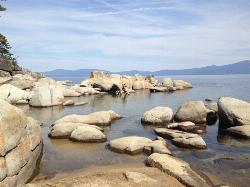
Skunk Harbor is a secluded, beautiful little cove on the quiet eastern shore of Lake Tahoe, tucked into the forest between Carson City and Incline Village, Nevada. Reached only on foot, this hidden gem rewards hikers with a small sandy beach, crystal-clear turquoise water, and a piece of Tahoe history — all far from the crowds of the lake's busier shores.
The hike begins from a gated forest-service road off State Route 28 (the Tahoe East Shore highway) and descends a couple of scenic miles through the trees to the water, with a few nice viewpoints along the way; some connecting mountain-bike trails can shorten the distance but make for a steeper climb. At the bottom sits the quiet harbor and its sandy beach, alongside a historic 1920s stone house — a lakeside summer retreat — that gives the cove its distinctive character and a marker explaining its past. Dogs are welcome on the trail.
Because the trail drops down to the lake, remember that the return trip is all uphill — budget energy and water for the climb out. The water is famously clear but cold, so swimming is refreshing but brisk. There are no services at the beach, so bring everything you need, and pack out all trash to keep this pristine spot beautiful.
Summer and early fall are the best seasons, when the beach is inviting and the road access is open. Arrive early on warm weekends, as parking along SR-28 is limited. For a quieter, more scenic taste of Lake Tahoe, Skunk Harbor is well worth the walk.
More Information
Lake Tahoe Beaches - Skunk Harbor
Secluded hike-to or boat-to beach on lake Tahoe
https://www.aboutlaketahoe.com/beaches/skunk_harbor.htmSkunk Harbor & Prey Meadows - Hidden East Shore Hike
Explore Skunk Harbor & Prey Meadows Lake Tahoe—easy forest walk, wildflowers in spring, secluded beach and stunning lake views.
https://laketahoetravel.com/listing/prey-meadowskunk-harbor/Skunk Harbor • Lake Tahoe Guide
Lake Tahoe's Skunk Harbor is a favorite destination for sunbathers and swimmers. It's a smaller yet beautiful beach area popular with boaters too.
https://www.tahoeactivities.com/skunk-harbor/Be courteous, informed, and prepared. Read trailhead guidelines, stay on the trail, and don't feed the wildlife.
Read More
- Plan Ahead and Prepare
- Travel & camp on durable surfaces
- Dispose of waste properly
- Leave what you find
- Minimize campfire impacts
- Respect wildlife
- Be considerate of other visitors
Directions
From Carson City, Nevada
- Head south on S Carson St toward W 2nd StPass by AutoZone (on the right in 1.9 mi)(3.0 mi)
- Turn right onto US-50 W (9.7 mi)
- Turn right onto NV-28 S (2.4 mi)
Park on highway turn off area, the trail starts right off the highway.


Other Hiking Trails Nearby
Sand Harbor State Park
Incline Village
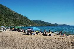
4.7 miles NA Nevada State Parks day-use beach on Lake Tahoe's northeast shore near Incline Village, with a 2,500-foot sandy swim beach, very clear cold water and a $10 entry fee ($15 for non-Nevada vehicles).
Hike, Kayak, Swim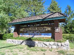
Zephyr Cove Park
Glenbrook, Nevada
8.2 miles SSix tennis courts, disc golf, a sledding hill, a beach, and a fishing pond all at one free park make Zephyr Cove one of Lake Tahoe's most versatile family hangouts.
Camp, Canoe, Disc Golf, Hike, Horseback, Kayak, Swim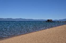
Nevada Beach Campground
Zephyr Cove
10.4 miles SA mile of wide, coarse granite sand on the Nevada shore of Lake Tahoe, with a long shallow shelf that makes it one of the easiest big beaches on the lake to swim from. The Forest Service concessionaire charges a per vehicle day use fee at the Elks Point R
Camp, Hike, Kayak, Swim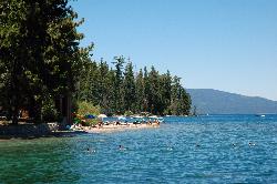
Sugar Pine Point Beach
Tahoma
11.0 miles SWA quarter-mile walk from the parking lot puts you on a sand beach at the foot of Ed Z'berg Sugar Pine Point State Park, where General Creek meets Lake Tahoe and the water runs clear enough to read the bottom. It is also genuinely cold, even in August.
Camp, Hike, Kayak, Swim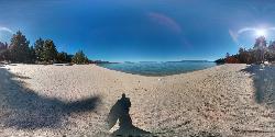
Lester Beach
South Lake Tahoe
12.7 miles SWLester Beach is the sandy main swim beach at D. L. Bliss State Park on Lake Tahoe's west shore, with clear, cold, shallow water and a $10 per vehicle day-use fee in season.
Camp, Canoe, Hike, Kayak, Swim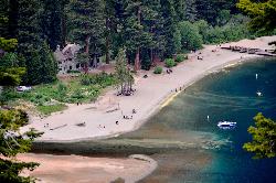
Vikingsholm Beach
South Lake Tahoe
15.4 miles SWSandy beach at the head of Emerald Bay in Emerald Bay State Park, below the 1929 Vikingsholm mansion, reached by a steep one-mile trail. Free to walk in; parking is $10 a day.
Hike, Kayak, Swim 4.1 mi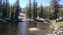
Shirley Lake Canyon Trail
Olympic Valley, California
17.3 miles WA 2.5-mile hike from Squaw Valley Village past streams and waterfalls to a pure Sierra lake — rocky near the top, with a free gondola ride back down from High Camp as a reward.
Hike, Swim
Shirley Canyon
Olympic Valley, California
17.9 miles WShirley Canyon is widely regarded as one of Lake Tahoe's finest half-day hikes, a spectacular climb up a granite canyon that rises straight out of the base of the Palisades Tahoe ski resort in...
Hike 0.4 mi
Glen Alpine Falls
South Lake Tahoe, California
18.8 miles SWA roadside waterfall near Lake Tahoe — wider than it is tall — with roadside parking, a scenic overlook, and the option to scramble down the rocks for a closer look.
Hike
China Cove Beach
Truckee
21.7 miles NWChina Cove Beach is the sandy, shallow corner at the west end of Donner Memorial State Park, on the south shore of Donner Lake outside Truckee. California State Parks runs it, access is open to anyone paying the 10 dollar day use parking fee, and there is
Camp, Canoe, Hike, Kayak, Swim
Hell Hole Reservoir
Georgetown
26.3 miles WA 4,630 foot Rubicon River reservoir in the Eldorado National Forest, 51 miles and two hours east of Georgetown, where the boat ramp cove is the only drivable shoreline and the lake drops over 100 feet by September.
Camp, Canoe, Hike, Kayak, Swim
Palisades Creek Trail
Truckee, California
29.5 miles NWA difficult Sierra Nevada trail past Palisade Falls — one of the tallest on the American River — with views of Devils Peak, alpine lakes, and 2,000 feet of elevation gain.
Hike, Swim
Heath Falls Overlook Trail
Truckee, California
29.5 miles NWHike and Swim near Truckee, California
Hike, Swim
North Fork Falls
Colfax, California
41.1 miles WClear water, cliff-jumping pools, and waterfalls at Sierra Nevada's North Fork Falls — a summer hike to two deep pools with 10-to-25-foot cliffs ready for leaping.
Camp, Hike, SwimNearby Campsites
Zephyr Cove Park
Glenbrook, Nevada
8.2 miles SSix tennis courts, disc golf, a sledding hill, a beach, and a fishing pond all at one free park make Zephyr Cove one of Lake Tahoe's most versatile family hangouts.
Camp, Canoe, Disc Golf, Hike, Horseback, Kayak, Swim
Nevada Beach Campground
Zephyr Cove
10.4 miles SA mile of wide, coarse granite sand on the Nevada shore of Lake Tahoe, with a long shallow shelf that makes it one of the easiest big beaches on the lake to swim from. The Forest Service concessionaire charges a per vehicle day use fee at the Elks Point R
Camp, Hike, Kayak, Swim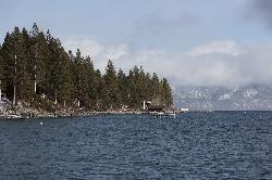
Lake Forest Beach
Tahoe City
10.5 miles WA free public beach at the end of Bristlecone Street, owned by Placer County and run by the Tahoe City Public Utility District. Sandy, pine shaded and genuinely quiet, with the one real constraint being how few cars fit at the end of the road.
Camp, Canoe, Kayak, Swim
Sugar Pine Point Beach
Tahoma
11.0 miles SWA quarter-mile walk from the parking lot puts you on a sand beach at the foot of Ed Z'berg Sugar Pine Point State Park, where General Creek meets Lake Tahoe and the water runs clear enough to read the bottom. It is also genuinely cold, even in August.
Camp, Hike, Kayak, Swim
Lester Beach
South Lake Tahoe
12.7 miles SWLester Beach is the sandy main swim beach at D. L. Bliss State Park on Lake Tahoe's west shore, with clear, cold, shallow water and a $10 per vehicle day-use fee in season.
Camp, Canoe, Hike, Kayak, Swim
China Cove Beach
Truckee
21.7 miles NWChina Cove Beach is the sandy, shallow corner at the west end of Donner Memorial State Park, on the south shore of Donner Lake outside Truckee. California State Parks runs it, access is open to anyone paying the 10 dollar day use parking fee, and there is
Camp, Canoe, Hike, Kayak, Swim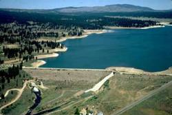
Boca Reservoir Hidden Beach
Truckee, California
21.8 miles NSandy informal beaches on the northeast shore of Boca Reservoir above Truckee, free to use, windy in the afternoons, and drawn down hard by the end of summer.
Camp, Canoe, Kayak, Kiteboard, Swim
Hell Hole Reservoir
Georgetown
26.3 miles WA 4,630 foot Rubicon River reservoir in the Eldorado National Forest, 51 miles and two hours east of Georgetown, where the boat ramp cove is the only drivable shoreline and the lake drops over 100 feet by September.
Camp, Canoe, Hike, Kayak, Swim
North Fork Falls
Colfax, California
41.1 miles WClear water, cliff-jumping pools, and waterfalls at Sierra Nevada's North Fork Falls — a summer hike to two deep pools with 10-to-25-foot cliffs ready for leaping.
Camp, Hike, Swim


