


Wingfield Park
Reno, Nevada

| Address: | Wingfield Park, 2 S Arlington Ave, Reno, NV 89501, USA |
| GPS: |
39°31'27.5"N 119°48'58.6"W Maps | Directions |
| State: | Nevada |
Restrooms Picnic Tables
Kayak and Swim
Wingfield Park is a oasis of outdoor activity in the middle of bustling Reno. The park provides a variety of activities including swimming, white water kayaking,and river rafting, river tubing, walking and biking. Wingfield park is located on the Truckee River, with manmade dams creating pools for various activities. The natural rock formations also provide rapids and places for sunbathing and relaxing. The water here has small waterfalls and rapids that create stunning views and exciting adventures. Crowds of people can be found here on hot days using the easily accessible water to cool off.
Wingfield park also has acres of onshore activities. There are paths for walking and biking as well as areas, such as the amphitheater, that host public and private events. Restrooms and picnic tables are also available for visitors.
Wingfield Park is a wonderful place to visit to easily enjoy a relaxing and exciting park, a unique experience inside Reno.
More Information
City of Reno, NV
function RZBarAddButton() { return false; } City of Reno, NV Live work play
https://www.reno.gov/Home/Components/FacilityDirectory/FacilityDirectory/112/2864?npage=5Wingfield Park, Reno, Nevada, NV
Information about Wingfield Park and the Truckee River Whitewater Park in downtown Reno, Nevada, NV
https://www.newtoreno.com/wingfield-park-reno-nevada.htm
- Plan Ahead and Prepare
- Travel & camp on durable surfaces
- Dispose of waste properly
- Leave what you find
- Minimize campfire impacts
- Respect wildlife
- Be considerate of other visitors
Directions
From Reno, Nevada
- Head south on Old U.S. 395 S/
N Virginia St toward W 4th St (10 ft) - Turn right at the 1st cross street onto W 4th St (0.2 mi)
- Turn left at the 3rd cross street onto N Arlington AveDestination will be on the left(0.4 mi)


Other Swimming Holes and Kayaking Areas Nearby
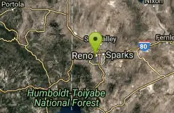
Reno Area
McGill, Nevada
0.1 miles WSwim near McGill, Nevada
Swim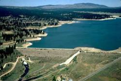
Boca Reservoir Hidden Beach
Truckee, California
16.1 miles SWSandy informal beaches on the northeast shore of Boca Reservoir above Truckee, free to use, windy in the afternoons, and drawn down hard by the end of summer.
Camp, Canoe, Kayak, Kiteboard, Swim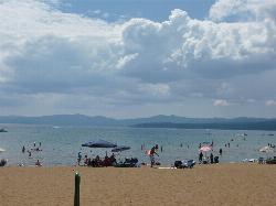
Kings Beach State Recreation Area
Kings Beach
22.8 miles SWA wide sand beach with a shallow, gently sloping entry on Lake Tahoe's north shore, run by California State Parks in downtown Kings Beach. Parking costs $3 an hour or $10 a day, charged year round.
Kayak, Swim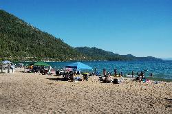
Sand Harbor State Park
Incline Village
23.5 miles SA Nevada State Parks day-use beach on Lake Tahoe's northeast shore near Incline Village, with a 2,500-foot sandy swim beach, very clear cold water and a $10 entry fee ($15 for non-Nevada vehicles).
Hike, Kayak, Swim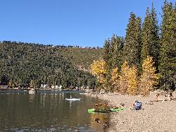
China Cove Beach
Truckee
27.2 miles SWChina Cove Beach is the sandy, shallow corner at the west end of Donner Memorial State Park, on the south shore of Donner Lake outside Truckee. California State Parks runs it, access is open to anyone paying the 10 dollar day use parking fee, and there is
Camp, Canoe, Hike, Kayak, Swim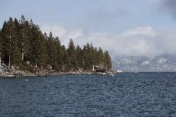
Lake Forest Beach
Tahoe City
28.6 miles SWA free public beach at the end of Bristlecone Street, owned by Placer County and run by the Tahoe City Public Utility District. Sandy, pine shaded and genuinely quiet, with the one real constraint being how few cars fit at the end of the road.
Camp, Canoe, Kayak, Swim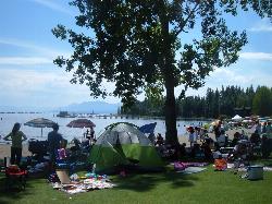
Commons Beach
Tahoe City
30.0 miles SWFree public beach and lakefront park in downtown Tahoe City on Lake Tahoe, run by the Tahoe City PUD, with cold clear water, a sand and cobble shore, kayak rentals and free summer concerts.
Kayak, Swim 4.1 mi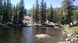
Shirley Lake Canyon Trail
Olympic Valley, California
32.0 miles SWA 2.5-mile hike from Squaw Valley Village past streams and waterfalls to a pure Sierra lake — rocky near the top, with a free gondola ride back down from High Camp as a reward.
Hike, Swim
William Kent Beach
Tahoe City
32.1 miles SWA free Forest Service swim beach on Lake Tahoe's West Shore, two miles south of Tahoe City on Highway 89, with a pebbly shore, cold clear water and picnic tables across from William Kent Campground.
Kayak, Swim
Tahoe Area
Olympic Valley, California
33.0 miles SWSwim near Olympic Valley, California
Swim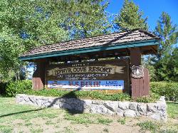
Zephyr Cove Park
Glenbrook, Nevada
36.1 miles SSix tennis courts, disc golf, a sledding hill, a beach, and a fishing pond all at one free park make Zephyr Cove one of Lake Tahoe's most versatile family hangouts.
Camp, Canoe, Disc Golf, Hike, Horseback, Kayak, Swim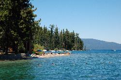
Sugar Pine Point Beach
Tahoma
36.2 miles SWA quarter-mile walk from the parking lot puts you on a sand beach at the foot of Ed Z'berg Sugar Pine Point State Park, where General Creek meets Lake Tahoe and the water runs clear enough to read the bottom. It is also genuinely cold, even in August.
Camp, Hike, Kayak, Swim
Heath Falls Overlook Trail
Truckee, California
36.5 miles SWHike and Swim near Truckee, California
Hike, Swim
Palisades Creek Trail
Truckee, California
36.5 miles SWA difficult Sierra Nevada trail past Palisade Falls — one of the tallest on the American River — with views of Devils Peak, alpine lakes, and 2,000 feet of elevation gain.
Hike, Swim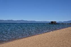
Nevada Beach Campground
Zephyr Cove
38.4 miles SA mile of wide, coarse granite sand on the Nevada shore of Lake Tahoe, with a long shallow shelf that makes it one of the easiest big beaches on the lake to swim from. The Forest Service concessionaire charges a per vehicle day use fee at the Elks Point R
Camp, Hike, Kayak, Swim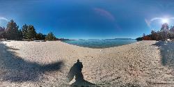
Lester Beach
South Lake Tahoe
39.3 miles SWLester Beach is the sandy main swim beach at D. L. Bliss State Park on Lake Tahoe's west shore, with clear, cold, shallow water and a $10 per vehicle day-use fee in season.
Camp, Canoe, Hike, Kayak, Swim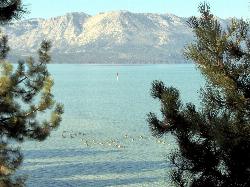
El Dorado Beach
South Lake Tahoe
40.9 miles SFree city beach at Lakeview Commons on Lake Tahoe's south shore in South Lake Tahoe, with a roped swim area, free parking, kayak rentals and a boat ramp. Shoreline construction can close it, so check before you go.
Canoe, Kayak, Swim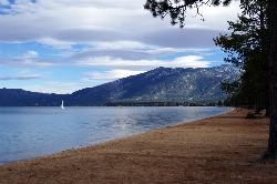
Pope Beach
South Lake Tahoe
42.2 miles SA long sandy Forest Service beach on Lake Tahoe's south shore, three miles northwest of South Lake Tahoe, with clear, cold water and a $10 per vehicle day-use fee.
Kayak, Swim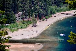
Vikingsholm Beach
South Lake Tahoe
42.5 miles SSandy beach at the head of Emerald Bay in Emerald Bay State Park, below the 1929 Vikingsholm mansion, reached by a steep one-mile trail. Free to walk in; parking is $10 a day.
Hike, Kayak, Swim
Hell Hole Reservoir
Georgetown
45.3 miles SWA 4,630 foot Rubicon River reservoir in the Eldorado National Forest, 51 miles and two hours east of Georgetown, where the boat ramp cove is the only drivable shoreline and the lake drops over 100 feet by September.
Camp, Canoe, Hike, Kayak, SwimNearby Campsites
Boca Reservoir Hidden Beach
Truckee, California
16.1 miles SWSandy informal beaches on the northeast shore of Boca Reservoir above Truckee, free to use, windy in the afternoons, and drawn down hard by the end of summer.
Camp, Canoe, Kayak, Kiteboard, Swim
China Cove Beach
Truckee
27.2 miles SWChina Cove Beach is the sandy, shallow corner at the west end of Donner Memorial State Park, on the south shore of Donner Lake outside Truckee. California State Parks runs it, access is open to anyone paying the 10 dollar day use parking fee, and there is
Camp, Canoe, Hike, Kayak, Swim
Lake Forest Beach
Tahoe City
28.6 miles SWA free public beach at the end of Bristlecone Street, owned by Placer County and run by the Tahoe City Public Utility District. Sandy, pine shaded and genuinely quiet, with the one real constraint being how few cars fit at the end of the road.
Camp, Canoe, Kayak, Swim
Zephyr Cove Park
Glenbrook, Nevada
36.1 miles SSix tennis courts, disc golf, a sledding hill, a beach, and a fishing pond all at one free park make Zephyr Cove one of Lake Tahoe's most versatile family hangouts.
Camp, Canoe, Disc Golf, Hike, Horseback, Kayak, Swim
Sugar Pine Point Beach
Tahoma
36.2 miles SWA quarter-mile walk from the parking lot puts you on a sand beach at the foot of Ed Z'berg Sugar Pine Point State Park, where General Creek meets Lake Tahoe and the water runs clear enough to read the bottom. It is also genuinely cold, even in August.
Camp, Hike, Kayak, Swim
Nevada Beach Campground
Zephyr Cove
38.4 miles SA mile of wide, coarse granite sand on the Nevada shore of Lake Tahoe, with a long shallow shelf that makes it one of the easiest big beaches on the lake to swim from. The Forest Service concessionaire charges a per vehicle day use fee at the Elks Point R
Camp, Hike, Kayak, Swim
Lester Beach
South Lake Tahoe
39.3 miles SWLester Beach is the sandy main swim beach at D. L. Bliss State Park on Lake Tahoe's west shore, with clear, cold, shallow water and a $10 per vehicle day-use fee in season.
Camp, Canoe, Hike, Kayak, Swim
Hell Hole Reservoir
Georgetown
45.3 miles SWA 4,630 foot Rubicon River reservoir in the Eldorado National Forest, 51 miles and two hours east of Georgetown, where the boat ramp cove is the only drivable shoreline and the lake drops over 100 feet by September.
Camp, Canoe, Hike, Kayak, Swim
Gold Lake
Graeagle
45.5 miles WGold Lake is the largest lake in the Plumas National Forest's Lakes Basin Recreation Area, with a free cartop launch and day-use area by the dam on its north shore where swimmers can get in.
Camp, Canoe, Hike, Kayak, Swim
North Fork Falls
Colfax, California
49.7 miles WClear water, cliff-jumping pools, and waterfalls at Sierra Nevada's North Fork Falls — a summer hike to two deep pools with 10-to-25-foot cliffs ready for leaping.
Camp, Hike, Swim


