


Glen Alpine Falls
South Lake Tahoe, California

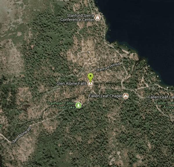
| Address: | Glen Alpine Rd, South Lake Tahoe, CA 96150, USA |
| GPS: |
38°52'47.6"N 120°4'24.0"W Maps | Directions |
| State: | California |
| Trails/Routes: | 0.4 mi |
Waterfalls Streams
Hike
As you drive up to the falls, take a look around. The views are spectacular. The drive can feel long, but the waterfall is peaceful and worth the drive. This waterfall is considered one of the shorter waterfalls around but it is wider. It is a peaceful location because of the sounds of birds chirping and the water flowing.
The best time to come to the waterfall is the middle of spring (June) all the way until the end of summer (August). That is when the water flow is the strongest and the most beautiful.
Something to keep in mind, there is no real trail to the falls, just because you can park right near it. But there are many places to park alongside the road, and you can walk up that road to the falls. There is an overlook point that you can sit at and watch the water flow down. If you are more adventurous, you can climb down the rocks to the water below.
Be sure to check it out when you are in or near Lake Tahoe.
More Information
Glen Alpine Falls at Fallen Leaf Lake in South Lake Tahoe - California Through My Lens
Glen Alpine Falls is a beautiful waterfall on the South side of Fallen Leaf Lake. It is a drive up waterfall that you can see with little effort but it is an great example of the amazing outdoor opportunities available in South Lake Tahoe.
https://californiathroughmylens.com/glen-alpine-falls/Glen Alpine Trail to Lake Aloha, Lake Tahoe, California
The Glen Alpine Trail begins near Fallen Leaf Lake on the southwest side of Lake Tahoe, climbs steadily past Susie Lake and Heather Lake to the shores of Lake Aloha, deep in the Desolation Wilderness
https://www.americansouthwest.net/california/lake_tahoe/lake-aloha.htmlrootsrated.com
Copyright © 2026 GoDaddy Operating Company, LLC. All Rights Reserved.
https://rootsrated.com/stories/12-best-waterfall-hikes-in-northern-californiaWaterfalls around Lake Tahoe: Glen Alpine Falls
Learn what makes Fallen Leaf Lake one of the best spots near Lake Tahoe to explore - including one of the best Lake Tahoe waterfalls!
https://visitlaketahoe.com/family/lake-tahoe-waterfalls-glen-alpine-falls/Be courteous, informed, and prepared. Read trailhead guidelines, stay on the trail, and don't feed the wildlife.
Read More
- Plan Ahead and Prepare
- Travel & camp on durable surfaces
- Dispose of waste properly
- Leave what you find
- Minimize campfire impacts
- Respect wildlife
- Be considerate of other visitors
Directions
From South Lake Tahoe, California
- Head south on Lake Tahoe Blvd toward Los Angeles Ave (2.5 mi)
- Continue straight to stay on Lake Tahoe Blvd (2.5 mi)
- Turn right onto Tahoe Mountain Rd (1.1 mi)
- Turn right onto Glenmore Way (194 ft)
- Turn left onto Dundee Cir (0.1 mi)
- Turn left to stay on Dundee Cir (184 ft)
- Continue onto Tahoe Mountain RdMay be closed at certain times or days(0.5 mi)
- Turn left onto Fallen Leaf RdMay be closed at certain times or days(2.8 mi)
- Continue straight onto Glen Alpine RdDestination will be on the right(0.2 mi)
The Glen Alpine trailhead is at the end of the paved Fallen Leaf Road, forking south off Hwy 89, 3 miles from the US 50 intersection in South Lake Tahoe. This runs through empty pine/aspen woodland for a while, past a USFS campground, and then along the east shore of Fallen Leaf Lake, where the road narrows and is bordered by big trees close to the edge.Courtesy of americansouthwest.net

Other Hiking Trails Nearby
Zephyr Cove Park
Glenbrook, Nevada
11.4 miles NESix tennis courts, disc golf, a sledding hill, a beach, and a fishing pond all at one free park make Zephyr Cove one of Lake Tahoe's most versatile family hangouts.
Camp, Canoe, Disc Golf, Hike, Horseback, Kayak, Swim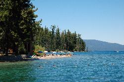
Sugar Pine Point Beach
Tahoma
12.3 miles NA quarter-mile walk from the parking lot puts you on a sand beach at the foot of Ed Z'berg Sugar Pine Point State Park, where General Creek meets Lake Tahoe and the water runs clear enough to read the bottom. It is also genuinely cold, even in August.
Camp, Hike, Kayak, Swim 1.5 mi
Skunk Harbor
Carson City, Nevada
18.8 miles NEA forest service road hike from the 28 freeway to a secluded beach area near Carson City with mountain views, a historic building, and a marker — dogs welcome.
Hike 4.1 mi
Shirley Lake Canyon Trail
Olympic Valley, California
23.8 miles NA 2.5-mile hike from Squaw Valley Village past streams and waterfalls to a pure Sierra lake — rocky near the top, with a free gondola ride back down from High Camp as a reward.
Hike, Swim
Shirley Canyon
Olympic Valley, California
24.3 miles NWShirley Canyon is widely regarded as one of Lake Tahoe's finest half-day hikes, a spectacular climb up a granite canyon that rises straight out of the base of the Palisades Tahoe ski resort in...
Hike
Palisades Creek Trail
Truckee, California
35.0 miles NWA difficult Sierra Nevada trail past Palisade Falls — one of the tallest on the American River — with views of Devils Peak, alpine lakes, and 2,000 feet of elevation gain.
Hike, Swim
Heath Falls Overlook Trail
Truckee, California
35.0 miles NWHike and Swim near Truckee, California
Hike, Swim
North Fork Falls
Colfax, California
41.8 miles NWClear water, cliff-jumping pools, and waterfalls at Sierra Nevada's North Fork Falls — a summer hike to two deep pools with 10-to-25-foot cliffs ready for leaping.
Camp, Hike, Swim
Calaveras Big Trees State Park
Arnold, California
43.5 miles STwo groves of towering Giant Sequoias — about 100 trees in the North Grove and 1,000 in the South Grove — with boardwalk trails, a famous 24-foot stump you can walk on, and great spring hiking in Northern California gold country.
HikeNearby Campsites
Zephyr Cove Park
Glenbrook, Nevada
11.4 miles NESix tennis courts, disc golf, a sledding hill, a beach, and a fishing pond all at one free park make Zephyr Cove one of Lake Tahoe's most versatile family hangouts.
Camp, Canoe, Disc Golf, Hike, Horseback, Kayak, Swim
Sugar Pine Point Beach
Tahoma
12.3 miles NA quarter-mile walk from the parking lot puts you on a sand beach at the foot of Ed Z'berg Sugar Pine Point State Park, where General Creek meets Lake Tahoe and the water runs clear enough to read the bottom. It is also genuinely cold, even in August.
Camp, Hike, Kayak, Swim
Boca Reservoir Hidden Beach
Truckee, California
37.3 miles NSandy informal beaches on the northeast shore of Boca Reservoir above Truckee, free to use, windy in the afternoons, and drawn down hard by the end of summer.
Camp, Canoe, Kayak, Kiteboard, Swim
North Fork Falls
Colfax, California
41.8 miles NWClear water, cliff-jumping pools, and waterfalls at Sierra Nevada's North Fork Falls — a summer hike to two deep pools with 10-to-25-foot cliffs ready for leaping.
Camp, Hike, Swim


