


Adams Canyon Waterfall
Layton, Utah

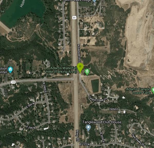
| Address: | 538 Eastside Dr, Layton, UT 84040, USA |
| GPS: |
41°3'59.4"N 111°54'36.9"W Maps | Directions |
| State: | Utah |
Trails
Hike
A great hike that is moderate in difficulty, but also provides a sense of adventure to hikers who love climbing rocks and seeing majestic waterfalls.
More Information
Add ResourceBe courteous, informed, and prepared. Read trailhead guidelines, stay on the trail, and don't feed the wildlife.
Read More
- Plan Ahead and Prepare
- Travel & camp on durable surfaces
- Dispose of waste properly
- Leave what you find
- Minimize campfire impacts
- Respect wildlife
- Be considerate of other visitors
Directions
From Layton, Utah
- Head east on W Gentile St toward S Dawson St (0.2 mi)
- Turn right onto Main St (0.3 mi)
- Turn left onto Layton Pkwy E (0.3 mi)
- Turn left onto 425/
S Fort Ln (0.3 mi) - Turn right onto E Gentile St (0.9 mi)
- Continue onto Oak Hills Dr (1.6 mi)
- Turn left onto US-89 N (0.4 mi)
- Turn right toward Eastside Dr (85 ft)
- Turn right at the 1st cross street onto Eastside Dr (0.4 mi)
The trailhead is located just off of HWY 89 in Layton Utah. From Salt Lake City travel on I-15 North to HWY 89. Travel on HWY 89 north to Layton. Turn right on East 1200 North, then immediately turn right on Eastside Road. Near the end of Eastside Road you will see a dirt parking area. This is the trail head parking area. Courtesy of utahoutdooractivities.com


Other Hiking Trails Nearby

Gailey Trail At Nicholls Park (Nicholls Hollow)
Kaysville, Utah
3.2 miles SA four-season nature trail through shady cottonwoods with bridges over streams, gorgeous autumn leaves, and a snowy winter transformation — perfect for walking, running, or biking.
Hike, Mountain Bike 6.4 mi
Farmington Canyon
Farmington, Utah
5.2 miles SA four-season canyon road and trail system near Farmington with vibrant autumn colors, access to Francis and Bountiful Peaks, two campgrounds, and sweeping views of Kaysville and the Great Salt Lake.
Hike, Mountain Bike 0.8-2.0 mi
Farmington Creek trail
Farmington, Utah
5.5 miles SA multi-destination Farmington trail connecting a fishing pond, Lagoon amusement park, a small zoo with elk and bison, and scenic downtown Farmington — open to bikes, rollerblades, and foot traffic.
Hike, Mountain Bike, Skateboard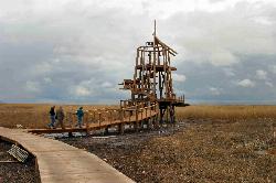
Great Salt Lake Shorelands Preserve
Layton, Utah
6.2 miles WThe Great Salt Lake Shorelands Preserve is a hidden gem on the eastern edge of the Great Salt Lake near Layton, Utah, where a mile-plus of boardwalk floats out over a living wetland that most people...
Hike, Mountain Bike
Bonneville Shoreline Trail, Ogden, UT, USA
Ogden, Utah
9.5 miles NBackpack, Hike, and Mountain Bike near Ogden, Utah
Backpack, Hike, Mountain Bike
Parrish Canyon Trail
Centerville, Utah
10.2 miles SA Wasatch foothills trail connecting to Barnard Creek with views of Salt Lake City from the summit, wildlife to spot, pictographs on rocks in spring and summer, and a bridge as an easy turnaround for young hikers.
Hike, Mountain Bike
Mueller Park Trail
Bountiful, Utah
14.5 miles SSmooth buff singletrack climbs gradually for 6.5 miles through Mueller Park before rewarding mountain bikers with fast, flowy descents all the way back down.
Cross-country Ski, Hike, Mountain Bike 2.9 mi
Pineview Reservoir
Eden, Utah
16.5 miles NA stunning Wasatch reservoir with three sandy beaches, boating, kayaking, paddleboarding, water skiing, and 18 miles of paved trail — the ultimate summer base behind the Ogden front.
Camp, Canoe, Hike, Kayak, Mountain Bike, Swim 5.6 mi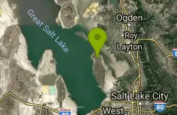
Antelope Island Lakeside Trail
Syracuse, Utah
16.7 miles WAn easy 2-hour loop on Antelope Island around the Great Salt Lake, with rock formations, views of the Sierra Nevadas, and the GSL — kid-friendly and good for bug fans.
Camp, Hike, Horseback 6.2-16.2 mi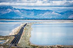
Antelope Island
Syracuse, Utah
17.0 miles WThe largest island in the Great Salt Lake, home to 500 bison, pronghorn, and bighorn sheep — with backcountry hiking, biking, horseback riding, and cross-country skiing across scenic rangelands.
Hike, Horseback, Mountain Bike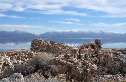
Antelope Island State Park
Syracuse, Utah
17.4 miles WTwenty miles of trails cross Utah's Great Salt Lake island alongside free-roaming bison, antelope, and bobcats — best visited in early spring or late fall to beat the bugs.
Backpack, Camp, Hike, Horseback, Mountain Bike 16.6 mi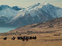
Antelope Island Figure 8
Layton, Utah
17.6 miles SWSmooth, open trail across Antelope Island's backcountry with awesome rock formations and desert silence — best ridden in spring and fall; nearly zero shade, so beat the heat and yield to horses and runners.
Hike, Mountain Bike, Snowshoe 7.2 mi
White Rock Loop
Syracuse, Utah
17.8 miles WAn easy loop around Antelope Island with sweeping landscape views, wildlife like bison and birds, and leashed-dog access — no shade, so pack sunscreen.
Hike, Mountain Bike, Snowshoe 4.7 mi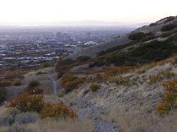
Bonneville Shoreline Trail
Salt Lake City, Utah
19.2 miles SA multi-use trail stretching from North Salt Lake to Parley's Canyon that follows the ancient shoreline of Lake Bonneville — perfect for hiking, biking, and trail running.
Hike, Mountain Bike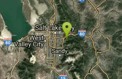
Grandeur Peak
Salt Lake City, Utah
26.1 miles SThe most accessible major peak on the Salt Lake City skyline, offering great valley views and year-round access for hikers of all abilities.
Hike 2.6 mi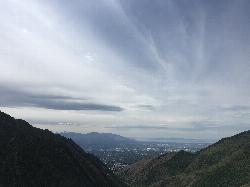
Salt Lake Valley Scenic Overlook
Salt Lake City, Utah
27.2 miles SA 2-mile uphill hike through Millcreek Canyon switchbacks rewards you with a breathtaking overlook of the Salt Lake Valley from high above downtown's skyline.
Hike
Pete's Rock
Salt Lake City, Utah
29.1 miles SA large roadside rock next to the Mount Olympus trailhead — a local favorite for casual rock climbing, with the 9,026-ft summit offering some of the best views in the Salt Lake Valley.
Hike, Rock Climb
Hidden Falls
Salt Lake City, Utah
31.4 miles SA popular roadside waterfall in Big Cottonwood Canyon that's just a short stroll from the parking lot — a quick 15-minute detour with a big payoff.
Hike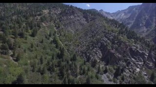
Storm Mountain
Salt Lake City, Utah
31.8 miles SA compact Wasatch peak just 3 miles up Big Cottonwood Canyon, with rock climbing routes, hiking, biking, and Big Cottonwood Creek running right alongside the day-use area.
Hike, Mountain Bike, Rock Climb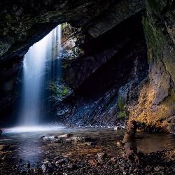
Donut Falls
Salt Lake City, Utah
31.9 miles SEA waterfall that pours through a hole in a cave ceiling — earning the 'donut' name — on a family-friendly 3-mile round-trip hike through Big Cottonwood Canyon.
Hike, SwimNearby Campsites
Holbrook Trailhead
Bountiful, Utah
13.2 miles SThe Holbrook Trailhead is a popular access point for the Bonneville Shoreline Trail and Holbrook Canyon above Bountiful, Utah, on the western face of the Wasatch. Perched on the bench right at the...
Airsoft, Backpack, Camp, Paintball, Snowshoe 2.9 mi
Pineview Reservoir
Eden, Utah
16.5 miles NA stunning Wasatch reservoir with three sandy beaches, boating, kayaking, paddleboarding, water skiing, and 18 miles of paved trail — the ultimate summer base behind the Ogden front.
Camp, Canoe, Hike, Kayak, Mountain Bike, Swim 5.6 mi
Antelope Island Lakeside Trail
Syracuse, Utah
16.7 miles WAn easy 2-hour loop on Antelope Island around the Great Salt Lake, with rock formations, views of the Sierra Nevadas, and the GSL — kid-friendly and good for bug fans.
Camp, Hike, Horseback
Antelope Island State Park
Syracuse, Utah
17.4 miles WTwenty miles of trails cross Utah's Great Salt Lake island alongside free-roaming bison, antelope, and bobcats — best visited in early spring or late fall to beat the bugs.
Backpack, Camp, Hike, Horseback, Mountain Bike
Mill Creek Canyon
Salt Lake City, Utah
27.3 miles SAn out-and-back canyon trail with over 1,000 feet of elevation gain — the lower ski trail sees heavy traffic while the upper section above Elbow Fork stays quiet, with a reservable Yurt at the top December through April.
Camp, Cross-country Ski, Snowshoe
Spruces Campground
Salt Lake City, Utah
32.7 miles SEA fee campground in Big Cottonwood Canyon near Salt Lake City — check USDA.gov for current rates and seasonal availability.
Camp, Sled 3.9 mi
Providence Canyon
Logan, Utah
43.9 miles NA wooded canyon near Logan packed with trails and campgrounds offering multiple loop or out-and-back options — beautiful scenery throughout, with a great MTB shuttle descent from top to bottom.
Camp, Hike, Mountain Bike 1.6-14.1 mi
Mount Timpanogas
Provo, Utah
46.1 miles SUtah's most-climbed mountain towers 7,000 feet above the Provo valley, stretching seven miles north to south with multiple peaks over 11,000 feet — a Wasatch landmark.
Camp, Hike, Horseback, Swim


