


Great Salt Lake Shorelands Preserve
Layton, Utah
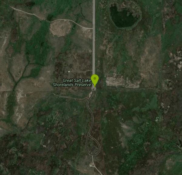
| Address: | S 3200 W, Layton, UT 84041, USA |
| GPS: |
41°2'45.1"N 112°1'34.6"W Maps | Directions |
| State: | Utah |
Hike and Mountain Bike
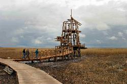
The Great Salt Lake Shorelands Preserve is a hidden gem on the eastern edge of the Great Salt Lake near Layton, Utah, where a mile-plus of boardwalk floats out over a living wetland that most people driving I-15 never know is there. Owned and managed by The Nature Conservancy, the preserve protects a stretch of marsh that provides essential habitat for over 250 species of birds, and it offers all of it up to visitors on a flat, easy, genuinely beautiful walk, for free.
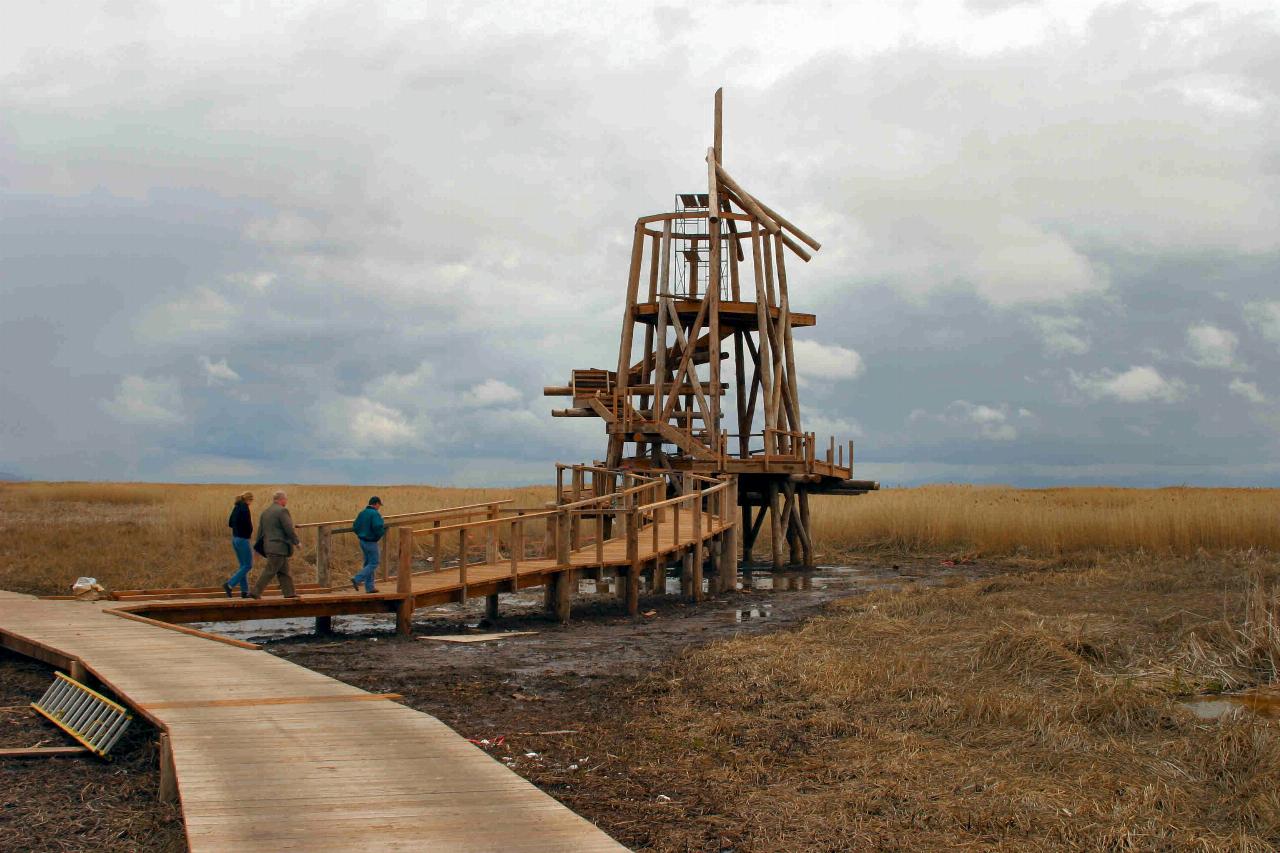
The boardwalk is the experience. The main loop runs about 1.3 miles on a spongy raised walkway laid directly over the marshes of the northern Great Salt Lake, taking most people around 20 to 30 minutes at a stroll, or far longer with binoculars in hand. It's flat and accessible, which makes it one of the rare wild places genuinely suited to all ages and abilities, and it comes with a viewing tower, educational signage and even an audio tour to interpret what you're seeing.
Birding is the headline. Between four and six million birds use the Great Salt Lake each year to feed, rest and nest, and the preserve puts you right in the middle of that traffic, with the best activity early in the morning and again in the couple of hours before sunset when everything is feeding. Spring and fall migrations bring the biggest numbers and the widest variety; the marsh is busy and loud with life at the right hour.
Facilities are excellent for a preserve: solid parking, restrooms, a visitor center and clear interpretive exhibits about the lake's birdlife and why the habitat matters. The visitor center runs roughly 7 a.m. to 8 p.m. April through September and 8 a.m. to 5 p.m. October through March. Admission is free. One firm rule to know before you go: dogs are not allowed on the boardwalk, to protect the birds and the fragile wetland.
This is an exposed lakeside wetland, so it can be buggy in the warm months, windy off the lake, and hot at midday with essentially no shade, which is another reason the early and late hours are best. Sunsets over the marsh and the lake beyond are, by wide agreement, spectacular.
Come with binoculars, sun protection, insect repellent in summer, and water. Time your visit to dawn or dusk, tread lightly on the boardwalk, and leave the dog at home. For a free, easy, deeply rewarding hour with one of the most important bird habitats in the West, the Shorelands Preserve is hard to beat.
More Information
The Great Salt Lake Shorelands Preserve | The Nature Conservancy
The Great Salt Lake Shorelands Preserve provides visitors with more than a mile of boardwalk and access to the wetlands of Utah’s Great Salt Lake.
https://www.nature.org/en-us/get-involved/how-to-help/places-we-protect/the-great-salt-lake-shorelands-preserve/Never modify trail features. Ride trails when they're dry enough that you won't leave ruts. Speak up when you see others on the trail and always yield to hikers, horses, and others coming uphill. Always ride on the established trail.
Read MoreBe courteous, informed, and prepared. Read trailhead guidelines, stay on the trail, and don't feed the wildlife.
Read More
- Plan Ahead and Prepare
- Travel & camp on durable surfaces
- Dispose of waste properly
- Leave what you find
- Minimize campfire impacts
- Respect wildlife
- Be considerate of other visitors
Directions
From Layton, Utah
- Head west on W Gentile St toward Ellison St (2.9 mi)
- Turn left onto S 3200 WDestination will be on the left(1.0 mi)
Added by torontoty1214
Other Mountain Bike Trails and Hiking Trails Nearby

Gailey Trail At Nicholls Park (Nicholls Hollow)
Kaysville, Utah
5.5 miles EA four-season nature trail through shady cottonwoods with bridges over streams, gorgeous autumn leaves, and a snowy winter transformation — perfect for walking, running, or biking.
Hike, Mountain Bike
Adams Canyon Waterfall
Layton, Utah
6.2 miles EA great hike that is moderate in difficulty, but also provides a sense of adventure to hikers who love climbing rocks and seeing majestic waterfalls.
Hike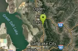
Bonneville Shoreline Trail - Layton Section
Kaysville, Utah
6.3 miles EA close-to-town singletrack mix of open exposed sections, twisty tree-threading, a couple of spooky drops, creek crossings, and great valley views — with a gun range audible below.
Mountain Bike 6.4 mi
Farmington Canyon
Farmington, Utah
8.0 miles SEA four-season canyon road and trail system near Farmington with vibrant autumn colors, access to Francis and Bountiful Peaks, two campgrounds, and sweeping views of Kaysville and the Great Salt Lake.
Hike, Mountain Bike 0.8-2.0 mi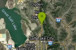
Farmington Creek trail
Farmington, Utah
8.1 miles SEA multi-destination Farmington trail connecting a fishing pond, Lagoon amusement park, a small zoo with elk and bison, and scenic downtown Farmington — open to bikes, rollerblades, and foot traffic.
Hike, Mountain Bike, Skateboard 5.6 mi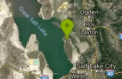
Antelope Island Lakeside Trail
Syracuse, Utah
10.6 miles WAn easy 2-hour loop on Antelope Island around the Great Salt Lake, with rock formations, views of the Sierra Nevadas, and the GSL — kid-friendly and good for bug fans.
Camp, Hike, Horseback
Riverdale Parkway
Ogden, Utah
10.8 miles NA paved riverside trail in Ogden that quickly transitions into a fun singletrack network — all skill levels, year-round access, and dogs welcome on leash; watch for flying frisbees.
Mountain Bike 6.2-16.2 mi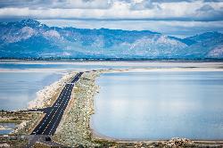
Antelope Island
Syracuse, Utah
11.0 miles WThe largest island in the Great Salt Lake, home to 500 bison, pronghorn, and bighorn sheep — with backcountry hiking, biking, horseback riding, and cross-country skiing across scenic rangelands.
Hike, Horseback, Mountain Bike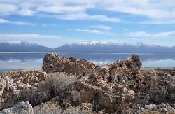
Antelope Island State Park
Syracuse, Utah
11.2 miles WTwenty miles of trails cross Utah's Great Salt Lake island alongside free-roaming bison, antelope, and bobcats — best visited in early spring or late fall to beat the bugs.
Backpack, Camp, Hike, Horseback, Mountain Bike 16.6 mi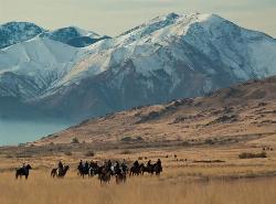
Antelope Island Figure 8
Layton, Utah
11.5 miles SWSmooth, open trail across Antelope Island's backcountry with awesome rock formations and desert silence — best ridden in spring and fall; nearly zero shade, so beat the heat and yield to horses and runners.
Hike, Mountain Bike, Snowshoe 7.2 mi
White Rock Loop
Syracuse, Utah
11.7 miles WAn easy loop around Antelope Island with sweeping landscape views, wildlife like bison and birds, and leashed-dog access — no shade, so pack sunscreen.
Hike, Mountain Bike, Snowshoe
Parrish Canyon Trail
Centerville, Utah
11.9 miles SEA Wasatch foothills trail connecting to Barnard Creek with views of Salt Lake City from the summit, wildlife to spot, pictographs on rocks in spring and summer, and a bridge as an easy turnaround for young hikers.
Hike, Mountain Bike
Bonneville Shoreline Trail, Ogden, UT, USA
Ogden, Utah
12.0 miles NEBackpack, Hike, and Mountain Bike near Ogden, Utah
Backpack, Hike, Mountain Bike
Needles
Ogden, Utah
12.9 miles NEA well-marked mountain bike trail network at Snowbasin Resort near Ogden — bone-jarring small-rock singletrack with moose in the lower regions and gondola-accessible terrain.
Mountain Bike
Bonneville Shoreline Ogden South Of 12th
Ogden, Utah
13.4 miles NThe most popular trail in Ogden — a mostly easy shoreline ride with a few rocky technical sections, great for pre- and post-season riding when summer heat makes it less ideal.
Mountain Bike
Coldwater Canyon Overlook
Ogden, Utah
14.7 miles NEA scenic out-and-back with a spectacular Ogden Canyon overlook at the top — the downhill is a blast but go off-peak to avoid hikers and horseback riders.
Mountain Bike
Sardine Peak Loop
Ogden, Utah
14.7 miles NEA 2.5-mile climb to Coldwater Overlook, a ridge traverse past Sardine Peak, and fun fast switchbacks back down — great views of Pine View Dam and a rewarding Wasatch loop.
Mountain Bike
Snowbasin Resort
Ogden, Utah
14.9 miles NETwenty-six miles of resort singletrack connecting to 50 miles of Forest Service trails — weaving through aspen groves, open fields, and pine forest with gondola access for all levels.
Mountain Bike
Mueller Park Trail
Bountiful, Utah
16.0 miles SESmooth buff singletrack climbs gradually for 6.5 miles through Mueller Park before rewarding mountain bikers with fast, flowy descents all the way back down.
Cross-country Ski, Hike, Mountain Bike
Wild Rose Trailhead Park
North Salt Lake, Utah
16.6 miles SESeveral singletrack and downhill trails in North Salt Lake's Wild Rose park — from a beginner-friendly 2.5-mile loop to technical bermed descents — with access from the Bonneville Shoreline Trail.
Mountain BikeNearby Campsites
Antelope Island Lakeside Trail
Syracuse, Utah
10.6 miles WAn easy 2-hour loop on Antelope Island around the Great Salt Lake, with rock formations, views of the Sierra Nevadas, and the GSL — kid-friendly and good for bug fans.
Camp, Hike, Horseback
Antelope Island State Park
Syracuse, Utah
11.2 miles WTwenty miles of trails cross Utah's Great Salt Lake island alongside free-roaming bison, antelope, and bobcats — best visited in early spring or late fall to beat the bugs.
Backpack, Camp, Hike, Horseback, Mountain Bike
Holbrook Trailhead
Bountiful, Utah
14.8 miles SEThe Holbrook Trailhead is a popular access point for the Bonneville Shoreline Trail and Holbrook Canyon above Bountiful, Utah, on the western face of the Wasatch. Perched on the bench right at the...
Airsoft, Backpack, Camp, Paintball, Snowshoe 2.9 mi
Pineview Reservoir
Eden, Utah
20.2 miles NEA stunning Wasatch reservoir with three sandy beaches, boating, kayaking, paddleboarding, water skiing, and 18 miles of paved trail — the ultimate summer base behind the Ogden front.
Camp, Canoe, Hike, Kayak, Mountain Bike, Swim
Mill Creek Canyon
Salt Lake City, Utah
29.0 miles SEAn out-and-back canyon trail with over 1,000 feet of elevation gain — the lower ski trail sees heavy traffic while the upper section above Elbow Fork stays quiet, with a reservable Yurt at the top December through April.
Camp, Cross-country Ski, Snowshoe
Spruces Campground
Salt Lake City, Utah
34.6 miles SEA fee campground in Big Cottonwood Canyon near Salt Lake City — check USDA.gov for current rates and seasonal availability.
Camp, Sled 3.9 mi
Providence Canyon
Logan, Utah
46.9 miles NA wooded canyon near Logan packed with trails and campgrounds offering multiple loop or out-and-back options — beautiful scenery throughout, with a great MTB shuttle descent from top to bottom.
Camp, Hike, Mountain Bike 1.6-14.1 mi
Mount Timpanogas
Provo, Utah
47.1 miles SEUtah's most-climbed mountain towers 7,000 feet above the Provo valley, stretching seven miles north to south with multiple peaks over 11,000 feet — a Wasatch landmark.
Camp, Hike, Horseback, Swim


