


Galt's Ferry Day Use Area
Acworth

Canoe, Kayak, and Swim
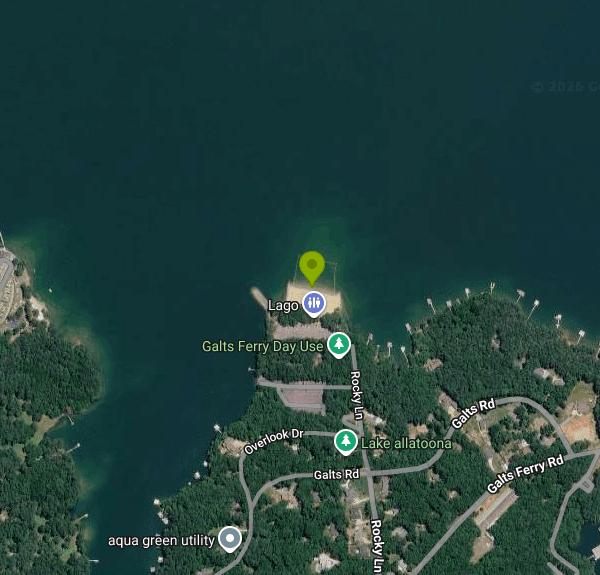
Galt's Ferry Day Use Area is a U.S. Army Corps of Engineers park on the south shore of Allatoona Lake, the reservoir the Corps built on the Etowah River northwest of Atlanta. It sits at the end of Rocky Lane in unincorporated Cherokee County, about 5 miles northeast of downtown Acworth, and it is one of the bigger Corps day-use parks on the lake. Besides the swim beach there is a three-lane boat ramp, a fishing jetty, a playground behind the sand, picnic tables with grills, and a group shelter that seats up to 100 people and can be reserved through Recreation.gov.
From I-75, take exit 277 (GA 92) and head east about a mile to the light at Hunt Road. Turn left and keep straight through the four-way stop, where the road becomes Kellogg Creek Road. After roughly a mile, turn left on Galt's Ferry Landing Road, go 0.8 mile to the third stop sign, and turn left on Rocky Lane to the park entrance. The Corps lists the address as 7299 Rocky Lane, Acworth, GA 30102. The beach and picnic area use their own parking lot, separate from the boat launch lot and its trailer spaces.
The beach is a strip of sand on a cove of the main lake, with a roped swim area off the shoreline and the fishing jetty just to one side. Corps rules for Allatoona state that designated swimming areas are not supervised, so there are no lifeguards and you swim at your own risk. The water inside the ropes is shallow near the sand and gets to roughly head height at the outer line at summer pool, though that changes with the lake level. Allatoona is a red-clay reservoir, so expect greenish, low-visibility water and a soft bottom past the sand. Pets are not allowed on Corps beaches at Allatoona, and the Recreation.gov listing says alcohol is not permitted in the park.
Galt's Ferry is not free. The Corps charges a facility-use fee of $5 per vehicle at its Allatoona parks that have beaches, and a separate $5 launch fee at the ramp. A Corps of Engineers Annual Day-Use Pass costs $40 and works at Corps day-use areas and boat ramps nationwide. Since 2019 the Allatoona day-use parks have been cashless, so bring a credit or debit card for the automated pay station. The park is gated and open in daytime only. Opening hours and seasonal dates are not posted online, so call the Allatoona Lake Project Management Office at 678-721-6700 before a trip outside summer.
A few things to know before you go. Swimming is banned at launch ramps and courtesy docks, so stay inside the ropes and away from the ramp and jetty. The south end of Allatoona carries heavy boat and personal watercraft traffic on summer weekends, and wakes reach the swim area. The Corps lowers the lake each fall and winter for flood control, which pulls the waterline back from the beach and leaves mud and clay exposed. The park can also close outright during federal funding lapses or for maintenance work. On busy summer holidays the beach lot can fill early.
Anglers work the jetty and the shoreline near the ramp for bass and crappie, and the ramp makes this an easy put-in for a canoe or kayak on the lower lake. Red Top Mountain State Park, across the lake, has hiking trails.
More Information
Allatoona Lake - Camping, Permits | Georgia | Recreation.gov
Reserve camping, permits & activities at Allatoona Lake, Georgia. 8 campgrounds, 2 permits. Book official reservations on Recreation.gov.
https://www.recreation.gov/gateways/440ALLATOONA LAKE MAKING CHANGES TO THE RECREATION PROGRAM | WBHF
Press Release ALLATOONA LAKE MAKING CHANGES TO THE RECREATION PROGRAM MOBILE, Alabama – The U.S. Army Corps of Engineers, Mobile District, announced today that Corps-managed campgrounds and day use areas at Allatoona Lake in Georgia will begin “cashless” operations in 2019. Cashless operations provide a more secure way to conduct financial transactions and reduce
https://wbhfradio.org/allatoona-lake-making-changes-to-the-recreation-program/DVIDS - News - Allatoona Lake Park Closures due to Lapse in Federal Appropriations
CARTERSVILLE, Ga. – Due to the ongoing Federal government shutdown, specified USACE-operated parks and day-use areas in the Mobile District will close starting October 31, until further notice. • Registered campers must depart by 3:00 p.m. on Saturday, November 1, unless directed otherwise by their local project office. • Most recreation area entrance gates will be secured, and ungated areas will be clearly marked as closed. • Minimal staffing will be available at project offices, but powerhouses and navigation locks will remain operational.
https://www.dvidshub.net/news/550590/allatoona-lake-park-closures-due-lapse-federal-appropriationsGalt'S Ferry Day Use Area (GA), Allatoona Lake - Recreation.gov
Explore Galt'S Ferry Day Use Area (GA) in Allatoona Lake, Georgia with Recreation.gov. Galt's Ferry Day Use Area is situated on Allatoona Lake on the Etowah River, a tributary of the Coosa River. The serene lake and peaceful surroundings offer a r
https://www.recreation.gov/camping/campgrounds/251868Galt'S Ferry Day Use Area (GA), Allatoona Lake - Recreation.gov
Explore Galt'S Ferry Day Use Area (GA) in Allatoona Lake, Georgia with Recreation.gov. Galt's Ferry Day Use Area is situated on Allatoona Lake on the Etowah River, a tributary of the Coosa River. The serene lake and peaceful surroundings offer a r
https://www.recreation.gov/camping/poi/251868Galt's Ferry Day Use Area To Close For Paving | Cartersville, GA Patch
The facility will close Sept. 12 and is expected to reopen Sept. 18.
https://patch.com/georgia/cartersville/galts-ferry-day-use-area-close-pavingGalt's Ferry, Georgia boat ramp and access | How's Your River
Public boat ramp and water access at Galt's Ferry on Allatoona Lake in Georgia. Map, directions, nearby USGS conditions, and amenities.
https://www.howsyourriver.com/access_sites/galts-ferrySite Shelter, Galt'S Ferry Day Use Area (GA) - Recreation.gov
Find out more details and check site availability for Site Shelter, Loop GALT'S FERRY DAY USE AREA (GA) in Galt'S Ferry Day Use Area (GA) at Allatoona Lake with Recreation.gov.
https://www.recreation.gov/camping/campsites/617471
- Plan Ahead and Prepare
- Travel & camp on durable surfaces
- Dispose of waste properly
- Leave what you find
- Minimize campfire impacts
- Respect wildlife
- Be considerate of other visitors
Directions
From Acworth
- Head northwest toward N Main St (0.1 mi)
- Turn right onto N Main St (0.4 mi)
- Turn left toward GA-92 N/
Lake Acworth Dr (0.1 mi) - Turn right onto GA-92 N/
Lake Acworth Dr Pass by McDonald's (on the left in 2.2 mi)(2.2 mi) - Turn left onto GA-92 N/
Cowan Rd Continue to follow GA-92 N(1.2 mi) - Turn left onto Kellogg Creek Rd (0.2 mi)
- Turn right to stay on Kellogg Creek Rd (1.9 mi)
- Slight left onto Galts Ferry Rd (0.8 mi)
- Continue straight onto Rocky Ln (0.3 mi)


Other Swimming Holes, Canoeing Areas, and Kayaking Areas Nearby

Sweetwater Day Use Area
Canton
6.0 miles NEA Corps of Engineers sand beach and roped swim area on a quiet cove of Allatoona Lake west of Canton, with a $5 per vehicle day use fee and no lifeguards.
Camp, Canoe, Kayak, Swim
Mill Creek
Woodstock, Georgia
8.5 miles ESwim near Woodstock, Georgia
Swim
Diving Rock
Atlanta, Georgia
20.3 miles SEA 25-foot granite diving rock, a riverside beach, and cool, clear water on the Chattahoochee — a classic Atlanta swimming hole.
Swim
Rockmart
Rockmart, Georgia
25.4 miles SWA concrete pump station platform over a dammed stretch of Thompson Creek on the Silver Comet Trail — reports say rocky water at low levels makes it best when the creek runs high.
Swim
Pooles Mill
Ball Ground, Georgia
25.6 miles NESwim near Ball Ground, Georgia
Swim
Sweetwater Creek State Park
Lithia Springs, Georgia
26.2 miles SSwim near Lithia Springs, Georgia
Swim 2.4 mi
Edge Of The World
Dawsonville, Georgia
32.0 miles NEA scenic 3-mile hike along the Amicalola River to a family-friendly swimming hole and small waterfall near Atlanta.
Hike, Swim
Buford Dam Park Beach (Lake Lanier)
Buford, Georgia
33.4 miles ESmall sandy swim beach in a no-boat cove at the Corps of Engineers' Buford Dam Park on Lake Lanier, with shelters, a fishing pier and the Laurel Ridge Trail.
Hike, Kayak, Swim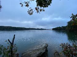
Lanier Park
Buford
33.8 miles EA Corps of Engineers day-use park just north of Buford Dam with a small swim beach in a sheltered cove of Lake Lanier. $8 per vehicle or $3 on foot, open 8 a.m. to 10 p.m., no lifeguards.
Hike, Kayak, Swim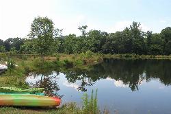
Pine Lake Beach
Pine Lake
34.5 miles SEA free municipal sand beach on a creek-fed lake in Pine Lake, the smallest city in DeKalb County, two and a half miles west of Stone Mountain. Roped swim area, no lifeguard, open June through September with no admission fee.
Canoe, Kayak, Swim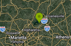
Van Pugh North Park
Flowery Branch
38.3 miles ECorps of Engineers day-use park on Lake Lanier near Flowery Branch with a designated swim beach at the end of the park road. $8 per vehicle, card only, no lifeguards, no pets.
Kayak, Swim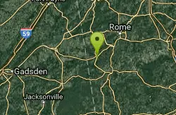
Conasauga Area
Cave Spring, Georgia
40.1 miles WSwim near Cave Spring, Georgia
Swim
Cave Spring
Cave Spring, Georgia
40.1 miles WA cave-fed spring flows into a Georgia-shaped swimming pool in Rolator Park — then explore the cave itself for a one-of-a-kind small-town splash.
Swim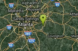
Yellow River Park
Stone Mountain, Georgia
40.4 miles SESwim near Stone Mountain, Georgia
Swim
Bolding Mill Park
Gainesville
42.2 miles EA Corps of Engineers park on Lake Lanier's Chestatee arm near Gainesville with a designated swim beach built on a gentle concrete slope, plus shelters, a boat ramp and a campground. Corps day-use fee applies.
Camp, Kayak, Swim 0.8 mi
Holly Creek Picnic Area
Chatsworth, Georgia
47.0 miles NA scenic North Georgia picnic and swimming spot with a shallow creek hole, easy rock jumps, and kayaking nearby.
Canoe, Kayak, SwimNearby Campsites
Sweetwater Day Use Area
Canton
6.0 miles NEA Corps of Engineers sand beach and roped swim area on a quiet cove of Allatoona Lake west of Canton, with a $5 per vehicle day use fee and no lifeguards.
Camp, Canoe, Kayak, Swim
Bolding Mill Park
Gainesville
42.2 miles EA Corps of Engineers park on Lake Lanier's Chestatee arm near Gainesville with a designated swim beach built on a gentle concrete slope, plus shelters, a boat ramp and a campground. Corps day-use fee applies.
Camp, Kayak, Swim


