


Bolding Mill Park
Gainesville

Camp, Kayak, and Swim
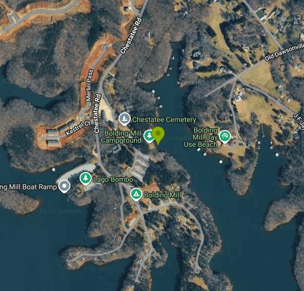
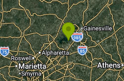
Bolding Mill Park is a U.S. Army Corps of Engineers park on the northwest shore of Lake Sidney Lanier, about 30 miles up the lake from Buford Dam and roughly 8 miles northwest of downtown Gainesville in Hall County. The park sits on the Chestatee River arm of the reservoir and combines a day-use area (picnic shelters, playground, restrooms, boat ramp and a designated swim beach) with a 97-site campground. Hall County Parks and Recreation now runs the campground in partnership with the Corps, but the beach is in the day-use part of the park, outside the campground gate, and is open to anyone.
To get there from Georgia 400, take the Highway 53 exit east toward Gainesville, turn left on Sardis Road, then left on Chestatee Road, and go straight through the stop sign until the road dead-ends into the park at 4055 Chestatee Road. Coming from Interstate 985, take Highway 53 west and turn right on Sardis Road. The beach lot is the row of parking just inside the day-use area, with restrooms and the playground a short walk from the water. Parking is first come, first served, and on summer weekends and the big holiday weekends it fills early.
The swim beach is unusual for Lanier. Instead of trucked-in sand, most of it is a wide concrete slope that runs gently down into the water, which gives wheelchair users and small kids an easy, even entry. Past the end of the slab the bottom turns to the lake's usual red clay, and it drops off faster than it looks. Swim only within the designated beach area. No lifeguards are listed for the beach, so swimming is at your own risk and children need an adult within reach. Surface water runs in the low to mid 80s Fahrenheit in July and August and is cold well into May.
Lake Lanier Corps parks charge a day-use fee, and Recreation.gov notes for Bolding Mill that day-use fees apply to all visitors, separate from any shelter or campsite reservation. The current Lake Lanier Corps schedule is $8 per vehicle and $3 per person walking or biking in, children under 16 free, and the $40 Corps annual day-use pass and America the Beautiful passes are accepted. One day-use payment covers the beach and the boat ramp for that day. Gate hours are posted at the park entrance, and the campground gate locks at 10:30 p.m.
Lanier records drownings nearly every summer, so treat the deep water past the slab with respect. Stay in the swim area, keep an eye on boat wakes from the main channel, and expect the shoreline to move with the lake level: in dry years the Corps draws the reservoir down and the water's edge can sit well below the bottom of the concrete. Alcohol is prohibited in the park and pets are not allowed in designated swim areas. Thunderstorms build fast over the lake on summer afternoons.
Beyond the beach there are two reservable group shelters (Recreation.gov), open picnic tables, a playground, a fishing pier and a boat ramp with a courtesy dock, so paddlers can launch kayaks here and explore the coves of the Chestatee arm. The campground has 88 water and electric sites plus nine tent-only sites, many right on the water, with showers and a laundry. Duckett Mill and Little Hall parks are a few miles away by road if Bolding Mill is full.
More Information
Bolding Mill Park on Lake Lanier
Fisherpeople will be happy to know they can launch their boats at Bolding Mill Park and have access to every big fish in Lake Lanier!
https://lakelanier.com/directory/parks/bolding-mill-park/Bolding Mill Park, Georgia boat ramp and access | How's Your River
Public boat ramp and water access at Bolding Mill Park on Lake Lanier in Georgia. Map, directions, nearby USGS conditions, and amenities.
https://www.howsyourriver.com/access_sites/bolding-mill-parkBolding Mill Shelters (GA), Lake Sidney Lanier - Recreation.gov
Explore Bolding Mill Shelters (GA) in Lake Sidney Lanier, Georgia with Recreation.gov. Bolding Mill Park lies approximately 30 miles north of Buford Dam on Lake Sidney Lanier. The site features beautiful views of the lake as well as excellent acc
https://www.recreation.gov/camping/campgrounds/251921Bolding Mill, Lake Sidney Lanier - Recreation.gov
Explore Bolding Mill in Lake Sidney Lanier, Georgia with Recreation.gov. Bolding Mill Campground is an excellent choice for camping on Lake Sidney Lanier, offering plenty of comfortable amenities in addition to a well-kept facility.
https://www.recreation.gov/camping/campgrounds/232531Camping in Hall County | Hall County, GA - Official Website
Create a Website Account - Manage notification subscriptions, save form progress and more.
https://www.hallcounty.org/1182/Camping-in-Hall-CountyCorps changing fees for day use, special permits at Lake Lanier - Forsyth News
FORSYTH COUNTY — The U.S. Army Corps of Engineers has announced that recreation day use fees charged for the boat launches and swimming beaches it manages on Lake Lanier have changed to a simpler structure.
https://www.forsythnews.com/local/corps-changing-fees-for-day-use-special-permits-at-lake-lanier/Lake Sidney Lanier - Camping, Permits | Georgia | Recreation.gov
Reserve camping, permits & activities at Lake Sidney Lanier, Georgia. 14 campgrounds, 1 permits. Book official reservations on Recreation.gov.
https://www.recreation.gov/gateways/442Lakeside Camping at Bolding Mill Campground - Lake Lanier
Bolding Mill Campground is a haven of rest on the northwest side of Lake Lanier, and the portal to excitement for sailing, paddling, fishing or water skiing.
https://lakelanier.com/2018/04/lakeside-camping-at-bolding-mill-campground/New Jointly Managed Lake Lanier Parks | Hall County, GA - Official Website
Visitor information for the newly jointly managed Lake Lanier day-use parks and water access points operated in partnership between Hall County Government and the U.S. Army Corps of Engineers. Learn about fees, passes, park access, shelter reservations, pet policies, boat ramp updates, and more.
https://www.hallcounty.org/1346/New-Jointly-Managed-Lake-Lanier-Parks
- Plan Ahead and Prepare
- Travel & camp on durable surfaces
- Dispose of waste properly
- Leave what you find
- Minimize campfire impacts
- Respect wildlife
- Be considerate of other visitors
Directions
From Gainesville
- Head north on N Main St toward NE 1st Ave (0.5 mi)
- Turn left onto NW 8th Ave (0.4 mi)
- Continue straight to stay on NW 8th Ave (4.2 mi)
- Turn right onto FL-26 W/
Newberry Rd Pass by Subway (on the right in 0.8 mi)(1.0 mi) - Turn right to merge onto I-75 N toward Lake CityEntering Georgia(240 mi)
- Take exit 156 on the left for I-475 N toward Atlanta (0.7 mi)
- Continue onto I-475 N (15.3 mi)
- Merge onto I-75 N (49.5 mi)
- Keep left to stay on I-75 N (22.9 mi)
- Take exit 251B on the left for I-85 N toward GA-400/
Greenville (0.4 mi) - Continue onto I-85 N (2.3 mi)
- Take exit 87 for GA-400 N toward Buckhead/
Cumming (0.7 mi) - Continue onto GA-400 N (6.3 mi)
- Continue onto GA-400 N/
US-19 N (31.1 mi) - Turn right onto Martin Rd (0.3 mi)
- Turn left onto Shadburn Rd (1.1 mi)
- Turn left onto GA-306 E (5.4 mi)
- Turn right onto Hwy 53 E (4.9 mi)
- Turn left onto Sardis Rd (0.6 mi)
- Turn left onto Chestatee Rd (3.8 mi)
- Continue onto J F Jay Rd Ext (371 ft)
- Turn left onto J F Jay Rd Exd (486 ft)


Other Swimming Holes and Kayaking Areas Nearby
Van Pugh North Park
Flowery Branch
10.7 miles SCorps of Engineers day-use park on Lake Lanier near Flowery Branch with a designated swim beach at the end of the park road. $8 per vehicle, card only, no lifeguards, no pets.
Kayak, Swim
Buford Dam Park Beach (Lake Lanier)
Buford, Georgia
14.1 miles SWSmall sandy swim beach in a no-boat cove at the Corps of Engineers' Buford Dam Park on Lake Lanier, with shelters, a fishing pier and the Laurel Ridge Trail.
Hike, Kayak, Swim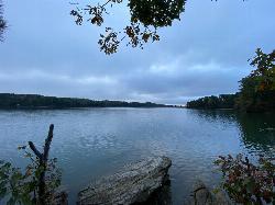
Lanier Park
Buford
14.3 miles SWA Corps of Engineers day-use park just north of Buford Dam with a small swim beach in a sheltered cove of Lake Lanier. $8 per vehicle or $3 on foot, open 8 a.m. to 10 p.m., no lifeguards.
Hike, Kayak, Swim 2.4 mi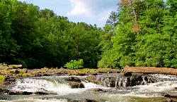
Edge Of The World
Dawsonville, Georgia
16.0 miles WA scenic 3-mile hike along the Amicalola River to a family-friendly swimming hole and small waterfall near Atlanta.
Hike, Swim
Pooles Mill
Ball Ground, Georgia
16.9 miles WSwim near Ball Ground, Georgia
Swim
Lake Russell Recreation Area
Mt Airy
27.9 miles EA grass swim beach on 100-acre Lake Russell in the Chattahoochee-Oconee National Forest near Mt. Airy, with a $5 per vehicle Forest Service day-use fee and no gas motors on the lake.
Camp, Canoe, Hike, Kayak, Swim
Vogle State Park
Blairsville, Georgia
29.6 miles NA 233-acre park at the base of Blood Mountain in the Chattahoochee National Forest — one of Georgia's first state parks, founded in 1931.
Camp, Canoe, Swim
Chattahoochee National Park
Cave Spring, Georgia
31.1 miles NSwim near Cave Spring, Georgia
Swim
Mill Creek
Woodstock, Georgia
34.8 miles SWSwim near Woodstock, Georgia
Swim
Sweetwater Day Use Area
Canton
37.0 miles WA Corps of Engineers sand beach and roped swim area on a quiet cove of Allatoona Lake west of Canton, with a $5 per vehicle day use fee and no lifeguards.
Camp, Canoe, Kayak, Swim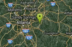
Yellow River Park
Stone Mountain, Georgia
38.9 miles SSwim near Stone Mountain, Georgia
Swim
Lake Rabun Beach Recreation Area
Lakemont
39.1 miles NEA small Forest Service swim beach with a roped swim area on Lake Rabun near Lakemont, Georgia. Open sunrise to sundown year-round; day use is $5 per person age 16 and up.
Camp, Hike, Kayak, Swim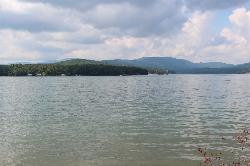
Morganton Point Recreation Area
Morganton, Georgia
40.4 miles NWForest Service swim beach, campground and boat ramp on a wooded point jutting into Lake Blue Ridge, two miles from the town of Morganton.
Camp, Canoe, Hike, Kayak, Swim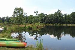
Pine Lake Beach
Pine Lake
40.7 miles SA free municipal sand beach on a creek-fed lake in Pine Lake, the smallest city in DeKalb County, two and a half miles west of Stone Mountain. Roped swim area, no lifeguard, open June through September with no admission fee.
Canoe, Kayak, Swim
Tallulah Falls Lake Beach (Terrora Day Use Area)
Tallulah Falls, Georgia
41.7 miles NESand swim beach on 63-acre Tallulah Falls Lake at Tallulah Gorge State Park's Terrora Day Use Area, with the gorge rim trails, suspension bridge and campground next door.
Camp, Hike, Kayak, Mountain Bike, Swim
Diving Rock
Atlanta, Georgia
42.0 miles SWA 25-foot granite diving rock, a riverside beach, and cool, clear water on the Chattahoochee — a classic Atlanta swimming hole.
Swim
Galt's Ferry Day Use Area
Acworth
42.3 miles WCorps of Engineers beach park on the south shore of Allatoona Lake near Acworth, with a roped, unguarded swim area, fishing jetty and boat ramp. $5 per vehicle, card only.
Canoe, Kayak, Swim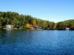
Timpson Cove Beach
Clayton
43.0 miles NEA Georgia Power swim beach on the east shore of Lake Burton, with a buoyed swim area, picnic tables and restrooms about nine miles out of Clayton. No posted fee, no lifeguard, and a winter drawdown that decides how much sand there is.
SwimNearby Campsites
Lake Russell Recreation Area
Mt Airy
27.9 miles EA grass swim beach on 100-acre Lake Russell in the Chattahoochee-Oconee National Forest near Mt. Airy, with a $5 per vehicle Forest Service day-use fee and no gas motors on the lake.
Camp, Canoe, Hike, Kayak, Swim
Vogle State Park
Blairsville, Georgia
29.6 miles NA 233-acre park at the base of Blood Mountain in the Chattahoochee National Forest — one of Georgia's first state parks, founded in 1931.
Camp, Canoe, Swim
Sweetwater Day Use Area
Canton
37.0 miles WA Corps of Engineers sand beach and roped swim area on a quiet cove of Allatoona Lake west of Canton, with a $5 per vehicle day use fee and no lifeguards.
Camp, Canoe, Kayak, Swim
Lake Rabun Beach Recreation Area
Lakemont
39.1 miles NEA small Forest Service swim beach with a roped swim area on Lake Rabun near Lakemont, Georgia. Open sunrise to sundown year-round; day use is $5 per person age 16 and up.
Camp, Hike, Kayak, Swim
Morganton Point Recreation Area
Morganton, Georgia
40.4 miles NWForest Service swim beach, campground and boat ramp on a wooded point jutting into Lake Blue Ridge, two miles from the town of Morganton.
Camp, Canoe, Hike, Kayak, Swim
Tallulah Falls Lake Beach (Terrora Day Use Area)
Tallulah Falls, Georgia
41.7 miles NESand swim beach on 63-acre Tallulah Falls Lake at Tallulah Gorge State Park's Terrora Day Use Area, with the gorge rim trails, suspension bridge and campground next door.
Camp, Hike, Kayak, Mountain Bike, Swim


