


Grapevine Trail
Washington, Utah
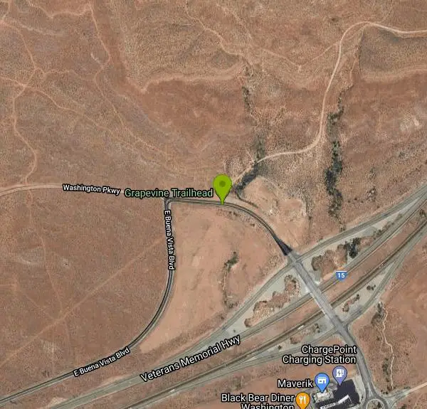
| Address: | Grapevine Trailhead, Grapevine Trail, Washington, UT 84780, USA |
| GPS: |
37°8'58.3"N 113°29'26.0"W Maps | Directions |
| State: | Utah |
| Trails/Routes: | 11.3 mi |
Hike and Mountain Bike
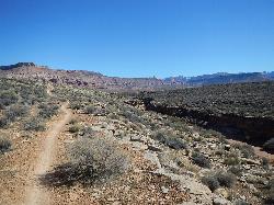
The Grapevine trail located near Washington, UT is a unique trail that connects to several other trails in the area such as the Prospector trail and the Church Rocks trail. What makes the Grapevine trail unique is that it ends at Grapevine Spring, a beautiful small waterfall that cascades down the red rock. The Grapevine trail runs underneath I-15 and comes out into the vast desert of southern Utah providing both paved trails and rocky terrain through portions of the trail. The trail also features flowers during the spring months giving diversity to the desert scenery. The trail is described as an intermediate level trail for bikers, offering many hills and sand to bike through.
At first glance, this trail looks very challenging when you see that you gain over 500 feet in elevation throughout the trail, since the trail is a loop and you start from a high elevation, this can be decieving. The Grapevine is challenging, but should also be a great experience that hikers and bike riders shouldn't feel exhausted after completing the trail.
The Grapevine trail is 5 miles long in total and is an out and back style trail. Parking for the trail is just off of Buena Vista road and the trail head begins at the parking lot. The trail leads to the Grapevine spring but also offers hikers to continue to the Elephant arch, if desired. Since this trail starts in the city, it is accessible year round although it would be best to avoid the trail when raining or after raining to keep the trail intact.
Grapevine offers an in-city mountain biking experience and gives both hikers and bike riders a great experience that is a little off the beaten path. The Grapevine trail could bring you your next adventure in southern Utah!
More Information
Add ResourceNever modify trail features. Ride trails when they're dry enough that you won't leave ruts. Speak up when you see others on the trail and always yield to hikers, horses, and others coming uphill. Always ride on the established trail.
Read MoreBe courteous, informed, and prepared. Read trailhead guidelines, stay on the trail, and don't feed the wildlife.
Read More- Plan Ahead and Prepare
- Travel & camp on durable surfaces
- Dispose of waste properly
- Leave what you find
- Minimize campfire impacts
- Respect wildlife
- Be considerate of other visitors
Directions
From Washington, Utah
- Head north on N 100 E toward E 200 N (0.5 mi)
- Turn left onto E 400 N (489 ft)
- Turn right at the 1st cross street onto N Main StMay be closed at certain times or days(0.2 mi)
- Turn right at the 1st cross street onto E Buena Vista Blvd (1.3 mi)
- E Buena Vista Blvd turns slightly right and becomes Washington Pkwy (0.1 mi)

Trails
Distance ?
11.3 miles Round TripElevation Gain ?
0 feetReal Ascent ?
655 feetReal Descent ?
655 feetAvg Grade (0°)
0%Grade (-11° to 8°)
-19% to 14%Elevation differences are scaled for emphasis. While the numbers are accurate, the cut-away shown here is not to scale.
Other Mountain Bike Trails and Hiking Trails Nearby

Church Rocks
Washington, Utah
0.4 miles SEThe Church Rocks hike near Hurricane, Utah, about a half hour outside of St. George, is another hidden gem outside of Zion National Park. Similar to the Slick Rock Trail in Moab, there are lots...
Hike, Mountain Bike
Ice House Loop
St. George, Utah
4.6 miles NWThe Ice House loop is a great trail in the St George area to try and ride. This portion of the trail is actually part of the Broken Mesa Loop, and is about 6.8 miles of the 15 mile loop. What...
Mountain Bike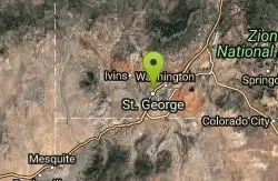
Pioneer Park
St. George, Utah
5.2 miles SWThis trail is easy aerobic and intermediate/advanced technical. Look for the singletrack in the SE corner it quickly become double track follow this up hill for a short climb and then...
Mountain Bike 0.1 mi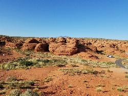
St. George Narrows
St. George, Utah
5.2 miles SWNot to be confused with the Narrows of Zion National Park, the St. George Narrows, also referred to by locals as the "Crack", are located near downtown St.George, Utah just a...
Hike 0.3 mi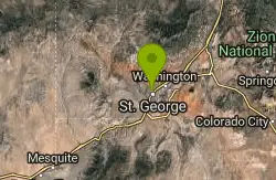
Dixie Sugarloaf / Dixie Rock
St. George, Utah
5.4 miles SWHike near St. George, Utah
Hike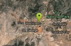
Prospector - Church Rocks Loop
Hurricane, Utah
5.4 miles EThe trail leaving the parking area is a wide track for about the first quarter mile until a signed intersection where you will turn left (south) onto singletrack and start your ride...
Mountain Bike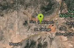
Paradise Rim/turtle Wall
St. George, Utah
6.4 miles WThis is a great little ride, easily accessible from town. Follow the trail downhill from the parking lot. It will curve toward town then back to the North. At the sign for the Beck...
Mountain Bike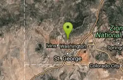
Broken Mesa Rim
St. George, Utah
6.7 miles NWThe trail starts at the northern end of the Red Cliffs Desert Reserve. You'll make an initial singletrack climb up some fairly buff switchbacks. At 0.5 mile, the trail reaches a...
Mountain Bike 0.7 mi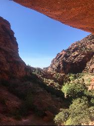
Red Reef trail
Hurricane, Utah
6.9 miles NEThe Red Reef trail is located near the small town of Leeds, Utah and in the Red Cliffs Desert Reserve. It is a 2 mile trail that takes hikers near the beautiful red slick rock cliffs of Southern...
Hike
Snake Hollow Bike Park
St. George, Utah
8.0 miles WSnake Hollow encompasses 80 acres of land in west St. George, located primarily on the west side of the park, with some additional courses on the east side along Tuweap Drive. There are hundreds of...
Mountain Bike 0.2-0.4 mi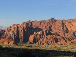
Snow Canyon State Park
St. George, Utah
9.1 miles NWSnow Canyon State park is often described as a smaller version of Zion National park. While both offer similar beautiful landscapes, exciting trails for adventure seeking hikers, and family friendly...
Cave, Hike, Mountain Bike, Rock Climb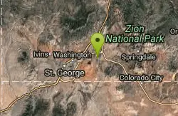
Hurricane Rim trail
Hurricane, Utah
9.7 miles EThis is fun but rocky trail along the rim above the Virgin river. There are some sections of slab rock that are awkward, and there are several areas of exposure of several hundred feet...
Mountain Bike 0.7 mi
Snow Canyon Lava Caves
St. George, Utah
9.7 miles NWThese caves are located in Snow Canyon State Park near Dammeron Valley in Utah and it's one of the most unique places in southern Utah. Years ago, lava flowed through these caves until...
Cave, Hike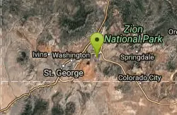
Gould's Rim trail
Hurricane, Utah
10.0 miles ERide the long steady double track climb for about two miles. After you reach the top of the hill, watch for the singletrack branching off to the right about 0.5 miles further...
Mountain Bike 0.5-15.1 mi
Green Valley Trail System
St. George, Utah
10.1 miles SWThe Green Valley trail system, located just outside of St. George, Utah, is a heavily trafficked trail system that features some of the more popular trails in Southern Utah. With trails such as the...
Hike, Mountain Bike 0.9-7.8 mi
Santa Clara River Reserve
Ivins, Utah
10.4 miles WThe Santa Clara River Reserve, located near Santa Clara, Utah and Snow Canyon State Park, is a trail system close to the Green Valley trail system that has similar trails and a connecter trail...
Mountain Bike 3.4 mi
More Cowbell
Virgin, Utah
13.7 miles EThe More Cowbell loop, located outside of Hurricane, Utah, is a beginner level bike trail that gives riders a good feel for what mountain biking is like. It is a great practice run for bigger, more...
Hike, Mountain Bike 5.1 mi
Dead Ringer
Virgin, Utah
13.7 miles EThe Dead Ringer trail is one of three biking trails located just outside of Hurricane, Utah. Starting at the JEM trailhead, bikers start on a winding, up and down trail that runs parallel to the JEM...
Hike, Mountain Bike
Crypto-Goosebumps
La Verkin, Utah
15.4 miles EProceed west on the trail about 1 mile to Junction of JEM and Hurricane Rim. This is the return point on the trail. Turn right onto the Rim trail and follow it to the outhouse and...
Mountain Bike 6.9 mi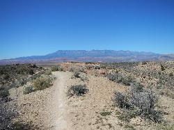
J.E.M. Trail
La Verkin, Utah
15.6 miles EThe J.E.M. trail is one of the many exciting trails located just outside of Hurricane, Utah. It is connected with the More Cowbell and Dead Ringer trails and is the longest of all three trails...
Hike, Mountain BikeNearby Campsites

Sand Hollow State Park
Hurricane, Utah
6.3 miles ESand Hollow is the closest thing to a tropical paradise in the middle of the Utah desert, near Hurricane, Utah. It features a beach area, places to cliff jump, swim, and off-road with your ATV. There...
Camp, Canoe, Dive, Kayak, Swim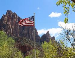
Zion National Park
Hurricane, Utah
28.2 miles EThis is a unique place in the world. Sandstone,carved from wind, water and ice have created icons to visitors. The buttes, landings, bends, mounts and mountains have all been given names over the...
Camp, Hike, Mountain Bike, Swim


