


More Cowbell
Virgin, Utah
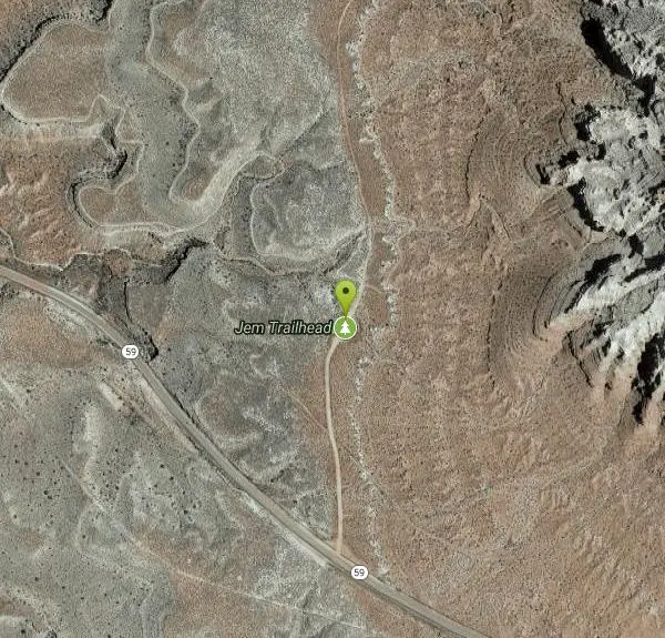
| Address: | ~JEM Trail, Virgin, UT 84779, USA |
| GPS: |
37°8'19.6"N 113°14'32.2"W Maps | Directions |
| State: | Utah |
| Trail Length: | 3.00 miles |
| Trail Type: | Lariat |
| MTB Trail Type: | Singletrack |
| Trails/Routes: | 3.4 mi |
Hike and Mountain Bike
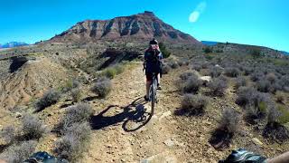
The More Cowbell loop, located outside of Hurricane, Utah, is a beginner level bike trail that gives riders a good feel for what mountain biking is like. It is a great practice run for bigger, more difficult trails that offers beautiful scenery as riders complete the loop. It is also a great place to take the family out for a bike ride and experience the beauty surrounding the Hurricane area together.
The singletrack trail is only 2.7 miles with mostly smooth trail to bike through the red bluffs of the southern Utah desert. The trail itself is mostly flat, allowing riders to both enjoy the scenery around them and gain experience to ride more complex and difficult trails. The More Cowbell loop connects to other more difficult trails like the Dead Ringer Trail and the J.E.M. trail.
To protect other riders experiences, a caution is given to not ride the trail after it has rained and the soil has become muddy. This creates ruts in the trail that last several months making it difficult for other riders to enjoy the trail. Hikers are also welcome to hike the trail to experience another hidden gem outside of Zion National Park and Snow Canyon State Park.
The More Cowbell loop will more than likely give anyone who loves the beauty of southern Utah and hitting the trails exactly what they are looking for.
More Information
More Cowbell
More Cowbell is a singletrack mountain bike trail in Hurricane, Utah. View maps, videos, photos, and reviews of More Cowbell bike trail in Hurricane.
https://www.singletracks.com/bike-trails/more-cowbell-12943/More Cowbell (JEM area) - Ultimate Guide to Mountain Biking in Utah
More Cowbell. Beginner-level singletrack, suitable for children. 3.4 mile lariat loop from the Highway 59 JEM trailhead. Minimal gentle climbing. Season year-round.
https://utahmountainbiking.com/trails/whiteledge/More Cowbell Trail - Utah | Bureau of Land Management
Recommended Users: Mountain Bikers, Hikers. Singletrack trail. 2.5 miles in length. Difficulty: Moderate/Easiest. More Cowbell Trail is a short loop that circles the rim of a small mesa. To reach the start of the trail, take Dead Ringer Trail for 0.36 miles. At the intersection, More Cowbell takes off on the right while Dead Ringer, on the left, drops down from the mesa top. Follow the trail around the mesa until it once again meets up with Dead Ringer. Stay to left on Dead Ringer and travel back to the Jem Trailhead.The views from the Mesa are striking. Gooseberry Mesa rises in the East and
https://www.blm.gov/visit/more-cowbell-trailNever modify trail features. Ride trails when they're dry enough that you won't leave ruts. Speak up when you see others on the trail and always yield to hikers, horses, and others coming uphill. Always ride on the established trail.
Read MoreBe courteous, informed, and prepared. Read trailhead guidelines, stay on the trail, and don't feed the wildlife.
Read More
- Plan Ahead and Prepare
- Travel & camp on durable surfaces
- Dispose of waste properly
- Leave what you find
- Minimize campfire impacts
- Respect wildlife
- Be considerate of other visitors
Directions
From Virgin, Utah
- Head south on Sierra Bella Dr toward Pocketville Rd (0.3 mi)
- Turn right onto Pocketville Rd (0.1 mi)
- Turn right at the 1st cross street onto UT-9 W/
150 N Continue to follow UT-9 W(1.4 mi) - Turn left at 1250 W/
Mesa Rd (223 ft) - Continue onto Sheep Bridge Rd (4.8 mi)
- Turn left onto UT-59 S (1.8 mi)
- Turn leftDestination will be on the left(0.3 mi)

Other Mountain Bike Trails and Hiking Trails Nearby
Dead Ringer
Virgin, Utah
0.0 miles NA 5-mile desert singletrack starting from the JEM trailhead near Virgin, winding through ups and downs and bottoming out in the bumpy, hoof-print-marked Goosebumps area.
Hike, Mountain Bike 
Gould's Rim trail
Hurricane, Utah
3.8 miles WA rim trail along the edge of a canyon near Hurricane, Utah — starts smooth and grows rocky, with stunning views as it winds between a doubletrack climb and the Goulds trail junction.
Mountain Bike 
Gooseberry Mesa
Hurricane, Utah
3.9 miles EGooseberry Mesa's 13.4-mile mountain bike loop near Zion National Park features mesas, desert scenery, challenging climbs, steep descents, and cliff-edge trail sections — best ridden April through November.
Mountain Bike 
Hurricane Rim trail
Hurricane, Utah
4.0 miles WA rocky singletrack rim trail above the Virgin River with slab sections, several hundred feet of exposure, and spectacular views — rideable out and back or as part of the Hurricane Loop.
Mountain Bike 7.0 mi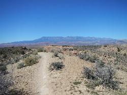
J.E.M. Trail
La Verkin, Utah
4.4 miles NA 13.27-mile round-trip mountain bike trail near Hurricane, Utah with jarring terrain and sharp turns near sheer cliffs — beautiful red rock and desert views reward the effort.
Hike, Mountain Bike 
Crypto-Goosebumps
La Verkin, Utah
4.5 miles NA flowing, narrow, and at times exposed mountain bike ride linking JEM, Hurricane Rim, Cryptobionic, and Goosebumps trails through the La Verkin area of southern Utah.
Mountain Bike 13.1 mi
Little Creek Mesa
Hurricane, Utah
5.5 miles STwenty miles of interconnected red-rock singletrack across Little Creek Mesa, Gooseberry Mesa, and West Mesa, with sheer cliffs, slickrock descents, and big scenery near Hurricane.
Mountain Bike 
Prospector - Church Rocks Loop
Hurricane, Utah
8.7 miles WA flowing singletrack loop through red rock ledges, slickrock bowls, and sandy stretches, finishing with over a mile of slickrock riding and a dramatic encounter with large black volcanic rocks.
Mountain Bike 8.4 mi
Grafton Mesa
Springdale, Utah
9.0 miles EA short but adrenaline-pumping 4.6-mile experienced-only trail through red rock with views of Zion's peaks — best ridden top-down via the Springdale shuttle, and skip it when wet.
Mountain Bike 3.3 mi
Guacamole Mesa
Virgin, Utah
9.3 miles NEAn 11-mile advanced desert loop on Guacamole Mesa outside Zion NP — a steep, narrow climb with gorgeous red rock views gives way to a flat desert finish; avoid in rain.
Hike, Mountain Bike 7.2 mi
Wire Mesa
Hurricane, Utah
9.4 miles EA 7.4-mile out-and-back through rolling desert mesas with options for all skill levels, beautiful southern Utah views, and a scenic overlook of Zion National Park at the end.
Mountain Bike 0.7 mi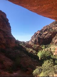
Red Reef trail
Hurricane, Utah
10.8 miles NWTwo miles of red slickrock, a slot canyon, a spring waterfall, and ancient Anasazi hieroglyphs in a small cave make this an exceptional family-friendly desert hike.
Hike 11.6 mi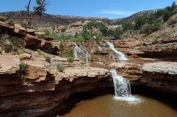
Toquerville Falls
La Verkin, Utah
11.1 miles NLedges, falls, a ladder to the best jumping spots, and a 7-foot-deep pool at the end of a 5.5-mile sandy desert drive — but stay away from the brittle, injury-prone cliff edges.
Dive, Hike, Mountain Bike, Swim 9.4 mi
Church Rocks
Washington, Utah
13.4 miles WA nearly 6-mile red rock ride near St. George winding through sandy desert washes and smooth slick rock — a great practice run before tackling Moab's Slick Rock Trail.
Hike, Mountain Bike 11.3 mi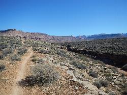
Grapevine Trail
Washington, Utah
13.7 miles WA 5-mile out-and-back trail connecting southern Utah desert, paved paths, and rocky terrain before ending at Grapevine Spring — a small waterfall cascading down red rock.
Hike, Mountain Bike 
Springdale Town Loop
Hurricane, Utah
13.8 miles EA fun, tight, twisty mountain bike trail near Hurricane that can be enjoyed year-round — quick turns and flow keep it entertaining on every lap.
Mountain Bike 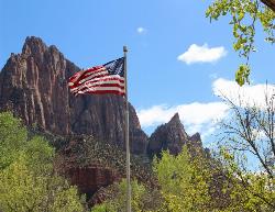
Zion National Park
Hurricane, Utah
15.0 miles EWind, water, and ice sculpted Zion's iconic red sandstone buttes, bends, and mounts into one of the most breathtaking and irreplaceable landscapes on Earth.
Camp, Hike, Mountain Bike, Swim 7.5 mi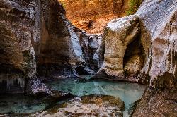
The Subway
Apple Valley, Utah
15.7 miles NEA slot canyon in Zion where you hike, swim, and rappel through majestic tunnels and lava tubes — one of the most magical canyon walks in all of Utah.
Canyoneer, Hike, Swim 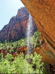
Emerald Pools Trail
Hurricane, Utah
17.4 miles NEThree algae-tinted pools carved into Zion's canyon walls glow with an otherworldly emerald color fed by near-constant waterfalls — though swimming and wading are strictly prohibited.
Hike 
The Grotto Trail
Springdale, Utah
18.0 miles NEThe Grotto Trail is an easy, nearly level half-mile Zion walk linking Zion Lodge and The Grotto — and the gateway to Angels Landing.
HikeNearby Campsites

Sand Hollow State Park
Hurricane, Utah
7.8 miles WA desert reservoir near Hurricane with a cliff-jumping area, a sandy beach for swimming and paddleboarding, and vast sand dunes for ATVs — southern Utah's desert playground.
Camp, Canoe, Dive, Kayak, Swim
Zion National Park
Hurricane, Utah
15.0 miles EWind, water, and ice sculpted Zion's iconic red sandstone buttes, bends, and mounts into one of the most breathtaking and irreplaceable landscapes on Earth.
Camp, Hike, Mountain Bike, Swim 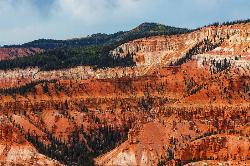
Dixie National Forest
Cedar City, Utah
47.8 miles NEOver 2 million acres of red rock canyons, forests, Duck Creek, and a ski resort span Dixie National Forest — with elevations from 2,800 to 11,322 feet and year-round recreation including skiing, snowmobiling, and hiking.
Backpack, Camp, Hike


